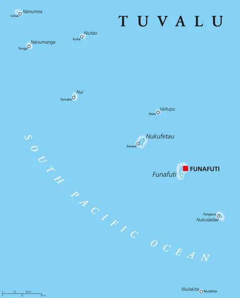
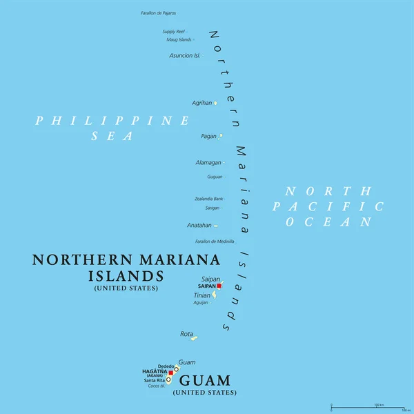
Stock vector Guam and Northern Mariana Islands, gray political map. Two separate unincorporated territories of the United States of America in the Micronesia subregion of the Western Pacific Ocean. Illustration.

Published: Aug.02, 2023 15:15:11
Author: Furian
Views: 2
Downloads: 2
File type: vector / eps
File size: 2.02 MB
Orginal size: 6000 x 8996 px
Available sizes:
Level: silver