photo free
Home Images Vectors Videos

Stock image Belgium Outline Map

stock vector Outline Simple Map of Belgium

Outline Simple Map Of Belgium

Vector, 0.3MB, 2401 × 2401 eps
stock vector Europe map

Europe Map

Vector, 4.78MB, 7658 × 6811 eps
stock vector Country Shape isolated on background of the country of Belgium

Country Shape Isolated On Background Of The Country Of Belgium

Vector, 1.51MB, 3472 × 3472 eps
stock vector Belgium map with shadow effect

Belgium Map With Shadow Effect

Vector, 1.15MB, 5418 × 4092 eps
stock vector Brussels Belgium Map in Retro Style.

Brussels Belgium Map In Retro Style.

Vector, 3.02MB, 8150 × 4702 eps
stock vector Belgium outline map vector with administrative borders, regions, municipalities, departments in black white colors

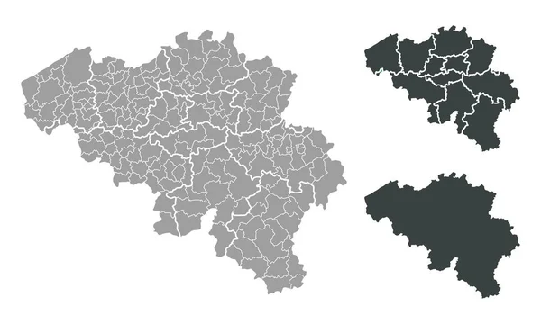
Belgium Outline Map Vector With Administrative Borders, Regions, Municipalities, Departments In Black White Colors

Vector, 8.26MB, 4932 × 3496 eps
stock vector Europe map

Europe Map

Vector, 4.21MB, 7658 × 6811 eps
stock vector Outline map of Belgium

Outline Map Of Belgium

Vector, 1.15MB, 7867 × 4729 eps
stock vector Vector illustration of administrative division map of Belgium. Vector map..

Vector Illustration Of Administrative Division Map Of Belgium. Vector Map..

Vector, 1.05MB, 4500 × 4500 eps
stock vector European Union map and flags

European Union Map And Flags

Vector, 1.12MB, 5571 × 3967 eps
stock vector East Flanders outline map set - Belgian version

East Flanders Outline Map Set - Belgian Version

Vector, 0.19MB, 5000 × 5000 eps
stock vector Maaseik arrondissement outline map set

Maaseik Arrondissement Outline Map Set

Vector, 0.28MB, 6000 × 3000 eps
stock vector Diksmuide arrondissement outline map set

Diksmuide Arrondissement Outline Map Set

Vector, 0.29MB, 6000 × 3000 eps
stock vector Waremme arrondissement outline map set

Waremme Arrondissement Outline Map Set

Vector, 0.28MB, 6000 × 3000 eps
stock vector Doodle Map of Belgium With States

Doodle Map Of Belgium With States

Vector, 2.41MB, 2401 × 2401 eps
stock vector Belgium blank outline map set

Belgium Blank Outline Map Set

Vector, 1.09MB, 6000 × 3000 eps
stock vector Tongeren arrondissement outline map set

Tongeren Arrondissement Outline Map Set

Vector, 0.3MB, 6000 × 3000 eps
stock vector Kortrijk arrondissement outline map set

Kortrijk Arrondissement Outline Map Set

Vector, 0.27MB, 6000 × 3000 eps
stock vector Tournai arrondissement outline map set

Tournai Arrondissement Outline Map Set

Vector, 0.27MB, 6000 × 3000 eps
stock vector Soignies arrondissement outline map set

Soignies Arrondissement Outline Map Set

Vector, 0.29MB, 6000 × 3000 eps
stock vector West-Vlaanderen province outline map set

West-Vlaanderen Province Outline Map Set

Vector, 0.67MB, 6000 × 3000 eps
stock vector Dendermonde arrondissement outline map set

Dendermonde Arrondissement Outline Map Set

Vector, 0.28MB, 6000 × 3000 eps
stock vector Grey map of Belgium

Grey Map Of Belgium

Vector, 1.61MB, 4100 × 4100 eps
stock vector Belgium vector set.

Belgium Vector Set.

Vector, 0.34MB, 6000 × 6000 eps
stock vector Belgium region map grey outline on white background Detailed map of Belgium regions Vector

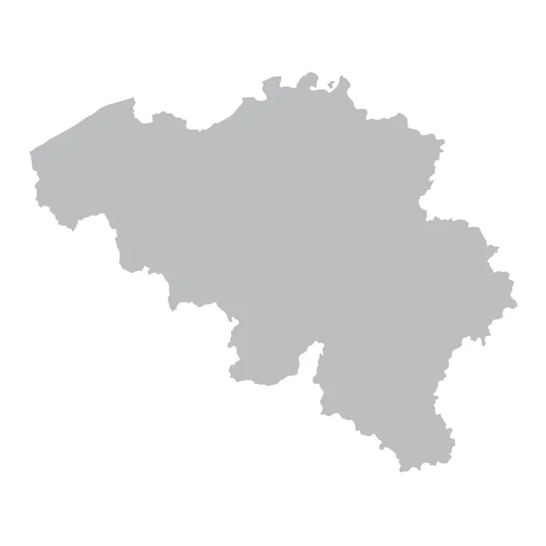
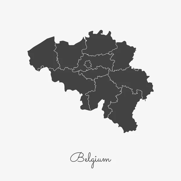
Belgium Region Map Grey Outline On White Background Detailed Map Of Belgium Regions Vector

Vector, 0.34MB, 8333 × 8333 eps
stock image map Belgium. Isolated Illustration. Black on White background.

Map Belgium. Isolated Illustration. Black On White Background.

Image, 0.88MB, 5000 × 5000 jpg
stock vector Belgium national vector map with sketch chalk flag. Sketch chalk hand drawn illustration

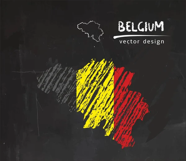
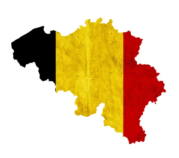
Belgium National Vector Map With Sketch Chalk Flag. Sketch Chalk Hand Drawn Illustration

Vector, 6.63MB, 5768 × 5000 eps
stock vector Black map of Belgium

Black Map Of Belgium

Vector, 1.62MB, 4100 × 4100 eps
stock vector Kingdom of Belgium

Kingdom Of Belgium

Vector, 0.12MB, 8500 × 7539 eps
stock vector Brussels color vector city map

Brussels Color Vector City Map

Vector, 4.25MB, 4223 × 5906 eps
stock vector Belgium map blackboard chalkboard vector

Belgium Map Blackboard Chalkboard Vector

Vector, 7.29MB, 4022 × 4044 eps
stock vector Lier , Belgium printable map

Lier , Belgium Printable Map

Vector, 2.87MB, 5376 × 5376 eps
stock vector Deinze, Belgium printable map

Deinze, Belgium Printable Map

Vector, 3.06MB, 5376 × 5376 eps
stock vector Beringen, Belgium printable map

Beringen, Belgium Printable Map

Vector, 1.99MB, 5376 × 5376 eps
stock vector Antwerp City Map in Retro Style. Outline Map.

Antwerp City Map In Retro Style. Outline Map.

Vector, 2.74MB, 8150 × 4702 eps
stock vector Krakow map with roads and rivers, city municipality administrative borders, art design with grey and blue on white background

Krakow Map With Roads And Rivers, City Municipality Administrative Borders, Art Design With Grey And Blue On White Background

Vector, 10.78MB, 5306 × 3081 eps
stock vector Vector editable city map of Brussels, Belgium

Vector Editable City Map Of Brussels, Belgium

Vector, 7.95MB, 4286 × 3585 eps
stock vector Amsterdam map with roads and rivers, city municipality administrative borders, art design with grey and blue on white background

Amsterdam Map With Roads And Rivers, City Municipality Administrative Borders, Art Design With Grey And Blue On White Background

Vector, 29.23MB, 4941 × 3627 eps
stock vector City map Antwerp, travel vector poster design

City Map Antwerp, Travel Vector Poster Design

Vector, 3.9MB, 4218 × 5906 eps
stock vector City map Antwerp, monochrome detailed plan, vector illustration

City Map Antwerp, Monochrome Detailed Plan, Vector Illustration

Vector, 4.22MB, 4218 × 5906 eps
stock vector Brussels map Bruxelles Brussel administrative districts regions vector template with map of Belgium grey on white background. Contour line city map for infographic and web.

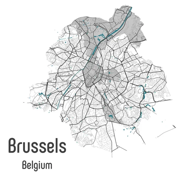
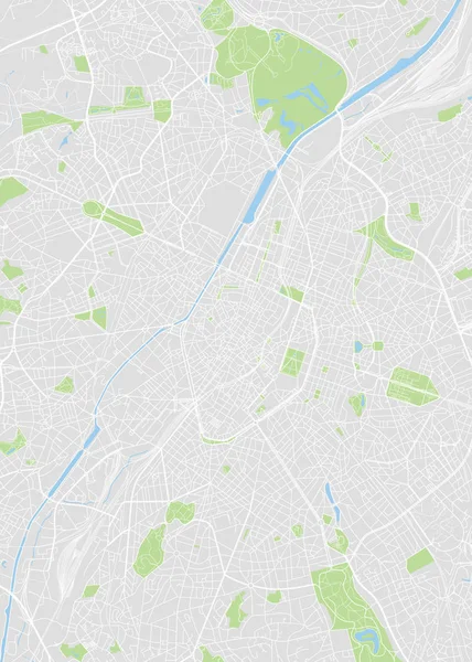
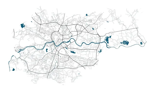
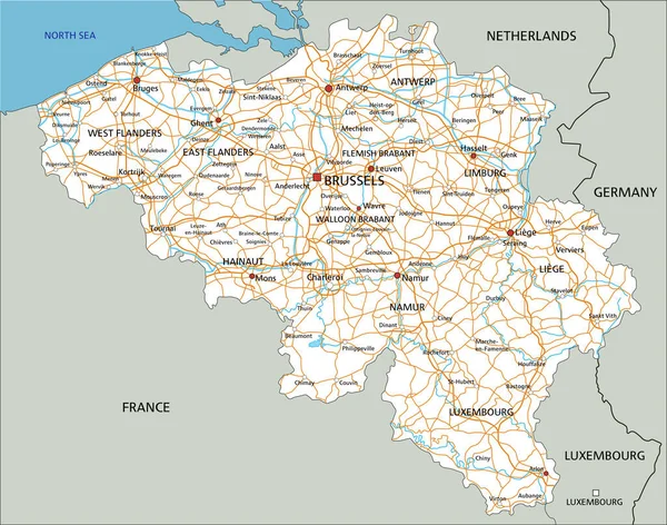
Brussels Map Bruxelles Brussel Administrative Districts Regions Vector Template With Map Of Belgium Grey On White Background. Contour Line City Map For Infographic And Web.

Vector, 19.95MB, 4075 × 4075 eps
stock vector Belgium communication network map. Vector low poly image of a global map with lights in the form of cities in or population density consisting of points and shapes and space. Easy to edit

Belgium Communication Network Map. Vector Low Poly Image Of A Global Map With Lights In The Form Of Cities In Or Population Density Consisting Of Points And Shapes And Space. Easy To Edit

Vector, 1.34MB, 2500 × 2500 eps
stock vector Antwerp Vector Map

Antwerp Vector Map

Vector, 3.54MB, 8000 × 8000 eps
stock vector Europe map in the dot on blue background . Vector illustration

Europe Map In The Dot On Blue Background . Vector Illustration

Vector, 2.68MB, 4134 × 4134 eps
stock vector North Atlantic Treaty Organization, NATO, member countries map.

North Atlantic Treaty Organization, NATO, Member Countries Map.

Vector, 0.95MB, 6000 × 3000 eps
stock vector Map of Antwerp, satellite view, black and white map. Street directory and city map. Belgium

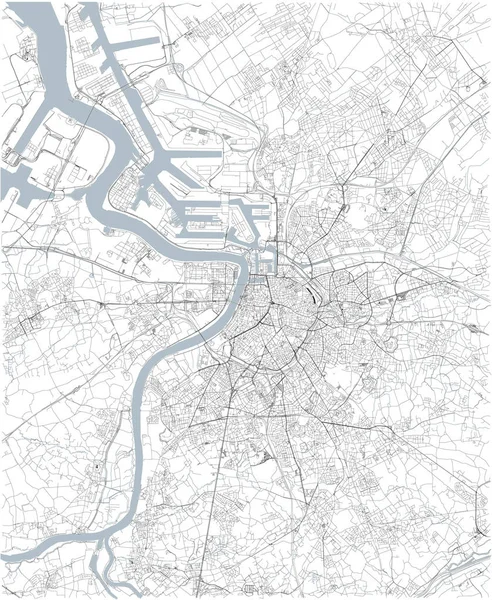
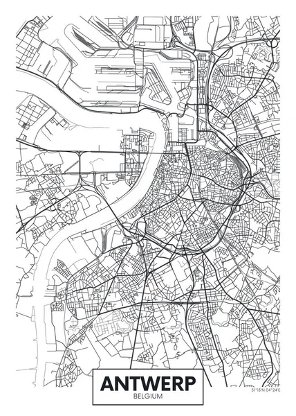
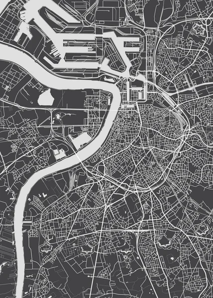
Map Of Antwerp, Satellite View, Black And White Map. Street Directory And City Map. Belgium

Vector, 9.58MB, 3937 × 4802 eps
stock vector Belgium dot vector outline polygonal grey map

Belgium Dot Vector Outline Polygonal Grey Map

Vector, 0.11MB, 4545 × 5000 eps
stock vector Belgium vector map with infographic elements, pointer marks. Editable template with regions, cities and capital Brussels.

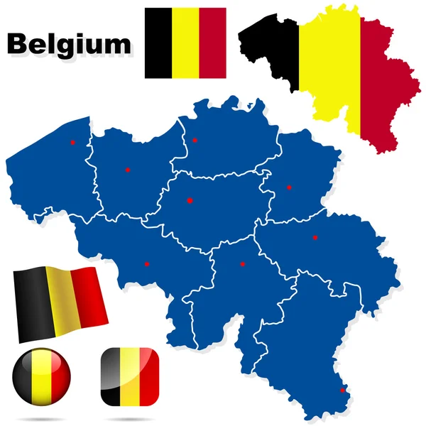
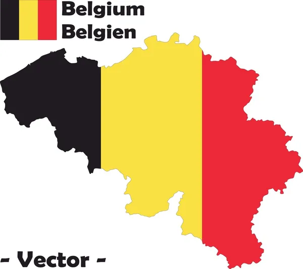
Belgium Vector Map With Infographic Elements, Pointer Marks. Editable Template With Regions, Cities And Capital Brussels.

Vector, 2.32MB, 4000 × 4000 eps
stock vector High detailed Belgium road map with labeling.

High Detailed Belgium Road Map With Labeling.

Vector, 6.56MB, 5408 × 4257 eps
stock image Vintage paper map of Belgium

Vintage Paper Map Of Belgium

Image, 2.81MB, 3216 × 2848 jpg
Page 1 >> Next