
Stock image Bundeslandgrenzen

Administrative Vector Map Of The Detmold Region In German Language, North Rhine-Westphalia, Germany
Vector, 1.3MB, 3340 × 3700 eps
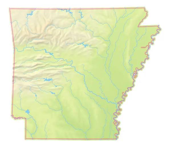
Map Of The State Arkansas (United States Of America) Showing The Isolated Territory With Relief Representation, Water Bodies Like Seas, Rivers, Lakes And With Borders. No Labels At All.
Image, 2.9MB, 6000 × 5130 jpg

Map Of The State New Jersey (United States Of America) Showing The Isolated Territory With Relief Representation, Water Bodies Like Seas, Rivers, Lakes And With Borders. No Labels At All.
Image, 1.17MB, 3388 × 6000 jpg

Map Of The State Texas (United States Of America) Showing The Isolated Territory With Relief Representation, Water Bodies Like Seas, Rivers, Lakes And With Borders. No Labels At All.
Image, 2.48MB, 6000 × 5442 jpg

Map Of The State Idaho (United States Of America) Showing The Isolated Territory With Relief Representation, Water Bodies Like Seas, Rivers, Lakes And With Borders. No Labels At All.
Image, 2.33MB, 4054 × 6000 jpg
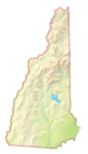
Map Of The State New Hampshire (United States Of America) Showing The Isolated Territory With Relief Representation, Water Bodies Like Seas, Rivers, Lakes And With Borders. No Labels At All.
Image, 1.49MB, 3418 × 6000 jpg

Map Of The State Alabama (United States Of America) Showing The Isolated Territory With Relief Representation, Water Bodies Like Seas, Rivers, Lakes And With Borders. No Labels At All.
Image, 2.23MB, 4077 × 6000 jpg

Map Of The State Wisconsin (United States Of America) Showing The Isolated Territory With Relief Representation, Water Bodies Like Seas, Rivers, Lakes And With Borders. No Labels At All.
Image, 2.33MB, 5981 × 6000 jpg

Map Of The State Missouri (United States Of America) Showing The Isolated Territory With Relief Representation, Water Bodies Like Seas, Rivers, Lakes And With Borders. No Labels At All.
Image, 2.49MB, 6000 × 5217 jpg
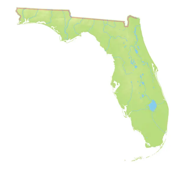
Map Of The State Florida (United States Of America) Showing The Isolated Territory With Relief Representation, Water Bodies Like Seas, Rivers, Lakes And With Borders. No Labels At All.
Image, 1.42MB, 6000 × 5722 jpg

Map Of The State South Carolina (United States Of America) Showing The Isolated Territory With Relief Representation, Water Bodies Like Seas, Rivers, Lakes And With Borders. No Labels At All.
Image, 1.83MB, 6000 × 4784 jpg

Map Of The State Hawaii (United States Of America) Showing The Isolated Territory With Relief Representation, Water Bodies Like Seas, Rivers, Lakes And With Borders. No Labels At All.
Image, 0.57MB, 6000 × 3949 jpg

Map Of The State Ohio (United States Of America) Showing The Isolated Territory With Relief Representation, Water Bodies Like Seas, Rivers, Lakes And With Borders. No Labels At All.
Image, 2.17MB, 5198 × 6000 jpg

Map Of The State Iowa (United States Of America) Showing The Isolated Territory With Relief Representation, Water Bodies Like Seas, Rivers, Lakes And With Borders. No Labels At All.
Image, 1.97MB, 6000 × 3942 jpg
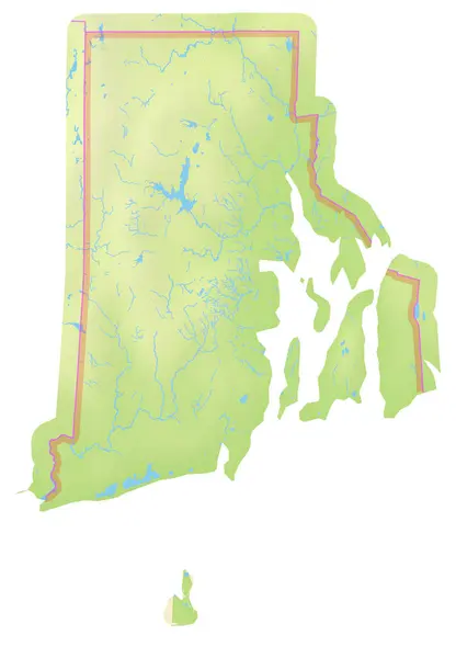
Map Of The State Rhode Island (United States Of America) Showing The Isolated Territory With Relief Representation, Water Bodies Like Seas, Rivers, Lakes And With Borders. No Labels At All.
Image, 1.94MB, 4165 × 6000 jpg

Map Of The State Georgia (United States Of America) Showing The Isolated Territory With Relief Representation, Water Bodies Like Seas, Rivers, Lakes And With Borders. No Labels At All.
Image, 2.48MB, 5334 × 6000 jpg

Map Of The State Tennessee (United States Of America) Showing The Isolated Territory With Relief Representation, Water Bodies Like Seas, Rivers, Lakes And With Borders. No Labels At All.
Image, 1.31MB, 6000 × 1757 jpg

Map Of The Federal District Washington, District Of Columbia (United States Of America) Showing The Isolated Territory With Relief Representation, Water Bodies Like Seas, Rivers, Lakes And With Borders. No Labels At All.
Image, 2.46MB, 4578 × 6000 jpg

Map Of The State Nevada (United States Of America) Showing The Isolated Territory With Relief Representation, Water Bodies Like Seas, Rivers, Lakes And With Borders. No Labels At All.
Image, 2.22MB, 4381 × 6000 jpg

Map Of The State Arizona (United States Of America) Showing The Isolated Territory With Relief Representation, Water Bodies Like Seas, Rivers, Lakes And With Borders. No Labels At All.
Image, 3.05MB, 5294 × 6000 jpg

Map Of The State Vermont (United States Of America) Showing The Isolated Territory With Relief Representation, Water Bodies Like Seas, Rivers, Lakes And With Borders. No Labels At All.
Image, 2.79MB, 3953 × 6000 jpg

Map Of The State Utah (United States Of America) Showing The Isolated Territory With Relief Representation, Water Bodies Like Seas, Rivers, Lakes And With Borders. No Labels At All.
Image, 3MB, 4914 × 6000 jpg

Map Of The State Michigan (United States Of America) Showing The Isolated Territory With Relief Representation, Water Bodies Like Seas, Rivers, Lakes And With Borders. No Labels At All.
Image, 2.1MB, 5671 × 6000 jpg

Map Of The State Pennsylvania (United States Of America) Showing The Isolated Territory With Relief Representation, Water Bodies Like Seas, Rivers, Lakes And With Borders. No Labels At All.
Image, 2.29MB, 6000 × 4084 jpg

Map Of The State Nebraska (United States Of America) Showing The Isolated Territory With Relief Representation, Water Bodies Like Seas, Rivers, Lakes And With Borders. No Labels At All.
Image, 1.6MB, 6000 × 2932 jpg

Map Of The State Montana (United States Of America) Showing The Isolated Territory With Relief Representation, Water Bodies Like Seas, Rivers, Lakes And With Borders. No Labels At All.
Image, 2.55MB, 6000 × 3448 jpg

Map Of The State Minnesota (United States Of America) Showing The Isolated Territory With Relief Representation, Water Bodies Like Seas, Rivers, Lakes And With Borders. No Labels At All.
Image, 2.42MB, 5806 × 6000 jpg

Map Of The State Illinois (United States Of America) Showing The Isolated Territory With Relief Representation, Water Bodies Like Seas, Rivers, Lakes And With Borders. No Labels At All.
Image, 1.87MB, 4035 × 6000 jpg

Map Of The State Massachusetts (United States Of America) Showing The Isolated Territory With Relief Representation, Water Bodies Like Seas, Rivers, Lakes And With Borders. No Labels At All.
Image, 2.43MB, 6000 × 3983 jpg

Map Of The State Kansas (United States Of America) Showing The Isolated Territory With Relief Representation, Water Bodies Like Seas, Rivers, Lakes And With Borders. No Labels At All.
Image, 1.93MB, 6000 × 3251 jpg

Map Of The State Louisiana (United States Of America) Showing The Isolated Territory With Relief Representation, Water Bodies Like Seas, Rivers, Lakes And With Borders. No Labels At All.
Image, 2.19MB, 6000 × 5446 jpg

Map Of The State Mississippi (United States Of America) Showing The Isolated Territory With Relief Representation, Water Bodies Like Seas, Rivers, Lakes And With Borders. No Labels At All.
Image, 2.2MB, 4020 × 6000 jpg

Map Of The State Oklahoma (United States Of America) Showing The Isolated Territory With Relief Representation, Water Bodies Like Seas, Rivers, Lakes And With Borders. No Labels At All.
Image, 1.73MB, 6000 × 3029 jpg

Map Of The State Wyoming (United States Of America) Showing The Isolated Territory With Relief Representation, Water Bodies Like Seas, Rivers, Lakes And With Borders. No Labels At All.
Image, 3.03MB, 6000 × 4791 jpg
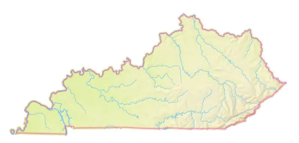
Map Of The State Kentucky (United States Of America) Showing The Isolated Territory With Relief Representation, Water Bodies Like Seas, Rivers, Lakes And With Borders. No Labels At All.
Image, 1.61MB, 6000 × 2876 jpg

Map Of The State Delaware (United States Of America) Showing The Isolated Territory With Relief Representation, Water Bodies Like Seas, Rivers, Lakes And With Borders. No Labels At All.
Image, 1.61MB, 2767 × 6000 jpg

Map Of The State Connecticut (United States Of America) Showing The Isolated Territory With Relief Representation, Water Bodies Like Seas, Rivers, Lakes And With Borders. No Labels At All.
Image, 2.82MB, 6000 × 4560 jpg

Map Of The State West Virginia (United States Of America) Showing The Isolated Territory With Relief Representation, Water Bodies Like Seas, Rivers, Lakes And With Borders. No Labels At All.
Image, 2.32MB, 6000 × 5357 jpg

Map Of The State Alaska (United States Of America) Showing The Isolated Territory With Relief Representation, Water Bodies Like Seas, Rivers, Lakes And With Borders. No Labels At All.
Image, 4.34MB, 6000 × 5310 jpg

Map Of The State California (United States Of America) Showing The Isolated Territory With Relief Representation, Water Bodies Like Seas, Rivers, Lakes And With Borders. No Labels At All.
Image, 2.38MB, 5507 × 6000 jpg

Map Of The State Virginia (United States Of America) Showing The Isolated Territory With Relief Representation, Water Bodies Like Seas, Rivers, Lakes And With Borders. No Labels At All.
Image, 1.55MB, 6000 × 2881 jpg

Map Of The State North Dakota (United States Of America) Showing The Isolated Territory With Relief Representation, Water Bodies Like Seas, Rivers, Lakes And With Borders. No Labels At All.
Image, 1.84MB, 6000 × 3758 jpg

Map Of The State Maine (United States Of America) Showing The Isolated Territory With Relief Representation, Water Bodies Like Seas, Rivers, Lakes And With Borders. No Labels At All.
Image, 2.11MB, 4302 × 6000 jpg

Map Of The State Oregon (United States Of America) Showing The Isolated Territory With Relief Representation, Water Bodies Like Seas, Rivers, Lakes And With Borders. No Labels At All.
Image, 2.8MB, 6000 × 4502 jpg

Map Of The State Washington (United States Of America) Showing The Isolated Territory With Relief Representation, Water Bodies Like Seas, Rivers, Lakes And With Borders. No Labels At All.
Image, 2.59MB, 6000 × 4030 jpg
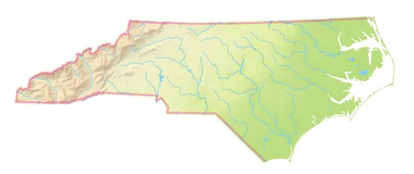
Map Of The State North Carolina (United States Of America) Showing The Isolated Territory With Relief Representation, Water Bodies Like Seas, Rivers, Lakes And With Borders. No Labels At All.
Image, 1.37MB, 6000 × 2534 jpg

Map Of The State Maryland (United States Of America) Showing The Isolated Territory With Relief Representation, Water Bodies Like Seas, Rivers, Lakes And With Borders. No Labels At All.
Image, 1.25MB, 6000 × 3395 jpg

Map Of The State Indiana (United States Of America) Showing The Isolated Territory With Relief Representation, Water Bodies Like Seas, Rivers, Lakes And With Borders. No Labels At All.
Image, 1.84MB, 4143 × 6000 jpg
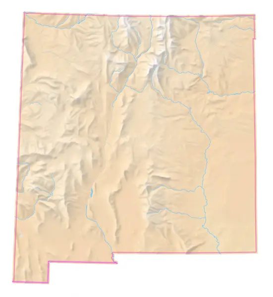
Map Of The State New Mexico (United States Of America) Showing The Isolated Territory With Relief Representation, Water Bodies Like Seas, Rivers, Lakes And With Borders. No Labels At All.
Image, 2.73MB, 5517 × 6000 jpg

Map Of The State South Dakota (United States Of America) Showing The Isolated Territory With Relief Representation, Water Bodies Like Seas, Rivers, Lakes And With Borders. No Labels At All.
Image, 1.88MB, 6000 × 3891 jpg
Page 1 >> Next