photo free
Home Images Vectors Videos

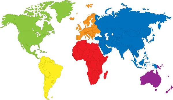
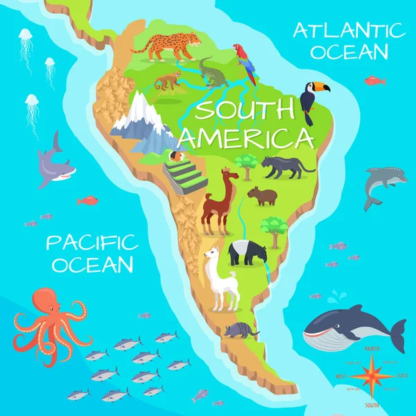
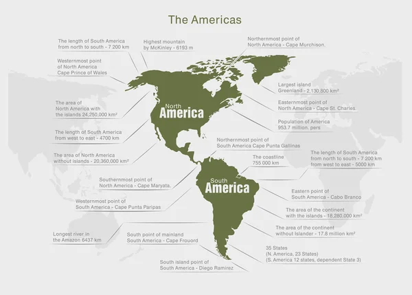
Stock image Continent America

stock vector world map, vector design

World Map, Vector Design

Vector, 11.25MB, 4000 × 4000 eps
stock vector Colorful America

Colorful America

Vector, 2.21MB, 2521 × 3136 eps
stock vector Set of vector globe icons showing earth with all continents. Vector illustration.

Set Of Vector Globe Icons Showing Earth With All Continents. Vector Illustration.

Vector, 1.09MB, 4000 × 4000 eps
stock vector North and South America map

North And South America Map

Vector, 1.34MB, 4567 × 4567 eps
stock vector Old map of the world

Old Map Of The World

Vector, 11.15MB, 4000 × 4000 eps
stock vector World map with continents

World Map With Continents

Vector, 0.22MB, 5000 × 4154 eps
stock image world map made from round pasta

World Map Made From Round Pasta

Image, 6.95MB, 6306 × 4209 jpg
stock vector Illustrated map of the world with all continents

Illustrated Map Of The World With All Continents

Vector, 8.82MB, 5869 × 5648 eps
stock vector Vector planet icon,  vector illustration

Vector Planet Icon, Vector Illustration

Vector, 4.06MB, 4000 × 4000 eps
stock vector North and South America - map - illustration.

North And South America - Map - Illustration.

Vector, 3.11MB, 5400 × 8114 eps
stock vector Infographic elements. Vector illustration.

Infographic Elements. Vector Illustration.

Vector, 1.91MB, 2668 × 4000 eps
stock image black world map illustration

Black World Map Illustration

Image, 3.06MB, 8000 × 5000 jpg
stock vector North America Map with Loop

North America Map With Loop

Vector, 2.47MB, 4000 × 4000 eps
stock vector Sketch America letter text continent, North and south America word - in the shape of the continent, Map of continent America - brown and black vector illustration

Sketch America Letter Text Continent, North And South America Word - In The Shape Of The Continent, Map Of Continent America - Brown And Black Vector Illustration

Vector, 2.26MB, 7087 × 4724 eps
stock image World map made from coffee beans

World Map Made From Coffee Beans

Image, 9.97MB, 7360 × 4912 jpg
stock vector Sketch drawing continents.

Sketch Drawing Continents.

Vector, 1.14MB, 5000 × 5000 eps
stock vector Green earth. Vector illustration

Green Earth. Vector Illustration

Vector, 4.49MB, 4002 × 4002 eps
stock vector World map, vector.

World Map, Vector.

Vector, 0.61MB, 5905 × 3543 eps
stock image World map made from coffee beans

World Map Made From Coffee Beans

Image, 6.42MB, 7329 × 4891 jpg
stock image Lightbulb World Shape - America, USA

Lightbulb World Shape - America, USA

Image, 1.75MB, 2222 × 2998 jpg
stock vector World flags. Vector design

World Flags. Vector Design

Vector, 1.52MB, 4000 × 4000 eps
stock vector Colorful world map

Colorful World Map

Vector, 3.24MB, 7003 × 5657 eps
stock image Flag of united states of america

Flag Of United States Of America

Image, 1.88MB, 6000 × 4000 jpg
stock vector South and North American countries map

South And North American Countries Map

Vector, 0.26MB, 2800 × 3502 eps
stock vector North america blue map

North America Blue Map

Vector, 0.36MB, 5031 × 3579 eps
stock vector World map

World Map

Vector, 3.04MB, 7502 × 4330 eps
stock vector North and South America - map and navigation icons - illustration.

North And South America - Map And Navigation Icons - Illustration.

Vector, 2.48MB, 5400 × 8618 eps
stock image Night Earth. A piece of North America - South Eastern United Sta

Night Earth. A Piece Of North America - South Eastern United Sta

Image, 10.34MB, 5000 × 5000 jpg
stock vector North America map with USA and Canada

North America Map With USA And Canada

Vector, 9.62MB, 5448 × 5247 eps
stock image Ice map

Ice Map

Image, 2.33MB, 3584 × 2248 jpg
stock vector Vector South America and North America map with countries borders. Abstract red and yellow American countries on map

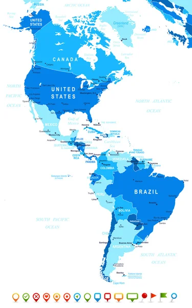
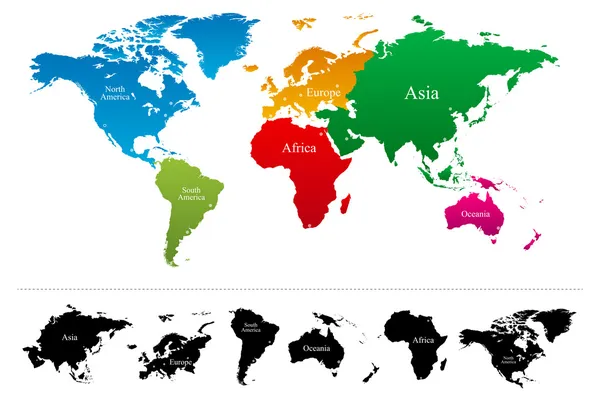
Vector South America And North America Map With Countries Borders. Abstract Red And Yellow American Countries On Map

Vector, 1.08MB, 4167 × 4167 eps
stock vector Political blank America Map vector illustration isolated on white background. Editable and clearly labeled layers.

Political Blank America Map Vector Illustration Isolated On White Background. Editable And Clearly Labeled Layers.

Vector, 6.05MB, 4000 × 4857 eps
stock vector continuous line drawing of world planet with checked mark icon

Continuous Line Drawing Of World Planet With Checked Mark Icon

Vector, 5.38MB, 6828 × 3600 eps
stock vector Political map of Americas in four shades of green on white background. North and South America with country labels. Simple flat vector illustration

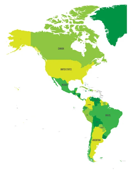
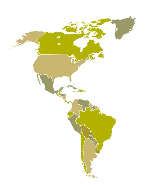
Political Map Of Americas In Four Shades Of Green On White Background. North And South America With Country Labels. Simple Flat Vector Illustration

Vector, 1.69MB, 4572 × 6001 eps
stock vector South America Mainland Cartoon Fauna Species

South America Mainland Cartoon Fauna Species

Vector, 4.04MB, 5000 × 5000 eps
stock vector Vector World map with colorful continents Atlas - EPS

Vector World Map With Colorful Continents Atlas - EPS

Vector, 6.75MB, 7505 × 5000 eps
stock vector World map, colorful continents atlas EPS10 vector file.

World Map, Colorful Continents Atlas EPS10 Vector File.

Vector, 1.72MB, 6200 × 3988 eps
stock vector Political world blue map and contour illustration

Political World Blue Map And Contour Illustration

Vector, 1.75MB, 4861 × 3668 eps
stock vector Dots Grey  North and South America map background vector

Dots Grey North And South America Map Background Vector

Vector, 1.6MB, 5905 × 5905 eps
stock vector Planet icon design

Planet Icon Design

Vector, 0.81MB, 3333 × 3333 eps
stock image Night Earth. A piece of North America - Mexico

Night Earth. A Piece Of North America - Mexico

Image, 10MB, 5000 × 5000 jpg
stock vector World map on the sunset

World Map On The Sunset

Vector, 8.9MB, 4567 × 4567 eps
stock vector Colorful world symbol

Colorful World Symbol

Vector, 2.86MB, 3032 × 3024 eps
stock image Main air routes in North America

Main Air Routes In North America

Image, 8.93MB, 5000 × 5000 jpg
stock vector Map of United state of America. High detailed vector map - United state of America.

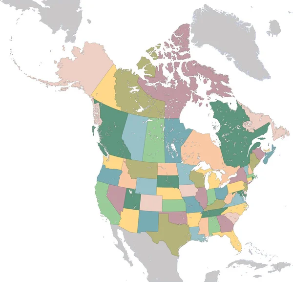
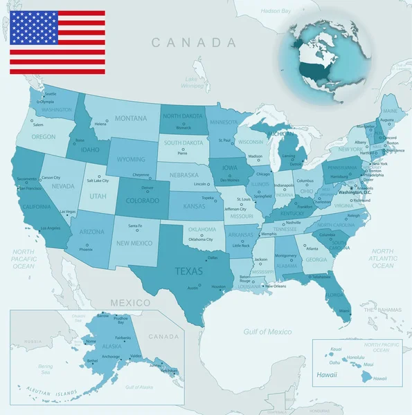
Map Of United State Of America. High Detailed Vector Map - United State Of America.

Vector, 5.76MB, 5000 × 3500 eps
stock vector America Continent Map Infographics

America Continent Map Infographics

Vector, 1.77MB, 5417 × 3878 eps
stock vector world map geography icon

World Map Geography Icon

Vector, 0.82MB, 5100 × 5315 eps
stock vector Outline maps of the countries in North and South America continent

Outline Maps Of The Countries In North And South America Continent

Vector, 3.76MB, 2861 × 4051 eps
stock vector Blue-green detailed map of USA and administrative divisions with country flag and location on the globe.

Blue-green Detailed Map Of USA And Administrative Divisions With Country Flag And Location On The Globe.

Vector, 19.44MB, 5288 × 5328 eps
stock image Planet earth with some clouds. Atlantic ocean view.

Planet Earth With Some Clouds. Atlantic Ocean View.

Image, 14.38MB, 5000 × 5000 jpg
Page 1 >> Next