photo free
Home Images Vectors Videos

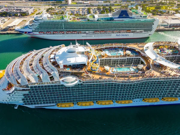
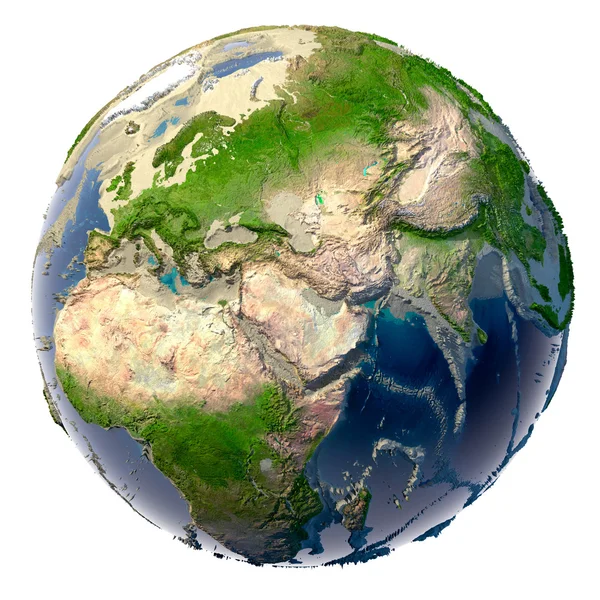
Stock image Elevation Seas

stock image MIAMI, FL, USA - JANUARY 5, 2019: Aerial drone photo Allure of the Seas mega cruise ship Port Miami

MIAMI, FL, USA - JANUARY 5, 2019: Aerial Drone Photo Allure Of The Seas Mega Cruise Ship Port Miami

Image, 9.91MB, 4200 × 2798 jpg
stock image Miami, FL, USA - March 26, 2023: Aerial drone photo Allure of the Seas at Port Miami full of tourists traveling

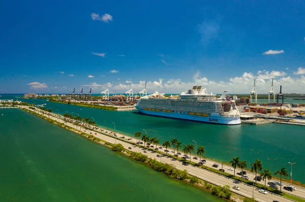
Miami, FL, USA - March 26, 2023: Aerial Drone Photo Allure Of The Seas At Port Miami Full Of Tourists Traveling

Image, 10.17MB, 4032 × 3024 jpg
stock image Metaphor for ecological disaster

Metaphor For Ecological Disaster

Image, 15.51MB, 5000 × 5000 jpg
stock image MIAMI, FL, USA - JANUARY 5, 2019: Aerial drone photo Allure of the Seas mega cruise ship Port Miami

MIAMI, FL, USA - JANUARY 5, 2019: Aerial Drone Photo Allure Of The Seas Mega Cruise Ship Port Miami

Image, 8.85MB, 4200 × 2798 jpg
stock image Aerial video Symphony of the Seas at Port Miami FL

Aerial Video Symphony Of The Seas At Port Miami FL

Image, 13.97MB, 5434 × 3620 jpg
stock image Large Seas Of Dunes Of Erg Chebbi In Morocco

Large Seas Of Dunes Of Erg Chebbi In Morocco

Image, 3.89MB, 4000 × 2667 jpg
stock image Aerial photo Royal Caribbean Symphony of the Seas at Port of Mia

Aerial Photo Royal Caribbean Symphony Of The Seas At Port Of Mia

Image, 10.65MB, 5462 × 3639 jpg
stock image Ecological catastrophe of the Earth - shallowing of the oceans a

Ecological Catastrophe Of The Earth - Shallowing Of The Oceans A

Image, 9.91MB, 5000 × 5000 jpg
stock image Isle of Arran in the Inner Seas off the West Coast of Scotland, belonging to United Kingdom, isolated on a bilevel elevation map, with distance scale

Isle Of Arran In The Inner Seas Off The West Coast Of Scotland, Belonging To United Kingdom, Isolated On A Bilevel Elevation Map, With Distance Scale

Image, 0.62MB, 2160 × 2160 jpg
stock image Ulva Island in the Inner Seas off the West Coast of Scotland on a colored elevation map

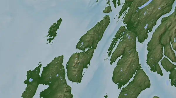
Ulva Island In The Inner Seas Off The West Coast Of Scotland On A Colored Elevation Map

Image, 1.52MB, 2880 × 1620 jpg
stock image Isle of Arran in the Inner Seas off the West Coast of Scotland on a colored elevation map

Isle Of Arran In The Inner Seas Off The West Coast Of Scotland On A Colored Elevation Map

Image, 2.36MB, 2880 × 1620 jpg
stock image Colonsay Island in the Inner Seas off the West Coast of Scotland on a colored elevation map

Colonsay Island In The Inner Seas Off The West Coast Of Scotland On A Colored Elevation Map

Image, 0.61MB, 2880 × 1620 jpg
stock image Harris Island in the North Atlantic Ocean, belonging to United Kingdom, isolated on a bilevel elevation map, with distance scale

Harris Island In The North Atlantic Ocean, Belonging To United Kingdom, Isolated On A Bilevel Elevation Map, With Distance Scale

Image, 0.63MB, 2160 × 2160 jpg
stock image Luing Island in the Inner Seas off the West Coast of Scotland, belonging to United Kingdom, isolated on a bilevel elevation map, with distance scale

Luing Island In The Inner Seas Off The West Coast Of Scotland, Belonging To United Kingdom, Isolated On A Bilevel Elevation Map, With Distance Scale

Image, 0.27MB, 2160 × 2160 jpg
stock image Tiree Island in the Inner Seas off the West Coast of Scotland on a colored elevation map

Tiree Island In The Inner Seas Off The West Coast Of Scotland On A Colored Elevation Map

Image, 0.7MB, 2880 × 1620 jpg
stock image Ireland Island in the Celtic Sea on a colored elevation map

Ireland Island In The Celtic Sea On A Colored Elevation Map

Image, 3.6MB, 2880 × 1620 jpg
stock image Isle of Rum in the Inner Seas off the West Coast of Scotland on a colored elevation map

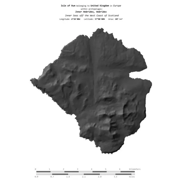
Isle Of Rum In The Inner Seas Off The West Coast Of Scotland On A Colored Elevation Map

Image, 1.23MB, 2880 × 1620 jpg
stock image Skye Island in the Inner Seas off the West Coast of Scotland on a colored elevation map

Skye Island In The Inner Seas Off The West Coast Of Scotland On A Colored Elevation Map

Image, 4.32MB, 2880 × 1620 jpg
stock image Bute Island in the Inner Seas off the West Coast of Scotland on a colored elevation map

Bute Island In The Inner Seas Off The West Coast Of Scotland On A Colored Elevation Map

Image, 3.11MB, 2880 × 1620 jpg
stock image Lismore Island in the Inner Seas off the West Coast of Scotland on a colored elevation map

Lismore Island In The Inner Seas Off The West Coast Of Scotland On A Colored Elevation Map

Image, 1.85MB, 2880 × 1620 jpg
stock image Aerial view of Great Barrier Reef and Green Island from helicopter, Queensland, Australia.

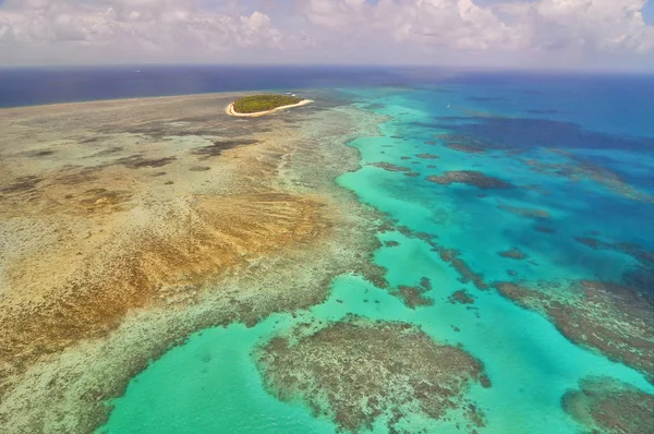
Aerial View Of Great Barrier Reef And Green Island From Helicopter, Queensland, Australia.

Image, 6.16MB, 4903 × 3256 jpg
stock image Drought on the planet Earth

Drought On The Planet Earth

Image, 8.95MB, 5000 × 5000 jpg
stock image Isle of Mull in the Inner Seas off the West Coast of Scotland on a colored elevation map

Isle Of Mull In The Inner Seas Off The West Coast Of Scotland On A Colored Elevation Map

Image, 3.58MB, 2880 × 1620 jpg
stock image North Uist Island in the North Atlantic Ocean on a colored elevation map

North Uist Island In The North Atlantic Ocean On A Colored Elevation Map

Image, 1.78MB, 2880 × 1620 jpg
stock image Barra Island in the North Atlantic Ocean on a colored elevation map

Barra Island In The North Atlantic Ocean On A Colored Elevation Map

Image, 0.96MB, 2880 × 1620 jpg
stock image Lismore Island in the Inner Seas off the West Coast of Scotland, belonging to United Kingdom, isolated on a bilevel elevation map, with distance scale

Lismore Island In The Inner Seas Off The West Coast Of Scotland, Belonging To United Kingdom, Isolated On A Bilevel Elevation Map, With Distance Scale

Image, 0.29MB, 2160 × 2160 jpg
stock image Isle of Mull in the Inner Seas off the West Coast of Scotland, belonging to United Kingdom, isolated on a bilevel elevation map, with distance scale

Isle Of Mull In The Inner Seas Off The West Coast Of Scotland, Belonging To United Kingdom, Isolated On A Bilevel Elevation Map, With Distance Scale

Image, 0.74MB, 2160 × 2160 jpg
stock image Gigha Island in the Inner Seas off the West Coast of Scotland, belonging to United Kingdom, isolated on a bilevel elevation map, with distance scale

Gigha Island In The Inner Seas Off The West Coast Of Scotland, Belonging To United Kingdom, Isolated On A Bilevel Elevation Map, With Distance Scale

Image, 0.28MB, 2160 × 2160 jpg
stock image Jura Island in the Inner Seas off the West Coast of Scotland on a colored elevation map

Jura Island In The Inner Seas Off The West Coast Of Scotland On A Colored Elevation Map

Image, 2.9MB, 2880 × 1620 jpg
stock image South Uist Island in the North Atlantic Ocean, belonging to United Kingdom, isolated on a bilevel elevation map, with distance scale

South Uist Island In The North Atlantic Ocean, Belonging To United Kingdom, Isolated On A Bilevel Elevation Map, With Distance Scale

Image, 0.52MB, 2160 × 2160 jpg
stock image Great Britain Island in the North Sea on a colored elevation map

Great Britain Island In The North Sea On A Colored Elevation Map

Image, 4.24MB, 2880 × 1620 jpg
stock image Scarba Island in the Inner Seas off the West Coast of Scotland, belonging to United Kingdom, isolated on a bilevel elevation map, with distance scale

Scarba Island In The Inner Seas Off The West Coast Of Scotland, Belonging To United Kingdom, Isolated On A Bilevel Elevation Map, With Distance Scale

Image, 0.45MB, 2160 × 2160 jpg
stock image Taransay Island in the Inner Seas off the West Coast of Scotland, belonging to United Kingdom, isolated on a bilevel elevation map, with distance scale

Taransay Island In The Inner Seas Off The West Coast Of Scotland, Belonging To United Kingdom, Isolated On A Bilevel Elevation Map, With Distance Scale

Image, 0.33MB, 2160 × 2160 jpg
stock image Great Britain Island in the North Sea, belonging to United Kingdom, isolated on a bilevel elevation map, with distance scale

Great Britain Island In The North Sea, Belonging To United Kingdom, Isolated On A Bilevel Elevation Map, With Distance Scale

Image, 0.42MB, 2160 × 2160 jpg
stock image Colonsay Island in the Inner Seas off the West Coast of Scotland, belonging to United Kingdom, isolated on a bilevel elevation map, with distance scale

Colonsay Island In The Inner Seas Off The West Coast Of Scotland, Belonging To United Kingdom, Isolated On A Bilevel Elevation Map, With Distance Scale

Image, 0.34MB, 2160 × 2160 jpg
stock image Skye Island in the Inner Seas off the West Coast of Scotland, belonging to United Kingdom, isolated on a bilevel elevation map, with distance scale

Skye Island In The Inner Seas Off The West Coast Of Scotland, Belonging To United Kingdom, Isolated On A Bilevel Elevation Map, With Distance Scale

Image, 0.61MB, 2160 × 2160 jpg
stock image Bute Island in the Inner Seas off the West Coast of Scotland, belonging to United Kingdom, isolated on a bilevel elevation map, with distance scale

Bute Island In The Inner Seas Off The West Coast Of Scotland, Belonging To United Kingdom, Isolated On A Bilevel Elevation Map, With Distance Scale

Image, 0.38MB, 2160 × 2160 jpg
stock image Isle of Rum in the Inner Seas off the West Coast of Scotland, belonging to United Kingdom, isolated on a bilevel elevation map, with distance scale

Isle Of Rum In The Inner Seas Off The West Coast Of Scotland, Belonging To United Kingdom, Isolated On A Bilevel Elevation Map, With Distance Scale

Image, 0.47MB, 2160 × 2160 jpg
stock image Lewis and Harris Island in the North Atlantic Ocean on a colored elevation map

Lewis And Harris Island In The North Atlantic Ocean On A Colored Elevation Map

Image, 2.82MB, 2880 × 1620 jpg
stock image Coll Island in the Inner Seas off the West Coast of Scotland on a colored elevation map

Coll Island In The Inner Seas Off The West Coast Of Scotland On A Colored Elevation Map

Image, 0.93MB, 2880 × 1620 jpg
stock image Scarba Island in the Inner Seas off the West Coast of Scotland on a colored elevation map

Scarba Island In The Inner Seas Off The West Coast Of Scotland On A Colored Elevation Map

Image, 1.14MB, 2880 × 1620 jpg
stock image Rathlin Island in the Inner Seas off the West Coast of Scotland on a colored elevation map

Rathlin Island In The Inner Seas Off The West Coast Of Scotland On A Colored Elevation Map

Image, 0.64MB, 2880 × 1620 jpg
stock image Ecological catastrophe of the Earth - shallowing of the oceans a

Ecological Catastrophe Of The Earth - Shallowing Of The Oceans A

Image, 10.9MB, 5000 × 5000 jpg
stock image Lewis and Harris Island in the North Atlantic Ocean, belonging to United Kingdom, isolated on a bilevel elevation map, with distance scale

Lewis And Harris Island In The North Atlantic Ocean, Belonging To United Kingdom, Isolated On A Bilevel Elevation Map, With Distance Scale

Image, 0.65MB, 2160 × 2160 jpg
stock image North Uist Island in the North Atlantic Ocean, belonging to United Kingdom, isolated on a bilevel elevation map, with distance scale

North Uist Island In The North Atlantic Ocean, Belonging To United Kingdom, Isolated On A Bilevel Elevation Map, With Distance Scale

Image, 0.66MB, 2160 × 2160 jpg
stock image Tiree Island in the Inner Seas off the West Coast of Scotland, belonging to United Kingdom, isolated on a bilevel elevation map, with distance scale

Tiree Island In The Inner Seas Off The West Coast Of Scotland, Belonging To United Kingdom, Isolated On A Bilevel Elevation Map, With Distance Scale

Image, 0.33MB, 2160 × 2160 jpg
stock image Islay Island in the Inner Seas off the West Coast of Scotland, belonging to United Kingdom, isolated on a bilevel elevation map, with distance scale

Islay Island In The Inner Seas Off The West Coast Of Scotland, Belonging To United Kingdom, Isolated On A Bilevel Elevation Map, With Distance Scale

Image, 0.59MB, 2160 × 2160 jpg
stock image Benbecula Island in the Inner Seas off the West Coast of Scotland on a colored elevation map

Benbecula Island In The Inner Seas Off The West Coast Of Scotland On A Colored Elevation Map

Image, 1.29MB, 2880 × 1620 jpg
stock image Harris Island in the North Atlantic Ocean on a colored elevation map

Harris Island In The North Atlantic Ocean On A Colored Elevation Map

Image, 2.17MB, 2880 × 1620 jpg
stock image Coll Island in the Inner Seas off the West Coast of Scotland, belonging to United Kingdom, isolated on a bilevel elevation map, with distance scale

Coll Island In The Inner Seas Off The West Coast Of Scotland, Belonging To United Kingdom, Isolated On A Bilevel Elevation Map, With Distance Scale

Image, 0.34MB, 2160 × 2160 jpg
Page 1 >> Next