photo free
Home Images Vectors Videos

Stock image Europe East

stock image world map made from round pasta

World Map Made From Round Pasta

Image, 6.95MB, 6306 × 4209 jpg
stock vector blue europe map on a white background in flat

Blue Europe Map On A White Background In Flat

Vector, 1.27MB, 4167 × 4167 eps
stock image World map made from coffee beans

World Map Made From Coffee Beans

Image, 9.97MB, 7360 × 4912 jpg
stock vector Vector map of Europe

Vector Map Of Europe

Vector, 14.14MB, 3124 × 2653 eps
stock vector Old map of the world

Old Map Of The World

Vector, 11.15MB, 4000 × 4000 eps
stock image The national dish of nomadic peoples of Mongolia, Kalmykia, Tuva, Buryatia, Kazakhstan, Asia Europe East. Liver soup liver fat

The National Dish Of Nomadic Peoples Of Mongolia, Kalmykia, Tuva, Buryatia, Kazakhstan, Asia Europe East. Liver Soup Liver Fat

Image, 9.86MB, 6000 × 4000 jpg
stock vector Set of vector globe icons showing earth with all continents. Vector illustration.

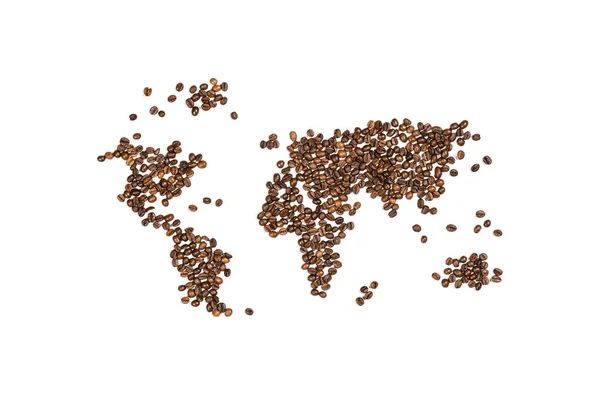
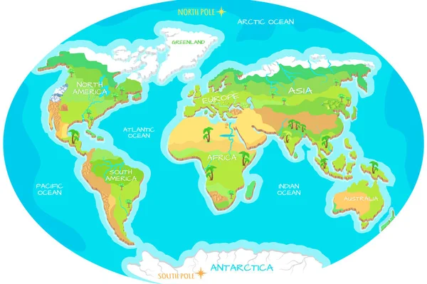
Set Of Vector Globe Icons Showing Earth With All Continents. Vector Illustration.

Vector, 1.09MB, 4000 × 4000 eps
stock image Image of oriental turtle dove, rufous turtle dove, Streptopelia

Image Of Oriental Turtle Dove, Rufous Turtle Dove, Streptopelia

Image, 8.84MB, 4608 × 3072 jpg
stock image World map made from coffee beans

World Map Made From Coffee Beans

Image, 6.42MB, 7329 × 4891 jpg
stock vector Europe vector map

Europe Vector Map

Vector, 0.93MB, 4131 × 5200 eps
stock vector Golden yen sign. Vector illustration.

Golden Yen Sign. Vector Illustration.

Vector, 12.07MB, 4000 × 4000 eps
stock image Physical map of Europe, Greenland, Middle East and Asia, with high resolution details. Satellite view of Planet Earth. 3D illustration - Elements of this image furnished by NASA

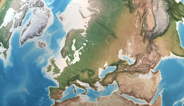
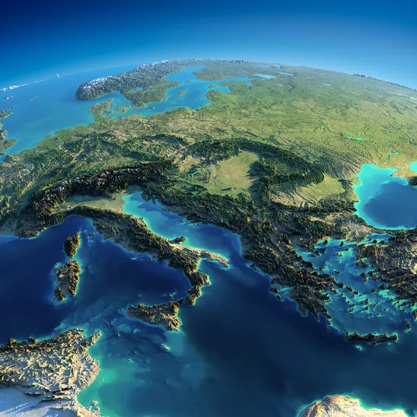
Physical Map Of Europe, Greenland, Middle East And Asia, With High Resolution Details. Satellite View Of Planet Earth. 3D Illustration - Elements Of This Image Furnished By NASA

Image, 15.26MB, 9000 × 5200 jpg
stock image Detailed Earth. Spain and the Mediterranean Sea

Detailed Earth. Spain And The Mediterranean Sea

Image, 12.49MB, 5000 × 5000 jpg
stock image Political map of the world. Gray world map-countries. White world map paper. Illustration

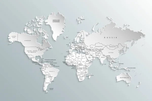
Political Map Of The World. Gray World Map-countries. White World Map Paper. Illustration

Image, 1.07MB, 3125 × 2083 jpg
stock vector europe

Europe

Vector, 2.82MB, 5000 × 4000 eps
stock image East Europe and Middle East

East Europe And Middle East

Image, 6.46MB, 2500 × 2500 jpg
stock image Detailed Earth. Italy, Greece and the Mediterranean Sea

Detailed Earth. Italy, Greece And The Mediterranean Sea

Image, 11.79MB, 5000 × 5000 jpg
stock image Europe 3D map isolated on dark background

Europe 3D Map Isolated On Dark Background

Image, 4.31MB, 4000 × 4000 jpg
stock image Planet Earth with detailed relief and atmosphere. Day and Night. Europe, North Africa and Middle East. 3D rendering. Elements of this image furnished by NASA

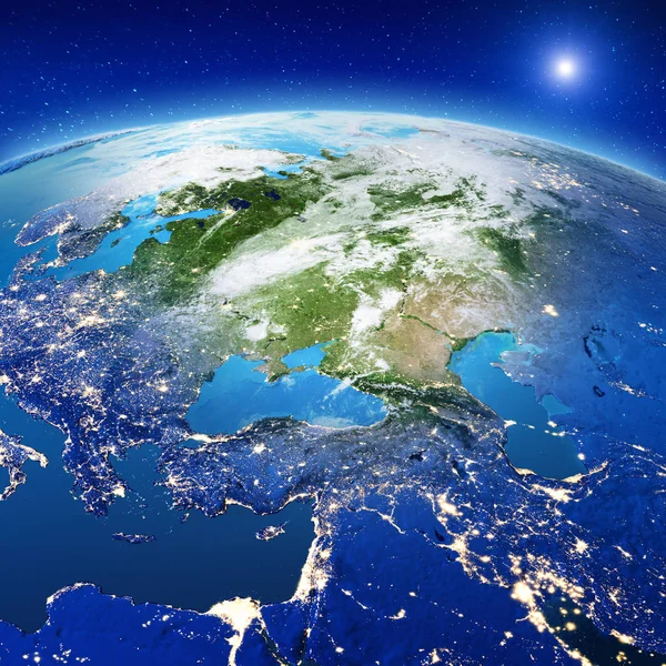
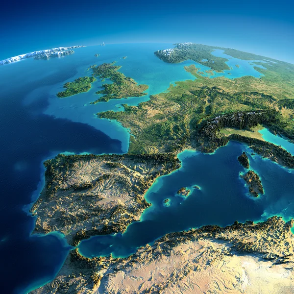
Planet Earth With Detailed Relief And Atmosphere. Day And Night. Europe, North Africa And Middle East. 3D Rendering. Elements Of This Image Furnished By NASA

Image, 19.01MB, 10000 × 5000 jpg
stock vector Continents, Oceans on Map of World. Our Planet.

Continents, Oceans On Map Of World. Our Planet.

Vector, 3.3MB, 5000 × 3329 eps
stock vector Europe vector high detailed political map with regions borders

Europe Vector High Detailed Political Map With Regions Borders

Vector, 14.21MB, 7292 × 5880 eps
stock vector Europe vector high detailed political map with regions borders

Europe Vector High Detailed Political Map With Regions Borders

Vector, 11.61MB, 7292 × 6038 eps
stock image Blue mosque in Istanbul, Turkey

Blue Mosque In Istanbul, Turkey

Image, 8.47MB, 4847 × 3416 jpg
stock image Istanbul silhouette on sunset

Istanbul Silhouette On Sunset

Image, 2.51MB, 2700 × 1920 jpg
stock image Blue mosque in Istanbul - Turkey

Blue Mosque In Istanbul - Turkey

Image, 9.44MB, 4847 × 3416 jpg
stock vector Markers with flags

Markers With Flags

Vector, 4.47MB, 5695 × 5406 eps
stock image   V4 Visegrad group on Euro flag, Poland, Czech Republic, Slovakia, Hungary

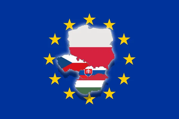
V4 Visegrad Group On Euro Flag, Poland, Czech Republic, Slovakia, Hungary

Image, 2.29MB, 6000 × 4000 jpg
stock image Germany Abstract Map Europe Region German Country European

Germany Abstract Map Europe Region German Country European

Image, 1.82MB, 4200 × 3200 jpg
stock image Flag of European Union

Flag Of European Union

Image, 3.27MB, 10000 × 10000 jpg
stock vector Flag of European Union

Flag Of European Union

Vector, 0.32MB, 10000 × 10000 eps
stock vector Political map of Europe in four shades of blue on white background. Vector illustration

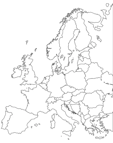
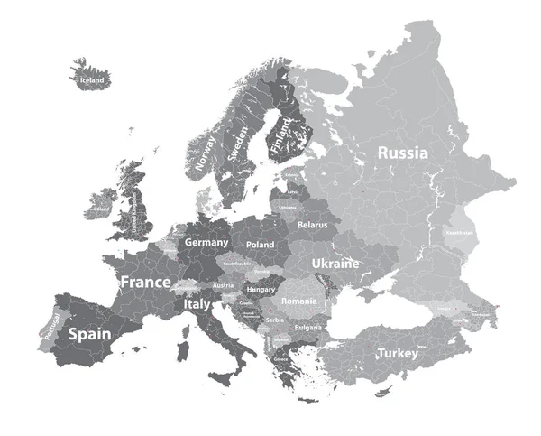
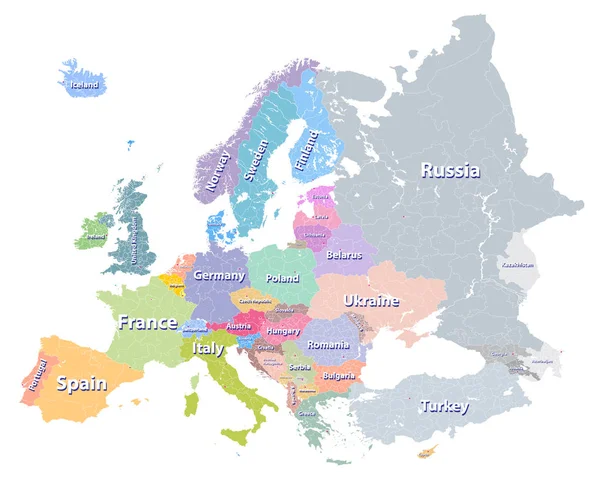
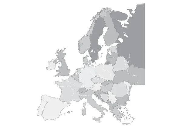
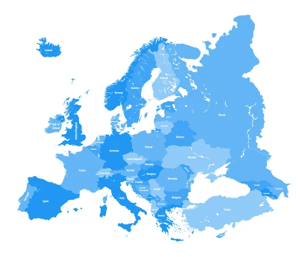
Political Map Of Europe In Four Shades Of Blue On White Background. Vector Illustration

Vector, 0.34MB, 6000 × 6000 eps
stock vector Europe map illustration

Europe Map Illustration

Vector, 4.37MB, 5000 × 3750 ai
stock vector china and europe flags

China And Europe Flags

Vector, 15.1MB, 7000 × 4947 ai
stock vector high detailed silhouette of Europe map

High Detailed Silhouette Of Europe Map

Vector, 10.15MB, 7292 × 5301 eps
stock image Europe  political map 3d rendered image

Europe Political Map 3d Rendered Image

Image, 11.77MB, 6000 × 4000 jpg
stock image Map of Russia with regions isolated on white

Map Of Russia With Regions Isolated On White

Image, 4.11MB, 5200 × 3250 jpg
stock vector Detailed vector political map of Europe

Detailed Vector Political Map Of Europe

Vector, 3.47MB, 7087 × 6326 eps
stock vector Europe map

Europe Map

Vector, 1.46MB, 4131 × 5200 eps
stock vector Europe map

Europe Map

Vector, 12.18MB, 7569 × 6033 eps
stock image Map of Russia with regions isolated on white

Map Of Russia With Regions Isolated On White

Image, 4.33MB, 5200 × 3250 jpg
stock image EU and Syria Flag painted on grunge wall

EU And Syria Flag Painted On Grunge Wall

Image, 21.08MB, 5184 × 3456 jpg
stock image EMEA region on political globe with flags

EMEA Region On Political Globe With Flags

Image, 15.6MB, 5000 × 5000 jpg
stock vector world map europe outline in vector, vector

World Map Europe Outline In Vector, Vector

Vector, 0.95MB, 8333 × 8333 eps
stock vector United Kingdom high detailed vector map with administrative divisions borders

United Kingdom High Detailed Vector Map With Administrative Divisions Borders

Vector, 7.6MB, 5379 × 8333 eps
stock image waving colorful national flag of european union. macro shot

Waving Colorful National Flag Of European Union. Macro Shot

Image, 21.29MB, 7360 × 4912 jpg
stock image Light blue 3D map of the European Union on a white background.

Light Blue 3D Map Of The European Union On A White Background.

Image, 5.2MB, 7680 × 4320 jpg
stock vector Simple flag of European Union. Correct size, proportion,

Simple Flag Of European Union. Correct Size, Proportion,

Vector, 0.34MB, 5833 × 4167 eps
stock vector Europe map

Europe Map

Vector, 1.16MB, 5200 × 3675 eps
stock vector European political map. All layers detachable and labeled

European Political Map. All Layers Detachable And Labeled

Vector, 10.69MB, 7292 × 6236 eps
stock image puzzle with the national flag of israel and european union on a world map

Puzzle With The National Flag Of Israel And European Union On A World Map

Image, 9.48MB, 6483 × 4327 jpg
Page 1 >> Next