photo free
Home Images Vectors Videos

Stock image Free State page 2

stock image town

Town

Image, 17.16MB, 6172 × 4115 jpg
stock vector Flag of Bavaria in Germany

Flag Of Bavaria In Germany

Vector, 7.87MB, 8333 × 5533 eps
stock image GERMANY, BAD SCHANDAU - 26 JUNE 2018: elbe river, road and buildings near rocks

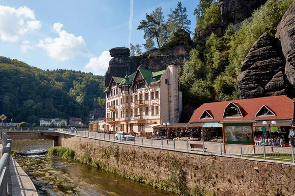
GERMANY, BAD SCHANDAU - 26 JUNE 2018: Elbe River, Road And Buildings Near Rocks

Image, 17.64MB, 6720 × 4480 jpg
stock image Visitors enjoying the amusement park at the annual Bloem Show

Visitors Enjoying The Amusement Park At The Annual Bloem Show

Image, 4.64MB, 3162 × 2100 jpg
stock image Man lies peacefully on bed in serene room.

Man Lies Peacefully On Bed In Serene Room.

Image, 26.18MB, 8256 × 5504 jpg
stock image Windmill along the line

Windmill Along The Line

Image, 16.1MB, 5616 × 3744 jpg
stock image Farm Road

Farm Road

Image, 11.18MB, 4752 × 3168 jpg
stock image Umngazi River Mouth

Umngazi River Mouth

Image, 11.9MB, 5472 × 3648 jpg
stock vector Free State of Thuringia

Free State Of Thuringia

Vector, 6.27MB, 5821 × 7021 eps
stock image Umngazi River Mouth

Umngazi River Mouth

Image, 10.3MB, 5472 × 3648 jpg
stock vector Background

Background "Oktoberfest"

Vector, 6.27MB, 4975 × 4963 eps
stock image Umngazi River Mouth

Umngazi River Mouth

Image, 15.11MB, 5472 × 3648 jpg
stock vector South Africa - map and flag - illustration

South Africa - Map And Flag - Illustration

Vector, 1.39MB, 6013 × 5900 eps
stock vector USA map with magnified Maryland State. Maryland flag and map.

USA Map With Magnified Maryland State. Maryland Flag And Map.

Vector, 1.99MB, 5000 × 3125 eps
stock image Blesbok or blesbuck

Blesbok Or Blesbuck

Image, 7.43MB, 4794 × 3200 jpg
stock image Misty Dam, Fouriesburg, South Africa

Misty Dam, Fouriesburg, South Africa

Image, 2.36MB, 4980 × 3320 jpg
stock image Free State gravel road

Free State Gravel Road

Image, 14.82MB, 5616 × 3744 jpg
stock vector south africa road, administrative and political vector map

South Africa Road, Administrative And Political Vector Map

Vector, 1.91MB, 4733 × 4091 eps
stock vector Maryland grunge flag

Maryland Grunge Flag

Vector, 5.32MB, 7087 × 4828 eps
stock image Bavaria, officially the Free State of Bavaria

Bavaria, Officially The Free State Of Bavaria

Image, 0MB, 6000 × 4000 jpg
stock vector The detailed map of South Africa with regions or states and cities, capital. Administrative division

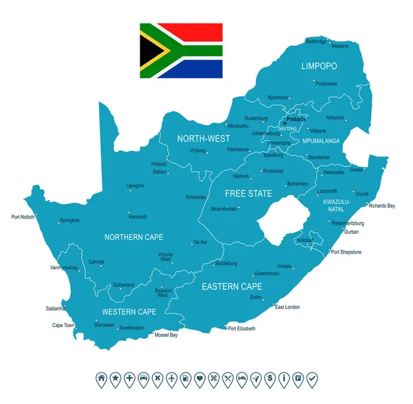
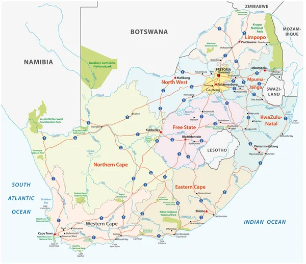
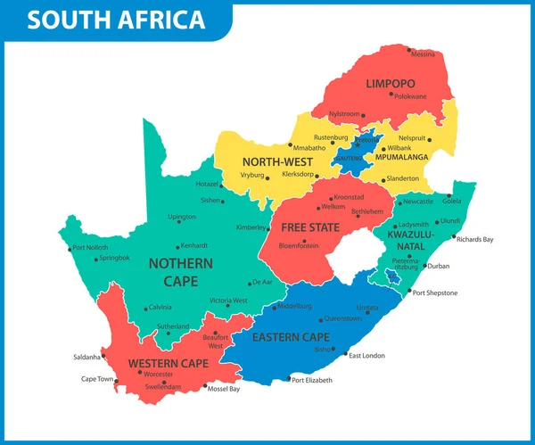
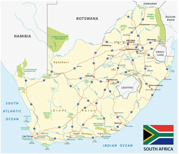
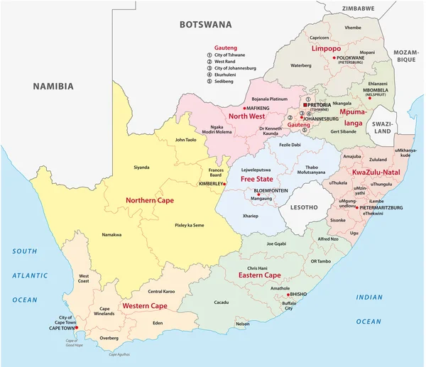
The Detailed Map Of South Africa With Regions Or States And Cities, Capital. Administrative Division

Vector, 1.02MB, 6000 × 5000 eps
stock image Landscape at Darling South Africa

Landscape At Darling South Africa

Image, 13.95MB, 5404 × 3602 jpg
stock image Free State Farm Sunrise

Free State Farm Sunrise

Image, 13.09MB, 5760 × 3840 jpg
stock image Bavaria, officially the Free State of Bavaria

Bavaria, Officially The Free State Of Bavaria

Image, 0MB, 3456 × 2304 jpg
stock vector Free State of Saxony

Free State Of Saxony

Vector, 5.74MB, 6721 × 7021 eps
stock image Free State of Bavaria

Free State Of Bavaria

Image, 8.1MB, 4041 × 2430 jpg
stock vector south africa road vector map with flag

South Africa Road Vector Map With Flag

Vector, 1.75MB, 4733 × 4091 eps
stock image Cattle grazing in the veld

Cattle Grazing In The Veld

Image, 16.5MB, 5616 × 3744 jpg
stock image Bavaria, officially the Free State of Bavaria

Bavaria, Officially The Free State Of Bavaria

Image, 0MB, 5184 × 3456 jpg
stock image Sheep in the Free State

Sheep In The Free State

Image, 8.31MB, 5760 × 3840 jpg
stock image beautiful Bavaria, officially the Free State

Beautiful Bavaria, Officially The Free State

Image, 0MB, 3456 × 2304 jpg
stock image Corns fields ready to be harvested near Koppies, a town in the Free State Province of South Africa

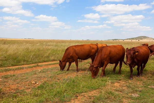
Corns Fields Ready To Be Harvested Near Koppies, A Town In The Free State Province Of South Africa

Image, 6.88MB, 3595 × 2400 jpg
stock image Free State Rugby Stadium

Free State Rugby Stadium

Image, 8.6MB, 4794 × 3200 jpg
stock image Golden Gate Highlands National Park panorama, South Africa

Golden Gate Highlands National Park Panorama, South Africa

Image, 7.65MB, 4121 × 2747 jpg
stock vector The detailed map of South Africa with regions or states. Administrative division

The Detailed Map Of South Africa With Regions Or States. Administrative Division

Vector, 0.68MB, 6000 × 5000 eps
stock vector South Africa Administrative map

South Africa Administrative Map

Vector, 1.23MB, 4713 × 4070 eps
stock image Cattle on the road to Modderpoort near Ladybrand

Cattle On The Road To Modderpoort Near Ladybrand

Image, 4.71MB, 3595 × 2400 jpg
stock image Physical map of the world, satellite view of South Africa. Globe. Hemisphere. Reliefs and oceans. 3d rendering. Element of this image are furnished by NASA

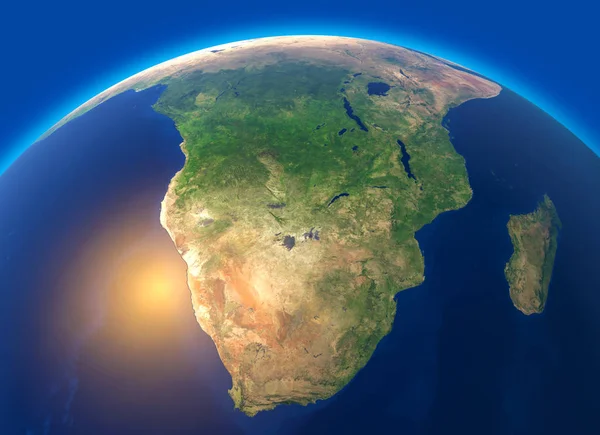
Physical Map Of The World, Satellite View Of South Africa. Globe. Hemisphere. Reliefs And Oceans. 3d Rendering. Element Of This Image Are Furnished By NASA

Image, 8.47MB, 5511 × 4000 jpg
stock image Dam in the Free State Botanical Gardens

Dam In The Free State Botanical Gardens

Image, 10.2MB, 3613 × 2400 jpg
stock image BOTSHABELO, SOUTH AFRICA - MARCH 12, 2018: Panorama of businesses at the Mall in Botshabelo, a town in the Mangaung Municipality of the Free State Province

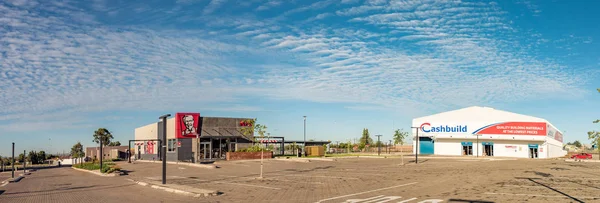
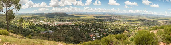
BOTSHABELO, SOUTH AFRICA - MARCH 12, 2018: Panorama Of Businesses At The Mall In Botshabelo, A Town In The Mangaung Municipality Of The Free State Province

Image, 11.08MB, 7079 × 2400 jpg
stock image beautiful Bavaria, officially the Free State

Beautiful Bavaria, Officially The Free State

Image, 0MB, 5806 × 3906 jpg
stock image Pretty Gardens Life Style Centre in Bloemfontein

Pretty Gardens Life Style Centre In Bloemfontein

Image, 6.99MB, 3595 × 2400 jpg
stock image The winder of a diamond mine, Kimberley, South Africa.

The Winder Of A Diamond Mine, Kimberley, South Africa.

Image, 13.81MB, 3773 × 5542 jpg
stock image Close up view of some Merino sheep in a flock on a Karoo farm just outside Touwsrivier in the western cape of south africa

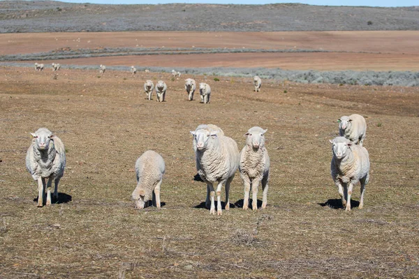
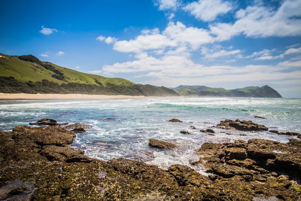
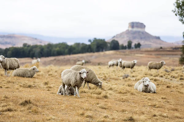
Close Up View Of Some Merino Sheep In A Flock On A Karoo Farm Just Outside Touwsrivier In The Western Cape Of South Africa

Image, 15.51MB, 5196 × 3464 jpg
stock image Dust storm between Bloemfontein and Petrusburg

Dust Storm Between Bloemfontein And Petrusburg

Image, 9.23MB, 4794 × 3200 jpg
stock image Panorama of Ficksburg in South Africa and Maputsoe in Lesotho

Panorama Of Ficksburg In South Africa And Maputsoe In Lesotho

Image, 14.05MB, 9054 × 2400 jpg
stock image ballot box in a polling station, election in a democracy

Ballot Box In A Polling Station, Election In A Democracy

Image, 0.29MB, 1704 × 2560 jpg
stock image Perspective road from Orange Free State, South Africa

Perspective Road From Orange Free State, South Africa

Image, 7.9MB, 4108 × 2738 jpg
stock image Bavaria, officially the Free State of Bavaria

Bavaria, Officially The Free State Of Bavaria

Image, 0MB, 5945 × 3969 jpg
stock image Street scene with gas station and vehicles in Phuthaditjhaba

Street Scene With Gas Station And Vehicles In Phuthaditjhaba

Image, 4.44MB, 3485 × 2400 jpg
Previous << Page 2 >> Next