photo free
Home Images Vectors Videos

Stock image Knox County

stock image Old courthouse in Galesburg, Knox County

Old Courthouse In Galesburg, Knox County

Image, 4.51MB, 3000 × 1868 jpg
stock image Old brick church in small Midwest town.

Old Brick Church In Small Midwest Town.

Image, 18.94MB, 4016 × 6016 jpg
stock image Golf Tee at Kelowna Lakeshore Road Okanagan Valley BC

Golf Tee At Kelowna Lakeshore Road Okanagan Valley BC

Image, 27.97MB, 7449 × 4848 jpg
stock image Bar Harbor is a Tourist Town on the Maine Coast by Acadia National Park

Bar Harbor Is A Tourist Town On The Maine Coast By Acadia National Park

Image, 5.24MB, 4754 × 3566 jpg
stock image Bar Harbor is a Tourist Town on the Maine Coast by Acadia National Park

Bar Harbor Is A Tourist Town On The Maine Coast By Acadia National Park

Image, 5.24MB, 4754 × 3566 jpg
stock vector Ohio Counties Map

Ohio Counties Map

Vector, 9.69MB, 5000 × 5000 eps
stock vector The black and white Maine State County Maps

The Black And White Maine State County Maps

Vector, 8.39MB, 5000 × 3500 eps
stock vector vector map of Texas's congressional districts since 2013. High detailed political map of Texasshowing counties formations

Vector Map Of Texas's Congressional Districts Since 2013. High Detailed Political Map Of Texasshowing Counties Formations

Vector, 7.71MB, 8333 × 7209 eps
stock vector The Nebraska State County Map with labels

The Nebraska State County Map With Labels

Vector, 9.48MB, 5000 × 3000 eps
stock vector Ohio Counties Map

Ohio Counties Map

Vector, 8.17MB, 5000 × 5000 eps
stock image Honey Run Waterfall

Honey Run Waterfall

Image, 7.53MB, 2400 × 3600 jpg
stock image Valley Forge Covered Bridge

Valley Forge Covered Bridge

Image, 9.43MB, 4461 × 2975 jpg
stock image Kelowna Okanagan lake

Kelowna Okanagan Lake

Image, 29.29MB, 10424 × 3826 jpg
stock image One Room Schoolhouse

One Room Schoolhouse

Image, 13.11MB, 4200 × 2800 jpg
stock image Aerial panorama of Knoxville, Tennessee skyline

Aerial Panorama Of Knoxville, Tennessee Skyline

Image, 31.56MB, 11392 × 4784 jpg
stock image Knox County School bus picking up students in the Cades Cove Campground in the Great Smoky Mountains National Park

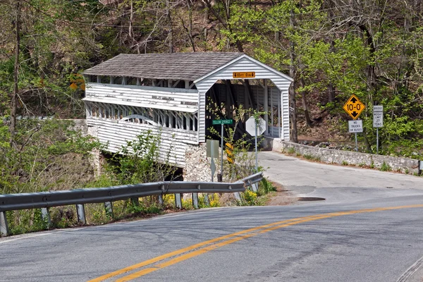
Knox County School Bus Picking Up Students In The Cades Cove Campground In The Great Smoky Mountains National Park

Image, 12.96MB, 5398 × 3448 jpg
stock image Map of Knox County in Illinois state on white background. single County map highlighted by black colour on Illinois map. UNITED STATES, US

Map Of Knox County In Illinois State On White Background. Single County Map Highlighted By Black Colour On Illinois Map. UNITED STATES, US

Image, 5.2MB, 8000 × 8000 jpg
stock image Map of Knox County in Ohio state on white background. single County map highlighted by black colour on Ohio map. UNITED STATES, US

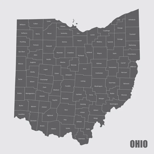
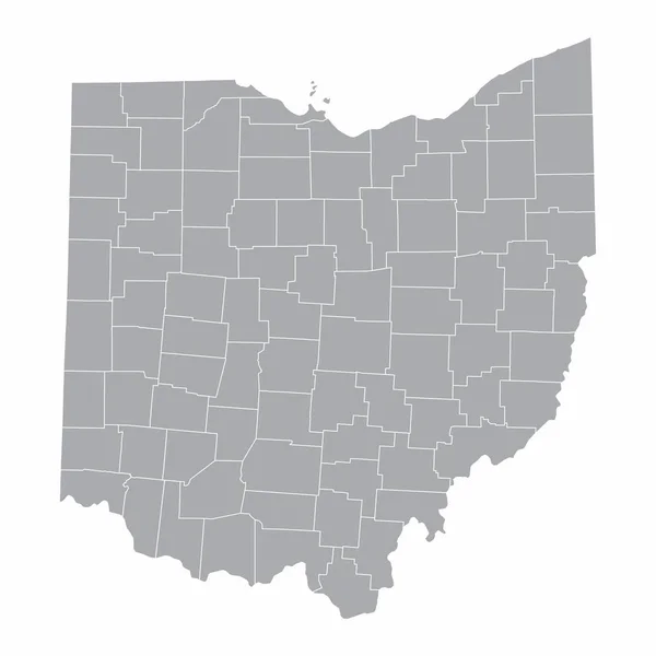
Map Of Knox County In Ohio State On White Background. Single County Map Highlighted By Black Colour On Ohio Map. UNITED STATES, US

Image, 5.59MB, 8000 × 8000 jpg
stock image Map of Knox County in Texas state on white background. single County map highlighted by black colour on Texas map. UNITED STATES, US

Map Of Knox County In Texas State On White Background. Single County Map Highlighted By Black Colour On Texas Map. UNITED STATES, US

Image, 6.5MB, 8000 × 8000 jpg
stock vector Nebraska, U.S. state, subdivided into 93 counties, gray political map with borders and county names. Triply landlocked state in the Midwestern region of United States, nicknamed The Cornhusker State.

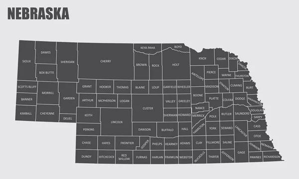
Nebraska, U.S. State, Subdivided Into 93 Counties, Gray Political Map With Borders And County Names. Triply Landlocked State In The Midwestern Region Of United States, Nicknamed The Cornhusker State.

Vector, 1.66MB, 9000 × 4645 eps
stock vector Tennessee, subdivided into 95 counties, political map with borders and county names. Landlocked state in the Southeastern region of the United States, nicknamed The Volunteer State. Illustration

Tennessee, Subdivided Into 95 Counties, Political Map With Borders And County Names. Landlocked State In The Southeastern Region Of The United States, Nicknamed The Volunteer State. Illustration

Vector, 2.51MB, 9000 × 4521 eps
stock vector Knox (Victoria) outline map set

Knox (Victoria) Outline Map Set

Vector, 0.61MB, 6000 × 3000 eps
stock vector Nebraska, U.S. state, subdivided into 93 counties,multi colored political map with capital Lincoln, borders and county names.State in the Midwestern region of the United States. The Cornhusker State.

Nebraska, U.S. State, Subdivided Into 93 Counties,multi Colored Political Map With Capital Lincoln, Borders And County Names.State In The Midwestern Region Of The United States. The Cornhusker State.

Vector, 1.68MB, 9000 × 4645 eps
stock vector Nebraska, U.S. state, subdivided into 93 counties, political map with borders and county names. Triply landlocked state in the Midwestern region of United States, nicknamed The Cornhusker State.

Nebraska, U.S. State, Subdivided Into 93 Counties, Political Map With Borders And County Names. Triply Landlocked State In The Midwestern Region Of United States, Nicknamed The Cornhusker State.

Vector, 2.06MB, 9000 × 5220 eps
stock vector Tennessee, subdivided into 95 counties, gray political map with borders and county names. Landlocked state in the Southeastern region of the United States, nicknamed The Volunteer State. Illustration

Tennessee, Subdivided Into 95 Counties, Gray Political Map With Borders And County Names. Landlocked State In The Southeastern Region Of The United States, Nicknamed The Volunteer State. Illustration

Vector, 2.22MB, 9000 × 4500 eps
Page 1 >> Next