photo free
Home Images Vectors Videos

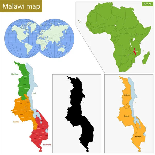
Stock image Map Of Malawi page 2

stock vector Vector maps set.  High detailed 46 maps of African countries wit

Vector Maps Set. High Detailed 46 Maps Of African Countries Wit

Vector, 12.15MB, 6000 × 3600 eps
stock vector Set of Flags of world sovereign states. Vector illustration.

Set Of Flags Of World Sovereign States. Vector Illustration.

Vector, 14.33MB, 5000 × 5000 eps
stock vector Flags of African countries like pins

Flags Of African Countries Like Pins

Vector, 0.85MB, 5000 × 4251 eps
stock vector Set Flags of world sovereign states. Vector illustration

Set Flags Of World Sovereign States. Vector Illustration

Vector, 8.82MB, 5000 × 5000 eps
stock vector Outline maps of African countries collection, black lined vector map.

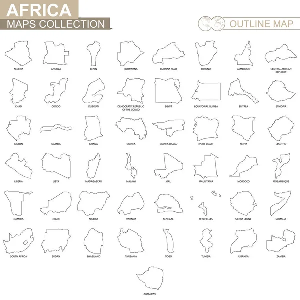
Outline Maps Of African Countries Collection, Black Lined Vector Map.

Vector, 2.04MB, 5000 × 5000 eps
stock vector Set of Flags of world sovereign states signed by the countries names

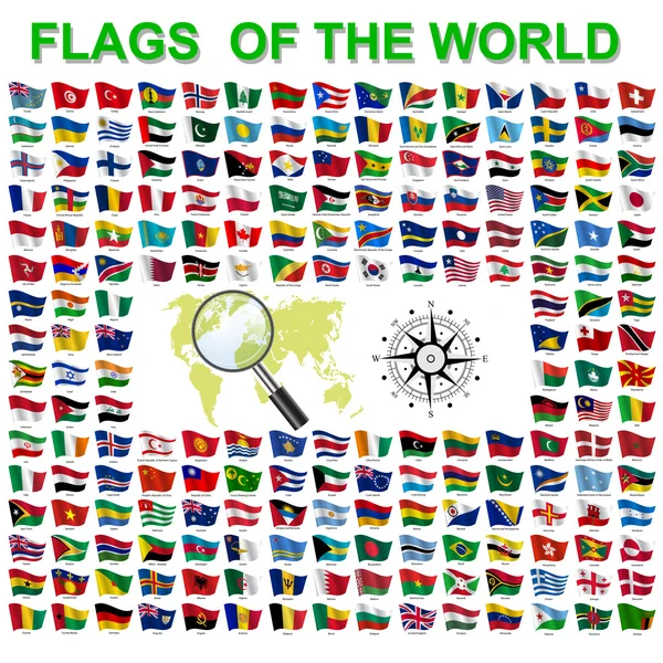
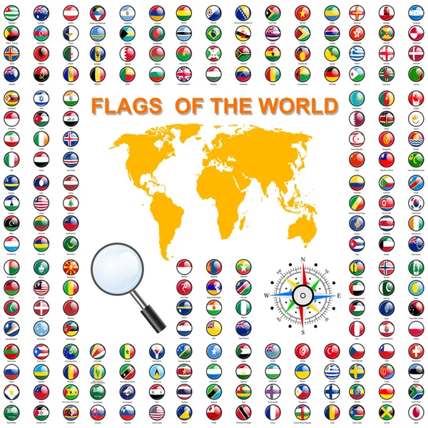
Set Of Flags Of World Sovereign States Signed By The Countries Names

Vector, 15.48MB, 5000 × 5000 eps
stock image Map of Africa with a selected country of Malawi

Map Of Africa With A Selected Country Of Malawi

Image, 1.77MB, 6250 × 6250 jpg
stock vector Africa Map - Vintage Vector Illustration

Africa Map - Vintage Vector Illustration

Vector, 6.12MB, 5500 × 6680 eps
stock image Nkhotakota, district of Malawi. High resolution satellite map. Locations and names of major cities of the region. Corner auxiliary location maps

Nkhotakota, District Of Malawi. High Resolution Satellite Map. Locations And Names Of Major Cities Of The Region. Corner Auxiliary Location Maps

Image, 11.42MB, 4930 × 3770 jpg
stock vector Tanzania Political Map

Tanzania Political Map

Vector, 1.29MB, 8533 × 7799 eps
stock image Somalia on Africa map

Somalia On Africa Map

Image, 8.07MB, 7000 × 6000 jpg
stock image Map of Africa

Map Of Africa

Image, 5.71MB, 7000 × 6000 jpg
stock image Africa map colorful, new political detailed map, separate individual states, with state city and sea names, natural paper 3D shadow blank

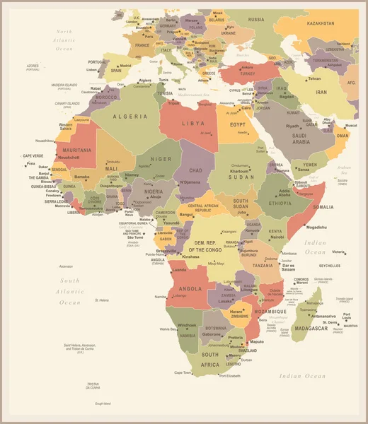
Africa Map Colorful, New Political Detailed Map, Separate Individual States, With State City And Sea Names, Natural Paper 3D Shadow Blank

Image, 1.61MB, 4231 × 4000 jpg
stock vector Africa, Arabia Global World

Africa, Arabia Global World

Vector, 0.92MB, 5560 × 5534 eps
stock vector Africa Global World

Africa Global World

Vector, 0.82MB, 5560 × 5534 eps
stock image Detailed Earth. Africa and Madagascar

Detailed Earth. Africa And Madagascar

Image, 11.72MB, 5000 × 5000 jpg
stock image Detailed Earth. Africa and Madagascar on a moonlit night

Detailed Earth. Africa And Madagascar On A Moonlit Night

Image, 7.08MB, 5000 × 5000 jpg
stock image African Great Lakes in planet earth,  aerial view from outer space

African Great Lakes In Planet Earth, Aerial View From Outer Space

Image, 18.68MB, 8000 × 4000 jpg
stock image Kenya on Africa map

Kenya On Africa Map

Image, 8.42MB, 7000 × 6000 jpg
stock vector vector map of Africa continent colored by regions. All flags of African countries arranged in alphabetical order and singled out by regions

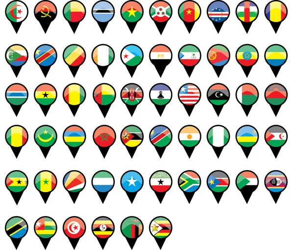
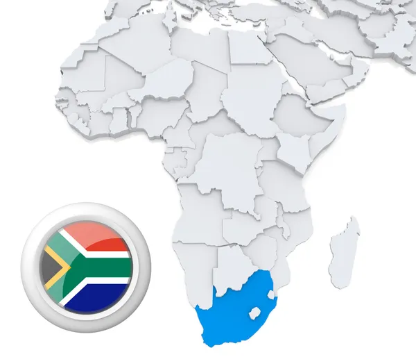
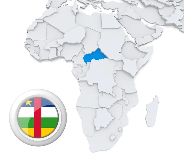
Vector Map Of Africa Continent Colored By Regions. All Flags Of African Countries Arranged In Alphabetical Order And Singled Out By Regions

Vector, 8.46MB, 8334 × 5379 eps
stock image Map of Africa

Map Of Africa

Image, 5.77MB, 7000 × 6000 jpg
stock image Night Earth. Africa and Madagascar

Night Earth. Africa And Madagascar

Image, 7.49MB, 5000 × 5000 jpg
stock image Swaziland on Africa map

Swaziland On Africa Map

Image, 8.47MB, 7000 × 6000 jpg
stock image Equatorial Guinea on Africa map

Equatorial Guinea On Africa Map

Image, 8.17MB, 7000 × 6000 jpg
stock vector Set Flags of world sovereign states. Vector illustration

Set Flags Of World Sovereign States. Vector Illustration

Vector, 8.87MB, 5000 × 5000 eps
stock vector Africa Map - Vintage Vector Illustration

Africa Map - Vintage Vector Illustration

Vector, 4.87MB, 5500 × 6337 eps
stock vector east africa map with flags

East Africa Map With Flags

Vector, 1.41MB, 4348 × 4108 eps
stock vector Navigation pointer icons with world flags

Navigation Pointer Icons With World Flags

Vector, 2.84MB, 4592 × 5476 eps
stock image Tanzania on Africa map

Tanzania On Africa Map

Image, 8.29MB, 7000 × 6000 jpg
stock vector Africa contoured map with highlighted Ivory Coast.

Africa Contoured Map With Highlighted Ivory Coast.

Vector, 1.26MB, 5000 × 5000 eps
stock vector Africa Map - Vector Illustration

Africa Map - Vector Illustration

Vector, 4.86MB, 5500 × 6380 eps
stock vector Map and Flag in Circle, Africa Countries Collection.

Map And Flag In Circle, Africa Countries Collection.

Vector, 14.44MB, 5000 × 5000 eps
stock image Western Sahara on Africa map

Western Sahara On Africa Map

Image, 5.41MB, 7000 × 6000 jpg
stock image Djibouti on Africa map

Djibouti On Africa Map

Image, 8.05MB, 7000 × 6000 jpg
stock vector Africa Map - Vintage Vector Illustration

Africa Map - Vintage Vector Illustration

Vector, 6.3MB, 5500 × 6655 eps
stock vector Africa contoured map with highlighted Swaziland.

Africa Contoured Map With Highlighted Swaziland.

Vector, 1.3MB, 5000 × 5000 eps
stock image Map of Africa

Map Of Africa

Image, 5.9MB, 7000 × 6000 jpg
stock vector Malawi map

Malawi Map

Vector, 9.8MB, 7004 × 7004 eps
stock vector Map marker with flag-set thirteenth

Map Marker With Flag-set Thirteenth

Vector, 7.09MB, 5000 × 5000 eps
stock vector Map of Africa illustration

Map Of Africa Illustration

Vector, 6.58MB, 3173 × 2289 eps
stock vector Vector isometric maps set - Africa continent.  Maps of African countries with administrative division and cities. Part 1.

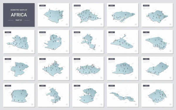
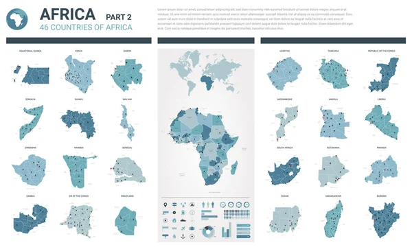
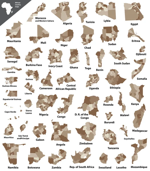
Vector Isometric Maps Set - Africa Continent. Maps Of African Countries With Administrative Division And Cities. Part 1.

Vector, 12.03MB, 5600 × 3500 eps
stock image Sierra Leone on Africa map

Sierra Leone On Africa Map

Image, 5.42MB, 7000 × 6000 jpg
stock image South Africa on Africa map

South Africa On Africa Map

Image, 8.39MB, 7000 × 6000 jpg
stock vector Southern africa - vector maps of territories

Southern Africa - Vector Maps Of Territories

Vector, 0.44MB, 5424 × 4533 eps
stock image Zimbabwe on Africa map

Zimbabwe On Africa Map

Image, 8.47MB, 7000 × 6000 jpg
stock image Central African republic on Africa map

Central African Republic On Africa Map

Image, 8.13MB, 7000 × 6000 jpg
stock vector Workshop Mosaic Map of Malawi with Multi-Colored Gear wheels

Workshop Mosaic Map Of Malawi With Multi-Colored Gear Wheels

Vector, 0.62MB, 3758 × 4258 eps
stock image Map of Africa

Map Of Africa

Image, 5.33MB, 7000 × 6000 jpg
stock vector Tanzania political map

Tanzania Political Map

Vector, 1.36MB, 8333 × 7601 eps
stock vector African vector isolated country maps

African Vector Isolated Country Maps

Vector, 9.92MB, 6250 × 7119 eps
Previous << Page 2 >> Next