photo free
Home Images Vectors Videos

Stock image Mariana Islands

stock vector Saipan and Tinian, Northern Mariana Islands, gray political map. Islands of the Mariana Archipelago. Unincorporated territory and commonwealth of United States with administrative center Capitol Hill.

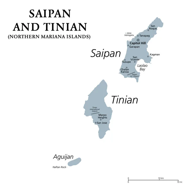
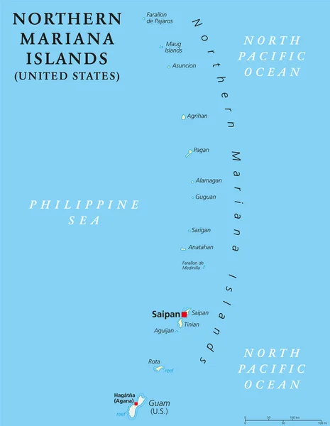
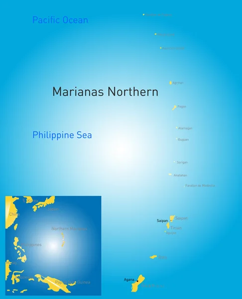
Saipan And Tinian, Northern Mariana Islands, Gray Political Map. Islands Of The Mariana Archipelago. Unincorporated Territory And Commonwealth Of United States With Administrative Center Capitol Hill.

Vector, 1.42MB, 6000 × 6000 eps
stock image Rocks and corals are visible through the crystal clear waters of the northern marianas

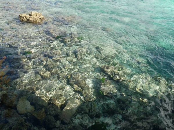
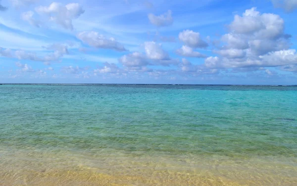
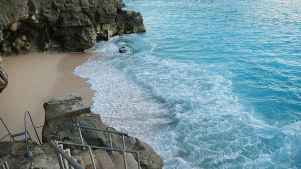
Rocks And Corals Are Visible Through The Crystal Clear Waters Of The Northern Marianas

Image, 10.37MB, 4592 × 3448 jpg
stock image Tumon Bay, Guam

Tumon Bay, Guam

Image, 5.63MB, 6177 × 2995 jpg
stock image Tumon Bay, Guam

Tumon Bay, Guam

Image, 3.82MB, 4423 × 3068 jpg
stock image Tumon Bay, Guam

Tumon Bay, Guam

Image, 9.68MB, 7222 × 3996 jpg
stock image Tachogna Beach, Tinian

Tachogna Beach, Tinian

Image, 2.5MB, 3924 × 2224 jpg
stock image Leaves from a tree frames a portion of the Wing Beach in Saipan, Northern Mariana Islands.

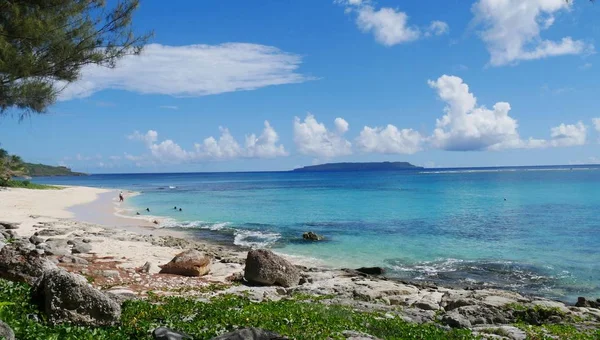
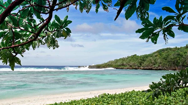
Leaves From A Tree Frames A Portion Of The Wing Beach In Saipan, Northern Mariana Islands.

Image, 7.91MB, 4592 × 2584 jpg
stock image Tumon Bay, Guam

Tumon Bay, Guam

Image, 4.18MB, 5219 × 2464 jpg
stock image Tumon Bay, Guam

Tumon Bay, Guam

Image, 6.73MB, 7609 × 2558 jpg
stock image Tree on a Tropical Beach

Tree On A Tropical Beach

Image, 10.21MB, 4554 × 3005 jpg
stock image Anak Krakatau erupting

Anak Krakatau Erupting

Image, 3.68MB, 2500 × 2500 jpg
stock image Saipans east coast is a display of lush scenery, golf courses with steep cliff lines with waves rolling in from the Pacific Ocean.

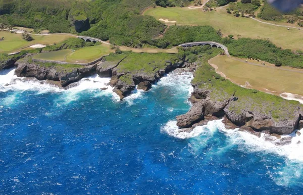
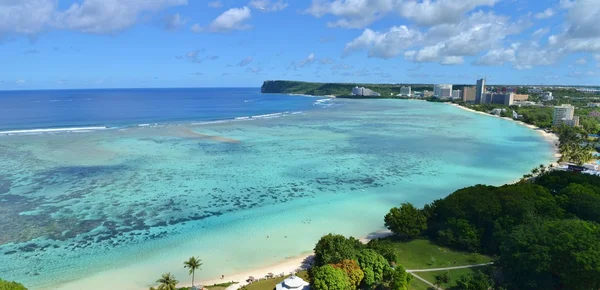
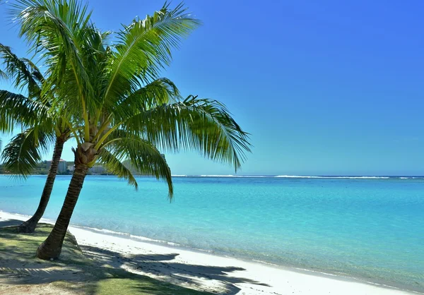
Saipans East Coast Is A Display Of Lush Scenery, Golf Courses With Steep Cliff Lines With Waves Rolling In From The Pacific Ocean.

Image, 10.92MB, 5000 × 3222 jpg
stock image Palm Trees on a Tropical Beach

Palm Trees On A Tropical Beach

Image, 4.7MB, 4608 × 2498 jpg
stock image Anak Krakatau erupting

Anak Krakatau Erupting

Image, 3.68MB, 2250 × 2250 jpg
stock image Tropical Island Beach and Ocean

Tropical Island Beach And Ocean

Image, 3.65MB, 4574 × 2880 jpg
stock image Palm Tree on a Tropical Beach

Palm Tree On A Tropical Beach

Image, 3.81MB, 4222 × 2946 jpg
stock image Anak Krakatau erupting

Anak Krakatau Erupting

Image, 3.19MB, 6000 × 3375 jpg
stock vector Guam map

Guam Map

Vector, 1.11MB, 6168 × 7183 eps
stock image Anak Krakatau erupting

Anak Krakatau Erupting

Image, 1.02MB, 4000 × 2608 jpg
stock image Geyser at Tinian Blow hole

Geyser At Tinian Blow Hole

Image, 7.19MB, 3872 × 2592 jpg
stock image Taga Beach, Tinian, Northern Mariana Islands

Taga Beach, Tinian, Northern Mariana Islands

Image, 6.71MB, 4592 × 2584 jpg
stock image Anak Krakatau erupting

Anak Krakatau Erupting

Image, 3.41MB, 4000 × 2250 jpg
stock vector Northern Mariana Islands political map

Northern Mariana Islands Political Map

Vector, 2.05MB, 6444 × 9666 eps
stock vector Northern Mariana Islands political map

Northern Mariana Islands Political Map

Vector, 2.47MB, 6974 × 8999 eps
stock vector Oceania highly detailed physical map

Oceania Highly Detailed Physical Map

Vector, 7.22MB, 8923 × 8398 eps
stock vector northern mariana islands map

Northern Mariana Islands Map

Vector, 1.32MB, 5523 × 6803 eps
stock vector Map of Guam a non incorporated territory of the United States

Map Of Guam A Non Incorporated Territory Of The United States

Vector, 0.67MB, 3113 × 3288 eps
stock image Last command post in Saipan, North Mariana Islands

Last Command Post In Saipan, North Mariana Islands

Image, 13.09MB, 5184 × 3456 jpg
stock vector Vector map of the Mariana Islands and the Mariana Trench, U.S

Vector Map Of The Mariana Islands And The Mariana Trench, U.S

Vector, 1.95MB, 3100 × 4990 eps
stock vector Guam political map

Guam Political Map

Vector, 2.98MB, 7294 × 8777 eps
stock image Super Typhoon Yutu, strongest storm on Earth in 2018. Satellite view. Elements of this image furnished by NASA.

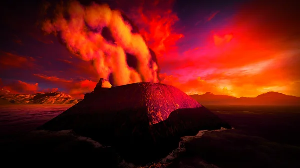
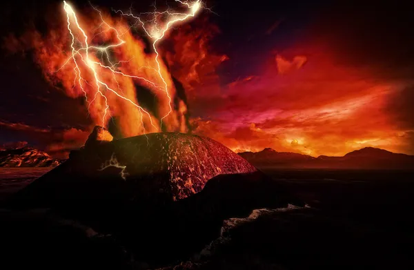
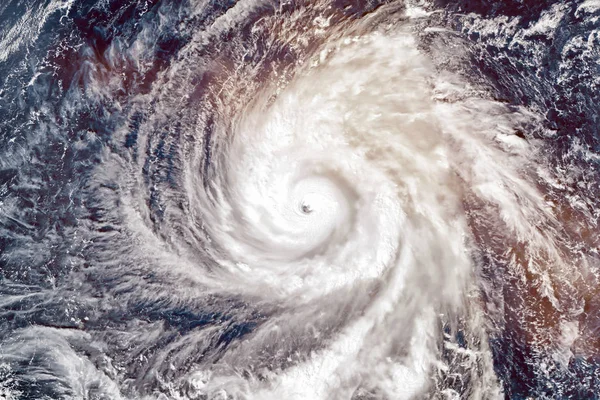
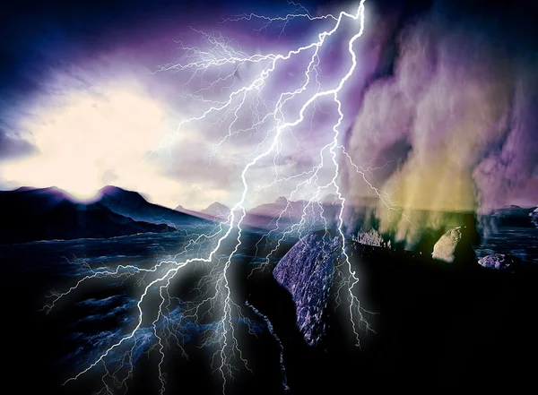
Super Typhoon Yutu, Strongest Storm On Earth In 2018. Satellite View. Elements Of This Image Furnished By NASA.

Image, 3.94MB, 4670 × 3113 jpg
stock vector the Marianas national vector drawing map on white background

The Marianas National Vector Drawing Map On White Background

Vector, 3.14MB, 5000 × 5769 eps
stock image Anak Krakatau erupting

Anak Krakatau Erupting

Image, 0.72MB, 2567 × 1888 jpg
stock image Closeup of Ruffled Northern Mariana Islands Flag

Closeup Of Ruffled Northern Mariana Islands Flag

Image, 23.99MB, 5910 × 4000 jpg
stock vector Guam and Northern Mariana Islands, political map. Two separate unincorporated territories of the United States of America in the Micronesia subregion of the Western Pacific Ocean. Illustration. Vector

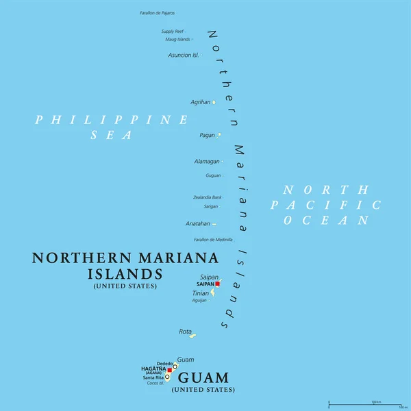
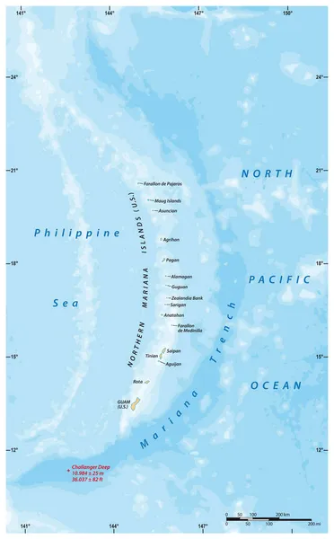
Guam And Northern Mariana Islands, Political Map. Two Separate Unincorporated Territories Of The United States Of America In The Micronesia Subregion Of The Western Pacific Ocean. Illustration. Vector

Vector, 3.12MB, 6000 × 6000 eps
stock vector High Quality map state of United States

High Quality Map State Of United States

Vector, 1.71MB, 4000 × 4000 eps
stock vector Northern Mariana Islands Independence Day Patriotic Design Expressive Brush Stroke in National Flag

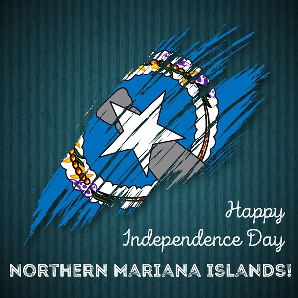
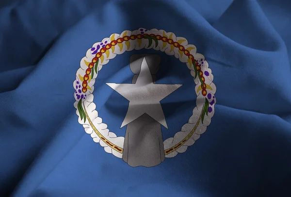
Northern Mariana Islands Independence Day Patriotic Design Expressive Brush Stroke In National Flag

Vector, 3.42MB, 8333 × 8333 eps
stock vector Northern Mariana Islands Independence Day Seamless Pattern Flying Rubber Balloons in Colors of the

Northern Mariana Islands Independence Day Seamless Pattern Flying Rubber Balloons In Colors Of The

Vector, 5.67MB, 8333 × 8333 eps
stock image US and Northern Mariana Island flags

US And Northern Mariana Island Flags

Image, 3.92MB, 3072 × 2304 jpg
stock vector Flag of Northern Mariana Islands (USA), Saipan - Micronesia

Flag Of Northern Mariana Islands (USA), Saipan - Micronesia

Vector, 8.22MB, 8338 × 5538 eps
stock vector Guam map vector

Guam Map Vector

Vector, 0.28MB, 7087 × 4724 eps
stock image close-up hanging Mariana fruit bat (Pteropus mariannus) on tree. nature background in Sri Lanka . wild animals in a natural environment for yourself

Close-up Hanging Mariana Fruit Bat (Pteropus Mariannus) On Tree. Nature Background In Sri Lanka . Wild Animals In A Natural Environment For Yourself

Image, 18.01MB, 6720 × 4480 jpg
stock image Agrihan Island in the Philippine Sea - belonging to United States. Described location diagram with yellow shape of the island and sample maps of its surroundings

Agrihan Island In The Philippine Sea - Belonging To United States. Described Location Diagram With Yellow Shape Of The Island And Sample Maps Of Its Surroundings

Image, 2.03MB, 3840 × 2160 jpg
stock image Guam Island in the Philippine Sea on a topographic, OSM Humanitarian style map

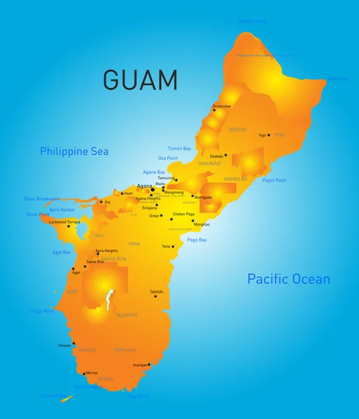
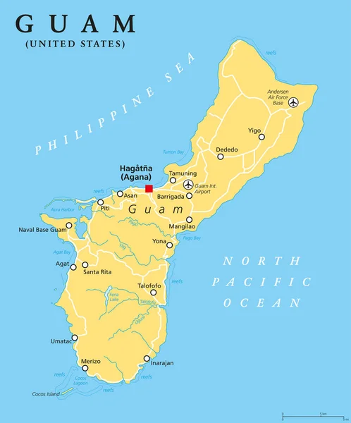
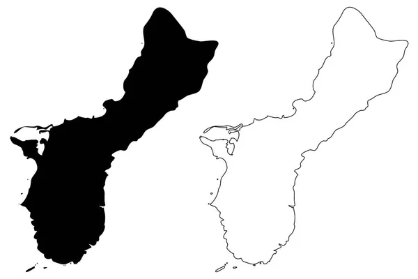
Guam Island In The Philippine Sea On A Topographic, OSM Humanitarian Style Map

Image, 0.74MB, 2880 × 1620 jpg
stock image Saipan Island in the Philippine Sea - belonging to United States. Described location diagram with yellow shape of the island and sample maps of its surroundings

Saipan Island In The Philippine Sea - Belonging To United States. Described Location Diagram With Yellow Shape Of The Island And Sample Maps Of Its Surroundings

Image, 2.1MB, 3840 × 2160 jpg
stock image Tinian Island in the Philippine Sea, belonging to United States, isolated on a bilevel elevation map, with distance scale

Tinian Island In The Philippine Sea, Belonging To United States, Isolated On A Bilevel Elevation Map, With Distance Scale

Image, 0.3MB, 2160 × 2160 jpg
stock image Pagan Island in the Philippine Sea, belonging to United States, isolated on a bilevel elevation map, with distance scale

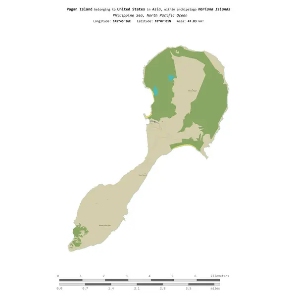
Pagan Island In The Philippine Sea, Belonging To United States, Isolated On A Bilevel Elevation Map, With Distance Scale

Image, 0.32MB, 2160 × 2160 jpg
stock image Pagan Island in the Philippine Sea, belonging to United States, isolated on a topographic, OSM Humanitarian style map, with distance scale

Pagan Island In The Philippine Sea, Belonging To United States, Isolated On A Topographic, OSM Humanitarian Style Map, With Distance Scale

Image, 0.39MB, 2160 × 2160 jpg
stock image Waving Flag of Northern Mariana Islands

Waving Flag Of Northern Mariana Islands

Image, 16.18MB, 5184 × 3456 jpg
stock vector Northern Mariana Islands football player. Soccer uniform.

Northern Mariana Islands Football Player. Soccer Uniform.

Vector, 3.64MB, 6400 × 6400 eps
Page 1 >> Next