
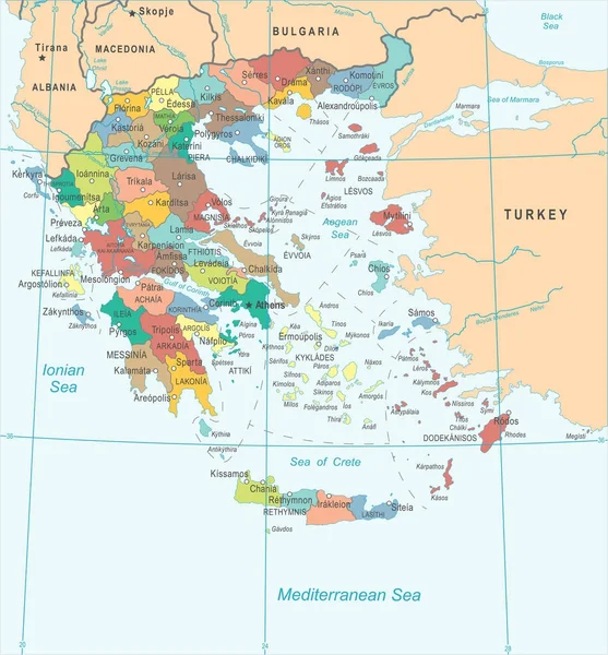
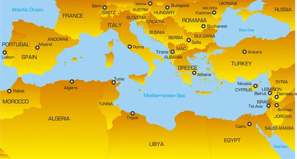
Stock image Mediterranean Regions


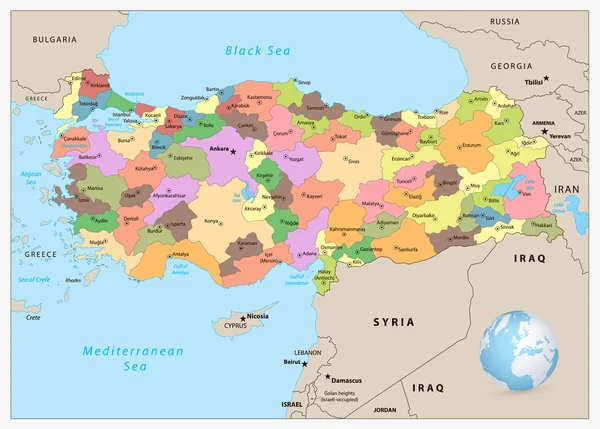
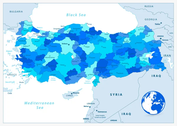
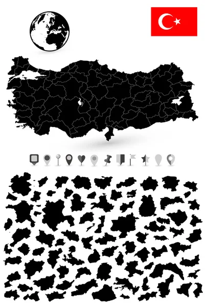
Map Of The Ottoman Empire At The Time Of The Greatest Expansion And In The Late 17th Century.
Vector, 1.54MB, 4573 × 3100 eps
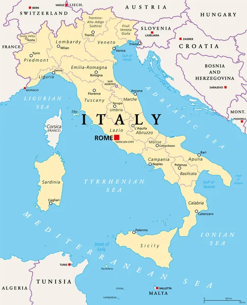
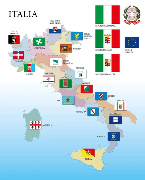
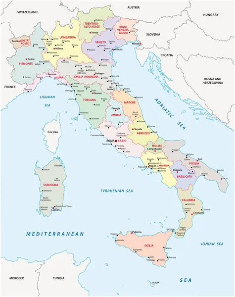
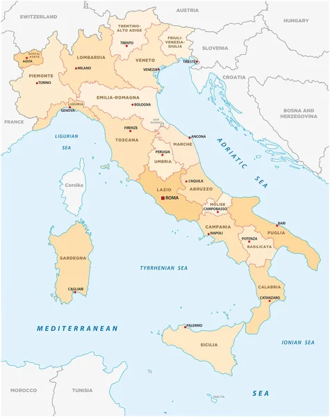
Italy, Political Map, Administrative Divisions. Italian Republic With Capital Rome, 20 Regions And Their Capitals, International Borders And Neighbor Countries. English Labeling. Illustration. Vector.
Vector, 4.09MB, 6000 × 7392 eps

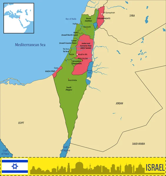
Vector Highly Detailed Political Map Of Israel With Regions And Their Capitals. All Elements Are Separated In Editable Layers Clearly Labeled.EPS 10
Vector, 3.7MB, 7000 × 7435 eps

Tamariu, Girona, Spain - July 4th Of 2015: Lots Of Tourists Spend Their Summer Holidays In Costa Brava's Wonderful Beaches And Villages. The Eastern Mediterranean Seaside Of Spain Is One Of The Most Beautiful Regions Of This Country
Image, 16.84MB, 5142 × 3428 jpg
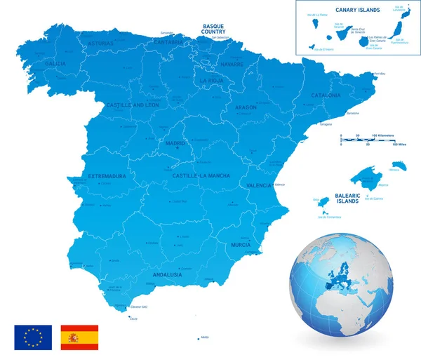
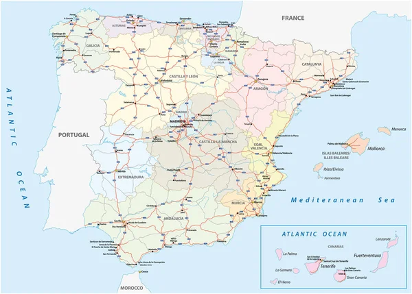
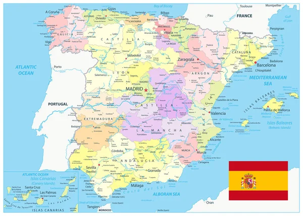
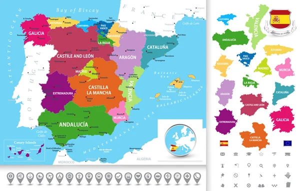
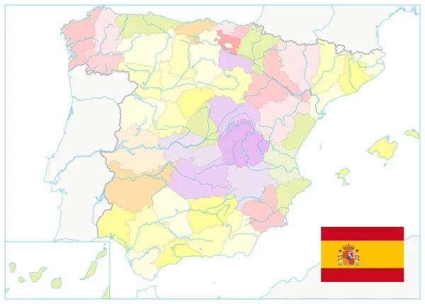
Vector Political Map Of Spain With Full Region And Provinces Boundaries, Completed With Flags Of Spain And EU And An Earth Globe Centered On Europe
Vector, 11.22MB, 6500 × 5601 eps

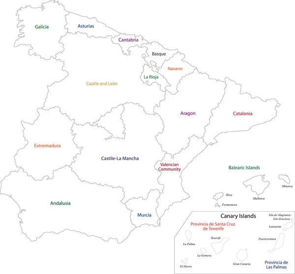
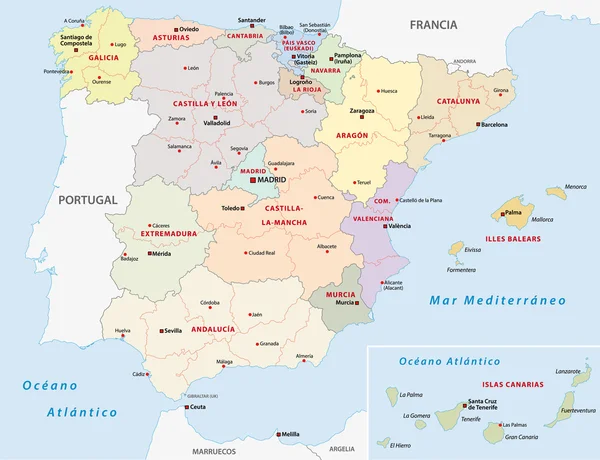
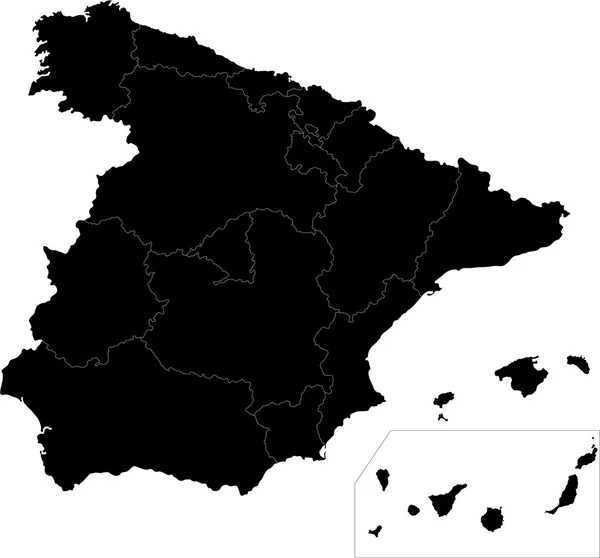
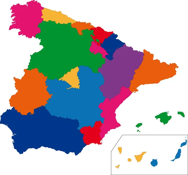
Spain Administrative Divisions Map. Teal Colors. All Elements Are Separated In Editable Layers Clearly Labeled. Vector Illustration.
Vector, 7.55MB, 4708 × 3370 eps
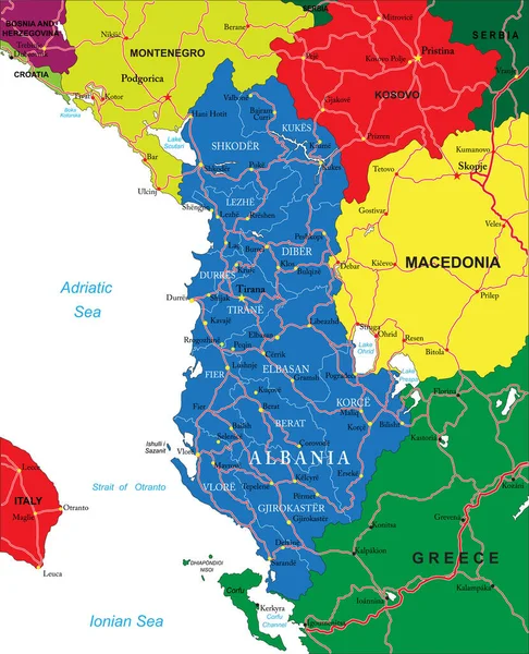
Highly Detailed Vector Map Of Albania With Administrative Regions, Main Cities And Roads.
Vector, 2.3MB, 4054 × 5000 eps
Spain Administrative Divisions Map Blue Color. All Elements Are Separated In Editable Layers Clearly Labeled. Vector Illustration.
Vector, 6.39MB, 4708 × 3370 eps

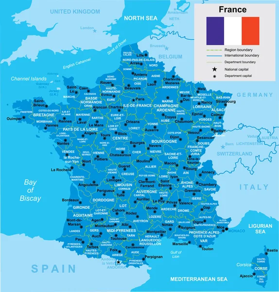
France, Political Map. Regions Of Metropolitan France. French Republic With Capital Paris And 13 Administrative Regions On The Mainland Of Europe And Their Prefectures. English. Illustration. Vector.
Vector, 3.93MB, 6000 × 6000 eps

Tamariu, Girona, Spain - July 4th Of 2015: Lots Of Tourists Spend Their Summer Holidays In Costa Brava's Wonderful Beaches And Villages. The Eastern Mediterranean Seaside Of Spain Is One Of The Most Beautiful Regions Of This Country
Image, 12.98MB, 5058 × 3372 jpg
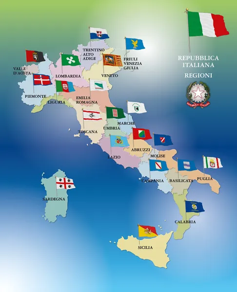

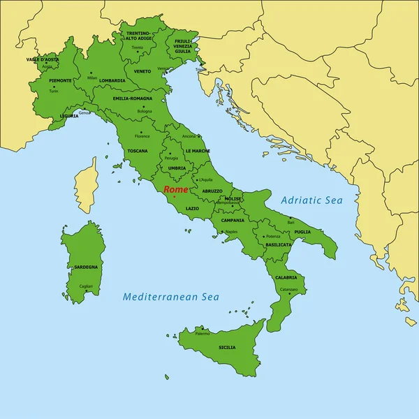
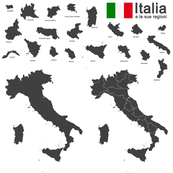
Beautiful And Colorful Map Of Italy With Italian Regions, Capitals And Important Cities. Vector Illustration.
Vector, 2.46MB, 4200 × 5250 eps


Vector Political Map Of Spain With Full Region And Provinces Boundaries, Completed With Flags Of Spain And EU And An Earth Globe Centered On Europe
Vector, 13MB, 6500 × 5601 eps
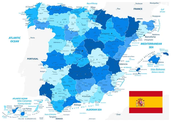
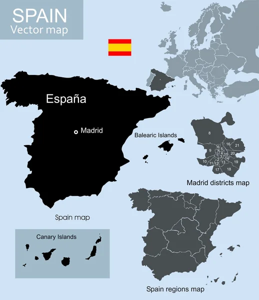
Detailed Political Map Of Spain. All Elements Are Separated In Editable Layers Clearly Labeled. Vector Illustration.
Vector, 8.15MB, 5631 × 4031 eps


View Of The Coastline Of The Aeolian Island, Group Of Small Volcanic Islands, Located In The Mediterranean Sea, Between The Shores Of Sicily And Calabria Regions (Southern Italy) Taken From A Boat In The Sea. Color Image.
Image, 12.63MB, 6000 × 4000 jpg

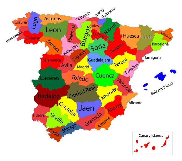
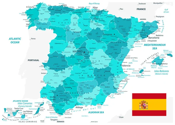
Editable Colorful Vector Map Of Spain. Vector Map Of Spain Isolated On Background. High Detailed. Autonomous Communities Of Spain. Administrative Divisions Of Spain, Separated Provinces With Color.
Vector, 2.44MB, 6001 × 5317 eps

Spain Detail Map White Color. All Elements Are Separated In Editable Layers Clearly Labeled. Vector Illustration.
Vector, 12.6MB, 5631 × 4031 eps


New Administrative And Political Map Of The Twelve Regions Of The Kingdom Of Morocco 2015
Vector, 0.77MB, 4159 × 4224 eps

Spain Map With Geographic Landscape On Blue Sea Background. Illustration Spanish Map With Nature Landscape And Blue Sea.
Vector, 2.92MB, 5000 × 5000 eps

Detailed Political Map Of Spain Isolated On White. No Text. All Elements Are Separated In Editable Layers Clearly Labeled. Vector Illustration.
Vector, 4.35MB, 5631 × 4031 eps
Page 1 >> Next