photo free
Home Images Vectors Videos

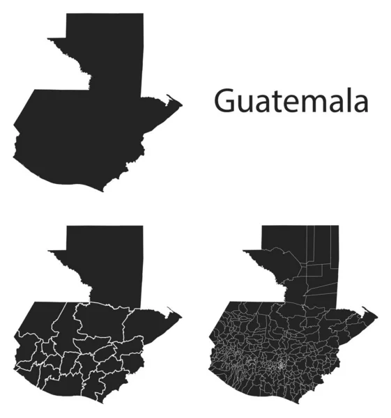
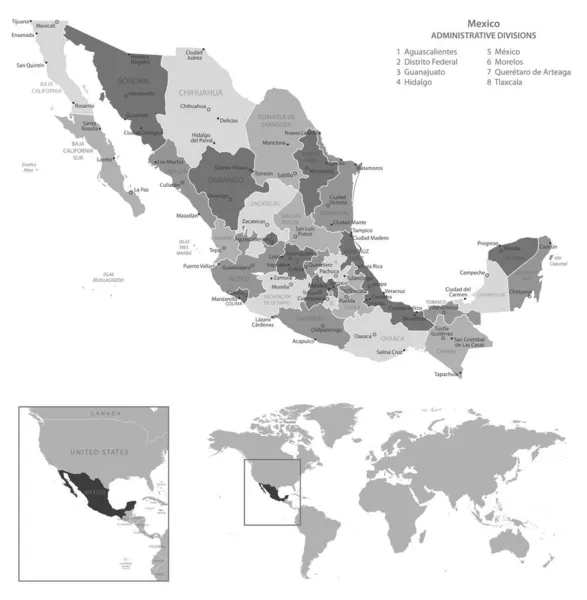
Stock image Municipios page 2

stock vector Guatemala map with regional division

Guatemala Map With Regional Division

Vector, 9.02MB, 4250 × 4545 eps
stock vector Detailed map of USA with flag, border of regions and country. Purple, yellow, green.

Detailed Map Of USA With Flag, Border Of Regions And Country. Purple, Yellow, Green.

Vector, 2.3MB, 5287 × 5712 eps
stock vector Belgium outline map vector with administrative borders, regions, municipalities, departments in black white colors

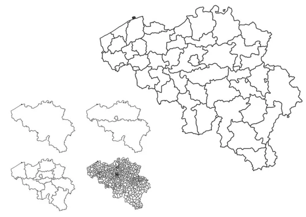
Belgium Outline Map Vector With Administrative Borders, Regions, Municipalities, Departments In Black White Colors

Vector, 8.26MB, 4932 × 3496 eps
stock vector Blue-gray detailed map of India administrative divisions and location on the globe.

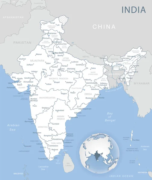
Blue-gray Detailed Map Of India Administrative Divisions And Location On The Globe.

Vector, 17.47MB, 5283 × 6246 eps
stock image Villages in the province of Malaga, Gaucin

Villages In The Province Of Malaga, Gaucin

Image, 8.16MB, 4272 × 2848 jpg
stock vector Detailed Hungary administrative map with country flag and location on a blue globe.

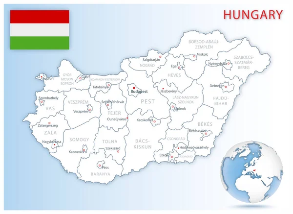
Detailed Hungary Administrative Map With Country Flag And Location On A Blue Globe.

Vector, 23.14MB, 7194 × 5251 eps
stock vector Blue-green detailed map of Hungary administrative divisions with country flag and location on the globe.

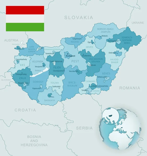
Blue-green Detailed Map Of Hungary Administrative Divisions With Country Flag And Location On The Globe.

Vector, 18.82MB, 5250 × 5588 eps
stock vector Blue-gray detailed map of Argentina administrative divisions and location on the globe.

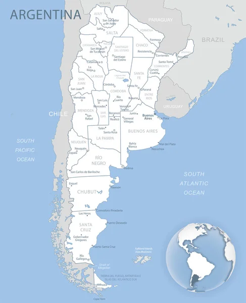
Blue-gray Detailed Map Of Argentina Administrative Divisions And Location On The Globe.

Vector, 20.9MB, 5293 × 6518 eps
stock image Abandoned city of Belchite after the bombings of the Spanish civil war

Abandoned City Of Belchite After The Bombings Of The Spanish Civil War

Image, 9.95MB, 6000 × 4000 jpg
stock image Villages of the province of Malaga, Igualeja

Villages Of The Province Of Malaga, Igualeja

Image, 13.66MB, 6000 × 4000 jpg
stock vector Taiwan administrative blue-green map with country flag and location on a globe.

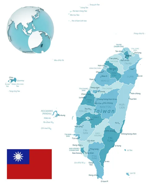
Taiwan Administrative Blue-green Map With Country Flag And Location On A Globe.

Vector, 18.85MB, 5215 × 6418 eps
stock vector Belarus map elections vector with administrative borders, regions, municipalities, departments in black white colors

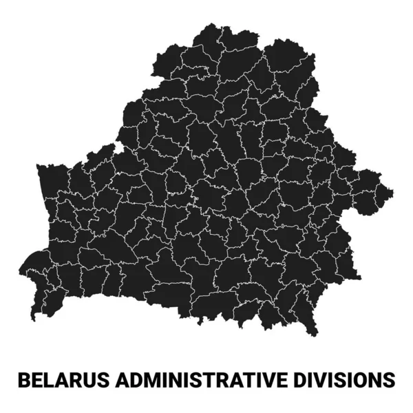
Belarus Map Elections Vector With Administrative Borders, Regions, Municipalities, Departments In Black White Colors

Vector, 2.62MB, 4000 × 4000 eps
stock vector Tanzania - detailed blue country map with cities, regions, location on world map and globe. Infographic icons. Vector illustration

Tanzania - Detailed Blue Country Map With Cities, Regions, Location On World Map And Globe. Infographic Icons. Vector Illustration

Vector, 3.93MB, 5734 × 7141 eps
stock vector Oman - detailed map with administrative divisions country. Vector illustration

Oman - Detailed Map With Administrative Divisions Country. Vector Illustration

Vector, 0.88MB, 4386 × 5535 eps
stock vector Set of state maps of Mauritania with regions and municipalities division. Department borders, isolated vector maps on white background.

Set Of State Maps Of Mauritania With Regions And Municipalities Division. Department Borders, Isolated Vector Maps On White Background.

Vector, 2.97MB, 7082 × 2487 eps
stock vector Kenya - detailed map with administrative divisions and country flag. Vector illustration

Kenya - Detailed Map With Administrative Divisions And Country Flag. Vector Illustration

Vector, 0.87MB, 6011 × 7175 eps
stock image Casares, beautiful little town in Las Hurdes Region, Caceres, Extremadura, Spain

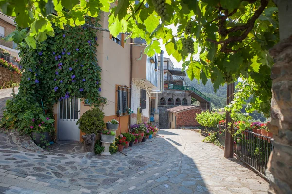
Casares, Beautiful Little Town In Las Hurdes Region, Caceres, Extremadura, Spain

Image, 14.18MB, 5616 × 3744 jpg
stock vector United Mexican States maps with markers

United Mexican States Maps With Markers

Vector, 5.2MB, 5197 × 5388 eps
stock vector Blue-green detailed map of Mozambique administrative divisions with country flag and location on the globe. Vector illustration

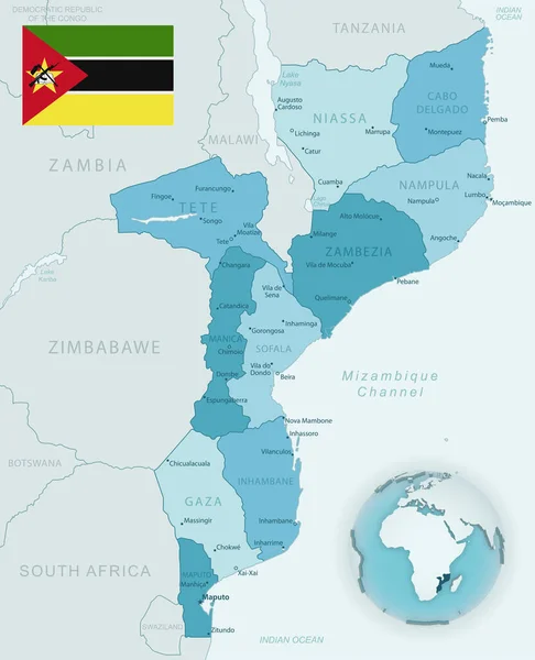
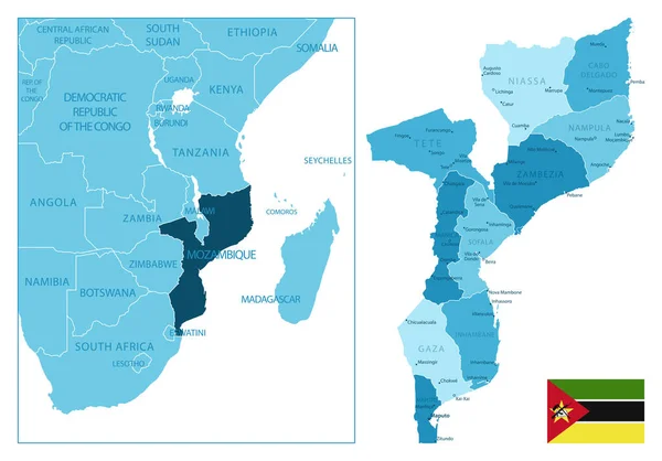
Blue-green Detailed Map Of Mozambique Administrative Divisions With Country Flag And Location On The Globe. Vector Illustration

Vector, 9.49MB, 5302 × 6532 eps
stock vector Blue-gray detailed map of Bahrain administrative divisions and location on the globe.

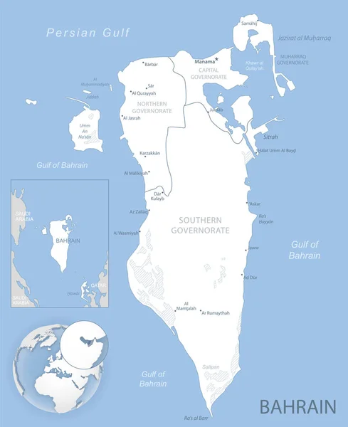
Blue-gray Detailed Map Of Bahrain Administrative Divisions And Location On The Globe.

Vector, 13.26MB, 5171 × 6337 eps
stock vector Mexico - highly detailed black and white map. Vector illustration

Mexico - Highly Detailed Black And White Map. Vector Illustration

Vector, 4.11MB, 5251 × 5359 eps
stock vector Taiwan - highly detailed blue map. Vector illustration

Taiwan - Highly Detailed Blue Map. Vector Illustration

Vector, 1.36MB, 8272 × 5001 eps
stock vector Mozambique - highly detailed blue map. Vector illustration

Mozambique - Highly Detailed Blue Map. Vector Illustration

Vector, 1.26MB, 7525 × 5251 eps
stock vector Moldova - detailed country outline and location on world map. Vector illustration

Moldova - Detailed Country Outline And Location On World Map. Vector Illustration

Vector, 2.94MB, 6876 × 5224 eps
stock vector Vector Map of the Geopolitical Subdivisions of the Region of the Veneto or Venetia with Provinces and Municipalities (Comuni) as of 2022 - Italy

Vector Map Of The Geopolitical Subdivisions Of The Region Of The Veneto Or Venetia With Provinces And Municipalities (Comuni) As Of 2022 - Italy

Vector, 2.62MB, 3000 × 3000 ai
stock vector Canada maps with markers

Canada Maps With Markers

Vector, 10.01MB, 5048 × 5598 eps
stock vector Federative Republic of Brazil maps with markers

Federative Republic Of Brazil Maps With Markers

Vector, 4.1MB, 4604 × 5457 eps
stock vector Nigeria - detailed blue country map with cities, regions, location on world map and globe. Infographic icons. Vector illustration

Nigeria - Detailed Blue Country Map With Cities, Regions, Location On World Map And Globe. Infographic Icons. Vector Illustration

Vector, 3.79MB, 5734 × 6327 eps
stock vector Blue-green detailed map of Spain and administrative divisions with country flag and location on the globe.

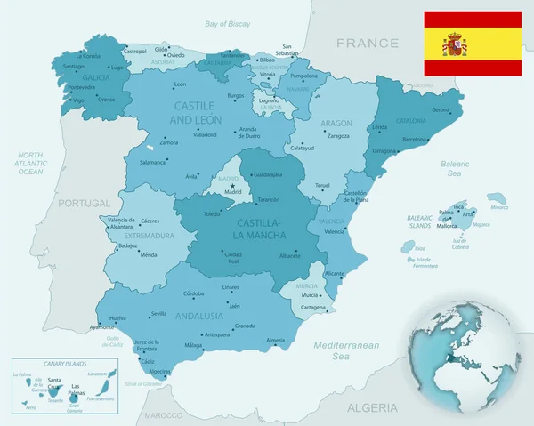
Blue-green Detailed Map Of Spain And Administrative Divisions With Country Flag And Location On The Globe.

Vector, 16.1MB, 6602 × 5283 eps
stock image Tagcloud of cities in Germany ordered by its' population. Every second city is written vertically. There are cities like Berlin, Munich, Cologne, Essen, Hamburg, and Leipzig.

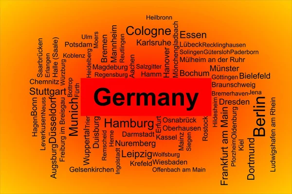
Tagcloud Of Cities In Germany Ordered By Its' Population. Every Second City Is Written Vertically. There Are Cities Like Berlin, Munich, Cologne, Essen, Hamburg, And Leipzig.

Image, 11.32MB, 11250 × 7500 jpg
stock vector United Kingdom - detailed map of the country in brown colors, divided into regions. Vector illustration

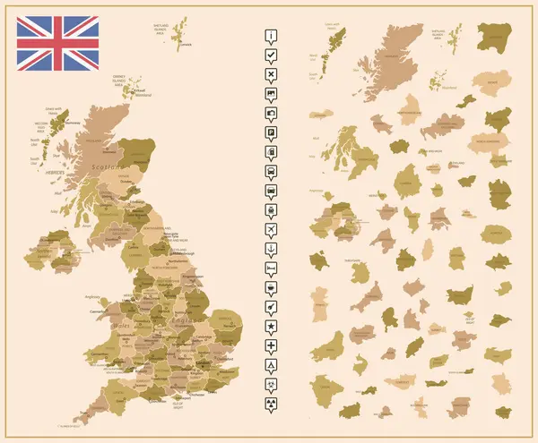
United Kingdom - Detailed Map Of The Country In Brown Colors, Divided Into Regions. Vector Illustration

Vector, 2.63MB, 6363 × 5251 eps
stock vector Blank map Bali province of Indonesia. High quality map Bali with municipalities on transparent background for your web site design, logo, app, UI. Republic of Indonesia.  EPS10.

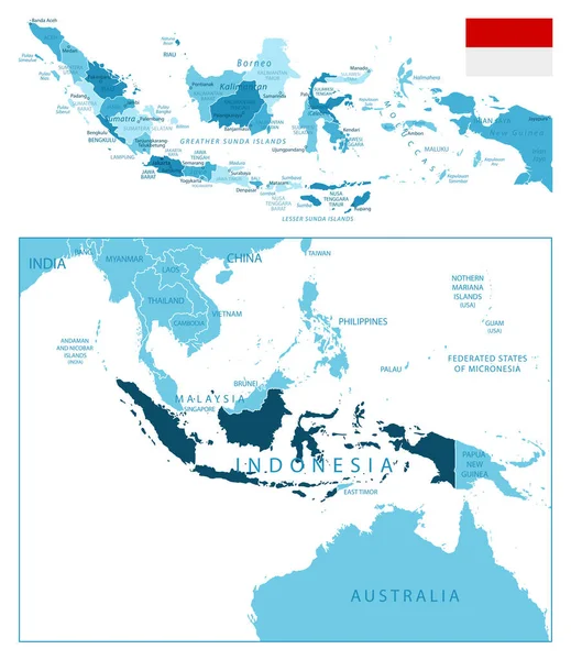
Blank Map Bali Province Of Indonesia. High Quality Map Bali With Municipalities On Transparent Background For Your Web Site Design, Logo, App, UI. Republic Of Indonesia. EPS10.

Vector, 4.92MB, 6668 × 5000 eps
stock image Satellite view of the Puglia region. Italy. 3d render. Physical map of Puglia, plains, mountains, lakes, mountain range

Satellite View Of The Puglia Region. Italy. 3d Render. Physical Map Of Puglia, Plains, Mountains, Lakes, Mountain Range

Image, 11.63MB, 4822 × 4133 jpg
stock image poet Giacomo Leopardi sculpture in Recanati old downton, Marche Italy

Poet Giacomo Leopardi Sculpture In Recanati Old Downton, Marche Italy

Image, 3.71MB, 3456 × 2304 jpg
stock vector Detailed Slovakia administrative map with country flag and location on a blue globe. Vector illustration

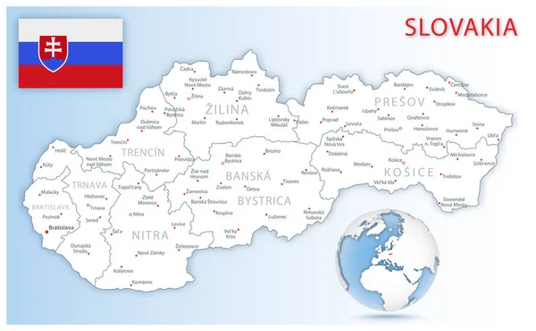
Detailed Slovakia Administrative Map With Country Flag And Location On A Blue Globe. Vector Illustration

Vector, 15.54MB, 8500 × 5243 eps
stock vector Uganda detailed administrative blue map with country flag and location on the world map.

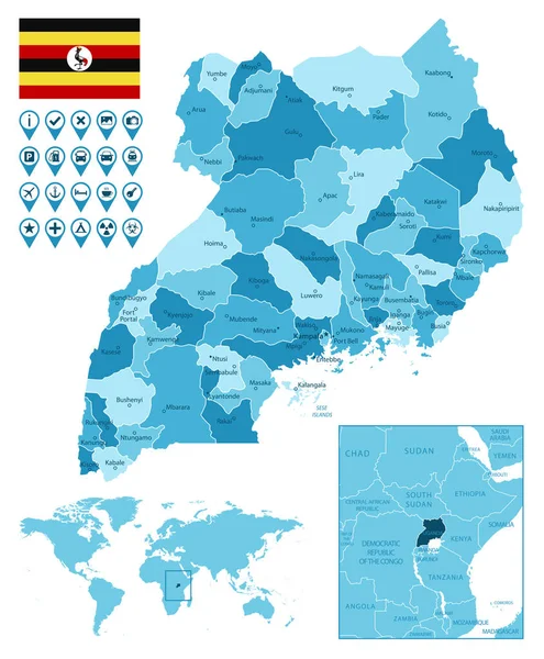
Uganda Detailed Administrative Blue Map With Country Flag And Location On The World Map.

Vector, 3.94MB, 5251 × 6358 eps
stock image Winter service vehicles. Big yellow snow plow tractor working in city at night in heavy snowfall

Winter Service Vehicles. Big Yellow Snow Plow Tractor Working In City At Night In Heavy Snowfall

Image, 7.26MB, 4900 × 3266 jpg
stock vector Indonesia - highly detailed blue map. Vector illustration

Indonesia - Highly Detailed Blue Map. Vector Illustration

Vector, 1.7MB, 5251 × 6067 eps
stock vector vector colorful map of Sweden municipalities colored by counties

Vector Colorful Map Of Sweden Municipalities Colored By Counties

Vector, 7.93MB, 4925 × 8333 eps
stock vector administrative road map of the metropolitan area of atlanta georgia

Administrative Road Map Of The Metropolitan Area Of Atlanta Georgia

Vector, 1.39MB, 3267 × 3100 eps
stock vector administrative and political vector map of the Colombian Department of Cundinamarca

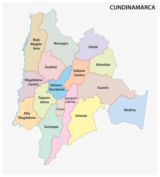
Administrative And Political Vector Map Of The Colombian Department Of Cundinamarca

Vector, 0.71MB, 3100 × 3421 eps
stock vector Germany - detailed blue country map with cities, regions, location on world map and globe. Infographic icons. Vector illustration

Germany - Detailed Blue Country Map With Cities, Regions, Location On World Map And Globe. Infographic Icons. Vector Illustration

Vector, 4.14MB, 5734 × 8377 eps
stock vector Vorarlberg map, Austrian state. Austria administrative division, provinces, boroughs, and municipalities.

Vorarlberg Map, Austrian State. Austria Administrative Division, Provinces, Boroughs, And Municipalities.

Vector, 4.1MB, 6252 × 2855 eps
stock vector Carinthia map, Austrian state. Austria administrative division, provinces, boroughs, and municipalities.

Carinthia Map, Austrian State. Austria Administrative Division, Provinces, Boroughs, And Municipalities.

Vector, 4.2MB, 6252 × 2855 eps
stock image Professional snow removal equipment clearing Palace Square at night after intense snowfall in city

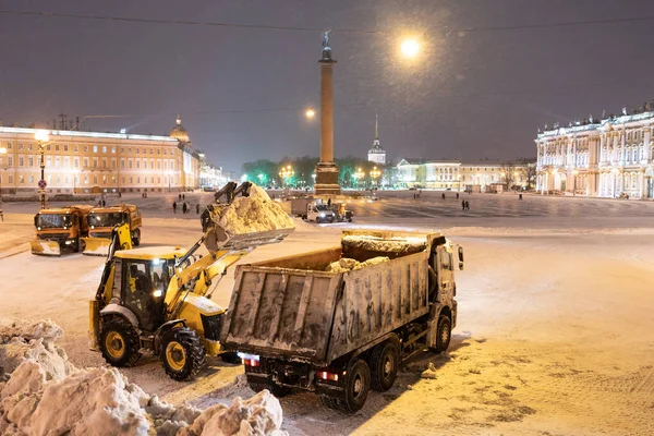
Professional Snow Removal Equipment Clearing Palace Square At Night After Intense Snowfall In City

Image, 8.99MB, 5000 × 3334 jpg
stock vector Blank map Department Huanuco of Peru. High quality map Department  of Huanuco with districts on transparent background for your web site design, logo, app, UI.  Republic of Peru.  EPS10.

Blank Map Department Huanuco Of Peru. High Quality Map Department Of Huanuco With Districts On Transparent Background For Your Web Site Design, Logo, App, UI. Republic Of Peru. EPS10.

Vector, 5.65MB, 3334 × 2500 eps
stock vector Blank map Canelones Department of Uruguay. High quality map Department  of Canelones with districts on transparent background for your web site design, logo, app, UI.  Oriental Republic of Uruguay.  EPS10.

Blank Map Canelones Department Of Uruguay. High Quality Map Department Of Canelones With Districts On Transparent Background For Your Web Site Design, Logo, App, UI. Oriental Republic Of Uruguay. EPS10.

Vector, 4.77MB, 5000 × 5000 eps
stock vector Butel municipality outline map set

Butel Municipality Outline Map Set

Vector, 0.22MB, 6000 × 3000 eps
stock vector Kavadartsi municipality outline map set

Kavadartsi Municipality Outline Map Set

Vector, 0.27MB, 6000 × 3000 eps
stock vector Demir Hisar municipality outline map set

Demir Hisar Municipality Outline Map Set

Vector, 0.23MB, 6000 × 3000 eps
Previous << Page 2 >> Next