photo free
Home Images Vectors Videos

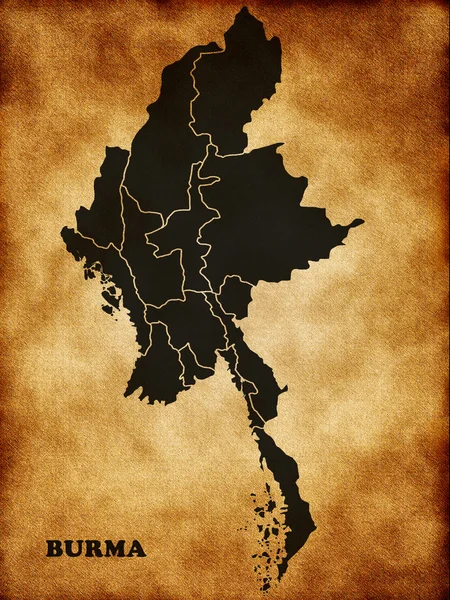
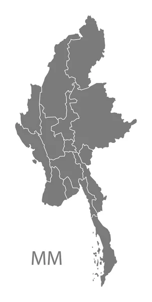
Stock image Myanmar Region Map page 2

stock vector Burma map made with name of cities

Burma Map Made With Name Of Cities

Vector, 5.85MB, 5983 × 5983 eps
stock image Thailand on the map background

Thailand On The Map Background

Image, 13.64MB, 6000 × 4000 jpg
stock vector East Asia, single states, political map. All countries in different colors, with national borders, labeled with English country names. Eastern subregion of the Asian continent. Illustration. Vector.

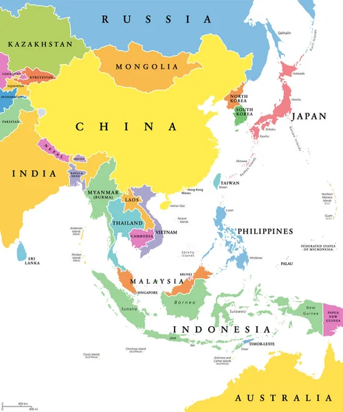
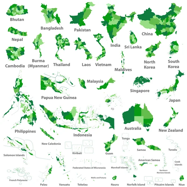
East Asia, Single States, Political Map. All Countries In Different Colors, With National Borders, Labeled With English Country Names. Eastern Subregion Of The Asian Continent. Illustration. Vector.

Vector, 3.56MB, 6000 × 7202 eps
stock vector thailand road vector map

Thailand Road Vector Map

Vector, 1.28MB, 3180 × 4675 eps
stock vector Map of Myanmar

Map Of Myanmar

Vector, 1.45MB, 4000 × 4000 eps
stock vector Myanmar higt detailed map with subdivisions. Administrative map of Myanmar with districts and cities name, colored by states and administrative districts. Vector illustration.

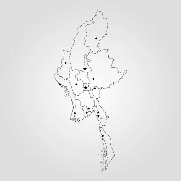
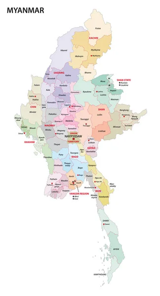
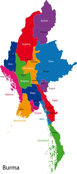
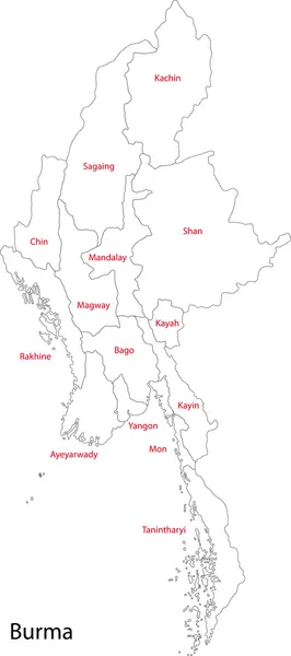
Myanmar Higt Detailed Map With Subdivisions. Administrative Map Of Myanmar With Districts And Cities Name, Colored By States And Administrative Districts. Vector Illustration.

Vector, 2.39MB, 4000 × 5000 eps
stock vector Black Location Map of the Myanmar/Burmese Region of Yangon within Grey Map of Myanmar

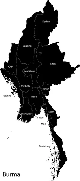
Black Location Map Of The Myanmar/Burmese Region Of Yangon Within Grey Map Of Myanmar

Vector, 0.9MB, 3600 × 4800 eps
stock vector Asian, Australia and Oceania countries maps

Asian, Australia And Oceania Countries Maps

Vector, 13.28MB, 7292 × 7292 eps
stock vector vector map of the Indian archipelago of the Andaman Islands

Vector Map Of The Indian Archipelago Of The Andaman Islands

Vector, 1.62MB, 3100 × 4446 eps
stock vector vector map of south east asian countries mixed with their national flags

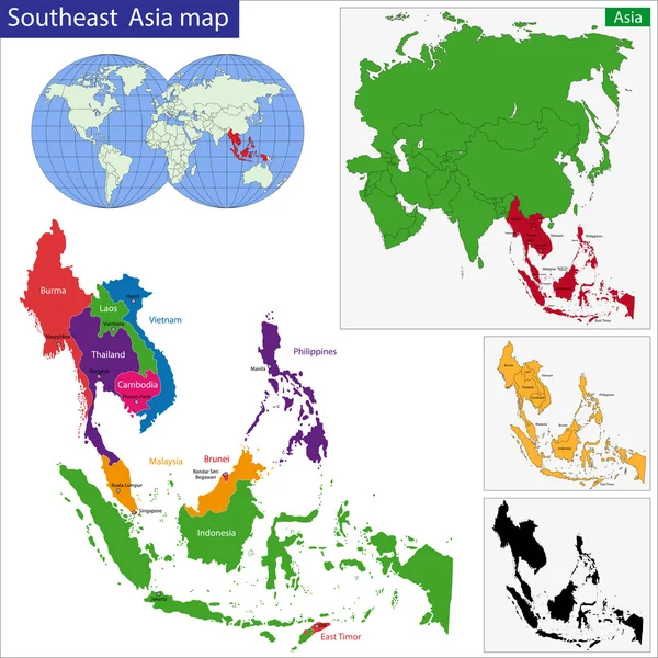
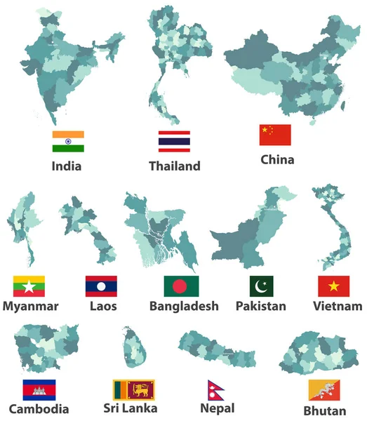
Vector Map Of South East Asian Countries Mixed With Their National Flags

Vector, 7.73MB, 7292 × 5687 eps
stock vector Mekong River Map with Country and City Location

Mekong River Map With Country And City Location

Vector, 1.28MB, 4000 × 5000 eps
stock vector Republic of India vector map

Republic Of India Vector Map

Vector, 1.44MB, 3245 × 3704 eps
stock vector Southeastern Asia map

Southeastern Asia Map

Vector, 7.03MB, 7000 × 7000 eps
stock image Map of Burma

Map Of Burma

Image, 15.2MB, 2400 × 3200 jpg
stock vector vector map of the Indian archipelago of the Andaman Islands

Vector Map Of The Indian Archipelago Of The Andaman Islands

Vector, 1.06MB, 3100 × 4446 eps
stock vector Map of India with the biggest cities and rivers

Map Of India With The Biggest Cities And Rivers

Vector, 2.4MB, 3435 × 4073 eps
stock vector Map of Myanmar

Map Of Myanmar

Vector, 1.84MB, 5000 × 4000 eps
stock vector Asian countries with provinces and capital population

Asian Countries With Provinces And Capital Population

Vector, 2.43MB, 4300 × 3667 ai
stock vector ASEAN Association of Southeast Asian Nations

ASEAN Association Of Southeast Asian Nations

Vector, 0.57MB, 7000 × 3000 eps
stock vector vector high detailed maps and flags of east asian countries with administrative divisions (regions borders)

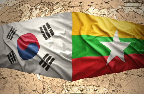
Vector High Detailed Maps And Flags Of East Asian Countries With Administrative Divisions (regions Borders)

Vector, 9.16MB, 6367 × 7293 eps
stock vector High detailed vector map - Myanmar

High Detailed Vector Map - Myanmar

Vector, 1.48MB, 4000 × 4000 eps
stock vector laos administrative and political vector map

Laos Administrative And Political Vector Map

Vector, 0.81MB, 3100 × 3497 eps
stock vector Black Burma map

Black Burma Map

Vector, 3.08MB, 3116 × 7002 eps
stock vector Collection of myanmar map sillhouette vector. Myanmar map design vector

Collection Of Myanmar Map Sillhouette Vector. Myanmar Map Design Vector

Vector, 6.26MB, 5001 × 4101 eps
stock vector East Asia political map

East Asia Political Map

Vector, 3.51MB, 7303 × 8766 eps
stock vector AEC ASEAN Economic Community Association of Southeast Asian Nations

AEC ASEAN Economic Community Association Of Southeast Asian Nations

Vector, 0.56MB, 7000 × 3000 eps
stock vector myanmar administrative map with regions and districts

Myanmar Administrative Map With Regions And Districts

Vector, 1.63MB, 3100 × 5740 eps
stock image Myanmar zoomed and neighborhood. Main physical landscape features. 3D rendering

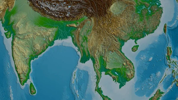
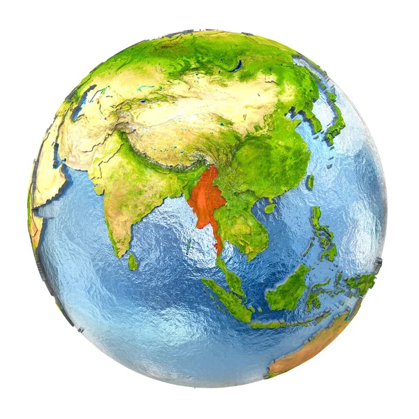
Myanmar Zoomed And Neighborhood. Main Physical Landscape Features. 3D Rendering

Image, 4.96MB, 2880 × 1620 jpg
stock vector India map, black and white detailed outline regions of the country.

India Map, Black And White Detailed Outline Regions Of The Country.

Vector, 0.98MB, 5283 × 5710 eps
stock vector Pastel Colored Labeled Flat Provinces Map of Asian Country of Myanmar

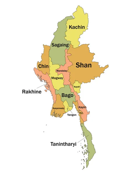
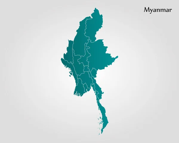
Pastel Colored Labeled Flat Provinces Map Of Asian Country Of Myanmar

Vector, 0.99MB, 3600 × 4800 eps
stock vector Map of Myanmar

Map Of Myanmar

Vector, 1.8MB, 4000 × 4000 eps
stock vector Burma map

Burma Map

Vector, 3.17MB, 3116 × 7002 eps
stock vector Road vector map of Lao People`s Democratic Republic

Road Vector Map Of Lao People`s Democratic Republic

Vector, 0.68MB, 3100 × 3506 eps
stock vector Burma map

Burma Map

Vector, 6.74MB, 7000 × 7000 eps
stock vector Myanmar with states Map grey

Myanmar With States Map Grey

Vector, 3.46MB, 5000 × 9890 eps
stock vector Contour Burma map

Contour Burma Map

Vector, 3.04MB, 3116 × 7004 eps
stock image Myanmar in red on full Earth

Myanmar In Red On Full Earth

Image, 19.67MB, 5000 × 5000 jpg
stock image Pattaya, Thailand - January 6, 2020: Map of the so called Golden Triangle,  where the borders of Thailand, Laos, and Myanmar meet.

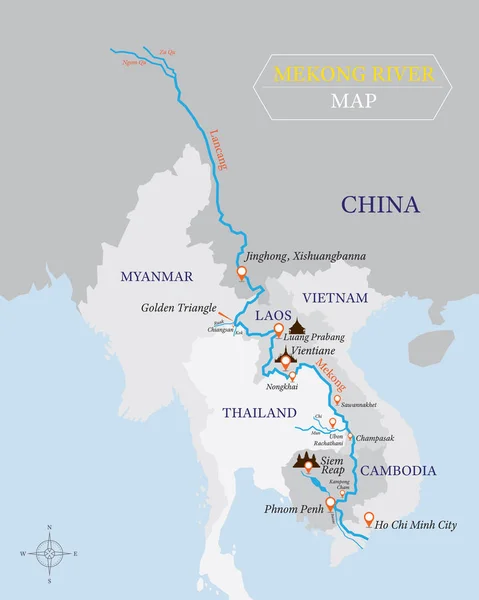
Pattaya, Thailand - January 6, 2020: Map Of The So Called Golden Triangle, Where The Borders Of Thailand, Laos, And Myanmar Meet.

Image, 10.4MB, 3806 × 3000 jpg
stock vector tibet administrative and political vector map with disputed border areas.

Tibet Administrative And Political Vector Map With Disputed Border Areas.

Vector, 0.59MB, 5064 × 3100 eps
stock vector Colorful flag, map pointer and map of Myanmar in the colors of the Myanmar flag. High detail. Vector illustration

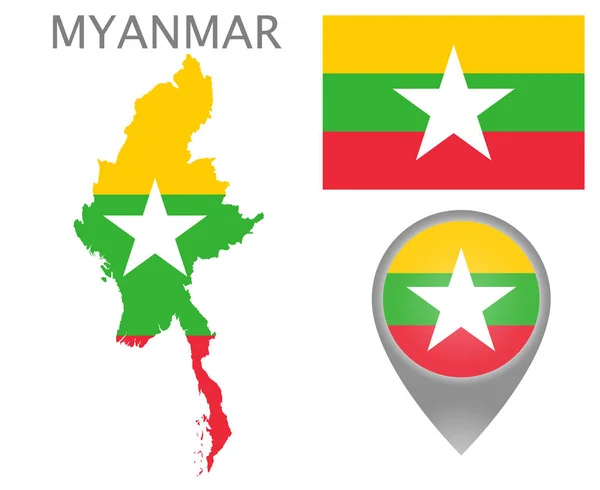
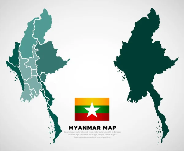
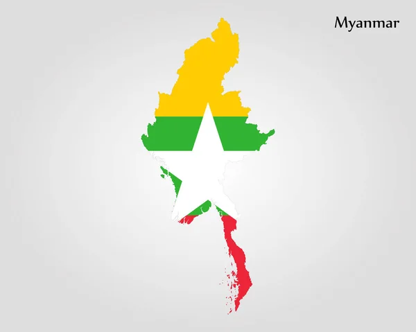
Colorful Flag, Map Pointer And Map Of Myanmar In The Colors Of The Myanmar Flag. High Detail. Vector Illustration

Vector, 7.75MB, 5500 × 4500 eps
stock vector Map of Burma

Map Of Burma

Vector, 4.98MB, 5983 × 5983 eps
stock vector Map and flag of Myanmar

Map And Flag Of Myanmar

Vector, 2.09MB, 6300 × 4200 eps
stock vector Map of Myanmar

Map Of Myanmar

Vector, 1.44MB, 5000 × 4000 eps
stock image Satellite map centered on Thailand neighborhood area

Satellite Map Centered On Thailand Neighborhood Area

Image, 9.48MB, 3840 × 2160 jpg
stock image Mandalay, division of Myanmar. Elevation map colored in wiki style with lakes and rivers

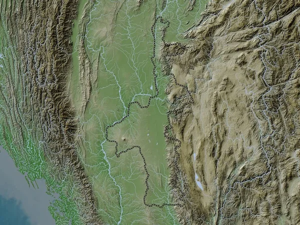
Mandalay, Division Of Myanmar. Elevation Map Colored In Wiki Style With Lakes And Rivers

Image, 10.66MB, 3840 × 2880 jpg
stock image Close-up of the India border area highlighting with a dark overlay on a satellite map. Capital point. Outline around the country shape. English name of the country and its capital

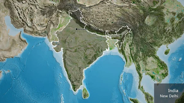
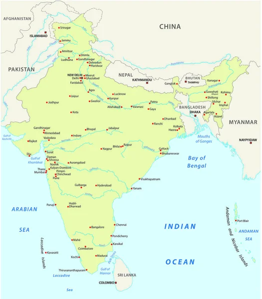
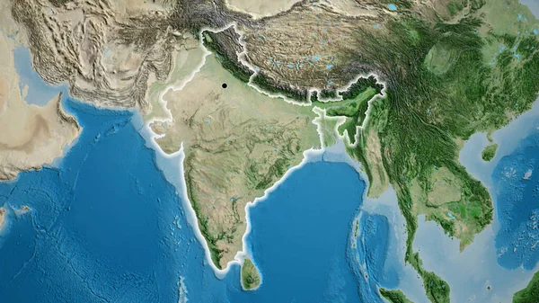
Close-up Of The India Border Area Highlighting With A Dark Overlay On A Satellite Map. Capital Point. Outline Around The Country Shape. English Name Of The Country And Its Capital

Image, 9.73MB, 3840 × 2160 jpg
stock image 3D Flag of Australia and Myanmar on Blue Sky with Sun Shine

3D Flag Of Australia And Myanmar On Blue Sky With Sun Shine

Image, 0.78MB, 3500 × 2000 jpg
stock vector Yellow map isolated on dark blue background of the Country Myanmar - vector illustration

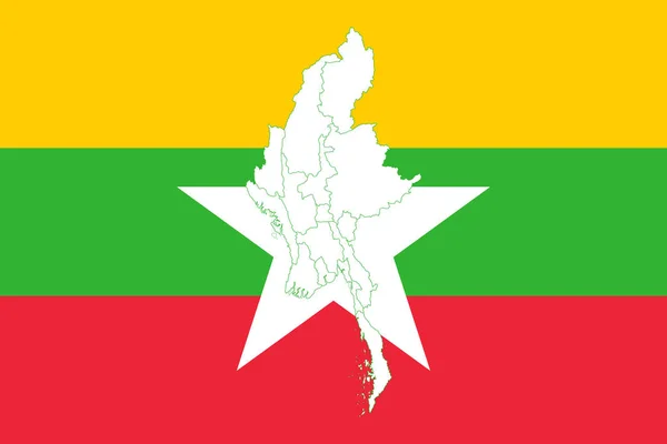
Yellow Map Isolated On Dark Blue Background Of The Country Myanmar - Vector Illustration

Vector, 0.76MB, 6000 × 4000 eps
stock image South Korea and Myanmar

South Korea And Myanmar

Image, 9.43MB, 5500 × 3602 jpg
stock image Close-up of the India border area on a satellite map. Capital point. Glow around the country shape.

Close-up Of The India Border Area On A Satellite Map. Capital Point. Glow Around The Country Shape.

Image, 10.15MB, 3840 × 2160 jpg
Previous << Page 2 >> Next