
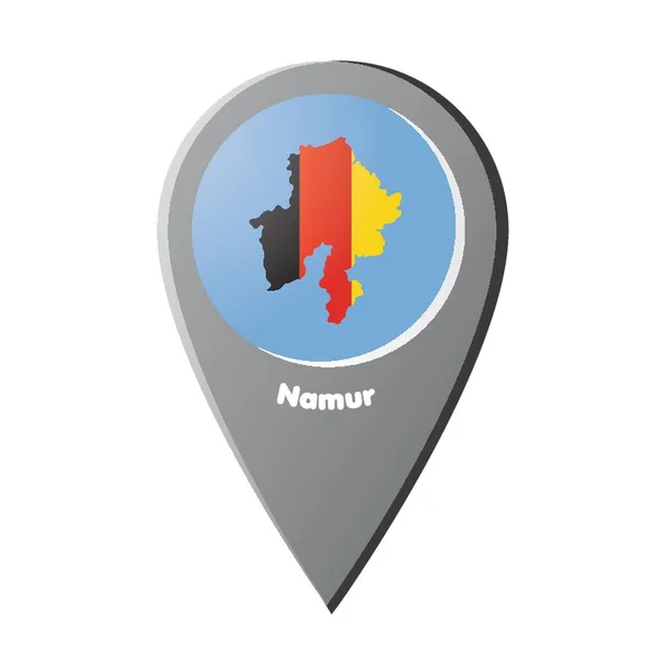
Stock image Namur Province

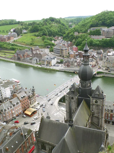
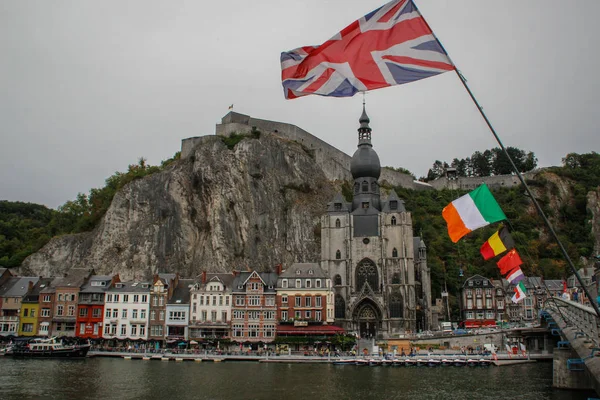
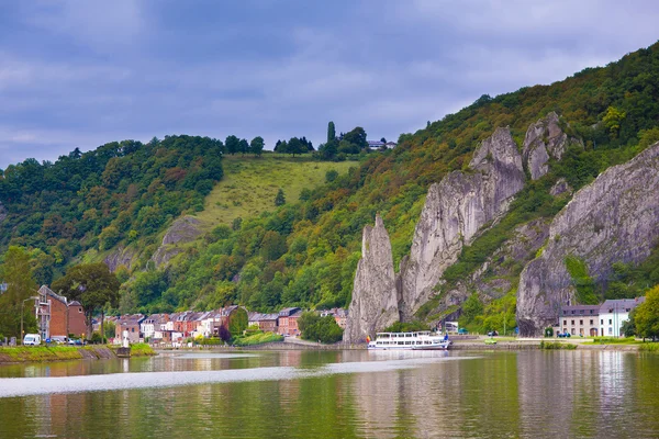
Tourist Famous Destination Town Of Dinant In Wallonia Region In Sunset. The Town Is Spread Around The River La Meuse With A Huge Rock In The Middle With Fortifications.
Image, 16.58MB, 4000 × 6000 jpg
Church Of Our Lady And Charles-de-Gaulle Bridge, View From The Citadel Of Dinant, Wallonia Region, Belgium
Image, 6.75MB, 2725 × 3650 jpg
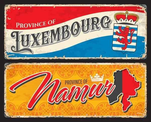
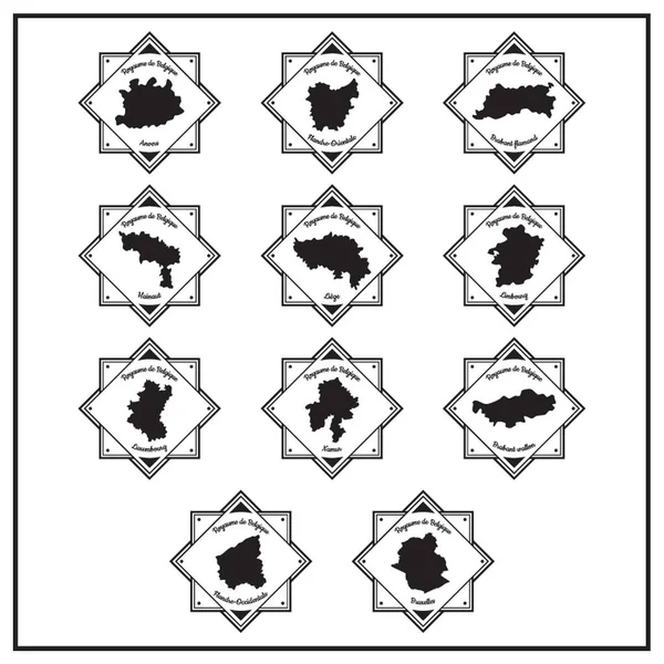
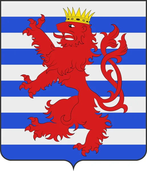
Namur, Luxembourg Belgian Province Vintage Plates And Travel Stickers. Belgium Territory Grunge Banners, Vector Tin Sign With Provinces Flags Colors, Map Silhouette And Coat Of Arms Lion, Crown Symbol
Vector, 4.52MB, 6087 × 4929 eps
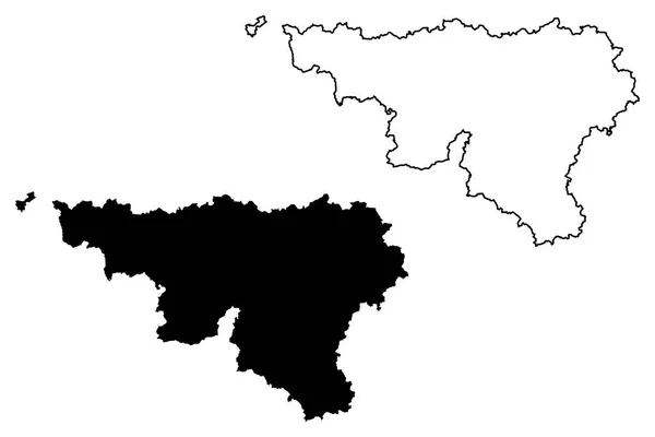
Wallonia (Community And Region Of Belgium, Kingdom Of Belgium) Map Vector Illustration, Scribble Sketch Wallonia Map
Vector, 0.6MB, 7087 × 4724 eps

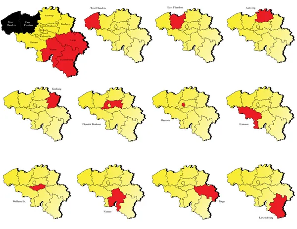
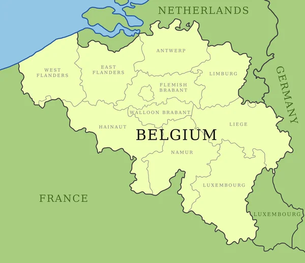
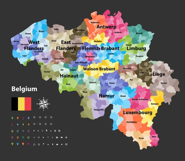
Provinces Of Belgium. Map Of Regional Country Administrative Divisions. Colorful Vector Illustration
Vector, 1MB, 6000 × 6000 eps

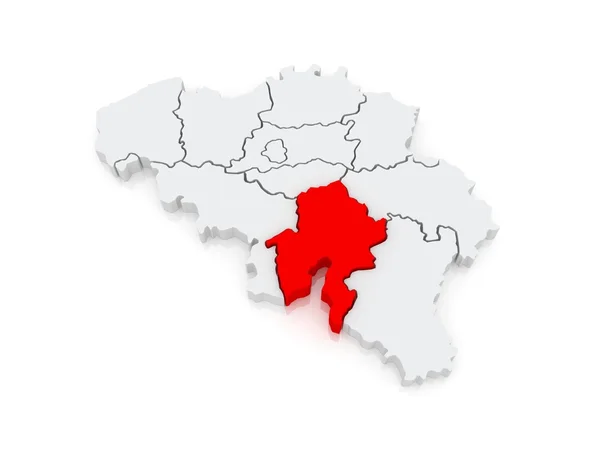
3d Flag Namur, Province Of Belgium, Isolated On Background With Copyspace
Vector, 5.53MB, 6000 × 4000 eps
Dinan, Belgium - September 24, 2018: The Ancient Medieval City Of Dinan, Where The Saxophone Was Coined. View Of Houses From The River And Flags Of Different Countries: England, Ireland, Germany, Turkey On The Bridge.
Image, 10.45MB, 5184 × 3456 jpg
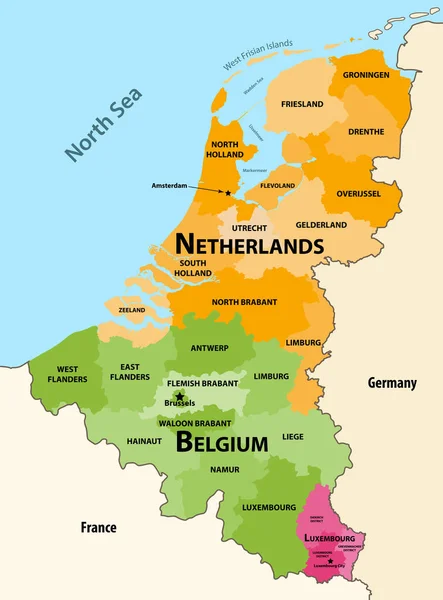
Vector Regions Map Of Benelux Countries: Belgium, Netherlands And Luxembourg, With Neighbouring Countries And Territories
Vector, 7.29MB, 6156 × 8333 eps

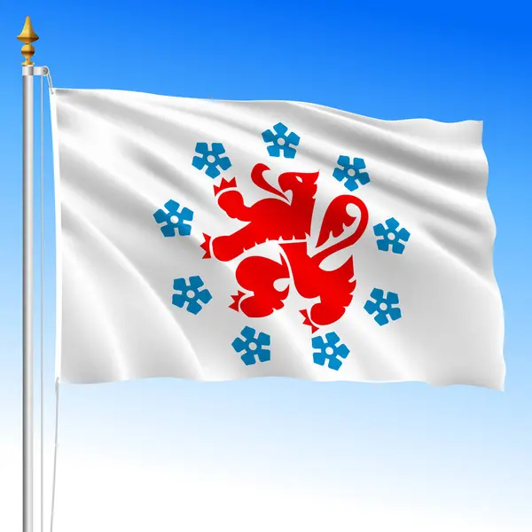
Waving Flag Of Namur Is A Province Of Belgium On Flagpole With Sky Background.
Vector, 5.06MB, 10000 × 6666 eps
German Speaking Community Waving Flag, Kingdom Of Belgium, Vector Illustration
Vector, 37.67MB, 8000 × 8000 eps

Waving Flag Of Namur Is A Province Of Belgium On Flagpole With Sky Background.
Image, 1.98MB, 3072 × 3072 jpg

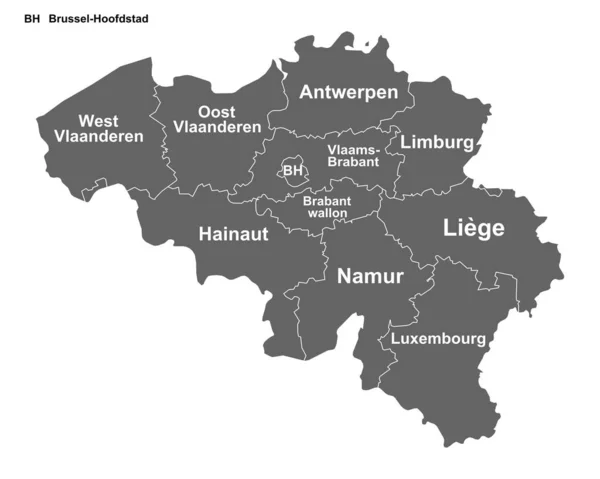
Detailed Map Of The Belgian Regions Of Wallonia And Brussels-Capital (Belgium) With Borders Of Municipalities, Districts, Provinces, And Regions. Vector Illustration
Vector, 5.63MB, 5000 × 5000 eps


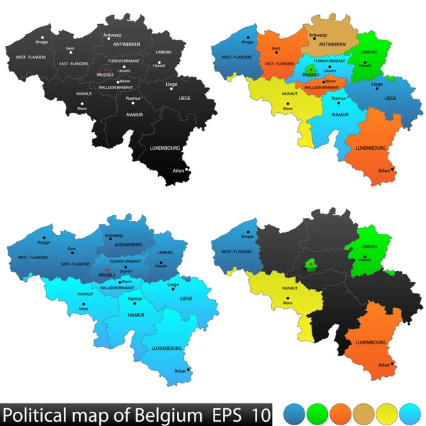
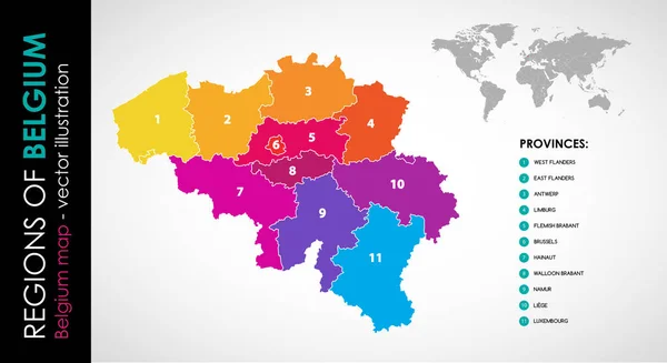
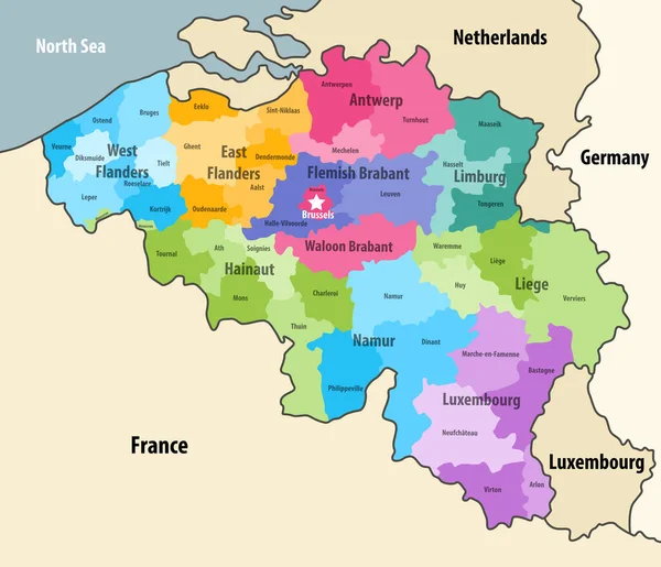
Political And Location Map Of Belgium. Versatile File, Every Piece Is Selectable And Editable In Layers Panel. Turn On And Off Visibility Of Every Province In One Click. Vector, Eps 10.
Vector, 1.93MB, 4480 × 4480 eps

Ruins In The Forest Surrounded By Trees.Old Abandoned Castle Ruins In The Forest.Maple Autumn Forest
Image, 14.75MB, 2592 × 3888 jpg

Political Vector Map Of Belgium With All Regions. All Layers Clearly Separated
Vector, 6.66MB, 6000 × 6000 eps


LESSIVE, BELGIUM - NOVEMBER 2, 2019: Telecommunication Parabolic Antenna And Infrastructure In The Forest In Lessive, Rochefort, Belgium
Image, 25.94MB, 7952 × 5304 jpg

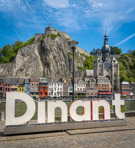
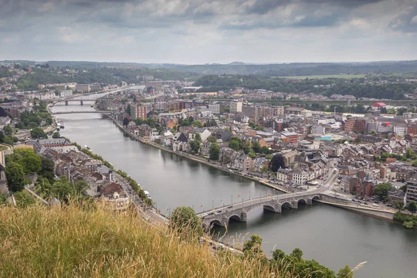
Dinant, Belgium, 04.05.2023, View Of Dinant, A Popular Tourist City On The Shores Of River Meuse In Belgian Ardennes
Image, 7.06MB, 3097 × 3390 jpg

Symbol Map Of The Province Namur (Belgium) Showing The State/province With A Pattern Of Black Squares Like A Chessboard
Vector, 0.59MB, 5044 × 6000 eps

Province Of Namur In Wallonia Region Of Belgium. Vector Travel Plate, Vintage Sign, Retro Postcard Design. Old Plaque With Ornaments And Map Of Territory, Royal Crown Symbolics, Tourist Mark
Vector, 0.67MB, 8462 × 3545 eps

Belgium Administrative Divisions Map Colored By Provinces. Brussels Cityscape Colorful Poster. Vector Illustration
Vector, 13.39MB, 7292 × 7292 eps

Symbol Map Of The Province Namur (Belgium). Abstract Map Showing The State/province With Horizontal Parallel Lines In Rainbow Colors
Vector, 0.58MB, 5044 × 6000 eps

Symbol Map Of The Province Namur (Belgium). Abstract Map Showing The State/province With A Pattern Of Overlapping Colorful Squares Like Candies
Vector, 0.68MB, 5044 × 6000 eps

Symbol Map Of The Province Namur (Belgium) Showing The State/province With A Pattern Of Black Circles
Vector, 1.2MB, 5044 × 6000 eps

LESSIVE, BELGIUM - NOVEMBER 2, 2019: Telecommunication Parabolic Antenna And Infrastructure In The Forest In Lessive, Rochefort, Belgium
Image, 30.49MB, 7952 × 5304 jpg
Belgium Vector Map Showing The Provinces And Administrative Subdivisions (municipalities), Colored By Arrondissements
Vector, 6.92MB, 7292 × 6340 eps

Symbol Map Of The Province Namur (Belgium) Showing The Territory With Concentric Circles In Rainbow Colors Like A Shooting Target
Vector, 0.64MB, 5044 × 6000 eps
Belgium Administrative Districts Map With Neighbouring Terrotories. Vector
Vector, 7.39MB, 7292 × 6264 eps
Page 1 >> Next