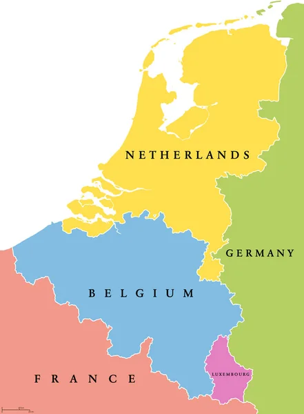
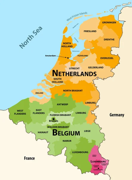
Stock vector Vector regions map of Benelux countries: Belgium, Netherlands and Luxembourg, with neighbouring countries and territories
Published: Mar.23, 2020 11:30:20
Author: Jktu_21
Views: 922
Downloads: 4
File type: vector / eps
File size: 7.29 MB
Orginal size: 6156 x 8333 px
Available sizes:
Level: silver