photo free
Home Images Vectors Videos

Stock image New Caledonia Map

stock vector New Caledonia map. Borders of New Caledonia for your infographic. Vector country shape. Vector illustration.

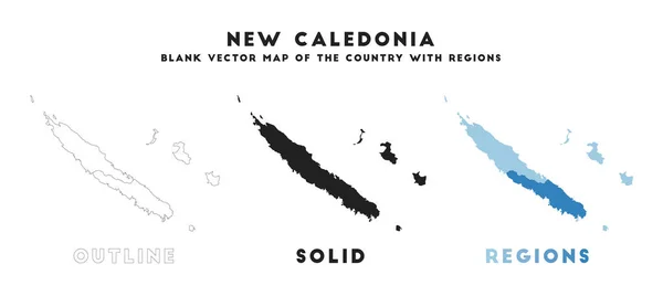
New Caledonia Map. Borders Of New Caledonia For Your Infographic. Vector Country Shape. Vector Illustration.

Vector, 0.3MB, 8181 × 3669 eps
stock vector New Caledonia political map

New Caledonia Political Map

Vector, 3.31MB, 9533 × 6638 eps
stock vector New Caledonia

New Caledonia

Vector, 0.96MB, 7502 × 5195 eps
stock vector New Caledonia map with waving flag of country.

New Caledonia Map With Waving Flag Of Country.

Vector, 0.99MB, 5000 × 5000 eps
stock vector New Caledonia political map gray

New Caledonia Political Map Gray

Vector, 2.79MB, 9533 × 6638 eps
stock vector Australia and Oceania - map and navigation icons - illustration.

Australia And Oceania - Map And Navigation Icons - Illustration.

Vector, 4.18MB, 6400 × 4774 eps
stock vector Australia and Oceania - map - illustration.

Australia And Oceania - Map - Illustration.

Vector, 3.28MB, 6400 × 4253 eps
stock vector Australia and Oceania - map, navigation icons - illustration.

Australia And Oceania - Map, Navigation Icons - Illustration.

Vector, 3.88MB, 7400 × 5312 eps
stock vector Australia and Oceania - map - illustration.

Australia And Oceania - Map - Illustration.

Vector, 3.8MB, 6400 × 4253 eps
stock vector Australia and Oceania - map - illustration.

Australia And Oceania - Map - Illustration.

Vector, 3.83MB, 6400 × 4253 eps
stock vector Australia and Oceania - map - illustration.

Australia And Oceania - Map - Illustration.

Vector, 4.55MB, 6400 × 4254 eps
stock vector Map markers with flags - Oceania. Original colors.

Map Markers With Flags - Oceania. Original Colors.

Vector, 5.12MB, 4000 × 7091 eps
stock vector Australia and Oceania map and navigation icons - Illustration.

Australia And Oceania Map And Navigation Icons - Illustration.

Vector, 1.19MB, 6400 × 4640 eps
stock vector Australia and Oceania - map and navigation labels - illustration.

Australia And Oceania - Map And Navigation Labels - Illustration.

Vector, 3.86MB, 7400 × 5359 eps
stock vector Melanesia, subregion of Oceania, political map. Extending from New Guinea in southwestern Pacific Ocean to Tonga, including Fiji, Vanuatu, Solomon Islands and Papua New Guinea. Illustration. Vector.

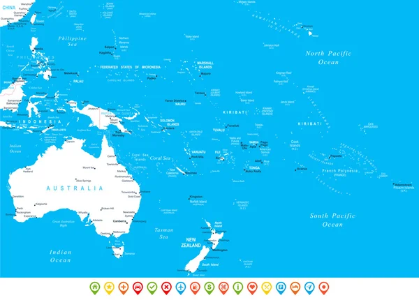
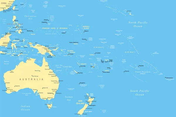
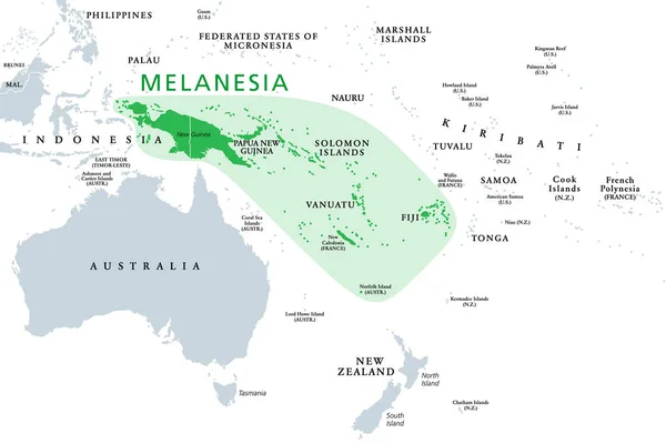
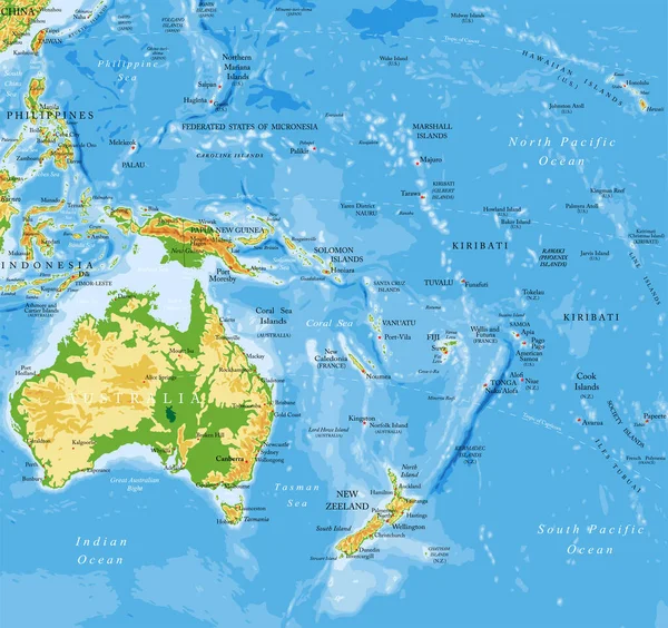
Melanesia, Subregion Of Oceania, Political Map. Extending From New Guinea In Southwestern Pacific Ocean To Tonga, Including Fiji, Vanuatu, Solomon Islands And Papua New Guinea. Illustration. Vector.

Vector, 2.46MB, 9000 × 6000 eps
stock vector Asian, Australia and Oceania countries maps

Asian, Australia And Oceania Countries Maps

Vector, 13.28MB, 7292 × 7292 eps
stock vector Outline maps of Oceanian countries collection, black lined vector map.

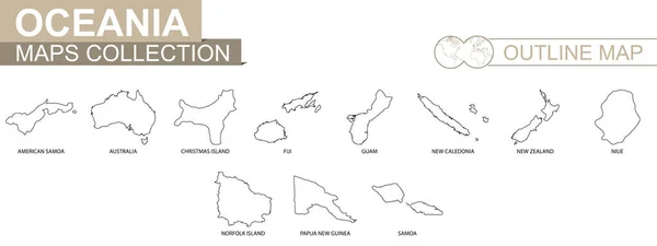
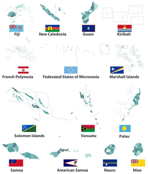
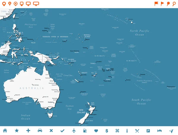
Outline Maps Of Oceanian Countries Collection, Black Lined Vector Map.

Vector, 1.86MB, 8000 × 3000 eps
stock vector Detailed vector map of New Caledonia and capital city Noumea

Detailed Vector Map Of New Caledonia And Capital City Noumea

Vector, 3.35MB, 5867 × 5867 eps
stock vector Australia and Oceania region vector high detailed map with countries names and national flags

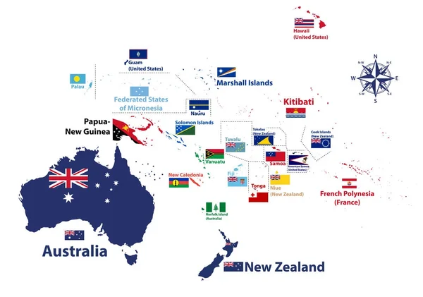
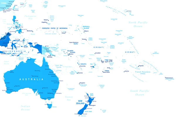
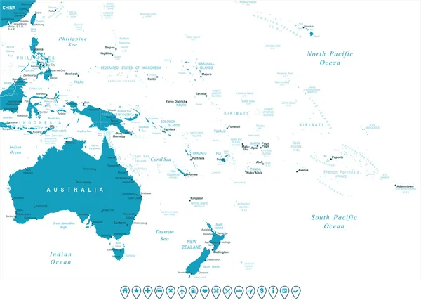
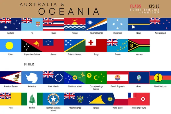
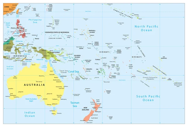
Australia And Oceania Region Vector High Detailed Map With Countries Names And National Flags

Vector, 7.35MB, 8334 × 5852 eps
stock image Set of illustrations of pointers in the form of flags of the countries of Australia and Oceania. Groups of Australasia, Micronesia, Melanesia and Polynesia.

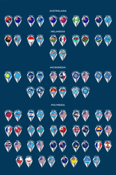
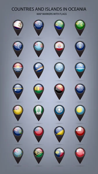
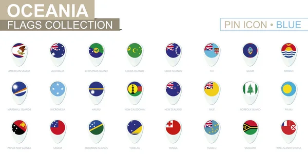
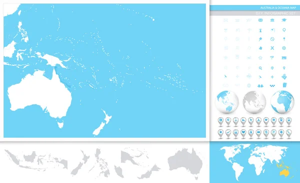
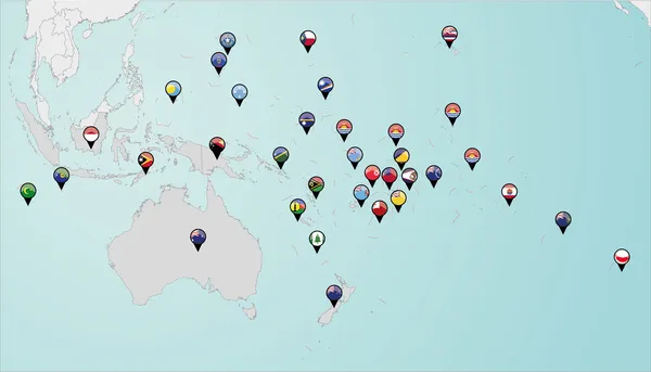
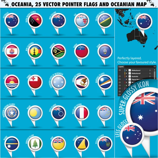
Set Of Illustrations Of Pointers In The Form Of Flags Of The Countries Of Australia And Oceania. Groups Of Australasia, Micronesia, Melanesia And Polynesia.

Image, 7.34MB, 5000 × 7501 jpg
stock vector vector maps and flags of oceania countries with administrative divisions (regions borders)

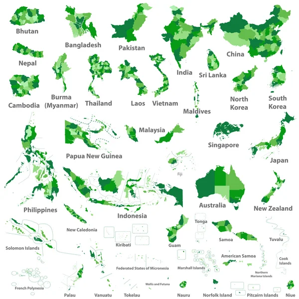
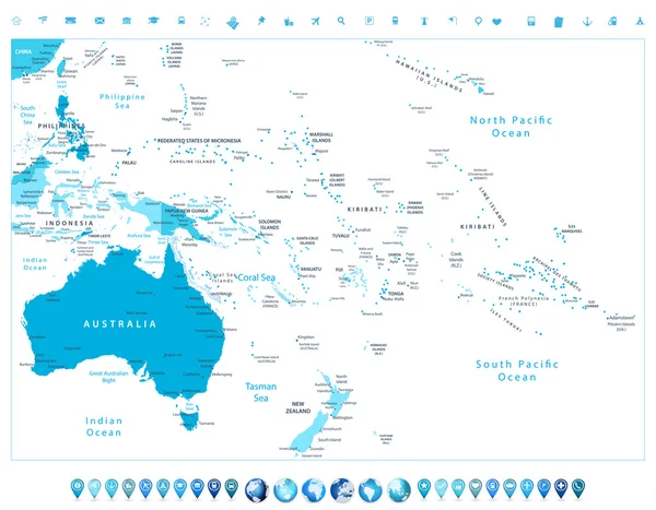
Vector Maps And Flags Of Oceania Countries With Administrative Divisions (regions Borders)

Vector, 7.89MB, 7139 × 8334 eps
stock vector Countries of Oceania and Australia

Countries Of Oceania And Australia

Vector, 2.09MB, 4500 × 5000 eps
stock vector Australia and Oceania - map and navigation icons - illustration.

Australia And Oceania - Map And Navigation Icons - Illustration.

Vector, 3.99MB, 6400 × 4640 eps
stock vector Set of Oceanian countries isometric map and flag.

Set Of Oceanian Countries Isometric Map And Flag.

Vector, 5.84MB, 8000 × 3000 eps
stock vector Oceania flags collection. Big set of blue pin icon with flags.

Oceania Flags Collection. Big Set Of Blue Pin Icon With Flags.

Vector, 1.16MB, 8000 × 4000 eps
stock image New Caledonia, Fiji and Vanuatu from space

New Caledonia, Fiji And Vanuatu From Space

Image, 6.26MB, 5000 × 3750 jpg
stock vector Australia and Oceania - map and navigation labels - illustration.

Australia And Oceania - Map And Navigation Labels - Illustration.

Vector, 4.32MB, 7400 × 5626 eps
stock vector Set of 9 isometric map and flag, 3D vector isometric shape.

Set Of 9 Isometric Map And Flag, 3D Vector Isometric Shape.

Vector, 1.76MB, 5170 × 5000 eps
stock image Map of New Caledonia with national flag

Map Of New Caledonia With National Flag

Image, 2.39MB, 7000 × 5000 jpg
stock vector national flags of the world

National Flags Of The World

Vector, 1.75MB, 7000 × 4666 eps
stock vector New Caledonia vector map. Black icon on white background.

New Caledonia Vector Map. Black Icon On White Background.

Vector, 2.4MB, 7000 × 7000 eps
stock image Mean temperature of warmest quarter within the New Caledonia area in the stereographic projection with legend - main composition

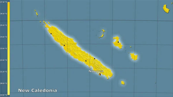
Mean Temperature Of Warmest Quarter Within The New Caledonia Area In The Stereographic Projection With Legend - Main Composition

Image, 1.15MB, 2880 × 1620 jpg
stock image New Caledonia area on the satellite A map in the stereographic projection - raw composition of raster layers with light glowing outline

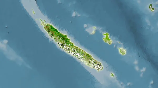
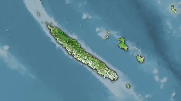
New Caledonia Area On The Satellite A Map In The Stereographic Projection - Raw Composition Of Raster Layers With Light Glowing Outline

Image, 2.19MB, 2880 × 1620 jpg
stock image Seismic activity earthquake New Caledonia map Richter scale

Seismic Activity Earthquake New Caledonia Map Richter Scale

Image, 19.91MB, 14000 × 7000 jpg
stock image Precipitation of wettest month within the New Caledonia area in the stereographic projection with legend - raw composition of raster layers

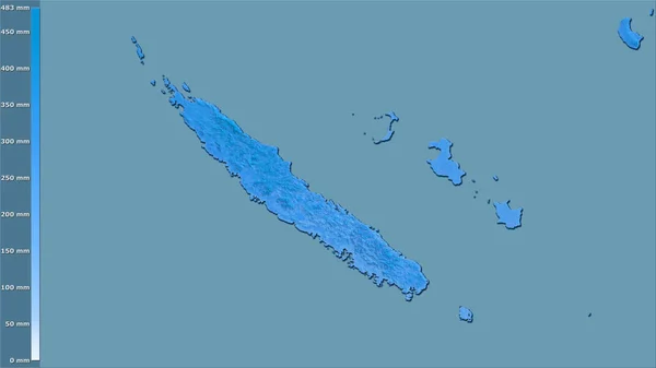
Precipitation Of Wettest Month Within The New Caledonia Area In The Stereographic Projection With Legend - Raw Composition Of Raster Layers

Image, 0.8MB, 2880 × 1620 jpg
stock image New Caledonia area on the satellite D map in the stereographic projection - raw composition of raster layers with dark glowing outline

New Caledonia Area On The Satellite D Map In The Stereographic Projection - Raw Composition Of Raster Layers With Dark Glowing Outline

Image, 2.16MB, 2880 × 1620 jpg
stock vector Blank map Australia and New Zealand. Detailed map of Australia with States  and territories and all Regions of New Zealand. Template.  EPS10.

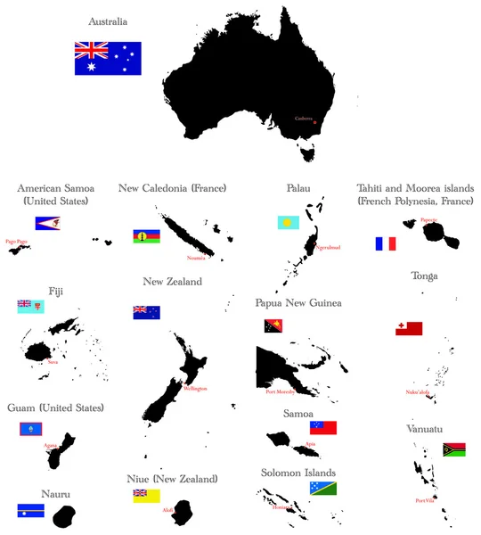
Blank Map Australia And New Zealand. Detailed Map Of Australia With States And Territories And All Regions Of New Zealand. Template. EPS10.

Vector, 4.97MB, 6667 × 5418 eps
stock vector Australia and Oceania outline blank map and navigation icons

Australia And Oceania Outline Blank Map And Navigation Icons

Vector, 12.35MB, 8192 × 5026 eps
stock vector Oceania highly detailed physical map

Oceania Highly Detailed Physical Map

Vector, 7.22MB, 8923 × 8398 eps
stock vector Australia and Oceania detailed political map in colors of blue a

Australia And Oceania Detailed Political Map In Colors Of Blue A

Vector, 8.68MB, 8192 × 6385 eps
stock image Map of oceania with national flags

Map Of Oceania With National Flags

Image, 2.63MB, 7000 × 5000 jpg
stock vector Pinned countries flags on map of Oceania

Pinned Countries Flags On Map Of Oceania

Vector, 0.53MB, 5156 × 2950 ai
stock vector Australian, Oceania Round Pointer Flag and map

Australian, Oceania Round Pointer Flag And Map

Vector, 6.96MB, 5000 × 5000 eps
stock image Night Earth. Pacific - New Zealand

Night Earth. Pacific - New Zealand

Image, 6.9MB, 5000 × 5000 jpg
stock vector Australia and Oceania detailed political map and navigation icon

Australia And Oceania Detailed Political Map And Navigation Icon

Vector, 7.94MB, 8192 × 6142 eps
stock vector Australia and Oceania detailed political map

Australia And Oceania Detailed Political Map

Vector, 6.55MB, 8192 × 5552 eps
stock image Gray Globe - Australia

Gray Globe - Australia

Image, 11.06MB, 4800 × 4800 jpg
stock image Night Earth. Pacific - New Zealand

Night Earth. Pacific - New Zealand

Image, 6.58MB, 5000 × 5000 jpg
stock vector Australia and Oceania - map and navigation icons - illustration.

Australia And Oceania - Map And Navigation Icons - Illustration.

Vector, 3.99MB, 6400 × 4774 eps
stock vector vector map of Australia, Oceania and South East Asian countries mixed with their national flags

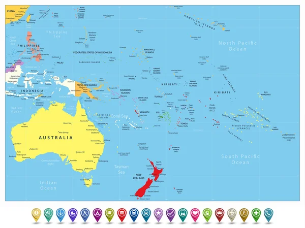
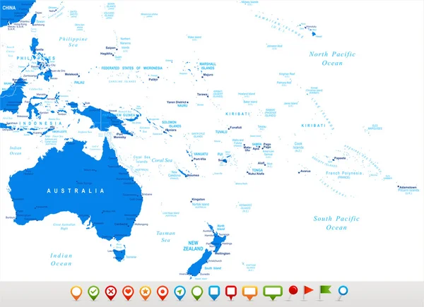
Vector Map Of Australia, Oceania And South East Asian Countries Mixed With Their National Flags

Vector, 7.57MB, 7292 × 5337 eps
Page 1 >> Next