photo free
Home Images Vectors Videos

Stock image Oceania Map page 2

stock vector Palau map

Palau Map

Vector, 1.71MB, 7348 × 4593 eps
stock vector Oceania political map

Oceania Political Map

Vector, 4.37MB, 9777 × 6514 eps
stock vector Colorful Oceania map

Colorful Oceania Map

Vector, 3.4MB, 7504 × 4988 eps
stock vector Political Oceania Map vector illustration isolated in white background. Editable and clearly labeled layers.

Political Oceania Map Vector Illustration Isolated In White Background. Editable And Clearly Labeled Layers.

Vector, 11.54MB, 5600 × 3939 eps
stock vector Oceania map

Oceania Map

Vector, 3.24MB, 7504 × 5107 eps
stock vector Australia and Oceania region vector high detailed map with countries names and national flags

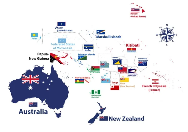
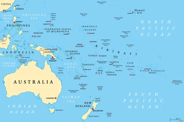
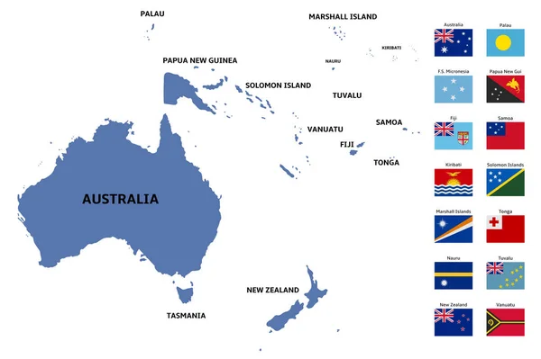
Australia And Oceania Region Vector High Detailed Map With Countries Names And National Flags

Vector, 7.35MB, 8334 × 5852 eps
stock vector Regions of Oceania, political map. Colored geographic regions, southeast of the Asia-Pacific region including Australasia, Melanesia, Micronesia and Polynesia. English. Illustration over white. Vector

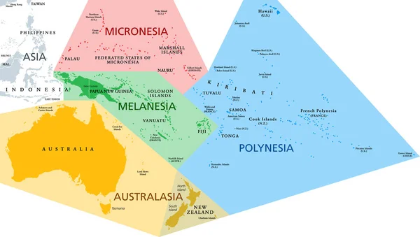
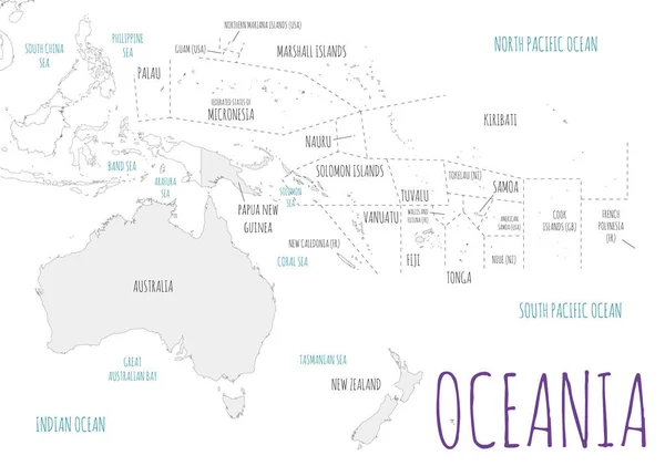
Regions Of Oceania, Political Map. Colored Geographic Regions, Southeast Of The Asia-Pacific Region Including Australasia, Melanesia, Micronesia And Polynesia. English. Illustration Over White. Vector

Vector, 3.27MB, 9000 × 5091 eps
stock vector Political Oceania Map vector illustration with different colors for each country. Editable and clearly labeled layers.

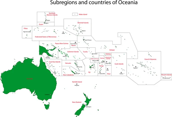
Political Oceania Map Vector Illustration With Different Colors For Each Country. Editable And Clearly Labeled Layers.

Vector, 12.15MB, 5600 × 3939 eps
stock vector Palau map

Palau Map

Vector, 0.76MB, 5248 × 7172 eps
stock vector Oceania map

Oceania Map

Vector, 3.25MB, 7502 × 5107 eps
stock vector Map of Australia with internal regional boundaries, vector

Map Of Australia With Internal Regional Boundaries, Vector

Vector, 2.71MB, 5120 × 3840 eps
stock vector oceania map and flags

Oceania Map And Flags

Vector, 5.45MB, 7917 × 5270 eps
stock vector Australia map outline set

Australia Map Outline Set

Vector, 4.29MB, 5313 × 5000 eps
stock vector Doodle Map of Oceania With Countries

Doodle Map Of Oceania With Countries

Vector, 4.41MB, 3001 × 2001 eps
stock vector Subregions of Oceania, political map. Geoscheme with regions in the Pacific Ocean and next to Asia. Melanesia, Micronesia, Polynesia, and Australasia, short for Australia and New Zealand. Vector.

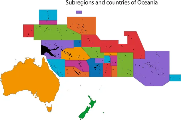
Subregions Of Oceania, Political Map. Geoscheme With Regions In The Pacific Ocean And Next To Asia. Melanesia, Micronesia, Polynesia, And Australasia, Short For Australia And New Zealand. Vector.

Vector, 5.06MB, 9000 × 6000 eps
stock vector Oceania Divided Map With Countries

Oceania Divided Map With Countries

Vector, 3.21MB, 3001 × 2001 eps
stock vector Outline Simple Map of Oceania

Outline Simple Map Of Oceania

Vector, 0.74MB, 3001 × 2001 eps
stock vector Gray Divided Map of Oceania

Gray Divided Map Of Oceania

Vector, 1.42MB, 3001 × 2001 eps
stock vector Oceania Map With Map Icons

Oceania Map With Map Icons

Vector, 0.7MB, 3001 × 2001 eps
stock vector Dotted Map of Oceania

Dotted Map Of Oceania

Vector, 0.96MB, 3001 × 2001 eps
stock image A Samoa flag map on white background with clipping path 3d illustration

A Samoa Flag Map On White Background With Clipping Path 3d Illustration

Image, 3.72MB, 7000 × 7000 jpg
stock vector Simple Black Map of Oceania Isolated on White Background

Simple Black Map Of Oceania Isolated On White Background

Vector, 0.4MB, 2401 × 2401 eps
stock vector World map background

World Map Background

Vector, 5.25MB, 5000 × 5000 eps
stock vector World Map Physical Topographic - Vector Detailed Illustration

World Map Physical Topographic - Vector Detailed Illustration

Vector, 39.43MB, 6001 × 3669 eps
stock vector World map with country name

World Map With Country Name

Vector, 0.46MB, 5999 × 3225 ai
stock vector Dotted world map

Dotted World Map

Vector, 0.98MB, 5000 × 2857 eps
stock image Planet earth with realistic geography surface and orbital 3D cloud atmosphere

Planet Earth With Realistic Geography Surface And Orbital 3D Cloud Atmosphere

Image, 2.96MB, 3840 × 2160 jpg
stock vector High Detail Grey World Map

High Detail Grey World Map

Vector, 14.16MB, 8000 × 5220 eps
stock vector World Map vector. Gray similar world map blank vector on transparent background.  Gray similar world map with borders of all countries and States of USA map, States of Australia and Countries of the UK. Quality world  map.

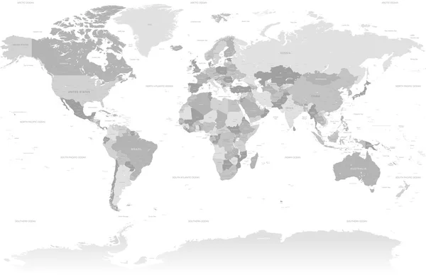
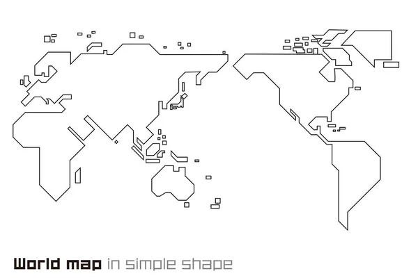
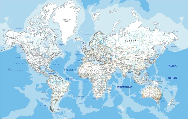
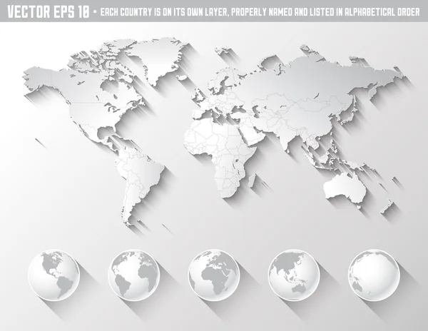
World Map Vector. Gray Similar World Map Blank Vector On Transparent Background. Gray Similar World Map With Borders Of All Countries And States Of USA Map, States Of Australia And Countries Of The UK. Quality World Map.

Vector, 7.27MB, 8334 × 4168 eps
stock vector The design of the world map composed of a straight line

The Design Of The World Map Composed Of A Straight Line

Vector, 0.28MB, 6000 × 4000 ai
stock vector World Map isolated on retro white color background with labeling

World Map Isolated On Retro White Color Background With Labeling

Vector, 13.24MB, 8178 × 5802 eps
stock vector Physical World Map Retro Colors with labeling

Physical World Map Retro Colors With Labeling

Vector, 21.07MB, 8192 × 5812 eps
stock vector Political World Map vector illustration isolated on white background with country names in spanish. Editable and clearly labeled layers.

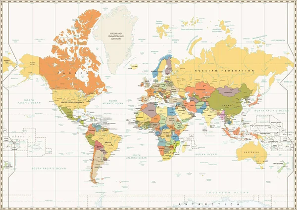
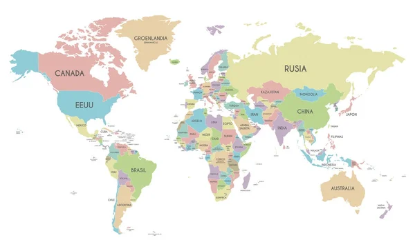
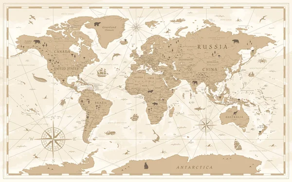
Political World Map Vector Illustration Isolated On White Background With Country Names In Spanish. Editable And Clearly Labeled Layers.

Vector, 8.9MB, 5600 × 3400 eps
stock vector World Map Color Political - Vector Detailed Illustration

World Map Color Political - Vector Detailed Illustration

Vector, 50.63MB, 5945 × 4005 eps
stock vector World Map Vintage Political - Vector Illustration

World Map Vintage Political - Vector Illustration

Vector, 39.88MB, 6001 × 3669 eps
stock vector Gray political map of World.

Gray Political Map Of World.

Vector, 14.6MB, 8000 × 5333 eps
stock vector Vector dotted world map

Vector Dotted World Map

Vector, 0.65MB, 9237 × 5302 eps
stock image World map, blue white card paper 3D, blank template raster

World Map, Blue White Card Paper 3D, Blank Template Raster

Image, 2.04MB, 5582 × 3500 jpg
stock vector World map

World Map

Vector, 1.08MB, 5039 × 3150 eps
stock vector World map countries colorful. Vector illustration.

World Map Countries Colorful. Vector Illustration.

Vector, 2.61MB, 7193 × 4984 eps
stock vector World Map Vintage Cartoon Detailed - Vector

World Map Vintage Cartoon Detailed - Vector

Vector, 40.46MB, 5998 × 3740 eps
stock vector Map vector icon. Flat style illustration. EPS 10 vector.

Map Vector Icon. Flat Style Illustration. EPS 10 Vector.

Vector, 2.33MB, 6945 × 6945 eps
stock vector Map Special lineal color icon. Illustration symbol design template for web mobile UI element. Perfect color modern pictogram on editable stroke.

Map Special Lineal Color Icon. Illustration Symbol Design Template For Web Mobile UI Element. Perfect Color Modern Pictogram On Editable Stroke.

Vector, 2.32MB, 6945 × 6945 eps
stock vector Black map of the world.

Black Map Of The World.

Vector, 1.37MB, 8527 × 4952 ai
stock vector World  road map with labeling

World Road Map With Labeling

Vector, 9.2MB, 5513 × 3506 eps
stock vector Flat Shadow World map with globes

Flat Shadow World Map With Globes

Vector, 8.98MB, 6500 × 5035 eps
stock vector Political blank World Map vector illustration with different colors for each continent and isolated on white background. Editable and clearly labeled layers.

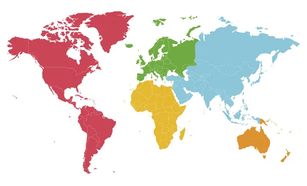
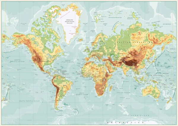
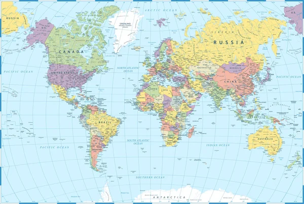
Political Blank World Map Vector Illustration With Different Colors For Each Continent And Isolated On White Background. Editable And Clearly Labeled Layers.

Vector, 7.74MB, 5600 × 3400 eps
stock vector Canada, Map, Location Business Logo Template. Flat Color

Canada, Map, Location Business Logo Template. Flat Color

Vector, 0.29MB, 5556 × 5556 eps
stock vector ������������

������������

Vector, 3.94MB, 3000 × 2978 eps
stock vector Illustrated map of the state of South Dakota

Illustrated Map Of The State Of South Dakota

Vector, 1MB, 3000 × 2978 eps
Previous << Page 2 >> Next