
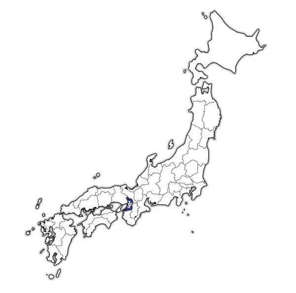
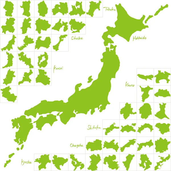
Stock image Osaka Prefecture Map
Flag Of Osaka Prefecture On Map With Administrative Divisions And Borders Of Japan
Image, 0.74MB, 4576 × 4531 jpg
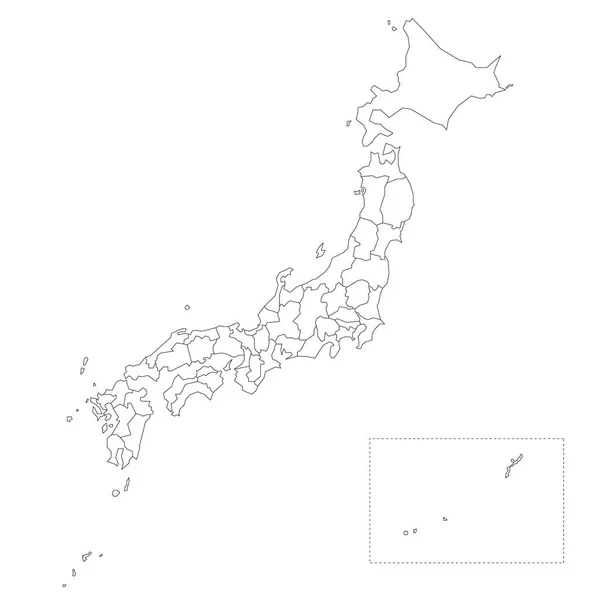
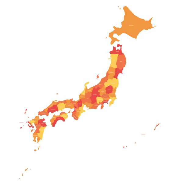
Japan Political Map Divide By State Colorful Outline Simplicity Style.
Vector, 5.47MB, 8086 × 11136 eps
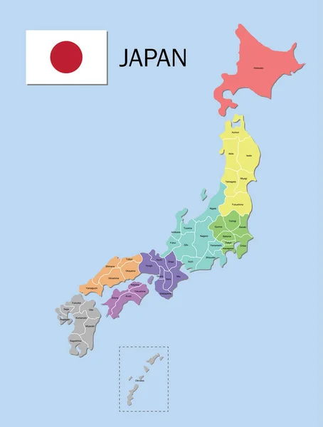
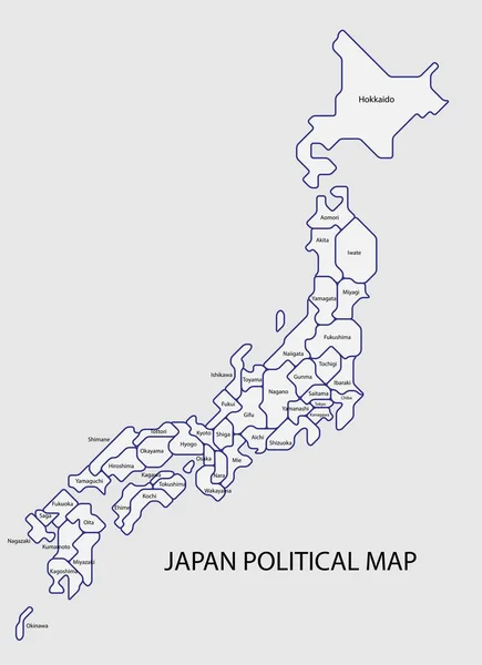
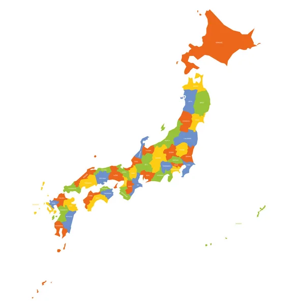
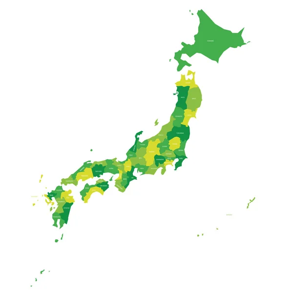
Japan Map. Color Map Of The Provinces Of Japan. Japan Administrative Map. Regions And Prefectures.
Vector, 5.62MB, 5248 × 6934 eps
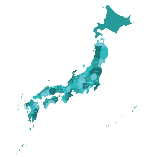
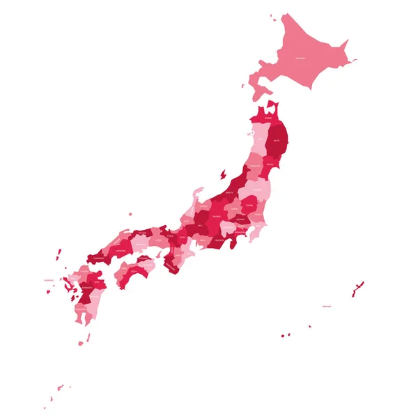
Japan Map. Color Map Of The Provinces Of Japan. Japan Administrative Map. Regions And Prefectures.
Vector, 4.79MB, 5248 × 6187 eps
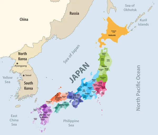
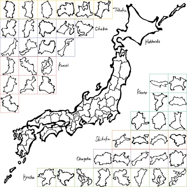
Japan Prefectures (japanese Names Gives In Parentheses) Vector Map Colored Be Regions With Neighbouring Countries And Territories
Vector, 6.87MB, 8333 × 7112 eps

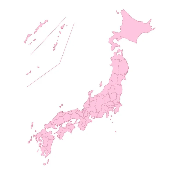
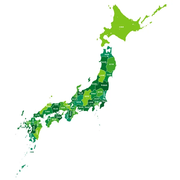
Japan Map. Color Map Of The Provinces Of Japan. Japan Administrative Map. Regions And Prefectures.
Vector, 4.7MB, 5248 × 6187 eps

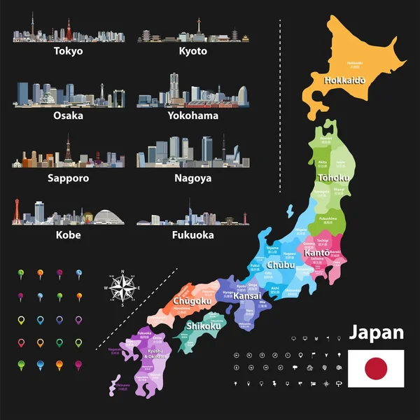
Vector Illustration Of Japanese Flag And Prefectures Map Colored By Regions. Largest City Skylines, Navigation, Location, And Travel Icons
Vector, 12.9MB, 7293 × 7292 eps

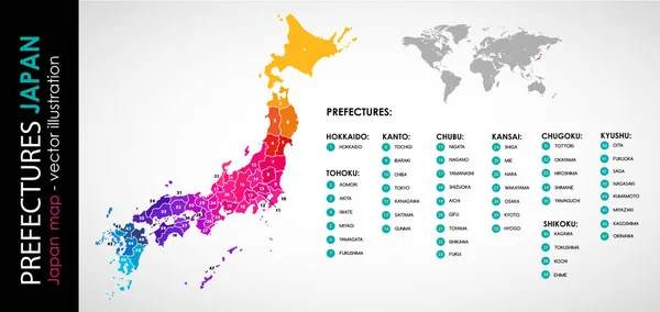
Japan Prefectures Vector Map Colored Be Regions. Japanese Names Gives In Parentheses. Flag Of Japan
Vector, 6.15MB, 5975 × 7292 eps


Miyagi Map, Japan, Asia. Filled And Outline Map Designs. Vector Illustration
Vector, 0.36MB, 6001 × 3001 eps

Welcome To OSAKA Japan! Hand Drawn Vector Illustration With Famous Landmarks.
Image, 3.34MB, 5000 × 3378 jpg


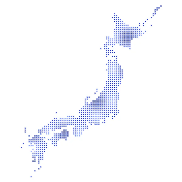
Symbol Map Of The Voivodeship/Province Swietokrzyskie (Poland) Showing The State/province With A Pattern Of Black Circles
Vector, 1.07MB, 4432 × 6000 eps

Kansai Region, Or The Kinki Region In Japan, Political Map. Southern-central Region Of The Main Island Honshu, Consisting Of The Prefectures Hyogo, Mie, Nara, Osaka, Kyoto, Shiga, And Wakayama. Vector
Vector, 5.8MB, 6000 × 6000 eps

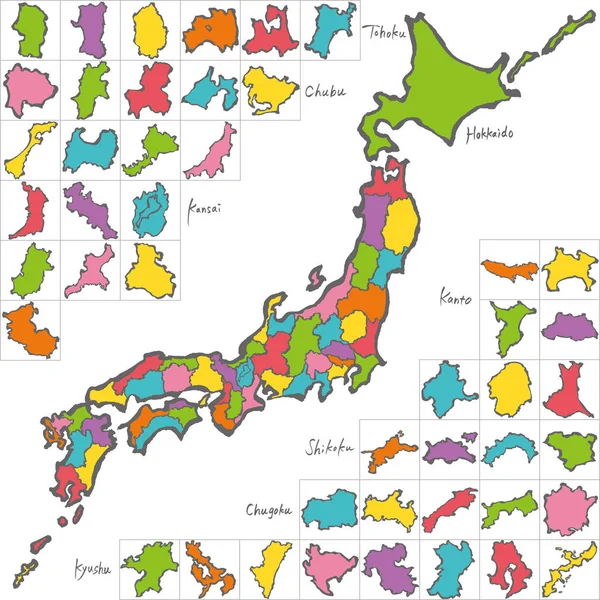
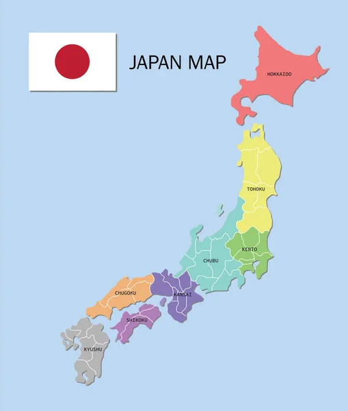
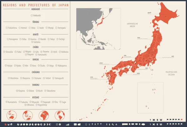
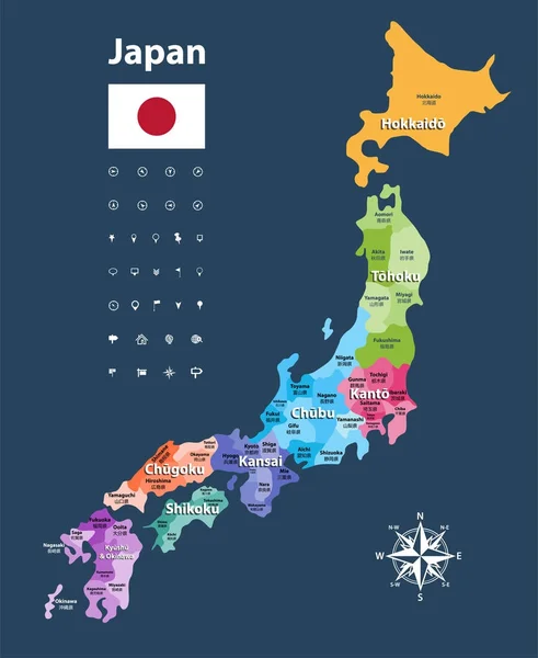
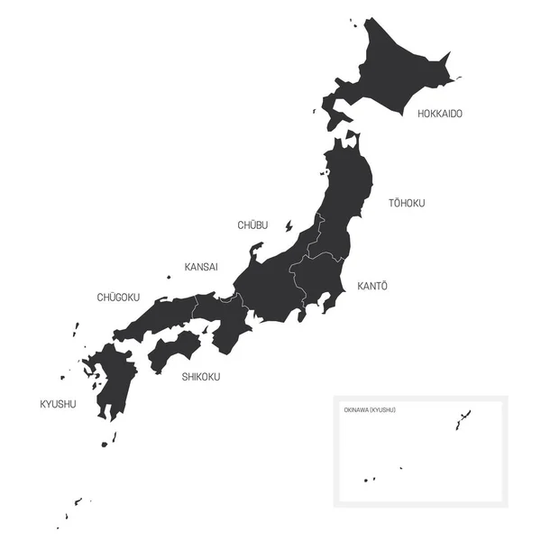
Japan, Regions And Prefectures, Multi Colored Political Map. The Eight Regions Of Japan, Divided Into 47 Prefectures, Which Are The First Level Administrative Divisions Of The Unitary State. Vector
Vector, 3.72MB, 6000 × 7045 eps

Shikoku Island And Region In Japan With Four Prefectures, Political Map. Region And Smallest Of The Main Islands Of Japan, Northeast Of Kyushu, And South Of Honshu, Separated By The Seto Inland Sea.
Vector, 4.62MB, 9000 × 6000 eps

Symbol Map Of The Urban Prefecture Osaka (Japan) Showing The State/province With A Pattern Of Black Squares Like A Chessboard
Vector, 0.58MB, 4432 × 6000 eps


Kansai Region, Or The Kinki Region In Japan, Gray Political Map. Southern-central Region Of The Main Island Honshu, Consisting Of The Prefectures Hyogo, Mie, Nara, Osaka, Kyoto, Shiga, And Wakayama.
Vector, 3.78MB, 6000 × 6000 eps

Symbol Map Of The Urban Prefecture Osaka (Japan) Showing The Contour Of The State/province Buffered Inside In Rainbow Colors
Vector, 0.67MB, 4432 × 6000 eps
Page 1 >> Next