photo free
Home Images Vectors Videos

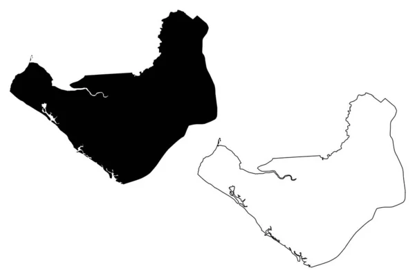
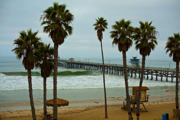
Stock image Pacific County

stock image The Columbia torrent salamander, Rhyacotriton kezeri walking in a seepage.

The Columbia Torrent Salamander, Rhyacotriton Kezeri Walking In A Seepage.

Image, 3.74MB, 3000 × 2000 jpg
stock image Close up of a Columbia torrent salamander, Rhyacotriton kezeri on green moss

Close Up Of A Columbia Torrent Salamander, Rhyacotriton Kezeri On Green Moss

Image, 3.13MB, 3000 × 2000 jpg
stock image A close up of a juvenile Copes giant salamander, Dicamptodon copei

A Close Up Of A Juvenile Copes Giant Salamander, Dicamptodon Copei

Image, 3MB, 3000 × 2000 jpg
stock image The rare Van Dyks salamander, Plethodon vandykei from Washington state

The Rare Van Dyks Salamander, Plethodon Vandykei From Washington State

Image, 3.95MB, 3000 × 2000 jpg
stock image Closeup of the orange Western redback salamander , Plethodon vehiculum from South Washington , on the forest floor

Closeup Of The Orange Western Redback Salamander , Plethodon Vehiculum From South Washington , On The Forest Floor

Image, 6.84MB, 3000 × 2000 jpg
stock vector Los Angeles County, California (USA) vector map

Los Angeles County, California (USA) Vector Map

Vector, 5.34MB, 8334 × 9507 eps
stock vector Washington state road map

Washington State Road Map

Vector, 8.49MB, 8192 × 6599 eps
stock vector Los Angeles, California (USA) vector map

Los Angeles, California (USA) Vector Map

Vector, 5.17MB, 5421 × 8333 eps
stock vector  vegetation vector map of Costa Rica country with important cities

Vegetation Vector Map Of Costa Rica Country With Important Cities

Vector, 1.08MB, 3601 × 3265 eps
stock vector Vector road map of the main Micronesian island of Pohnpei

Vector Road Map Of The Main Micronesian Island Of Pohnpei

Vector, 1.35MB, 3134 × 3100 eps
stock vector Oregon map

Oregon Map

Vector, 7.16MB, 7002 × 7002 eps
stock vector Red map of California

Red Map Of California

Vector, 1.39MB, 3553 × 4500 eps
stock vector Physical map of Washington state

Physical Map Of Washington State

Vector, 10.96MB, 8192 × 6235 eps
stock vector Black map of Wisconsin

Black Map Of Wisconsin

Vector, 1.58MB, 4000 × 4000 eps
stock vector Black and white map of California

Black And White Map Of California

Vector, 1.3MB, 3394 × 4800 eps
stock vector Veraguas Province (Republic of Panama, Provinces of Panama) map vector illustration, scribble sketch Veraguas map

Veraguas Province (Republic Of Panama, Provinces Of Panama) Map Vector Illustration, Scribble Sketch Veraguas Map

Vector, 0.74MB, 7087 × 4726 eps
stock vector Chinandega Department (Republic of Nicaragua, Departments of Nicaragua) map vector illustration, scribble sketch Chinandega (NI-CI) ma

Chinandega Department (Republic Of Nicaragua, Departments Of Nicaragua) Map Vector Illustration, Scribble Sketch Chinandega (NI-CI) Ma

Vector, 0.63MB, 7087 × 4726 eps
stock vector vector map of United States with indication of California

Vector Map Of United States With Indication Of California

Vector, 2.23MB, 4600 × 3450 eps
stock vector Wisconsin state detailed editable map

Wisconsin State Detailed Editable Map

Vector, 1.12MB, 5743 × 6000 eps
stock vector Los Angeles County, California (USA) vector map

Los Angeles County, California (USA) Vector Map

Vector, 5.37MB, 8334 × 9507 eps
stock vector Los Angeles County, California (USA) vector map

Los Angeles County, California (USA) Vector Map

Vector, 5.34MB, 8334 × 9507 eps
stock vector San Miguel Department (Republic of El Salvador, Departments of El Salvador) map vector illustration, scribble sketch San Miguel map

San Miguel Department (Republic Of El Salvador, Departments Of El Salvador) Map Vector Illustration, Scribble Sketch San Miguel Map

Vector, 0.57MB, 7087 × 4726 eps
stock vector Road map of the French overseas territory of Wallis and Futuna

Road Map Of The French Overseas Territory Of Wallis And Futuna

Vector, 1.02MB, 5078 × 3100 eps
stock vector Washington state map

Washington State Map

Vector, 8.45MB, 8192 × 6235 eps
stock vector Los Angeles, California (USA) vector map

Los Angeles, California (USA) Vector Map

Vector, 5.17MB, 5421 × 8333 eps
stock vector Road map of the Hawaiian Islands of Maui, Molokai, Lanai and Kahoolawe

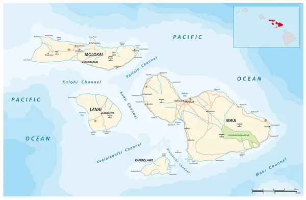
Road Map Of The Hawaiian Islands Of Maui, Molokai, Lanai And Kahoolawe

Vector, 1.26MB, 4733 × 3100 eps
stock vector Physical map of Washington state isolated on white

Physical Map Of Washington State Isolated On White

Vector, 8.76MB, 8192 × 6235 eps
stock vector California county map

California County Map

Vector, 3.04MB, 3417 × 3667 eps
stock vector Washington state map navigation set

Washington State Map Navigation Set

Vector, 12.22MB, 8192 × 4439 eps
stock vector Washington state map navigation set in colors of blue

Washington State Map Navigation Set In Colors Of Blue

Vector, 11.62MB, 8192 × 4439 eps
stock vector Vector map of the U.S. state of Hawaii with Flag

Vector Map Of The U.S. State Of Hawaii With Flag

Vector, 1.35MB, 4436 × 3100 eps
stock vector oregon administrative and political map with flag

Oregon Administrative And Political Map With Flag

Vector, 3MB, 4482 × 3100 eps
stock vector Hawaii vector map silhouette. High detailed illustration. United state of America country

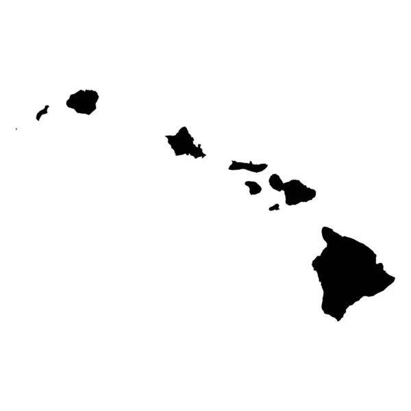
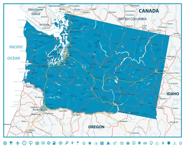
Hawaii Vector Map Silhouette. High Detailed Illustration. United State Of America Country

Vector, 0.2MB, 4096 × 4096 eps
stock vector Administrative and road map of the California region San Francisco Bay Area

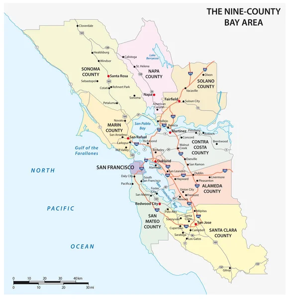
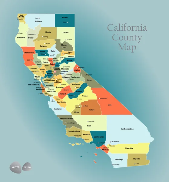
Administrative And Road Map Of The California Region San Francisco Bay Area

Vector, 1.55MB, 3100 × 3189 eps
stock vector High quality map of Newfoundland is the island of Canada

High Quality Map Of Newfoundland Is The Island Of Canada

Vector, 1.64MB, 4000 × 4000 eps
stock vector Grey map of Wisconsin

Grey Map Of Wisconsin

Vector, 1.58MB, 4000 × 4000 eps
stock image Palm trees at California beach

Palm Trees At California Beach

Image, 14.71MB, 4000 × 6000 jpg
stock vector Colorful outline map of the states and counties in the United States

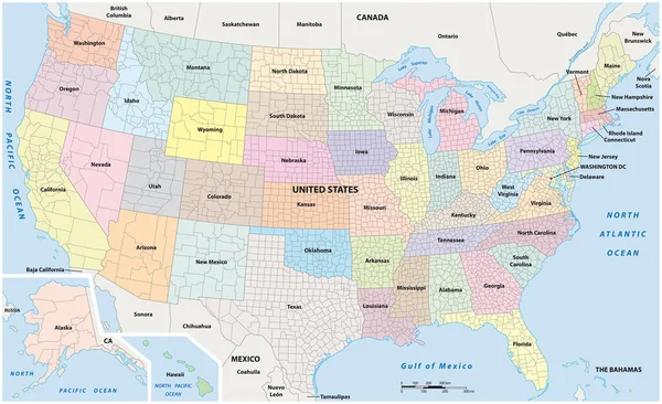
Colorful Outline Map Of The States And Counties In The United States

Vector, 1.86MB, 14578 × 8902 eps
stock vector High quality map of island

High Quality Map Of Island

Vector, 0.91MB, 4000 × 4000 eps
stock vector North America administrative vector map with latitude and longitude

North America Administrative Vector Map With Latitude And Longitude

Vector, 1.11MB, 4020 × 3100 eps
stock image Flowers and view of the Pacific Ocean at Heisler Park, in Laguna

Flowers And View Of The Pacific Ocean At Heisler Park, In Laguna

Image, 9.88MB, 2533 × 3800 jpg
stock image palms by the sea in Laguna Beach

Palms By The Sea In Laguna Beach

Image, 15.09MB, 6436 × 3497 jpg
stock image San Clemente Pier during a big swell

San Clemente Pier During A Big Swell

Image, 19.19MB, 6144 × 4096 jpg
stock vector Vector map of the border districts in the United States and Mexico along the border

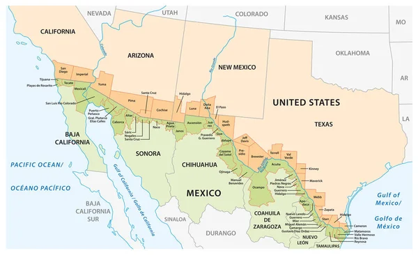
Vector Map Of The Border Districts In The United States And Mexico Along The Border

Vector, 1.17MB, 5067 × 3100 eps
stock image San Clemente Pier on a calm Day

San Clemente Pier On A Calm Day

Image, 2.48MB, 2500 × 1618 jpg
stock vector vector street map of greater Los Angeles area, California, United States

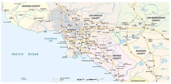
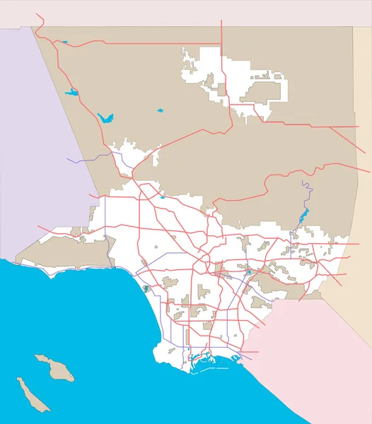
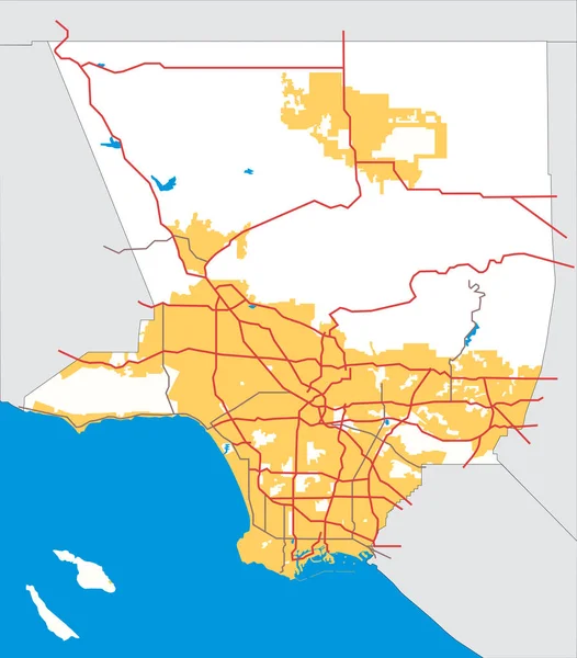
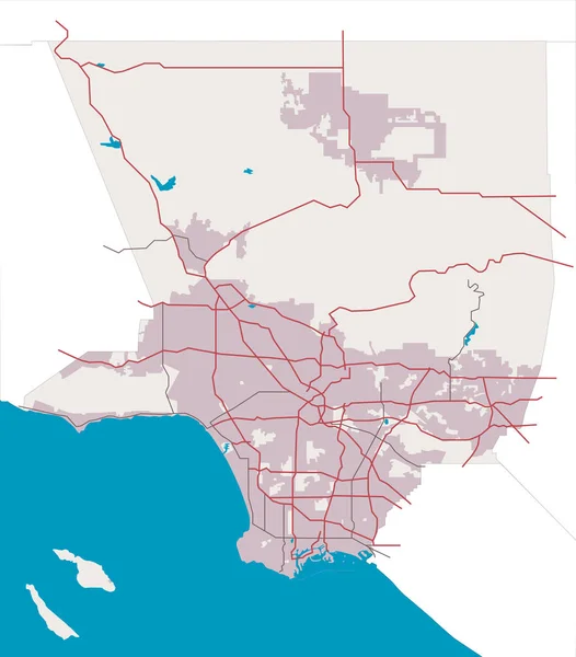
Vector Street Map Of Greater Los Angeles Area, California, United States

Vector, 2.44MB, 6259 × 3100 eps
stock image Tropical Shoreline and Driftwood on Kauai, Hawai

Tropical Shoreline And Driftwood On Kauai, Hawai

Image, 8.89MB, 3814 × 2534 jpg
stock vector United States Map, states border map. Vector illustration.

United States Map, States Border Map. Vector Illustration.

Vector, 1.29MB, 4167 × 4167 eps
stock vector United States of America map isolated on white background. USA map with state names. Vector stock

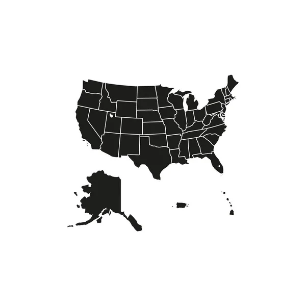
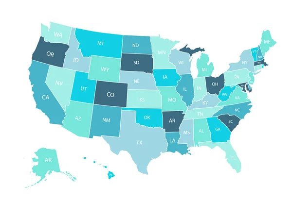
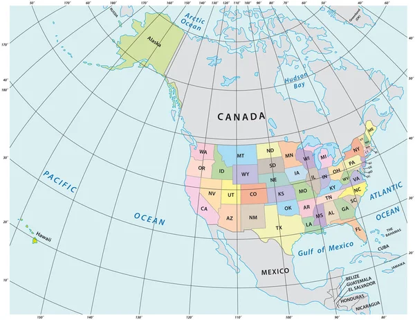
United States Of America Map Isolated On White Background. USA Map With State Names. Vector Stock

Vector, 5.24MB, 5000 × 3472 eps
stock vector Map of the Japanese island of Hokkaido

Map Of The Japanese Island Of Hokkaido

Vector, 1.42MB, 3790 × 3100 eps
Page 1 >> Next