photo free
Home Images Vectors Videos

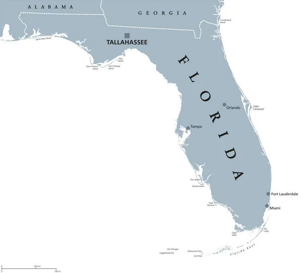
Stock image Political Map Of Usa page 7

stock vector World map with countries. Vector illustration

World Map With Countries. Vector Illustration

Vector, 6.85MB, 6060 × 3330 eps
stock vector North America -highly detailed map.

North America -highly Detailed Map.

Vector, 15.18MB, 3936 × 5001 eps
stock vector World map - America centered. Grey colored on dark background. High detailed political map of World with country, capital, ocean and sea names labeling

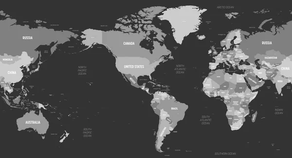
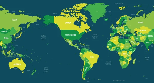
World Map - America Centered. Grey Colored On Dark Background. High Detailed Political Map Of World With Country, Capital, Ocean And Sea Names Labeling

Vector, 6.4MB, 6000 × 3250 eps
stock vector The Americas political map

The Americas Political Map

Vector, 3.26MB, 6521 × 9777 eps
stock vector map of standard time zones of the world with continents separately and clocks with current local times in main world cities

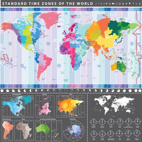
Map Of Standard Time Zones Of The World With Continents Separately And Clocks With Current Local Times In Main World Cities

Vector, 14.72MB, 5208 × 5204 eps
stock vector political map

Political Map

Vector, 19.16MB, 7577 × 4812 eps
stock vector North and South America Political Map and Flat Map Markers

North And South America Political Map And Flat Map Markers

Vector, 5.52MB, 5241 × 8192 eps
stock vector Map of The United States of America (USA) with Colorful States Illustration on White Background

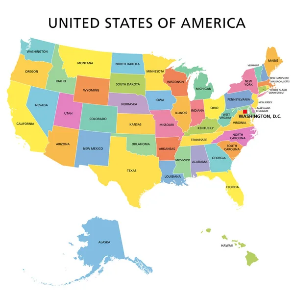
Map Of The United States Of America (USA) With Colorful States Illustration On White Background

Vector, 1.39MB, 7501 × 5834 eps
stock vector North America map

North America Map

Vector, 12.7MB, 3890 × 5001 eps
stock vector World maps and globes

World Maps And Globes

Vector, 5.27MB, 4995 × 5258 eps
stock vector USA blank map. High detailed political map United States of America and neighboring countries

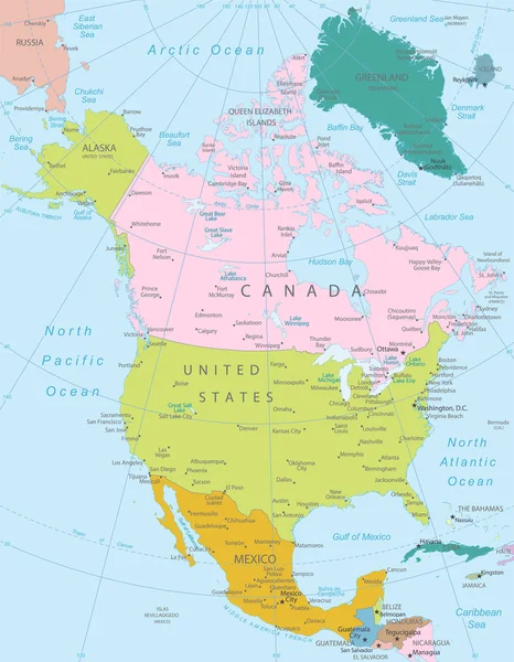
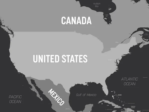
USA Blank Map. High Detailed Political Map United States Of America And Neighboring Countries

Vector, 1.08MB, 8000 × 6000 eps
stock vector United States of America isolated map and Idaho State territory. vector USA political map. geographic background design

United States Of America Isolated Map And Idaho State Territory. Vector USA Political Map. Geographic Background Design

Vector, 0.75MB, 6000 × 4000 eps
stock vector World map - America centered. Green hue colored on dark background. High detailed political map of World with country, capital, ocean and sea names labeling

World Map - America Centered. Green Hue Colored On Dark Background. High Detailed Political Map Of World With Country, Capital, Ocean And Sea Names Labeling

Vector, 6.42MB, 6000 × 3250 eps
stock vector world map colored by continents

World Map Colored By Continents

Vector, 13.53MB, 10417 × 6477 eps
stock vector United States of America -  political map

United States Of America - Political Map

Vector, 8.1MB, 5640 × 3844 eps
stock vector Detailed United States of America map

Detailed United States Of America Map

Vector, 1.59MB, 7000 × 3791 eps
stock vector Map of United States split into Census regions and divisions. Region definition, widely used for data collection and analysis. Most commonly used classification system. English. Illustration. Vector

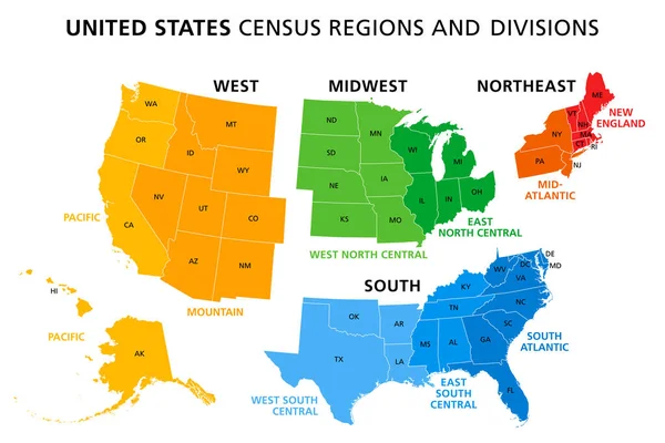
Map Of United States Split Into Census Regions And Divisions. Region Definition, Widely Used For Data Collection And Analysis. Most Commonly Used Classification System. English. Illustration. Vector

Vector, 3.06MB, 9000 × 6000 eps
stock vector North and South America vector political map in tints of soft blue

North And South America Vector Political Map In Tints Of Soft Blue

Vector, 12.09MB, 5042 × 7292 eps
stock vector political world map

Political World Map

Vector, 8.62MB, 7569 × 5123 eps
stock vector Political map of continents

Political Map Of Continents

Vector, 4.29MB, 3693 × 2247 eps
stock vector Florida United States political map

Florida United States Political Map

Vector, 3.05MB, 8333 × 7526 eps
stock vector Map of The United States of America (USA) Divided States Maps Outline Illustration on White Background

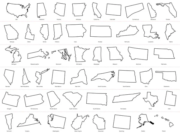
Map Of The United States Of America (USA) Divided States Maps Outline Illustration On White Background

Vector, 3.44MB, 10000 × 7437 eps
stock vector South Carolina, SC, political map, with the capital Columbia, largest cities and borders. State in the southeastern region of the United States of America. The Palmetto State.  Illustration. Vector.

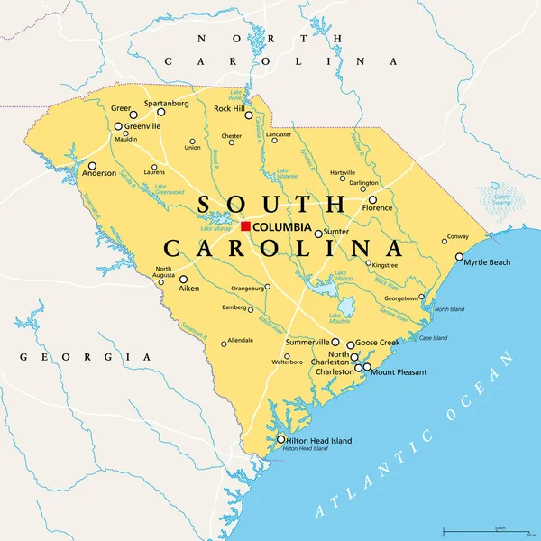
South Carolina, SC, Political Map, With The Capital Columbia, Largest Cities And Borders. State In The Southeastern Region Of The United States Of America. The Palmetto State. Illustration. Vector.

Vector, 4.52MB, 6000 × 6000 eps
stock vector North America Region. Map of countries in northern America. Vector illustration

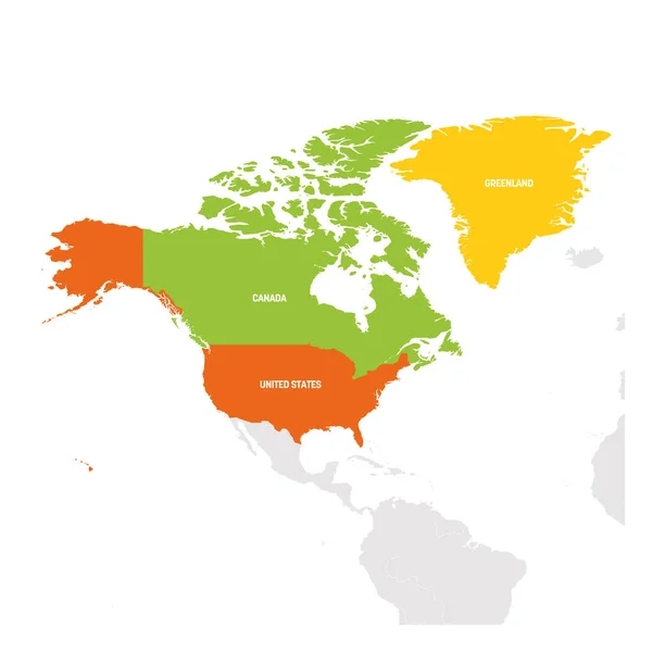
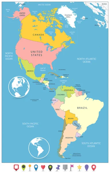
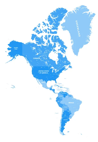
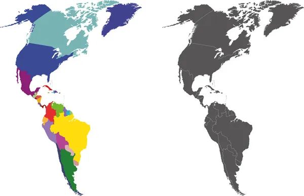
North America Region. Map Of Countries In Northern America. Vector Illustration

Vector, 2.52MB, 6000 × 6000 eps
stock vector United States of America isolated map and Hawaii islands territory. vector USA political map. geographic banner design

United States Of America Isolated Map And Hawaii Islands Territory. Vector USA Political Map. Geographic Banner Design

Vector, 0.7MB, 6000 × 4000 eps
stock vector North America map - green hue colored on dark background. High detailed political map North American continent with country, capital, ocean and sea names labeling

North America Map - Green Hue Colored On Dark Background. High Detailed Political Map North American Continent With Country, Capital, Ocean And Sea Names Labeling

Vector, 1.71MB, 6000 × 4503 eps
stock vector United States divided in Census regions and divisions, gray map. Region definition used for data collection and analysis. Most commonly used classification system. English. Illustration. Vector.

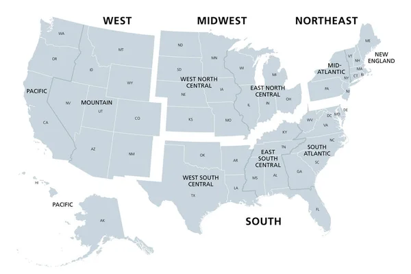
United States Divided In Census Regions And Divisions, Gray Map. Region Definition Used For Data Collection And Analysis. Most Commonly Used Classification System. English. Illustration. Vector.

Vector, 3.11MB, 9000 × 6000 eps
stock vector North and South America Political Map and Navigation Icons

North And South America Political Map And Navigation Icons

Vector, 6.03MB, 5125 × 8192 eps
stock vector Americas map. High detailed political map of North and South America continent with country, capital, ocean and sea names labeling

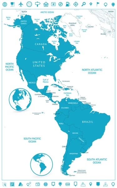
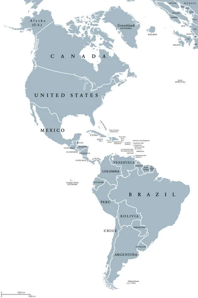
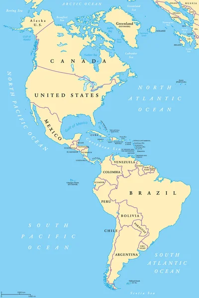
Americas Map. High Detailed Political Map Of North And South America Continent With Country, Capital, Ocean And Sea Names Labeling

Vector, 2.76MB, 4500 × 6000 eps
stock vector Alaska

Alaska

Vector, 2.47MB, 4935 × 3000 eps
stock vector Blue colored North America outline map. Political north american map. Vector illustration map.

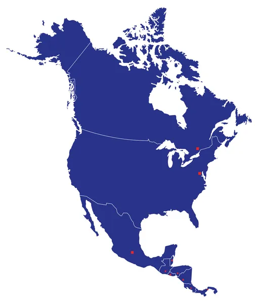
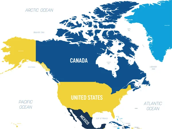
Blue Colored North America Outline Map. Political North American Map. Vector Illustration Map.

Vector, 3.55MB, 4000 × 3951 eps
stock vector Rhode Island, political map with capital Providence. State of Rhode Island and Providence Plantations, RI, in the New England region of United States of America. Gray illustration, over white. Vector.

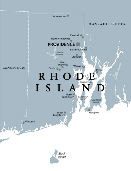
Rhode Island, Political Map With Capital Providence. State Of Rhode Island And Providence Plantations, RI, In The New England Region Of United States Of America. Gray Illustration, Over White. Vector.

Vector, 2.04MB, 6000 × 7823 eps
stock vector Mexico

Mexico

Vector, 2.15MB, 4851 × 3601 eps
stock vector North Carolina County Map

North Carolina County Map

Vector, 1.09MB, 5864 × 3000 ai
stock vector Vintage Color Political Map of USA and Flat Map Pointers

Vintage Color Political Map Of USA And Flat Map Pointers

Vector, 8.71MB, 8192 × 6786 eps
stock vector United States of America isolated map and California state territory. vector USA political map. geographic banner template

United States Of America Isolated Map And California State Territory. Vector USA Political Map. Geographic Banner Template

Vector, 0.73MB, 6000 × 4000 eps
stock vector The Americas, North and South America, political map

The Americas, North And South America, Political Map

Vector, 5.31MB, 6520 × 9777 eps
stock vector United States of America isolated map and Oregon State territory. vector USA political map. geographic banner template

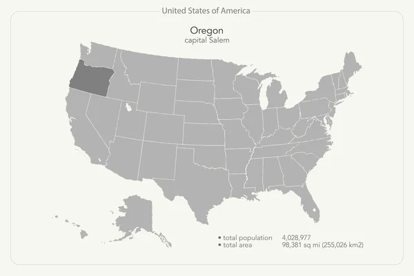
United States Of America Isolated Map And Oregon State Territory. Vector USA Political Map. Geographic Banner Template

Vector, 0.71MB, 6000 × 4000 eps
stock vector America

America

Vector, 22.35MB, 6056 × 3909 eps
stock vector North America Map Silhouette

North America Map Silhouette

Vector, 5.84MB, 7000 × 8220 eps
stock vector Blank map of United States of America - USA. Simplified dark grey silhouette vector map on white background

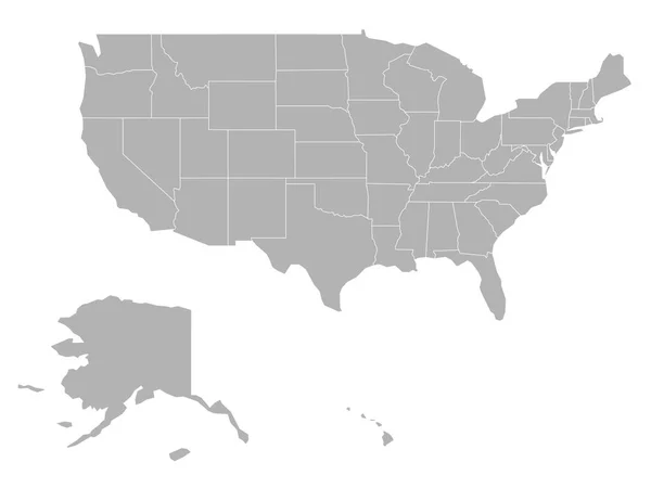
Blank Map Of United States Of America - USA. Simplified Dark Grey Silhouette Vector Map On White Background

Vector, 0.43MB, 6000 × 4500 eps
stock vector United States of America, multi colored political map. 50 states with own geographic territory, constituent entities, bound together in a union and a federal government. English. Illustration. Vector.

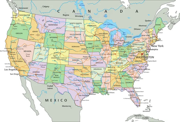
United States Of America, Multi Colored Political Map. 50 States With Own Geographic Territory, Constituent Entities, Bound Together In A Union And A Federal Government. English. Illustration. Vector.

Vector, 3.96MB, 6000 × 6000 eps
stock vector USA map - grey colored on dark background. High detailed political map United States of America and neighboring countries with country, capital, ocean and sea names labeling

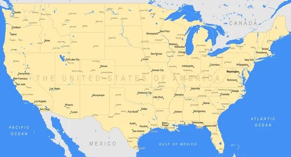
USA Map - Grey Colored On Dark Background. High Detailed Political Map United States Of America And Neighboring Countries With Country, Capital, Ocean And Sea Names Labeling

Vector, 1.29MB, 6000 × 4500 eps
stock vector Black and white map of the world. A set of globes with different continents

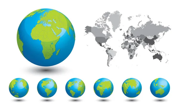
Black And White Map Of The World. A Set Of Globes With Different Continents

Vector, 7.74MB, 7087 × 4347 eps
stock vector United States of America maps and Missouri state territory. vector USA political map. US election assistance app for smart phone. technology banner

United States Of America Maps And Missouri State Territory. Vector USA Political Map. US Election Assistance App For Smart Phone. Technology Banner

Vector, 1.51MB, 6000 × 4000 eps
stock vector New York City gray political map. Most populous city in the United States located in the state of New York. Manhattan, Bronx, Queens, Brooklyn and Staten Island. English labeling. Illustration. Vector

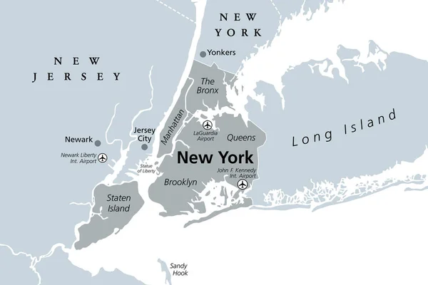
New York City Gray Political Map. Most Populous City In The United States Located In The State Of New York. Manhattan, Bronx, Queens, Brooklyn And Staten Island. English Labeling. Illustration. Vector

Vector, 1.31MB, 9000 × 6000 eps
stock vector Political map of USA

Political Map Of USA

Vector, 1.54MB, 3306 × 2556 eps
stock vector Map of The United States of America (USA) Divided States Maps Silhouette Illustration on White Background

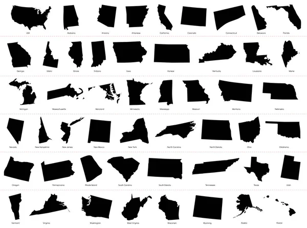
Map Of The United States Of America (USA) Divided States Maps Silhouette Illustration On White Background

Vector, 2.77MB, 10000 × 7436 eps
stock vector Georgia, GA, political map, with capital Atlanta and largest cities. State in the southeastern region of the United States of America. Peach State. Empire State of the South.  Illustration. Vector.

Georgia, GA, Political Map, With Capital Atlanta And Largest Cities. State In The Southeastern Region Of The United States Of America. Peach State. Empire State Of The South. Illustration. Vector.

Vector, 5.5MB, 6000 × 6000 eps
stock vector North America map - brown orange hue colored on dark background. High detailed political map North American continent with country, ocean and sea names labeling

North America Map - Brown Orange Hue Colored On Dark Background. High Detailed Political Map North American Continent With Country, Ocean And Sea Names Labeling

Vector, 1.7MB, 6000 × 4503 eps
Previous << Page 7 >> Next