
Stock image Schelde page 2
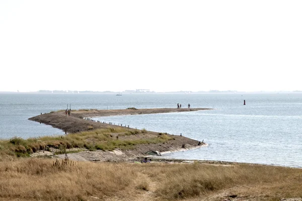
Netherlands,Holland,Dutch,Zeeland Schouwen-duiveland,Ouwerkerk, Nieuwendijk, July 2018:Peer, Jetty At The Coast Of The Eastern Scheldt
Image, 10.49MB, 6000 × 4000 jpg
Netherlands,Holland,Dutch,Zeeland Schouwen-duiveland,Ouwerkerk, July 2018:Low Tide At The Coast Of The Eastern Scheldt
Image, 11.47MB, 5772 × 3848 jpg
Storm Surge Barrier Bridge To Protect The Netherlands Mainland From Rising Seas
Image, 17.86MB, 5272 × 3948 jpg
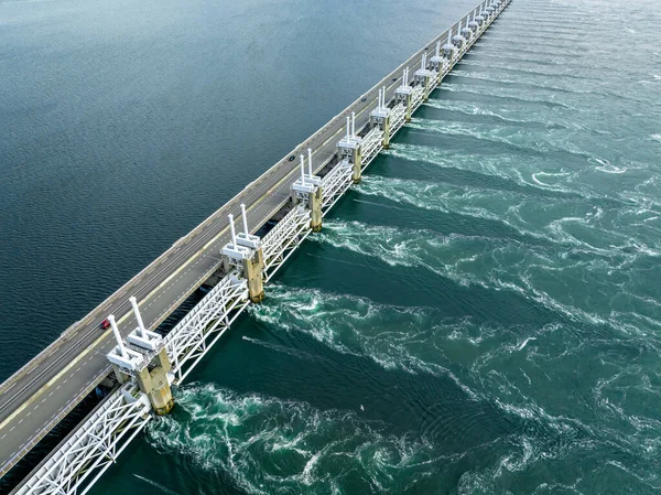
Storm Surge Barrier Bridge To Protect The Netherlands Mainland From Rising Seas
Image, 16.15MB, 5272 × 3948 jpg

The Delta Works Storm Surge Barrier And Wind Turbines At The Oosterschelde Viewed From Banjjardstrand In Zeeand Province In The Netherlands
Image, 13.58MB, 5856 × 3294 jpg

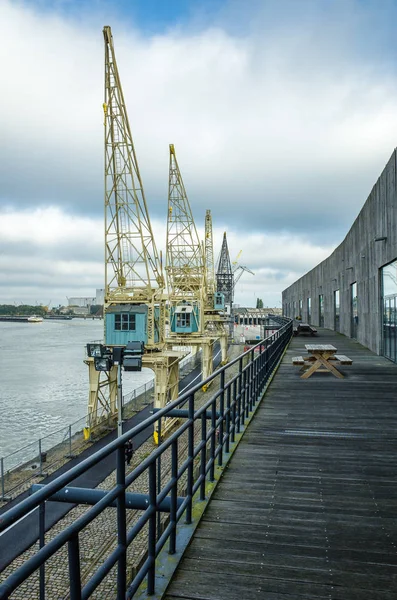
Editorial: LILLO, BELGIUM, July 15, 2024 - The Port Of Waasland With Its Container Terminals Seen From Lillo
Image, 23.23MB, 6960 × 4640 jpg

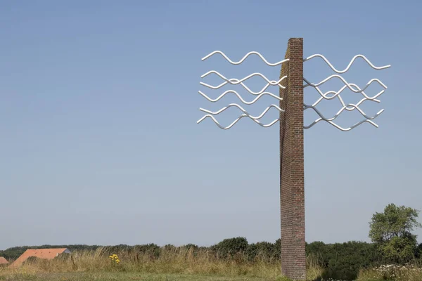
A Pole At The Seawall In Front Of The Brown Coloured Salt Marsh In The Westerschelde Sea At The Dutch Coast In Zeeland In Winter
Image, 11.43MB, 5042 × 3361 jpg


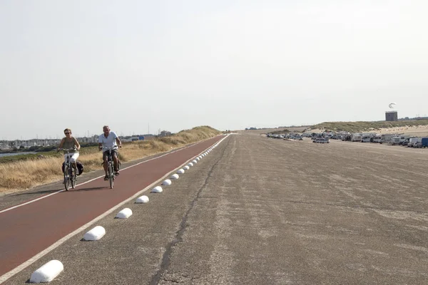
A Bicycle Handlebar At The Seawall Of The Westerschelde Sea With The Water And The Sky With Clouds In The Background In Summer At The Dutch Coast In Zeeland
Image, 6.97MB, 5184 × 3456 jpg

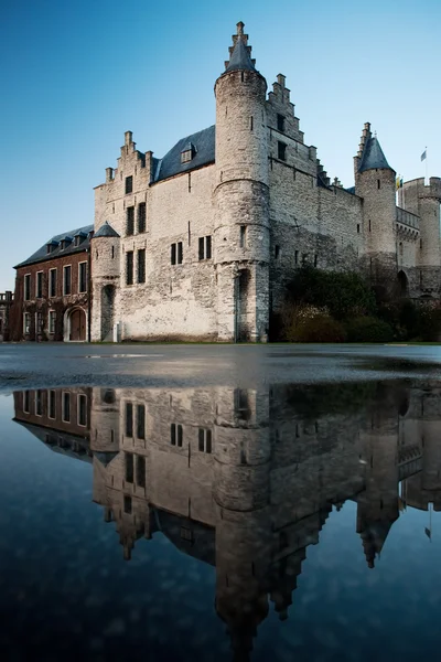
Editorial: LILLO, BELGIUM, July 15, 2024 - A Part Of The Fortress Of Lillo In The Middle Of The Port Of Antwerp
Image, 26.39MB, 6960 × 4640 jpg

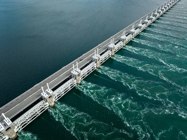
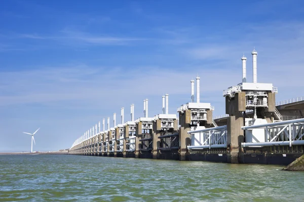
Eastern Scheldt Storm Surge Barrier At Neeltje Jans In The Netherlands
Image, 10.28MB, 5760 × 3840 jpg


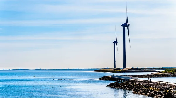
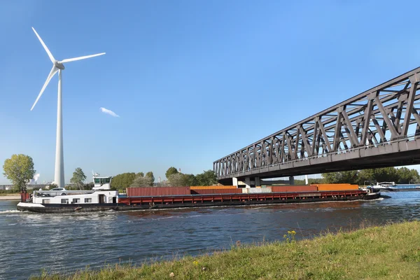
Wind Turbines At The Oosterschelde Inlet At The Neeltje Jans Island At The Delta Works Storm Surge Barrier In Zeeand Province In The Netherlands
Image, 7.69MB, 6000 × 3375 jpg


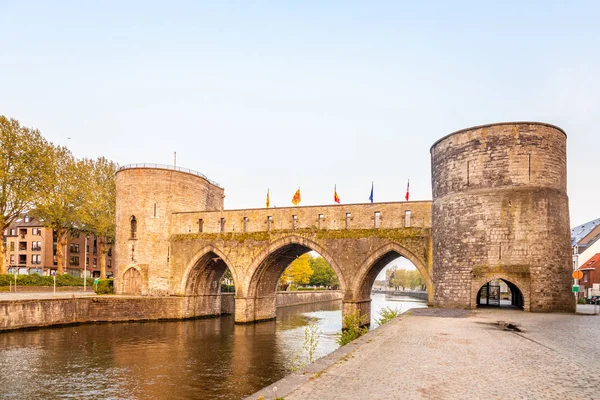
TOURNAI,BELGIUM - MAY 19,2018 - View At The Trous Bridge Over Scheldt River In Tournai. Tournai Is One Of The Oldest Cities In Belgium .
Image, 15.95MB, 5932 × 3960 jpg

Netherlands,Holland,Dutch,Zeeland Schouwen-duiveland,Ouwerkerk, Nieuwendijk, July 2018:nice View On The Eastern Scheldt And In The Distance The Zeeland Bridge
Image, 13.11MB, 5759 × 3840 jpg
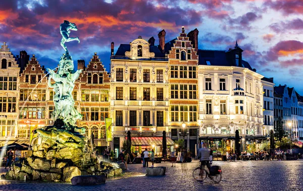
ANTWERP, BELGIUM - AUG 21, 2022: Architecture Of The Historic City Center Of Antwerp, In The Flemish Region Of Belgium, After Sunset
Image, 13.6MB, 8256 × 5216 jpg
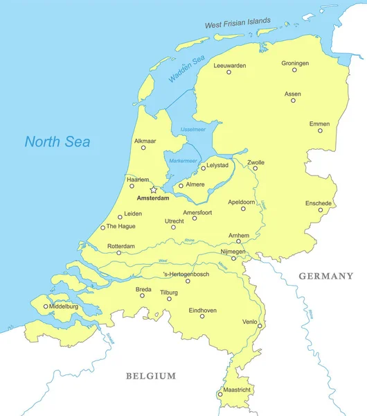
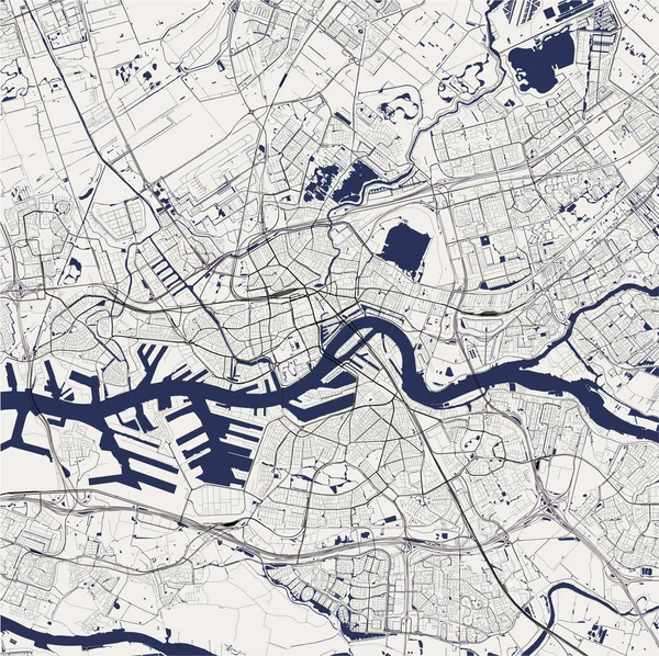
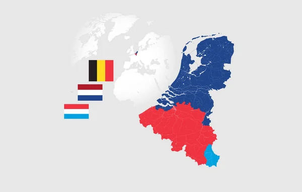
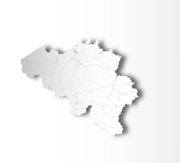
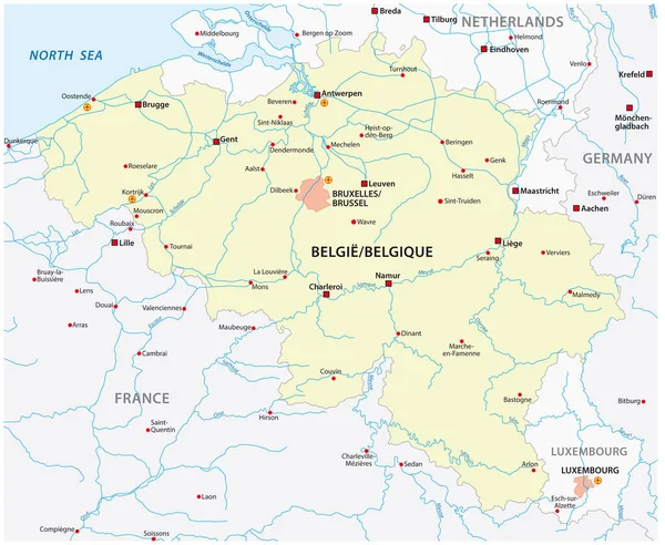
Political Map Of Netherlands With National Borders, Cities And Rivers
Vector, 1.55MB, 4000 × 4520 eps

Summer View Of Vlassenbroek (North) Nature Reserve In East Flanders, Belgium. Situated Close To Dendermonde And Baasrode It Is Part Of The New Scheldt Valley National Park.
Image, 14.58MB, 5000 × 3333 jpg
Netherlands,Holland,Dutch,Zeeland Schouwen-duiveland,Ouwerkerk, July 2018:Low Tide At The Coast Of The Eastern Scheldt
Image, 13.66MB, 6000 × 4000 jpg
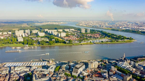
Antwerp, Belgium. Flying Over The Roofs Of The Historic City. Schelde (Esco) River. Industrial Area Of The City, Aerial View
Image, 3.02MB, 2732 × 1537 jpg


The Wide And Clean Sandy Beach At Banjaardstrand Along The Oosterschelde Inlet At The Schouwen-Duiveland Peninsula In The Province Of Zeeand In The Netherlands
Image, 12.94MB, 6000 × 3375 jpg

Antwerp, Belgium. Flying Over The Roofs Of The Historic City. Schelde (Esco) River, Aerial View
Image, 3.43MB, 2732 × 1537 jpg

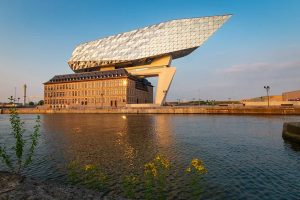
Cruise Ship Sailing At The Docks Of Antwerp Near The Authority Building Of Antwerp At The Zaha Hadid Plein With The City Of Antwerp Skyline In The Background
Image, 6.91MB, 3983 × 2987 jpg

ZEELANDBRUG, NETHERLANDS - JUN 16, 2023: Bridge Opening Of Eastern Scheldt Bridge For Sailboats With High Masts, Eastern Scheldt, Zeeland
Image, 7.35MB, 4438 × 3332 jpg
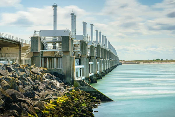
Eastern Scheldt Storm Surge Barrier (Oosterscheldekering) In The Dutch Province Of Zeeland.
Image, 12.17MB, 5454 × 3636 jpg

Editorial: LILLO, BELGIUM, July 15, 2024 - The Nuclear Power Plant Of Doel Seen From Lillo With Busy Container Traffic On The Scheldt
Image, 20.17MB, 6960 × 4640 jpg

View Into Drowned Land Of Saeftinghe From Oude Doel, On The Border Between Belgium And The Netherlands
Image, 19.09MB, 10544 × 2757 jpg


Previous << Page 2 >> Next