photo free
Home Images Vectors Videos

Stock image Spratly Islands

stock vector South China Sea Islands political map

South China Sea Islands Political Map

Vector, 3.66MB, 7209 × 8888 eps
stock image Golden gorgonian seafan on deep shear wall of Spratly Island atoll, South China Sea.

Golden Gorgonian Seafan On Deep Shear Wall Of Spratly Island Atoll, South China Sea.

Image, 8.61MB, 4249 × 3399 jpg
stock image Large colony of luminescent gorgonian seafans. Spratly Islands, South China Sea.

Large Colony Of Luminescent Gorgonian Seafans. Spratly Islands, South China Sea.

Image, 10.29MB, 4203 × 2802 jpg
stock image Fire coral (Milliepora) with community of anthias in deep waters. Spratly Islands, South China Sea.

Fire Coral (Milliepora) With Community Of Anthias In Deep Waters. Spratly Islands, South China Sea.

Image, 5.82MB, 3848 × 2749 jpg
stock image A large colony of flexible finger coral (Sinularia flexibilis) wavering in the surge. Spratly Islands, South China Sea.

A Large Colony Of Flexible Finger Coral (Sinularia Flexibilis) Wavering In The Surge. Spratly Islands, South China Sea.

Image, 15.95MB, 5218 × 3479 jpg
stock vector Map of the Malaysia, Philippines, Taiwan, Vietnam, People's Republic of China and Brunei controversial Spratly Islands in the South China Sea

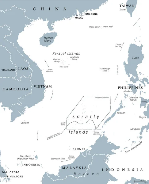
Map Of The Malaysia, Philippines, Taiwan, Vietnam, People's Republic Of China And Brunei Controversial Spratly Islands In The South China Sea

Vector, 1.85MB, 3164 × 3100 eps
stock vector Highly detailed physical map of Indonesia,in vector format,with all the relief forms,countries and big cities

Highly Detailed Physical Map Of Indonesia,in Vector Format,with All The Relief Forms,countries And Big Cities

Vector, 6.79MB, 5000 × 3185 eps
stock vector South China Sea Islands, political map. Islands, atolls, cays, shoals, reefs and sandbars. Partially claimed by China and other neighboring states. Paracel and Spratly Islands. Illustration. Vector.

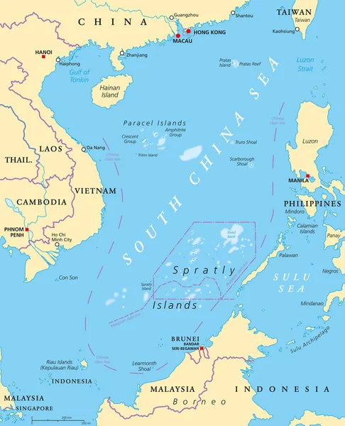
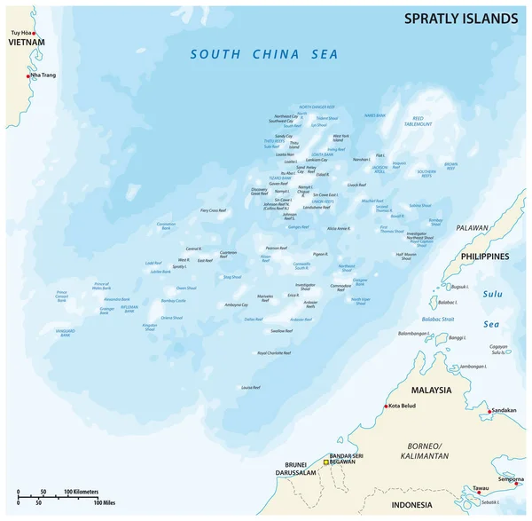
South China Sea Islands, Political Map. Islands, Atolls, Cays, Shoals, Reefs And Sandbars. Partially Claimed By China And Other Neighboring States. Paracel And Spratly Islands. Illustration. Vector.

Vector, 6.6MB, 7165 × 8833 eps
stock vector Peoples Republic of China, PRC, political map. Area controlled by China in yellow, and claimed but uncontrolled regions shown in orange. Capitals and borders. English labeling. Illustration. Vector.

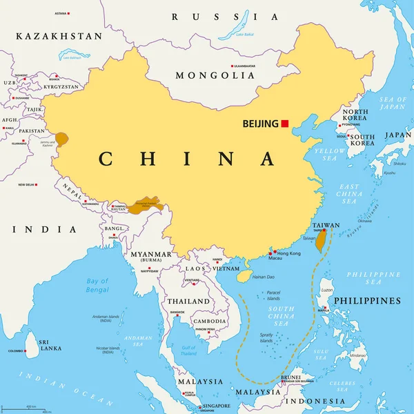
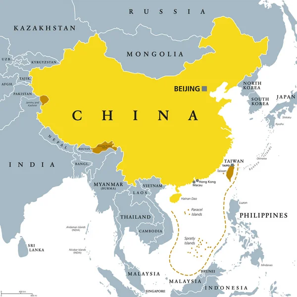
Peoples Republic Of China, PRC, Political Map. Area Controlled By China In Yellow, And Claimed But Uncontrolled Regions Shown In Orange. Capitals And Borders. English Labeling. Illustration. Vector.

Vector, 5.31MB, 8033 × 8033 eps
stock vector Peoples Republic of China, PRC, gray political map. Area controlled by China in yellow color, and claimed but uncontrolled regions shown in brown. English labeling. Illustration over white. Vector.

Peoples Republic Of China, PRC, Gray Political Map. Area Controlled By China In Yellow Color, And Claimed But Uncontrolled Regions Shown In Brown. English Labeling. Illustration Over White. Vector.

Vector, 4.41MB, 8033 × 8033 eps
stock vector Southeast Asia, political map with capitals and borders. Subregion of Asia with countries south of China, east of India, west of New Guinea, north of Australia. English labeling. Illustration. Vector.

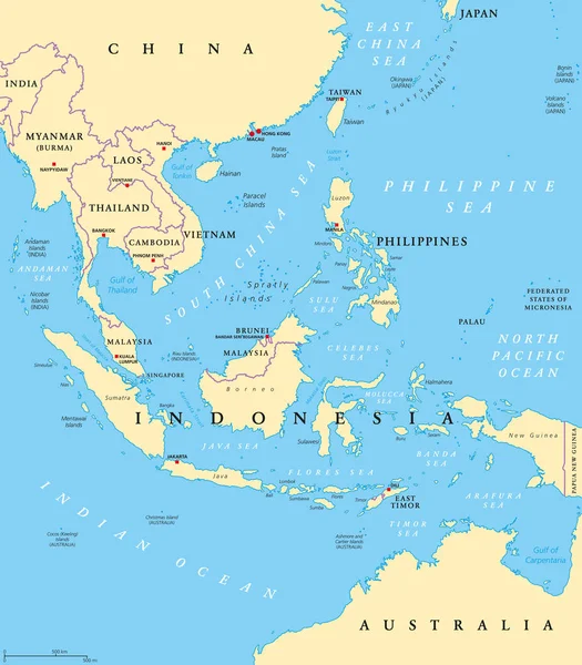
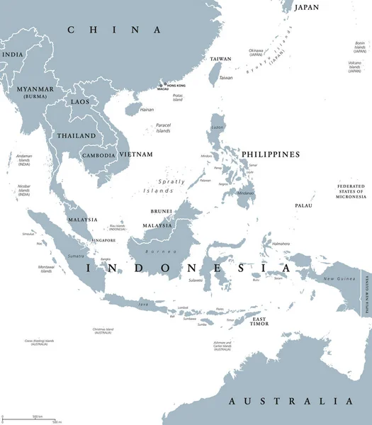
Southeast Asia, Political Map With Capitals And Borders. Subregion Of Asia With Countries South Of China, East Of India, West Of New Guinea, North Of Australia. English Labeling. Illustration. Vector.

Vector, 6.58MB, 7292 × 8333 eps
stock vector Southeast Asia political map

Southeast Asia Political Map

Vector, 4.43MB, 7486 × 8555 eps
stock vector Flag of China in the country outline. Area controlled by the Peoples Republic of China, PRC, and claimed but uncontrolled regions. Five-star Red Flag. Isolated illustration on white background. Vector

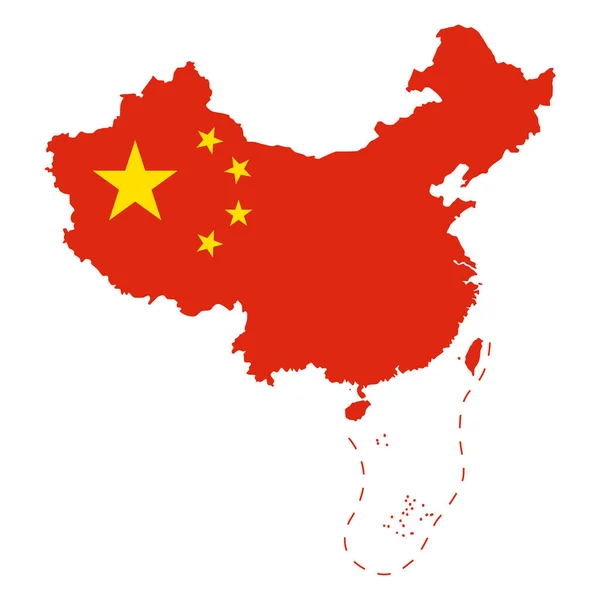
Flag Of China In The Country Outline. Area Controlled By The Peoples Republic Of China, PRC, And Claimed But Uncontrolled Regions. Five-star Red Flag. Isolated Illustration On White Background. Vector

Vector, 2.54MB, 8033 × 8033 eps
Page 1 >> Next