
Stock image Sri Lanka Region Map

Sri Lanka Region Map Retro Style Brown Outline On Old Paper Background Detailed Map Of Sri Lanka
Vector, 0.4MB, 8333 × 8333 eps

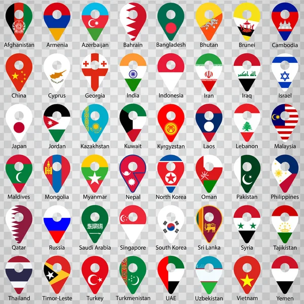
Flags Of All Asian Countries - Alphabetical Order With Name. Set Of Geolocation Signs Like Flags Of Asian Countries. Forty Eight Asian Countries. Geolocation Signs For Your Web Site Design, Logo, App, UI. EPS10.
Vector, 10.32MB, 5000 × 5000 eps
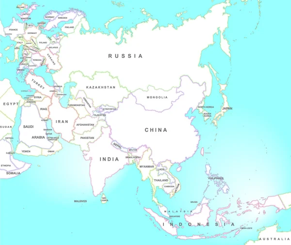

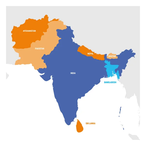
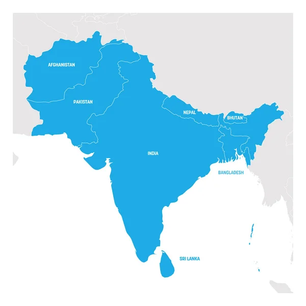
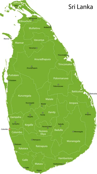
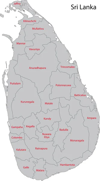
South Asia Region. Map Of Countries In Southern Asia. Vector Illustration
Vector, 1.28MB, 6000 × 6000 eps
South Asia Region. Map Of Countries In Southern Asia. Vector Illustration
Vector, 1.28MB, 6000 × 6000 eps

South Asia Region. Map Of Countries In Southern Asia. Vector Illustration
Vector, 1.48MB, 6000 × 6000 eps
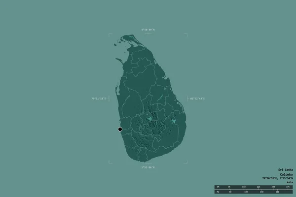
Area Of Sri Lanka Isolated On A Solid Background In A Georeferenced Bounding Box. Main Regional Division, Distance Scale, Labels. Colored Elevation Map. 3D Rendering
Image, 0.77MB, 3000 × 2000 jpg

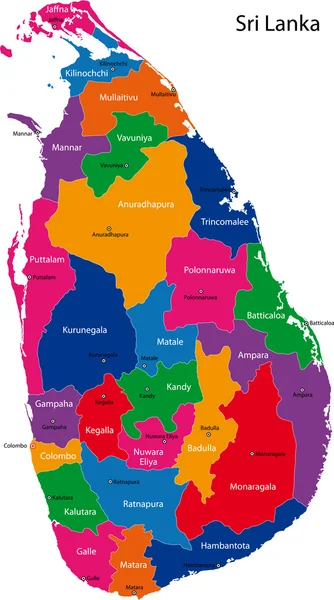
South Asia Region. Map Of Countries In Southern Asia. Vector Illustration
Vector, 1.28MB, 6000 × 6000 eps

Vector Map Of South East Asian Countries Mixed With Their National Flags
Vector, 7.73MB, 7292 × 5687 eps

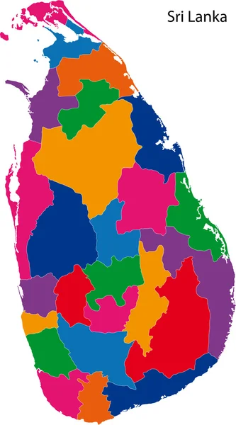
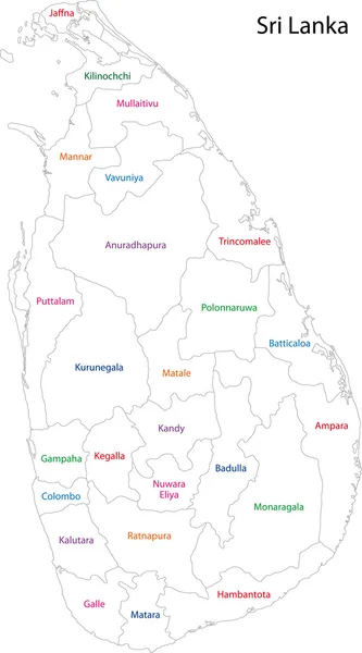
Sri Lanka Map, Black And White Detailed Outline Regions Of The Country. Vector Illustration
Vector, 1.03MB, 5238 × 7068 eps

Shape Of Nuwara Eliya, District Of Sri Lanka, With Its Capital Isolated On White Background. Topographic Relief Map. 3D Rendering
Image, 7.66MB, 3836 × 3763 jpg
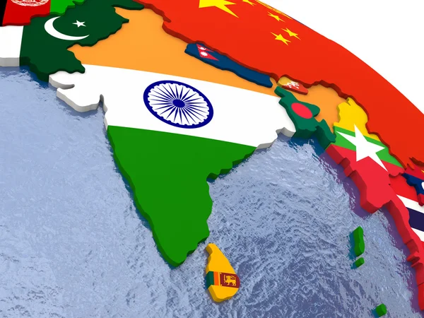
Vector High Detailed Maps And Flags Of East Asian Countries With Administrative Divisions (regions Borders)
Vector, 9.16MB, 6367 × 7293 eps


Shape Of Sri Lanka Separated By The Desaturation Of Neighboring Areas. Satellite Imagery. 3D Rendering
Image, 2.62MB, 3000 × 2000 jpg
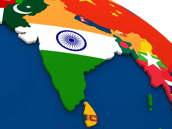


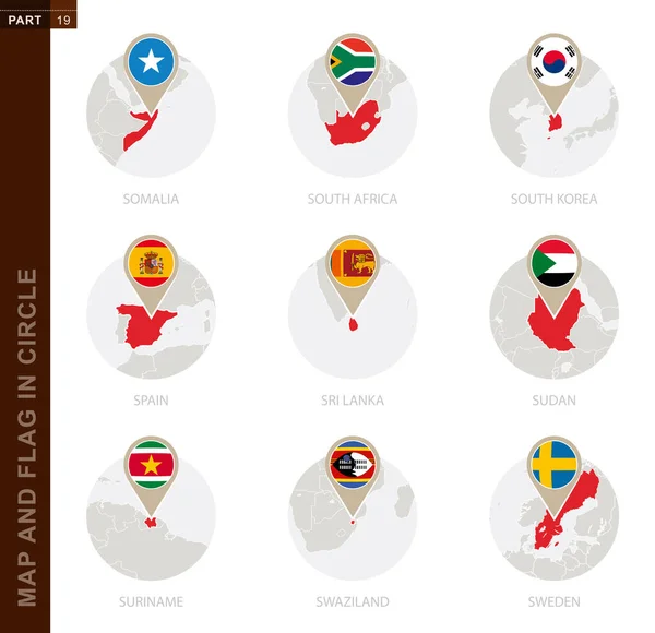
Map And Flag In A Circle Of 9 Countries: Somalia, South Africa, South Korea, Spain, Sri Lanka, Sudan, Suriname, Swaziland, Sweden
Vector, 1.23MB, 5170 × 5000 eps

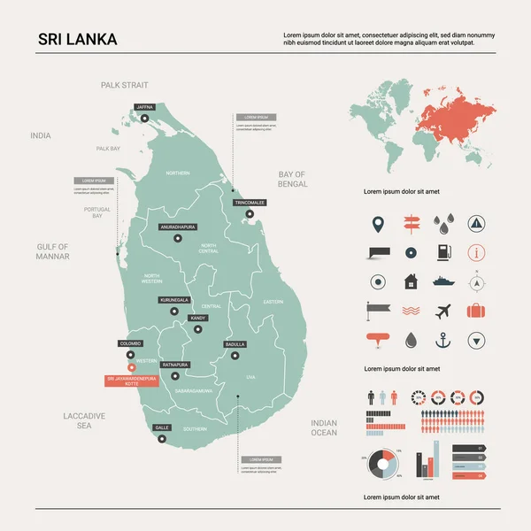
Map Design Concept Of White Color Isolated On Peacock Blue Background Of Country Sri Lanka - Vector Illustration
Vector, 0.77MB, 6000 × 4000 eps

Velanai Island In The Bay Of Bengal - Belonging To Sri Lanka. Described Location Diagram With Yellow Shape Of The Island And Sample Maps Of Its Surroundings
Image, 2.63MB, 3840 × 2160 jpg


Pungudutivu Island In The Bay Of Bengal, Belonging To Sri Lanka, Isolated On A Topographic, OSM Humanitarian Style Map, With Distance Scale
Image, 0.83MB, 2160 × 2160 jpg

Nedunthivu Island In The Bay Of Bengal, Belonging To Sri Lanka, Isolated On A Topographic, OSM Humanitarian Style Map, With Distance Scale
Image, 0.69MB, 2160 × 2160 jpg


Bay Of Bengal, Gray Political Map. Northeastern Part Of Indian Ocean And Largest Bay Of The World, Positioned Between The Indian Subcontinent And Indochinese Peninsula, Located Below Bengal Region.
Vector, 3.92MB, 6000 × 6000 eps

Pungudutivu Island In The Bay Of Bengal On A Topographic, OSM Humanitarian Style Map
Image, 1.06MB, 2880 × 1620 jpg

Nedunthivu Island In The Bay Of Bengal On A Topographic, OSM Humanitarian Style Map
Image, 0.46MB, 2880 × 1620 jpg

Nedunthivu Island In The Bay Of Bengal - Belonging To Sri Lanka. Described Location Diagram With Yellow Shape Of The Island And Sample Maps Of Its Surroundings
Image, 1.65MB, 3840 × 2160 jpg
Page 1 >> Next