
Stock image Surface Waters

A Man Sits Peacefully On A Massive Inflatable Object, Pondering The World Around Him As He Floats Gently On The Waters Surface.
Image, 17.13MB, 7739 × 5160 jpg

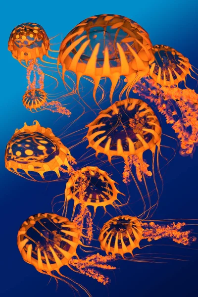
A Mermaid With Dark Hair Gazes Intensely From Beneath The Water's Surface In An Aquarium.
Image, 12.09MB, 4000 × 6000 jpg
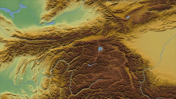
Tajikistan. Close-up Perspective Of The Country - No Outline. Color Physical Map
Image, 7.64MB, 2880 × 1620 jpg
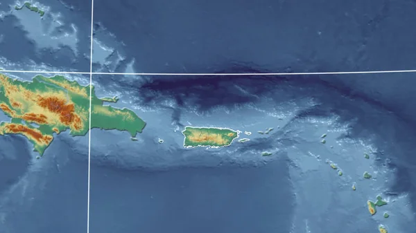
Puerto Rico. Neighborhood - Distant Perspective With Outline Of The Country. Topographic Relief Map
Image, 2.31MB, 2880 × 1620 jpg

Main Color Trend 2020 Classic Blue Pantone. Surface Waters Of The Sea With Blue Waves
Image, 3.4MB, 3600 × 2700 jpg
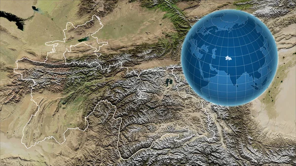
Tajikistan. Globe With The Shape Of The Country Against Zoomed Map With Its Outline. Satellite Imagery
Image, 6.43MB, 2880 × 1620 jpg
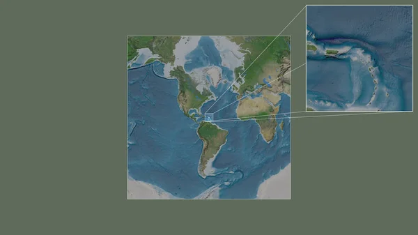
Expanded And Enlarged Area Of Caribbean Netherlands Sint Eustatius Extracted From The Large-scale Map Of The World With Leading Lines Connecting The Corners Of The Frames. Satellite Imagery
Image, 1.67MB, 2880 × 1620 jpg
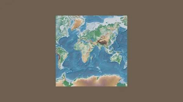
Square Frame Of The Large-scale Map Of The World In An Oblique Van Der Grinten Projection Centered On The Territory Of Somalia. Color Physical Map
Image, 1.42MB, 2880 × 1620 jpg
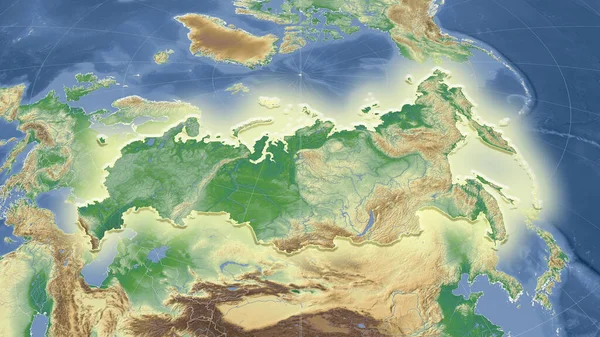
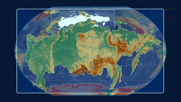
Russia And Its Neighborhood. Distant Oblique Perspective - Shape Glowed. Color Physical Map
Image, 4.99MB, 2880 × 1620 jpg

The Highlighted Area Of Tajikistan With Capital Point And Label On The Desaturated Map Of Its Neighbourhood. Color Physical Map
Image, 4.08MB, 2880 × 1620 jpg
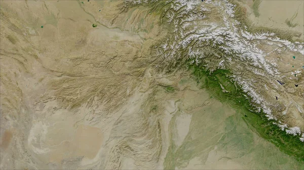
Afghanistan. Close-up Perspective Of The Country - No Outline. Satellite Imagery
Image, 5.39MB, 2880 × 1620 jpg
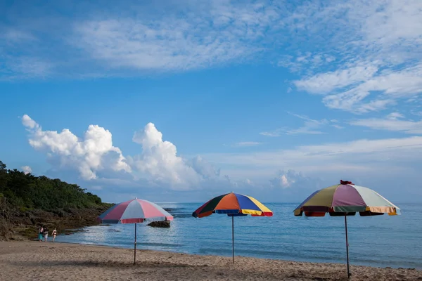
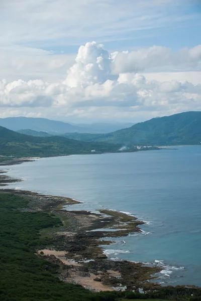
Hengchun Peninsula, The Southernmost Island Of Taiwan, Kenting National Park --- Little Bay Beach
Image, 3.65MB, 6048 × 4032 jpg

Expanded And Enlarged Area Of Caribbean Netherlands Bonaire Extracted From The Large-scale Map Of The World With Leading Lines Connecting The Corners Of The Frames. Satellite Imagery
Image, 1.83MB, 2880 × 1620 jpg

Close-up Of Guernsey And Its Location In The Region And In The Center Of A Large-scale World Map. Satellite Imagery
Image, 1.92MB, 2880 × 1620 jpg
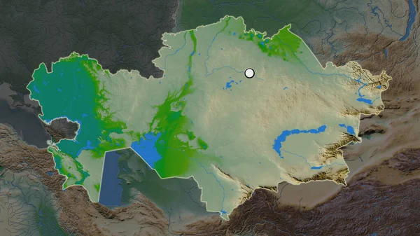
The Highlighted Area Of Kazakhstan With Capital Point On The Desaturated Map Of Its Neighbourhood. Color Physical Map
Image, 3.73MB, 2880 × 1620 jpg

North Korea And Its Neighborhood. Distant Oblique Perspective - No Outline. Color Physical Map
Image, 3.89MB, 2880 × 1620 jpg

Enlarged Area Of South Korea Surrounded By A Circle On The Background Of Its Neighborhood. Color Physical Map
Image, 2.85MB, 2880 × 1620 jpg
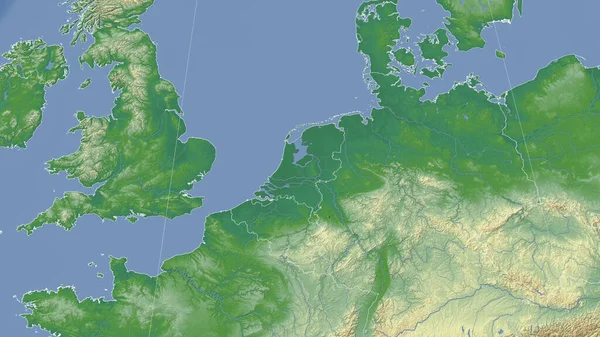
Netherlands And Its Neighborhood. Distant Oblique Perspective - No Outline. Color Physical Map
Image, 4.03MB, 2880 × 1620 jpg

Okinawa Tectonic Plate Outlined On The Globe. Satellite Imagery. 3D Rendering
Image, 3.53MB, 2880 × 1620 jpg

Close-up Of Norway And Its Location In The Region And In The Center Of A Large-scale World Map. Color Physical Map
Image, 1.83MB, 2880 × 1620 jpg
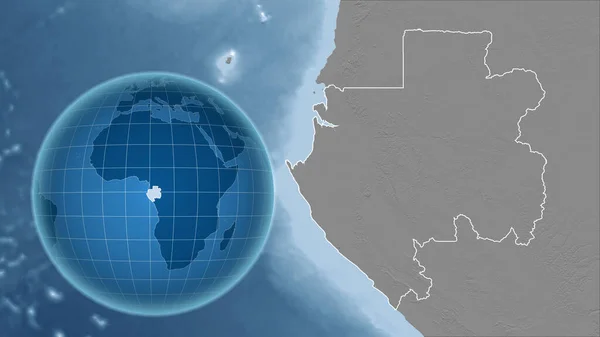
Gabon. Globe With The Shape Of The Country Against Zoomed Map With Its Outline. Grayscale Elevation Map
Image, 2.27MB, 2880 × 1620 jpg

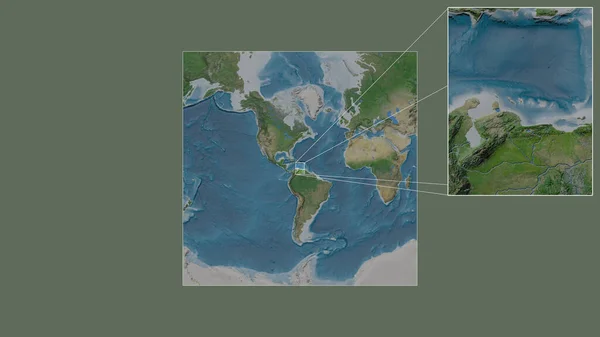
The Highlighted Area Of Colombia With Capital Point And Label On The Desaturated Map Of Its Neighbourhood. Satellite Imagery
Image, 3.36MB, 2880 × 1620 jpg


Zoomed-in View Of El Salvador Outline With Perspective Lines Against A Global Map In The Kavrayskiy Projection. Shape Centered. Topographic Relief Map
Image, 3.23MB, 2880 × 1620 jpg

Close-up Of Cayman Islands Grand Cayman And Its Location In The Region And In The Center Of A Large-scale World Map. Satellite Imagery
Image, 1.96MB, 2880 × 1620 jpg
Hengchun Peninsula, The Southernmost Island Of Taiwan, Kenting National Park --- Maobitou
Image, 3.35MB, 6048 × 4032 jpg
Zoomed-in View Of Russia Outline With Perspective Lines Against A Global Map In The Kavrayskiy Projection. Shape Centered. Topographic Relief Map
Image, 3.25MB, 2880 × 1620 jpg

Hengchun Peninsula, The Southernmost Island Of Taiwan, Kenting National Park --- Maobitou
Image, 3.43MB, 6048 × 4032 jpg

Area Of Caf Marked With A Circle On The Large-scale Map Of The Continent Isolated Against Desaturated Background. Capital Georeferences And Names Given. Color Physical Map
Image, 1.8MB, 2880 × 1620 jpg
Hengchun Peninsula, The Southernmost Island Of Taiwan, Kenting National Park --- Maobitou
Image, 4.27MB, 6048 × 4032 jpg

The Area Of Svalbard Centered In The Circle Surrounding Its Continent On The Desaturated Background. Capital Georeferences And Names Given. Satellite Imagery
Image, 1.95MB, 2880 × 1620 jpg

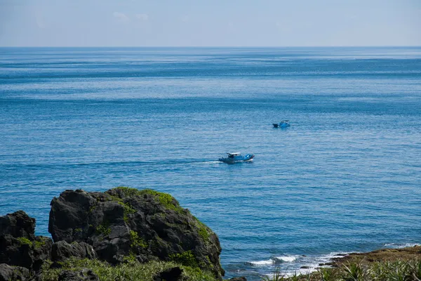
Taiwan Island, The Southernmost Hengchun Peninsula --- Pan Park Kenting National Park Long Bay
Image, 2.55MB, 6048 × 4032 jpg
Taiwan Island, The Southernmost Hengchun Peninsula --- Pan Park Kenting National Park Long Bay
Image, 2.47MB, 4032 × 6048 jpg
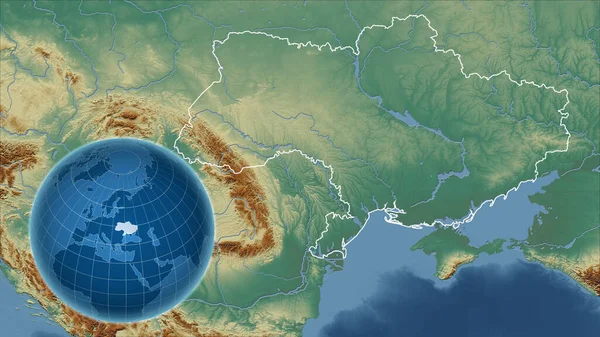
Ukraine. Globe With The Shape Of The Country Against Zoomed Map With Its Outline. Topographic Relief Map
Image, 4.5MB, 2880 × 1620 jpg

The Highlighted Area Of Costa Rica With Capital Point And Label On The Desaturated Map Of Its Neighbourhood. Color Physical Map
Image, 2.52MB, 2880 × 1620 jpg
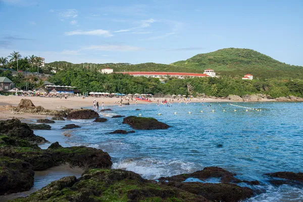
Hengchun Peninsula, The Southernmost Island Of Taiwan, Kenting National Park --- Little Bay Beach
Image, 5.47MB, 6048 × 4032 jpg

Hengchun Peninsula, The Southernmost Island Of Taiwan, Kenting National Park --- Maobitou
Image, 6.47MB, 11579 × 5278 jpg
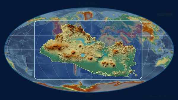
Zoomed-in View Of El Salvador Outline With Perspective Lines Against A Global Map In The Mollweide Projection. Shape Centered. Topographic Relief Map
Image, 3.32MB, 2880 × 1620 jpg

Hengchun Peninsula, The Southernmost Island Of Taiwan, Kenting National Park --- Little Bay Beach
Image, 3.69MB, 6048 × 4032 jpg

Area Of Somalia Marked With A Circle On The Large-scale Map Of The Continent Isolated Against Desaturated Background. Capital Georeferences And Names Given. Color Physical Map
Image, 1.92MB, 2880 × 1620 jpg

Zoomed-in View Of Taiwan Outline With Perspective Lines Against A Global Map In The Mollweide Projection. Shape Centered. Topographic Relief Map
Image, 3.26MB, 2880 × 1620 jpg

Close-up Of Colombia And Its Location In The Region And In The Center Of A Large-scale World Map. Color Physical Map
Image, 2.15MB, 2880 × 1620 jpg
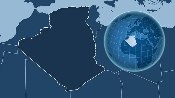
Algeria. Globe With The Shape Of The Country Against Zoomed Map With Its Outline. Shapes Only - Land/ocean Mask
Image, 1.13MB, 2880 × 1620 jpg

Taiwan Island, The Southernmost Hengchun Peninsula --- Pan Park Kenting National Park Long Prairie
Image, 5.56MB, 6048 × 4032 jpg
The Highlighted Area Of Jan Mayen With Capital Point On The Desaturated Map Of Its Neighbourhood. Satellite Imagery
Image, 1.57MB, 2880 × 1620 jpg

Hengchun Peninsula, The Southernmost Island Of Taiwan, Kenting National Park --- Little Bay Beach
Image, 4.35MB, 6048 × 4032 jpg
Page 1 >> Next