photo free
Home Images Vectors Videos

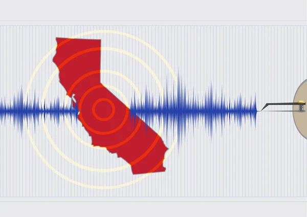
Stock image Tectonic Activity page 2

stock image Lava

Lava

Image, 6.65MB, 3888 × 2592 jpg
stock vector Earthquake magnitude levels vector illustration diagram, Richter scale seismic activity diagram.

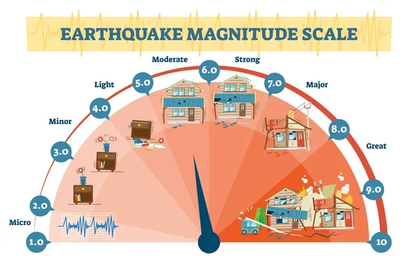
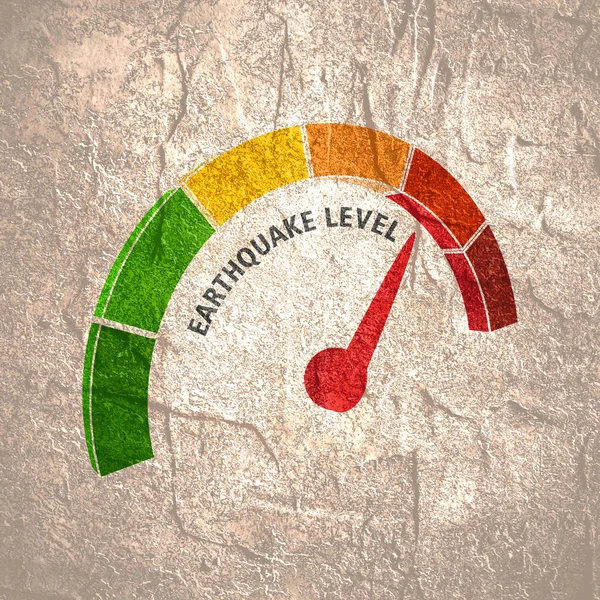
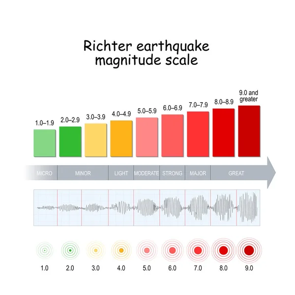
Earthquake Magnitude Levels Vector Illustration Diagram, Richter Scale Seismic Activity Diagram.

Vector, 5.98MB, 6053 × 3767 eps
stock vector Plate boundaries vector illustration. Labeled tectonic movement comparison.

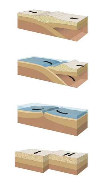
Plate Boundaries Vector Illustration. Labeled Tectonic Movement Comparison.

Vector, 5.64MB, 4000 × 4000 eps
stock image Geyser and hot thermal pools, Iceland

Geyser And Hot Thermal Pools, Iceland

Image, 4.66MB, 4500 × 3000 jpg
stock vector Continental drift chronological movement, historical timeline with earth continents: Pangaea, Laurasia, Gondwana.

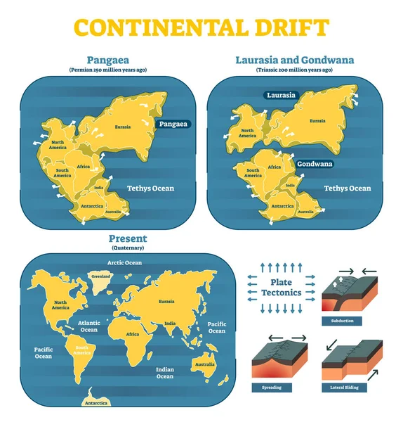
Continental Drift Chronological Movement, Historical Timeline With Earth Continents: Pangaea, Laurasia, Gondwana.

Vector, 7.05MB, 5174 × 5401 eps
stock image Earthquake Just Ahead sign

Earthquake Just Ahead Sign

Image, 4.54MB, 5382 × 3341 jpg
stock image Earthquake Yellow Road Sign 3D rendering

Earthquake Yellow Road Sign 3D Rendering

Image, 3.83MB, 6000 × 4000 jpg
stock vector Fault type vector illustration set (3 dimensions) / Normal, Reverse, Strike-slip etc.

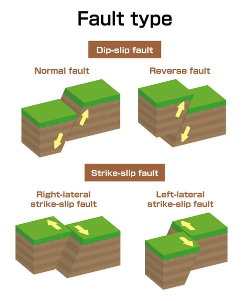
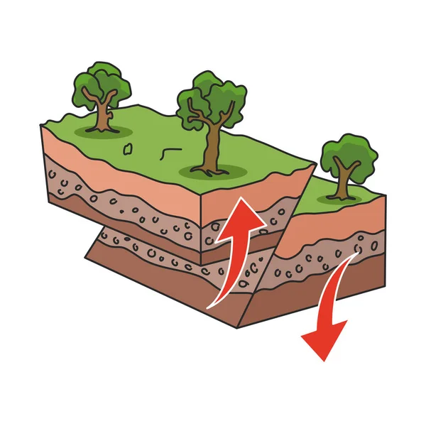
Fault Type Vector Illustration Set (3 Dimensions) / Normal, Reverse, Strike-slip Etc.

Vector, 0.72MB, 7297 × 8835 eps
stock image Seismograph closeup, 3D rendering isolated on white background

Seismograph Closeup, 3D Rendering Isolated On White Background

Image, 11.83MB, 8000 × 5300 jpg
stock vector Isometric Natural Geological Disaster Earthquake

Isometric Natural Geological Disaster Earthquake

Vector, 0.51MB, 4867 × 4867 ai
stock image Earthquake wooden sign

Earthquake Wooden Sign

Image, 3.95MB, 4100 × 2662 jpg
stock image Earthquake magnitude level

Earthquake Magnitude Level

Image, 19.97MB, 4000 × 4000 jpg
stock image Earthquake wooden sign

Earthquake Wooden Sign

Image, 4.71MB, 4100 × 2662 jpg
stock image South American tectonic plate enlarged and extruded the global grayscale elevation map in the Azimuthal Equidistant projection with dashed plates borders. 3D rendering

South American Tectonic Plate Enlarged And Extruded The Global Grayscale Elevation Map In The Azimuthal Equidistant Projection With Dashed Plates Borders. 3D Rendering

Image, 2.87MB, 2880 × 1620 jpg
stock image Scuba diving at Silfra rift, where Eurasian and American tectonic plate are divided in Thingvellir National Park, Iceland. High quality photo

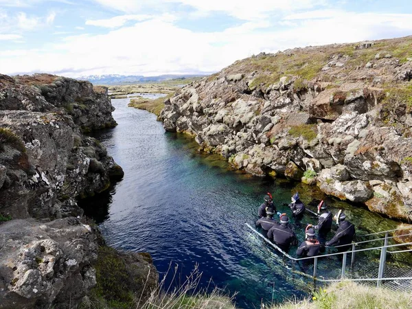
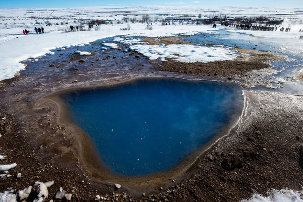
Scuba Diving At Silfra Rift, Where Eurasian And American Tectonic Plate Are Divided In Thingvellir National Park, Iceland. High Quality Photo

Image, 5.16MB, 4592 × 3448 jpg
stock image Cross-Sections of Plate Boundaries

Cross-Sections Of Plate Boundaries

Image, 5.38MB, 5312 × 9449 jpg
stock vector Richter earthquake magnitude scale.

Richter Earthquake Magnitude Scale.

Vector, 0.82MB, 4444 × 4444 eps
stock vector Earthquake cartoon vector illustration. Tectonic movements. Seismic activity. Shaking of earth. Cracked ground in rural area. Calamity. Flat color natural disaster isolated on white background

Earthquake Cartoon Vector Illustration. Tectonic Movements. Seismic Activity. Shaking Of Earth. Cracked Ground In Rural Area. Calamity. Flat Color Natural Disaster Isolated On White Background

Vector, 0.76MB, 5000 × 5000 eps
stock vector Philippine Islands Earthquake Concept

Philippine Islands Earthquake Concept

Vector, 2.54MB, 6366 × 4500 eps
stock vector Seismograph or Seismometer, Geodetic Device, Seismic and Earthquake Activity Flat Style Vector Illustration on White Background

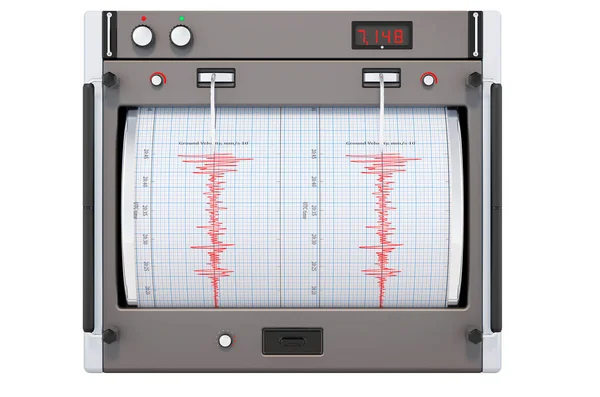
Seismograph Or Seismometer, Geodetic Device, Seismic And Earthquake Activity Flat Style Vector Illustration On White Background

Vector, 5.16MB, 6251 × 6251 eps
stock vector Seismology abstract concept vector illustration.

Seismology Abstract Concept Vector Illustration.

Vector, 5.66MB, 5209 × 5209 eps
stock vector Earthquake or seismic activity diagram. Flat style. Isolated.

Earthquake Or Seismic Activity Diagram. Flat Style. Isolated.

Vector, 0.18MB, 4500 × 4500 eps
stock vector Mountain landscape horizontal

Mountain Landscape Horizontal

Vector, 1.65MB, 9449 × 1211 eps
stock image Folded strata on the Jurassic Coastline, Lulworth cove, Dorset, UK

Folded Strata On The Jurassic Coastline, Lulworth Cove, Dorset, UK

Image, 14.27MB, 5184 × 3456 jpg
stock vector Seismology abstract concept vector illustration.

Seismology Abstract Concept Vector Illustration.

Vector, 5.33MB, 5209 × 5209 eps
stock vector Italy Map Earthquake. Editable Clip Art.

Italy Map Earthquake. Editable Clip Art.

Vector, 2.51MB, 7419 × 5233 eps
stock image Seismological device sheet - Seismometer vignette red

Seismological Device Sheet - Seismometer Vignette Red

Image, 8.62MB, 5760 × 3840 jpg
stock image Solomon Sea tectonic plate outlined on the global color physical map in the Kavrayskiy projection. 3D rendering

Solomon Sea Tectonic Plate Outlined On The Global Color Physical Map In The Kavrayskiy Projection. 3D Rendering

Image, 3.81MB, 2880 × 1620 jpg
stock vector New Zealand Earthquake Concept

New Zealand Earthquake Concept

Vector, 2.5MB, 6779 × 4792 eps
stock vector Deserted island with active volcano cartoon vector

Deserted Island With Active Volcano Cartoon Vector

Vector, 6.67MB, 6500 × 3000 eps
stock vector volcano mountain erupting icon

Volcano Mountain Erupting Icon

Vector, 0.41MB, 4167 × 4167 eps
stock image Okinawa tectonic plate outlined on the globe. satellite imagery. 3D rendering

Okinawa Tectonic Plate Outlined On The Globe. Satellite Imagery. 3D Rendering

Image, 3.53MB, 2880 × 1620 jpg
stock vector Vector flat icon

Vector Flat Icon

Vector, 0.41MB, 4167 × 4167 eps
stock image White mask of lands within areas adjacent to the Altiplano tectonic plate. Black background. Van der Grinten I projection (oblique transformation). Compositing tool

White Mask Of Lands Within Areas Adjacent To The Altiplano Tectonic Plate. Black Background. Van Der Grinten I Projection (oblique Transformation). Compositing Tool

Image, 0.09MB, 2880 × 1620 jpg
stock image Earthquake wooden sign

Earthquake Wooden Sign

Image, 4.66MB, 4100 × 2662 jpg
stock vector Islamic Republic of Iran Earthquake Vector concept. Editable Clip Art.

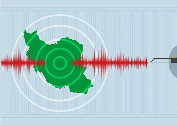
Islamic Republic Of Iran Earthquake Vector Concept. Editable Clip Art.

Vector, 2.61MB, 6852 × 4833 eps
stock vector Volcano mountain top exploding

Volcano Mountain Top Exploding

Vector, 0.06MB, 5972 × 5872 eps
stock vector Fault type vector illustration (3 dimensions) / Oblique-slip fault

Fault Type Vector Illustration (3 Dimensions) / Oblique-slip Fault

Vector, 0.96MB, 7198 × 6922 eps
stock vector Japan Earthquake Concept

Japan Earthquake Concept

Vector, 2.94MB, 6366 × 4500 eps
stock image Volcanos and all things related

Volcanos And All Things Related

Image, 5.38MB, 3872 × 2592 jpg
stock vector California Earthquake Concept. Editable Clip Art.

California Earthquake Concept. Editable Clip Art.

Vector, 2.59MB, 7179 × 5074 eps
stock image Geyser and hot thermal pools, Iceland

Geyser And Hot Thermal Pools, Iceland

Image, 9.83MB, 4500 × 3000 jpg
stock image Neighborhoods of the Aegean Sea tectonic plate on the relief map in the van der Grinten I projection (oblique transformation). Raw composite - no outlines

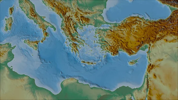
Neighborhoods Of The Aegean Sea Tectonic Plate On The Relief Map In The Van Der Grinten I Projection (oblique Transformation). Raw Composite - No Outlines

Image, 5.12MB, 2880 × 1620 jpg
stock image Earthquake in Italy, concept. Seismograph on the Italian map. 3D rendering isolated on white background

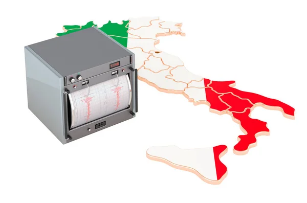
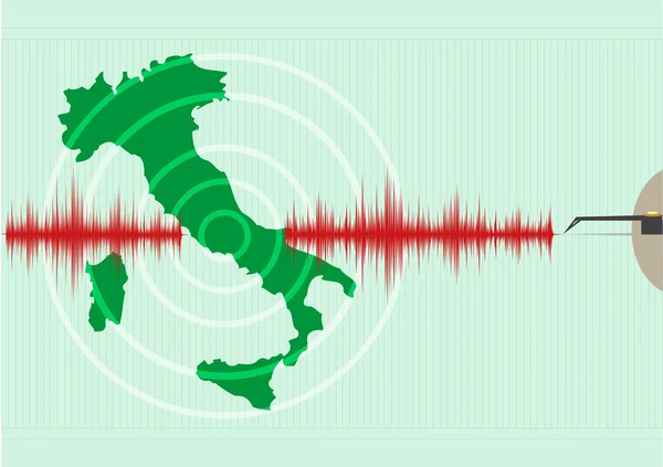
Earthquake In Italy, Concept. Seismograph On The Italian Map. 3D Rendering Isolated On White Background

Image, 5.62MB, 8000 × 5300 jpg
stock image Lava in front of a volcano

Lava In Front Of A Volcano

Image, 4.04MB, 3888 × 2592 jpg
stock image Saint Beatus, Canton Bern, Switzerland, February 12, 2023 Incredible beautiful rock formations inside the popular Saint Beatus caves near Interlaken at the lake of Thun

Saint Beatus, Canton Bern, Switzerland, February 12, 2023 Incredible Beautiful Rock Formations Inside The Popular Saint Beatus Caves Near Interlaken At The Lake Of Thun

Image, 5.73MB, 5568 × 3712 jpg
stock image Relief map of the area around the Molucca Sea tectonic plate. 3D rendering

Relief Map Of The Area Around The Molucca Sea Tectonic Plate. 3D Rendering

Image, 4.05MB, 2880 × 1620 jpg
stock image Outline of the North Andes tectonic plate with the borders of surrounding plates against the background of a physical map. 3D rendering

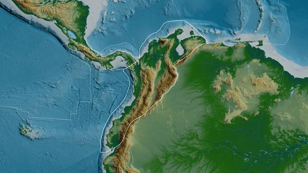
Outline Of The North Andes Tectonic Plate With The Borders Of Surrounding Plates Against The Background Of A Physical Map. 3D Rendering

Image, 4.76MB, 2880 × 1620 jpg
stock image Volcanos and all things related

Volcanos And All Things Related

Image, 6.52MB, 3872 × 2592 jpg
stock vector Deserted island with active volcano cartoon vector

Deserted Island With Active Volcano Cartoon Vector

Vector, 7.66MB, 6500 × 3000 eps
Previous << Page 2 >> Next