photo free
Home Images Vectors Videos

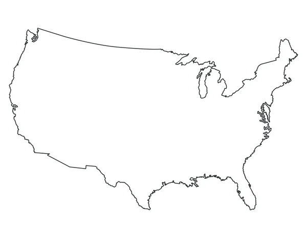
Stock image Usa Line Map

stock vector Stylized vector globe. Illustration

Stylized Vector Globe. Illustration

Vector, 33.8MB, 4000 × 4000 eps
stock vector United States Vector Map

United States Vector Map

Vector, 0.49MB, 3300 × 2700 eps
stock vector Vector website template,  vector illustration

Vector Website Template, Vector Illustration

Vector, 1.07MB, 4000 × 4000 eps
stock vector USA map

USA Map

Vector, 4.58MB, 7006 × 5385 eps
stock vector United States map

United States Map

Vector, 2.57MB, 8000 × 6222 eps
stock vector Map of World

Map Of World

Vector, 9.81MB, 5000 × 3000 eps
stock vector Blue abstract map of United States

Blue Abstract Map Of United States

Vector, 1.43MB, 4500 × 3600 eps
stock vector United States map

United States Map

Vector, 1.92MB, 8000 × 6222 eps
stock vector Accurate map of Texas

Accurate Map Of Texas

Vector, 0.77MB, 5000 × 4000 eps
stock vector North America

North America

Vector, 3.58MB, 6228 × 7699 eps
stock vector black thin line usa icon with shadow

Black Thin Line Usa Icon With Shadow

Vector, 0.23MB, 5000 × 5000 eps
stock vector massachusetts

Massachusetts

Vector, 2.81MB, 5000 × 4000 eps
stock vector Maps of the World by Country Pixel Perfect Icons (line style)

Maps Of The World By Country Pixel Perfect Icons (line Style)

Vector, 3.14MB, 6150 × 4650 eps
stock vector Accurate map of Texas

Accurate Map Of Texas

Vector, 0.71MB, 5000 × 4000 eps
stock vector Accurate map of Texas

Accurate Map Of Texas

Vector, 0.71MB, 5000 × 4000 eps
stock vector Ohio map high quality vector. American state simple hand made line drawing map

Ohio Map High Quality Vector. American State Simple Hand Made Line Drawing Map

Vector, 0.04MB, 3500 × 3500 eps
stock image Colorado administrative map. counties map of Colorado, blank Map, empty map of Colorado

Colorado Administrative Map. Counties Map Of Colorado, Blank Map, Empty Map Of Colorado

Image, 4.46MB, 8000 × 6266 jpg
stock image outline Florida map with Counties on white background. Administrative map of Florida state, United State of America, US, United State.

Outline Florida Map With Counties On White Background. Administrative Map Of Florida State, United State Of America, US, United State.

Image, 5.85MB, 8000 × 8000 jpg
stock image High detailed illustration map - outline Arizona State Map

High Detailed Illustration Map - Outline Arizona State Map

Image, 4.39MB, 8000 × 8000 jpg
stock image Colorado administrative map. black map of Colorado, blank Map, empty map of Colorado

Colorado Administrative Map. Black Map Of Colorado, Blank Map, Empty Map Of Colorado

Image, 3.36MB, 8000 × 6266 jpg
stock image Colorado administrative map. counties map of Colorado, blank Map, empty map of Colorado

Colorado Administrative Map. Counties Map Of Colorado, Blank Map, Empty Map Of Colorado

Image, 4.46MB, 8000 × 6266 jpg
stock image Colorado administrative map. black map of Colorado, blank Map, empty map of Colorado

Colorado Administrative Map. Black Map Of Colorado, Blank Map, Empty Map Of Colorado

Image, 3.31MB, 8000 × 6266 jpg
stock image outline Florida map with Counties on white background. Administrative map of Florida state, United State of America, US, United State.

Outline Florida Map With Counties On White Background. Administrative Map Of Florida State, United State Of America, US, United State.

Image, 7.94MB, 8000 × 8000 jpg
stock image Colorado administrative map. counties map of Colorado, blank Map, empty map of Colorado

Colorado Administrative Map. Counties Map Of Colorado, Blank Map, Empty Map Of Colorado

Image, 5.88MB, 8000 × 6266 jpg
stock image Colorado administrative map. counties map of Colorado, blank Map, empty map of Colorado

Colorado Administrative Map. Counties Map Of Colorado, Blank Map, Empty Map Of Colorado

Image, 5.79MB, 8000 × 6266 jpg
stock image outline Florida map with Counties on white background. Administrative map of Florida state, United State of America, US, United State.

Outline Florida Map With Counties On White Background. Administrative Map Of Florida State, United State Of America, US, United State.

Image, 7.92MB, 8000 × 8000 jpg
stock image outline Florida map on white background. Administrative map of Florida state, United State of America, US, United State.

Outline Florida Map On White Background. Administrative Map Of Florida State, United State Of America, US, United State.

Image, 5.23MB, 8000 × 8000 jpg
stock image outline Florida map on white background. Administrative map of Florida state, United State of America, US, United State.

Outline Florida Map On White Background. Administrative Map Of Florida State, United State Of America, US, United State.

Image, 5.08MB, 8000 × 8000 jpg
stock image outline Florida map with Counties on white background. Administrative map of Florida state, United State of America, US, United State.

Outline Florida Map With Counties On White Background. Administrative Map Of Florida State, United State Of America, US, United State.

Image, 5.42MB, 8000 × 8000 jpg
stock vector illustration of geography, International Date Line map, line of demarcation, defines the boundary between calendar dates, Crossing the date line eastbound decreases the date by one day

Illustration Of Geography, International Date Line Map, Line Of Demarcation, Defines The Boundary Between Calendar Dates, Crossing The Date Line Eastbound Decreases The Date By One Day

Vector, 5.76MB, 6504 × 4253 eps
stock vector Outline map of Minnesota white background. USA state,  vector map with contour.

Outline Map Of Minnesota White Background. USA State, Vector Map With Contour.

Vector, 5.41MB, 4000 × 4000 eps
stock vector Abstract background with map

Abstract Background With Map

Vector, 10.03MB, 5148 × 5148 eps
stock vector World map silhouette for Your design

World Map Silhouette For Your Design

Vector, 1.84MB, 4999 × 3535 eps
stock vector World line icons, signs, vector set, linear concept, outline illustration

World Line Icons, Signs, Vector Set, Linear Concept, Outline Illustration

Vector, 2.35MB, 6000 × 6000 eps
stock vector World map

World Map

Vector, 1.08MB, 5039 × 3150 eps
stock vector Big set of High Detailed Maps and Globes. Pins collection. Different effects. World Map and infograpchic elements. Political countries World Map. Vector illustration

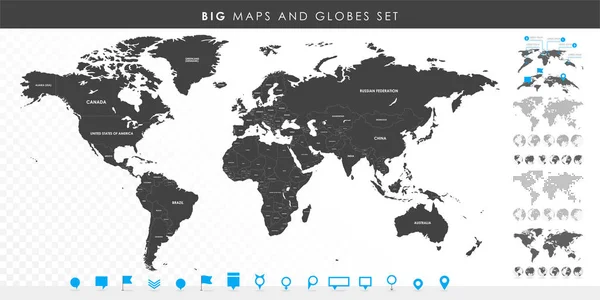
Big Set Of High Detailed Maps And Globes. Pins Collection. Different Effects. World Map And Infograpchic Elements. Political Countries World Map. Vector Illustration

Vector, 10.86MB, 12002 × 6001 eps
stock vector Illustrated map of the state of West Virginia in United States with cities and landmarks. Editable vector illustration

Illustrated Map Of The State Of West Virginia In United States With Cities And Landmarks. Editable Vector Illustration

Vector, 1.4MB, 3000 × 1997 eps
stock vector Map of Great Lakes

Map Of Great Lakes

Vector, 0.95MB, 5000 × 4000 eps
stock vector World map drawn. Vector illustration.

World Map Drawn. Vector Illustration.

Vector, 1.71MB, 6025 × 4173 eps
stock vector hatched map of the world

Hatched Map Of The World

Vector, 0.63MB, 8000 × 5000 eps
stock vector Map of USA and Nuclear Power Technology Icon Set.

Map Of USA And Nuclear Power Technology Icon Set.

Vector, 8.81MB, 8192 × 6483 eps
stock vector World Map. Circuit board. Technology background

World Map. Circuit Board. Technology Background

Vector, 4.09MB, 5421 × 3460 eps
stock vector bent, deformed world map on background of lines

Bent, Deformed World Map On Background Of Lines

Vector, 0.94MB, 5000 × 5000 eps
stock vector abstract outline world map

Abstract Outline World Map

Vector, 0.34MB, 5710 × 3791 eps
stock vector Abstract telecommunication network map - USA

Abstract Telecommunication Network Map - USA

Vector, 3.32MB, 2500 × 1842 eps
stock vector USA Territories map - High detailed blue map with counties/regions/states of USA Territories. USA Territories map isolated on transparent background.

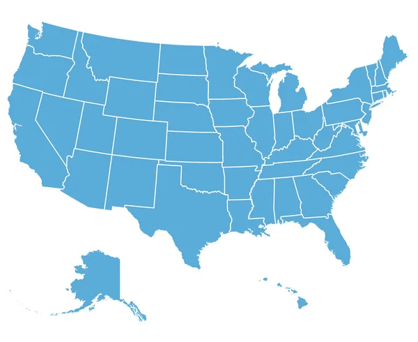
USA Territories Map - High Detailed Blue Map With Counties/regions/states Of USA Territories. USA Territories Map Isolated On Transparent Background.

Vector, 1.98MB, 7000 × 4988 eps
stock vector Map of the USA created from lines, bright points and polygons. Map of United States of America Vector illustartion

Map Of The USA Created From Lines, Bright Points And Polygons. Map Of United States Of America Vector Illustartion

Vector, 24.4MB, 6124 × 4082 eps
stock vector United States of America USA map outline with stars and lines abstract framework.

United States Of America USA Map Outline With Stars And Lines Abstract Framework.

Vector, 3.14MB, 5892 × 4167 eps
stock vector map of usa

Map Of Usa

Vector, 2.74MB, 4167 × 4167 eps
stock vector Abstract polygonal world map with glowing dots and lines

Abstract Polygonal World Map With Glowing Dots And Lines

Vector, 0.7MB, 5513 × 3519 eps
Page 1 >> Next