photo free
Home Images Vectors Videos

Stock image West Virginia Region page 2

stock image Huntington of West Virginia of United States flag waving

Huntington Of West Virginia Of United States Flag Waving

Image, 0.59MB, 3660 × 2440 jpg
stock vector West Virginia, state of USA - solid black outline map of country area. Simple flat vector illustration

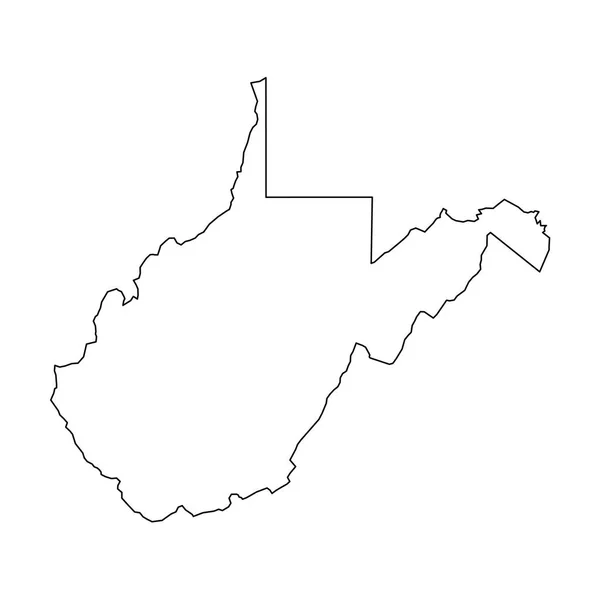
West Virginia, State Of USA - Solid Black Outline Map Of Country Area. Simple Flat Vector Illustration

Vector, 0.22MB, 5000 × 5000 eps
stock image Geographic border map and flag of West Virginia state isolated on a white background, 3D rendering

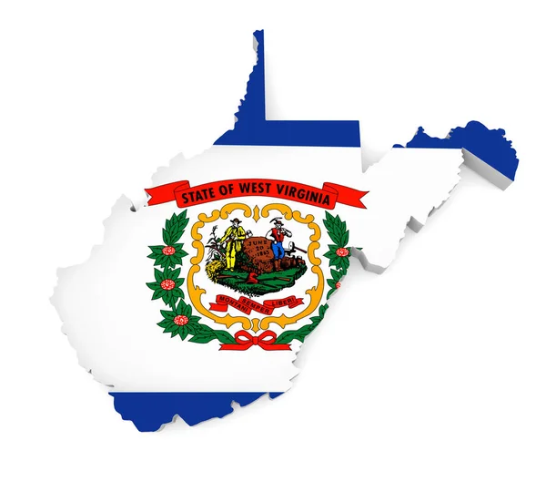
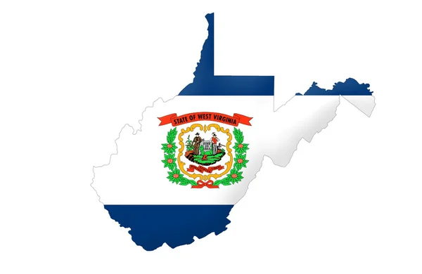
Geographic Border Map And Flag Of West Virginia State Isolated On A White Background, 3D Rendering

Image, 1.17MB, 4000 × 3600 jpg
stock image Flags of U.S. states Fabric Flag West Virginia, Flag Of West Virginia. Flag of American state. Symbol of West Virginia. American state. Fabric Texture

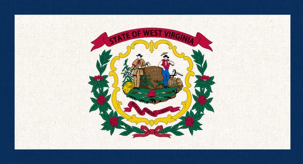
Flags Of U.S. States Fabric Flag West Virginia, Flag Of West Virginia. Flag Of American State. Symbol Of West Virginia. American State. Fabric Texture

Image, 3.61MB, 2835 × 1535 jpg
stock image State of West Virginia

State Of West Virginia

Image, 1.39MB, 4300 × 2800 jpg
stock vector West Virginia State Map Polygonal Mesh and Distress Bicolor Stamp

West Virginia State Map Polygonal Mesh And Distress Bicolor Stamp

Vector, 2MB, 6449 × 3000 eps
stock image Silhouette of West Virginia with USA flag on white background

Silhouette Of West Virginia With USA Flag On White Background

Image, 1.94MB, 5000 × 4000 jpg
stock vector Set of West Virginia state with flag america and map pointer

Set Of West Virginia State With Flag America And Map Pointer

Vector, 1.32MB, 5000 × 5000 eps
stock image Flag of West Virginia, USA

Flag Of West Virginia, USA

Image, 1.1MB, 3072 × 1920 jpg
stock vector Flag of Huntington, West Virginia, USA. Vector Format

Flag Of Huntington, West Virginia, USA. Vector Format

Vector, 5.78MB, 8250 × 5500 eps
stock image West Virginia

West Virginia

Image, 1.51MB, 4300 × 2800 jpg
stock vector Symbol Map of the State West Virginia (United States of America) showing the state with concentric circles in rainbow colors like a shooting target

Symbol Map Of The State West Virginia (United States Of America) Showing The State With Concentric Circles In Rainbow Colors Like A Shooting Target

Vector, 0.63MB, 6000 × 5467 eps
stock image Symbol Map of the State West Virginia (United States of America) showing the territory of the state as a lawn football field

Symbol Map Of The State West Virginia (United States Of America) Showing The Territory Of The State As A Lawn Football Field

Image, 12.99MB, 6000 × 5467 jpg
stock image Symbol Map of the State West Virginia (United States of America) showing the outline of the state as an asphalt surface

Symbol Map Of The State West Virginia (United States Of America) Showing The Outline Of The State As An Asphalt Surface

Image, 14.34MB, 6000 × 5467 jpg
stock image Flag of West Virginia State, painted on old wood plank backgroun

Flag Of West Virginia State, Painted On Old Wood Plank Backgroun

Image, 15.57MB, 5184 × 3456 jpg
stock image Waving Flag of West Virginia State

Waving Flag Of West Virginia State

Image, 9.76MB, 5184 × 3456 jpg
stock vector Symbol Map of the State West Virginia (United States of America) showing the contour of the state buffered inside in rainbow colors

Symbol Map Of The State West Virginia (United States Of America) Showing The Contour Of The State Buffered Inside In Rainbow Colors

Vector, 0.69MB, 6000 × 5467 eps
stock vector Symbol Map of the State West Virginia (United States of America). Abstract map showing the state with horizontal parallel lines in rainbow colors

Symbol Map Of The State West Virginia (United States Of America). Abstract Map Showing The State With Horizontal Parallel Lines In Rainbow Colors

Vector, 0.58MB, 6000 × 5467 eps
stock image Waving Flag of West Virginia State

Waving Flag Of West Virginia State

Image, 10.28MB, 5184 × 3456 jpg
stock vector Symbol Map of the State West Virginia (United States of America) showing the state with a pattern of black circles

Symbol Map Of The State West Virginia (United States Of America) Showing The State With A Pattern Of Black Circles

Vector, 1.07MB, 6000 × 5467 eps
stock vector Symbol Map of the State West Virginia (United States of America). Abstract map showing the state with a pattern of overlapping colorful squares like candies

Symbol Map Of The State West Virginia (United States Of America). Abstract Map Showing The State With A Pattern Of Overlapping Colorful Squares Like Candies

Vector, 0.67MB, 6000 × 5467 eps
stock image Flag of Huntington, West Virginia, USA

Flag Of Huntington, West Virginia, USA

Image, 15.05MB, 4950 × 3300 jpg
stock image Map of the State West Virginia (United States of America) showing the isolated territory with relief representation, water bodies like seas, rivers, lakes and with borders. No labels at all.

Map Of The State West Virginia (United States Of America) Showing The Isolated Territory With Relief Representation, Water Bodies Like Seas, Rivers, Lakes And With Borders. No Labels At All.

Image, 2.32MB, 6000 × 5357 jpg
stock image west virginia on map of usa

West Virginia On Map Of Usa

Image, 20.58MB, 4576 × 4531 jpg
stock vector Kentucky, KY, political map with capital Frankfort and largest cities. Commonwealth of Kentucky. State in the Southeastern region of the United States of America. Bluegrass State. Illustration. Vector

Kentucky, KY, Political Map With Capital Frankfort And Largest Cities. Commonwealth Of Kentucky. State In The Southeastern Region Of The United States Of America. Bluegrass State. Illustration. Vector

Vector, 3.22MB, 9000 × 4633 eps
stock vector Symbol Map of the State West Virginia (United States of America). Abstract map showing the state with a pattern of black and white squares like a chessboard

Symbol Map Of The State West Virginia (United States Of America). Abstract Map Showing The State With A Pattern Of Black And White Squares Like A Chessboard

Vector, 0.59MB, 6000 × 5467 eps
stock vector Detailed vintage map of United States of America with names of 5

Detailed Vintage Map Of United States Of America With Names Of 5

Vector, 25.88MB, 7296 × 4104 eps
stock vector Vector Contour Dotted Map of West Virginia State with Name

Vector Contour Dotted Map Of West Virginia State With Name

Vector, 0.38MB, 5450 × 3600 eps
stock image Charlottesville, Virginia, USA - October 20, 2016. Monticello, Thomas Jefferson's home in Virginia, from the West Lawn, built 1772

Charlottesville, Virginia, USA - October 20, 2016. Monticello, Thomas Jefferson's Home In Virginia, From The West Lawn, Built 1772

Image, 10.48MB, 5464 × 3360 jpg
stock vector Map of US regions. Maps USA

Map Of US Regions. Maps USA

Vector, 3.51MB, 7087 × 5011 eps
stock vector Kentucky state detailed editable map

Kentucky State Detailed Editable Map

Vector, 0.91MB, 8000 × 3898 eps
stock image USA map. States and territories of United States of America

USA Map. States And Territories Of United States Of America

Image, 1.4MB, 5000 × 5000 jpg
stock vector west virginia

West Virginia

Vector, 2.35MB, 4000 × 4000 eps
stock image West Virginia (USA) flag waving on the wind

West Virginia (USA) Flag Waving On The Wind

Image, 7.98MB, 6000 × 4094 jpg
stock vector West Virginia network map.

West Virginia Network Map.

Vector, 8.09MB, 8333 × 8333 eps
stock vector Ohio state detailed editable map

Ohio State Detailed Editable Map

Vector, 0.97MB, 5000 × 5552 eps
stock vector Usa map. Outline silhouette of united states of america. Simple line borders of us. Flat american map with california, hawaii, texas, washington, florida, michigan, virginia and other state. Vector.

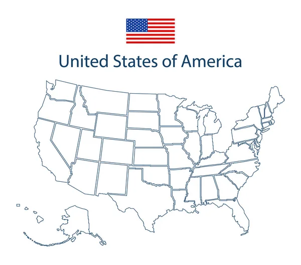
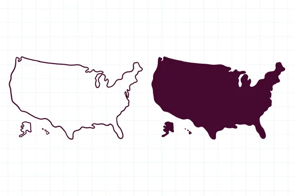
Usa Map. Outline Silhouette Of United States Of America. Simple Line Borders Of Us. Flat American Map With California, Hawaii, Texas, Washington, Florida, Michigan, Virginia And Other State. Vector.

Vector, 0.46MB, 4533 × 4000 eps
stock vector Highly detailed vector silhouettes of US state maps, Division United States into counties, political and geographic subdivisions of a states, South Atlantic - Virginia, West Virginia, Maryland - set 8 of 17

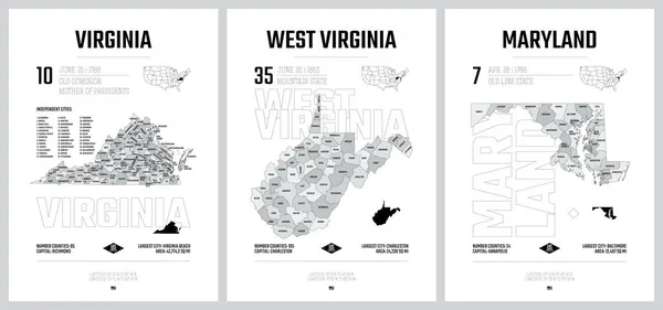
Highly Detailed Vector Silhouettes Of US State Maps, Division United States Into Counties, Political And Geographic Subdivisions Of A States, South Atlantic - Virginia, West Virginia, Maryland - Set 8 Of 17

Vector, 10.22MB, 9608 × 4501 eps
stock vector Vector illustration USA map. States and territories of United States of America. Washington city marked with U.S.A flag

Vector Illustration USA Map. States And Territories Of United States Of America. Washington City Marked With U.S.A Flag

Vector, 0.74MB, 5000 × 3571 eps
stock vector Vector abstract hatched map of State of West Virginia with lines isolated on a white background.

Vector Abstract Hatched Map Of State Of West Virginia With Lines Isolated On A White Background.

Vector, 0.26MB, 5000 × 5000 eps
stock vector hand drawn map of usa doodle illustration

Hand Drawn Map Of Usa Doodle Illustration

Vector, 5.52MB, 6000 × 4000 eps
stock vector Marion (South Australia) outline map set

Marion (South Australia) Outline Map Set

Vector, 0.33MB, 6000 × 3000 eps
stock vector Isolated waving flag of West Virginia is a state United States on white background.

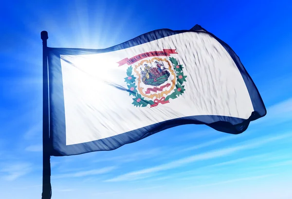
Isolated Waving Flag Of West Virginia Is A State United States On White Background.

Vector, 7.56MB, 6400 × 4000 eps
stock image West Virginia State of the United States with Counties Boundary Lines

West Virginia State Of The United States With Counties Boundary Lines

Image, 0.56MB, 3500 × 2000 jpg
stock vector West Virginia counties, political map with borders and county names. Landlocked state in the Southeastern and Mid-Atlantic regions of the United States, subdivided into 55 counties. Illustration

West Virginia Counties, Political Map With Borders And County Names. Landlocked State In The Southeastern And Mid-Atlantic Regions Of The United States, Subdivided Into 55 Counties. Illustration

Vector, 1.52MB, 6571 × 6000 eps
stock vector West Virginia counties, gray political map with borders and county names. Landlocked state in the Southeastern and Mid-Atlantic regions of the United States, subdivided into 55 counties. Illustration

West Virginia Counties, Gray Political Map With Borders And County Names. Landlocked State In The Southeastern And Mid-Atlantic Regions Of The United States, Subdivided Into 55 Counties. Illustration

Vector, 1.32MB, 6612 × 6000 eps
stock vector South Atlantic states, multi colored political map. United States Census division of the South region. Delaware, Florida, Georgia, Maryland, North and South Carolina, Virginia, DC, and West Virginia.

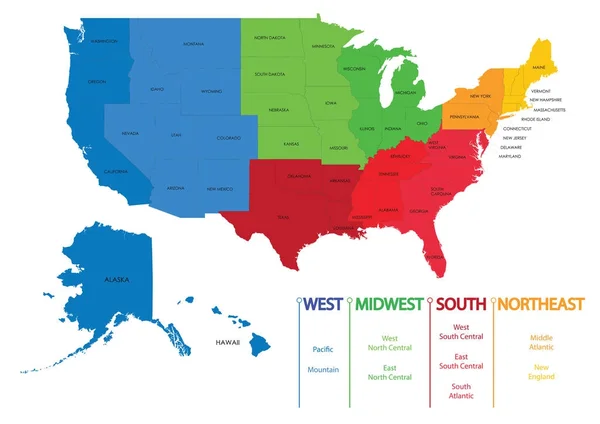
South Atlantic States, Multi Colored Political Map. United States Census Division Of The South Region. Delaware, Florida, Georgia, Maryland, North And South Carolina, Virginia, DC, And West Virginia.

Vector, 0.85MB, 6000 × 7818 eps
stock vector The Virginias, political map. The two Virginias, two states in the Southeastern and Mid-Atlantic regions of the United States. Virginia with capital Richmond and West Virginia with capital Charleston.

The Virginias, Political Map. The Two Virginias, Two States In The Southeastern And Mid-Atlantic Regions Of The United States. Virginia With Capital Richmond And West Virginia With Capital Charleston.

Vector, 4.22MB, 9000 × 5829 eps
stock vector The Virginias, gray political map of Virginia with its capital Richmond and of West Virginia with capital Charleston. Two states in the Southeastern and Mid-Atlantic regions of the United States.

The Virginias, Gray Political Map Of Virginia With Its Capital Richmond And Of West Virginia With Capital Charleston. Two States In The Southeastern And Mid-Atlantic Regions Of The United States.

Vector, 3.01MB, 9000 × 5829 eps
Previous << Page 2 >> Next