
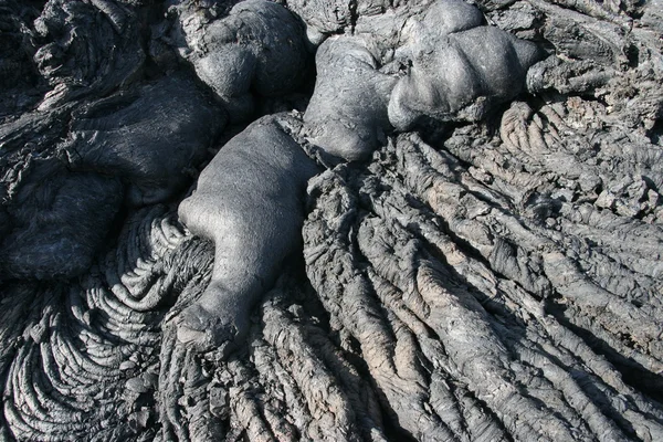
Stock image Subduction
Vestor Illustratiion Shows Collision Of Oceanic And Continental Plates
Vector, 6.32MB, 4588 × 4000 eps

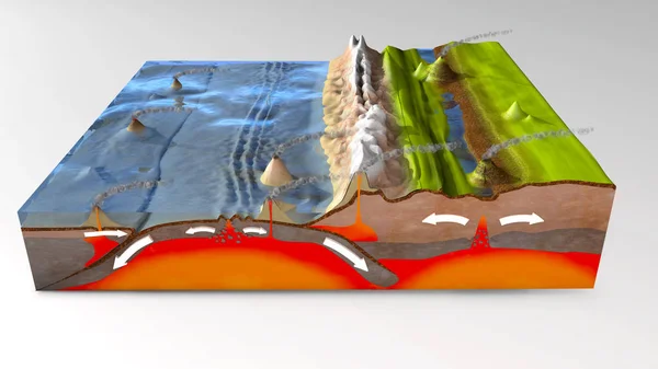
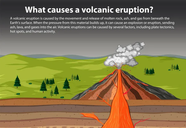
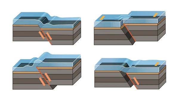
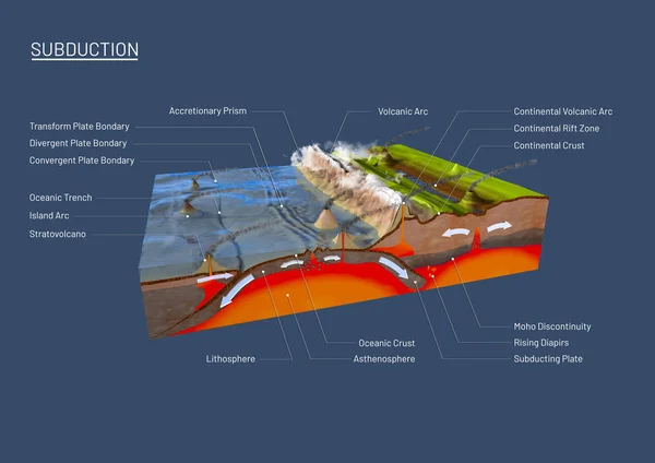
Scientific Ground Cross-section To Explain Subduction And Plate Tectonics
Image, 9.35MB, 9800 × 6932 jpg

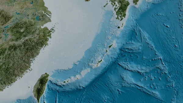
Solomon Sea Tectonic Plate Outlined On The Global Color Physical Map In The Kavrayskiy Projection. 3D Rendering
Image, 3.81MB, 2880 × 1620 jpg
3d Illustration Of A Scientific Ground Cross-section To Explain Subduction And Plate Tectonics
Image, 16.67MB, 10000 × 5625 jpg

Neighborhoods Of The Caribbean Tectonic Plate On The Grayscale Map In The Van Der Grinten I Projection (oblique Transformation). Raw Composite - No Outlines
Image, 2.65MB, 2880 × 1620 jpg


Horse Design Vector Illustration, Creative Horse Logo Template, Icon Symbol
Vector, 3.21MB, 5000 × 5000 eps
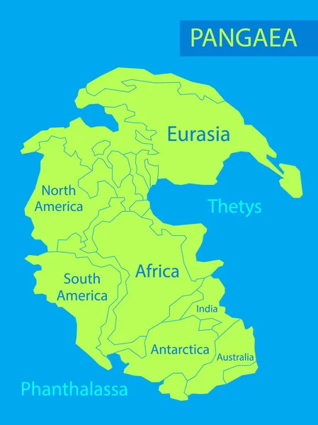
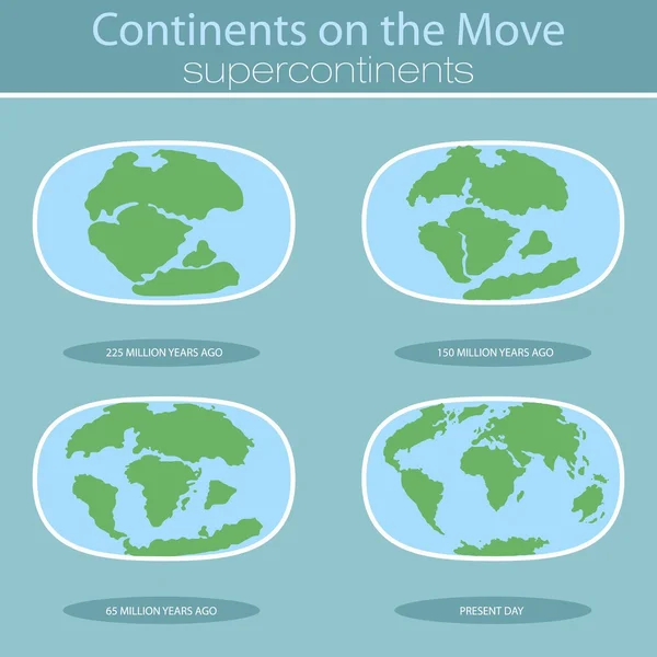
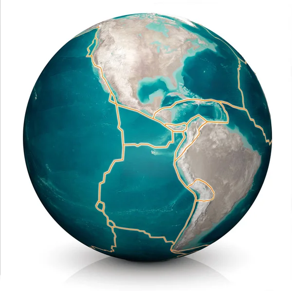
Pangaea Or Pangea. Vector Illustration Of Supercontinent That Existed During The Late Paleozoic And Early Mesozoic Eras. Map Of Green Ancient Continent And Ocean In Flat Style. Poster. Education
Vector, 4.63MB, 5000 × 6667 eps

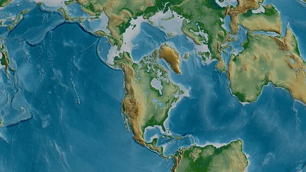
Tectonic Plates Move Constantly, Making New Areas Of Ocean Floor, Building Mountains, Causing Earthquakes, And Creating Volcanoes. 3d Rendering. Map. Element Of This Image Are Furnished By Nasa
Image, 9.22MB, 5014 × 5010 jpg

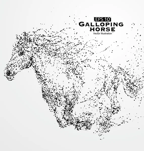
Particle Cheetah, Particle Divergent Composition Galloping Horse,Many Particles,sketch ,vector Illustration,The Moral Of Hard Work Ahead.
Vector, 4.68MB, 3000 × 3000 eps

Particle Cheetah,particle Divergent Composition Galloping Horse,Many Particles,sketch ,vector Illustration,The Moral Of Hard Work Ahead.
Vector, 5.33MB, 3000 × 3000 eps
Area Of The Nazca Tectonic Plate Marked With A Solid Line On A Pale Colored Elevation Map In The Patterson Cylindrical Projection
Image, 7.51MB, 3840 × 2160 jpg
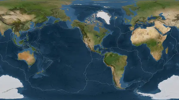
Satellite Imagery Map Of The World In The Patterson Cylindrical Projection Transformed To The Center Of The Rivera Tectonic Plate
Image, 6.56MB, 3840 × 2160 jpg


Relief Map Of The Area Around The Pacific Tectonic Plate. 3D Rendering
Image, 5.32MB, 2880 × 1620 jpg
Tectonic Plates On The Planet Earth. Modern Continents And Infographics Set Of Icons Flat Style
Vector, 2.58MB, 5000 × 5000 eps
Satellite Map Of The Area Around The Okinawa Tectonic Plate. 3D Rendering
Image, 4.05MB, 2880 × 1620 jpg


Tectonic Plates On The Planet Earth. Modern Continents And Infographics Set Of Icons Flat Style With Scheme
Vector, 3.34MB, 5000 × 5000 eps

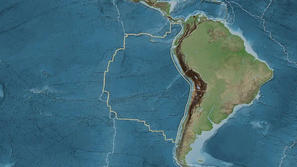
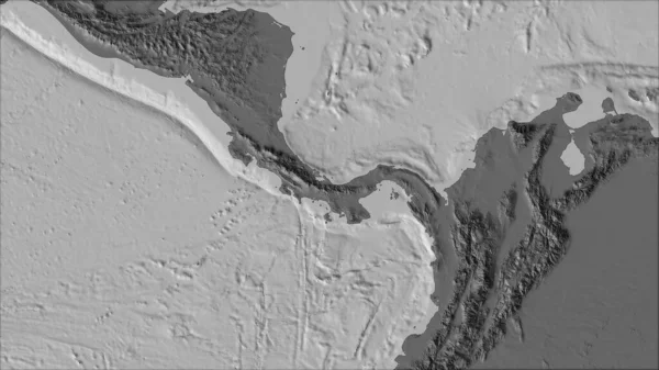
Physical Map Of The Area Around The North American Tectonic Plate. 3D Rendering
Image, 5.52MB, 2880 × 1620 jpg
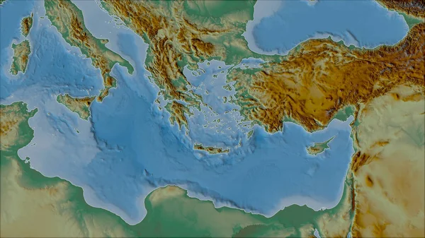
Neighborhoods Of The Aegean Sea Tectonic Plate On The Relief Map In The Van Der Grinten I Projection (oblique Transformation). Raw Composite - No Outlines
Image, 5.12MB, 2880 × 1620 jpg

Chinese Dragon Composed Of Particles, Vector Illustration Composition.
Vector, 10.92MB, 3960 × 3974 eps

Tectonic Plates Move Constantly, Making New Areas Of Ocean Floor, Building Mountains, Causing Earthquakes, And Creating Volcanoes. 3d Rendering. Map. Element Of This Image Are Furnished By Nasa
Image, 9.11MB, 5014 × 5010 jpg
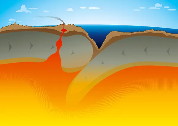
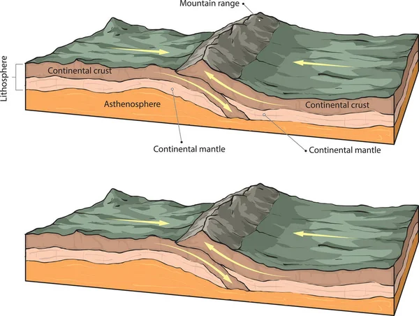
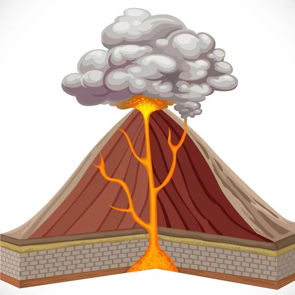
Layers Of Tectonic Plates Concept. Lithosphere And The Structure Of The Earth. Soil And Limestone. Geography Geology Background. The Scheme Of The Formation Of Mountains.
Vector, 8.92MB, 6000 × 3600 eps

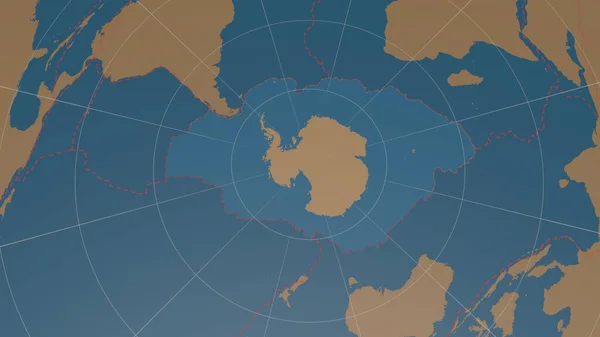
Antarctic Tectonic Plate Overview The Global Shapes Only - Land/ocean Mask In The Azimuthal Equidistant Projection With Dashed Plates Borders. 3D Rendering
Image, 1.56MB, 2880 × 1620 jpg

Antarctica Tectonic Plate Extruded On The Globe. Color Physical Map. 3D Rendering
Image, 3.72MB, 2880 × 1620 jpg
Neighborhoods Of The Panama Tectonic Plate On The Bilevel Elevation Map In The Van Der Grinten I Projection (oblique Transformation). Raw Composite - No Outlines
Image, 2.12MB, 2880 × 1620 jpg
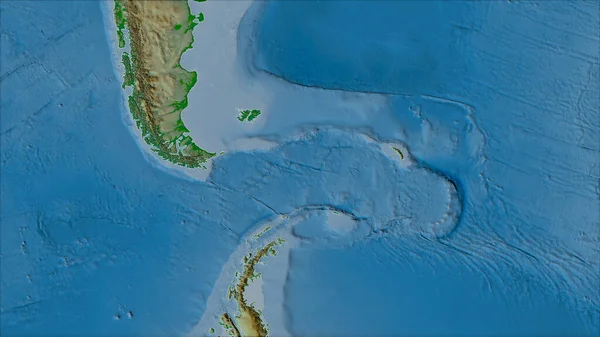
Neighborhoods Of The Scotia Tectonic Plate On The Physical Map In The Van Der Grinten I Projection (oblique Transformation). Raw Composite - No Outlines
Image, 3.92MB, 2880 × 1620 jpg

Okinawa Tectonic Plate Outlined On The Globe. Satellite Imagery. 3D Rendering
Image, 3.53MB, 2880 × 1620 jpg
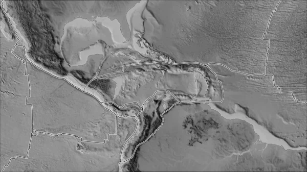
Tectonic Plates Borders On The Grayscale Map Of Areas Adjacent To The Caribbean Plate Area. Van Der Grinten I Projection (oblique Transformation)
Image, 2.7MB, 2880 × 1620 jpg
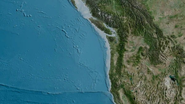
Satellite Map Of The Area Around The Juan De Fuca Tectonic Plate. 3D Rendering
Image, 5.02MB, 2880 × 1620 jpg
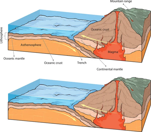
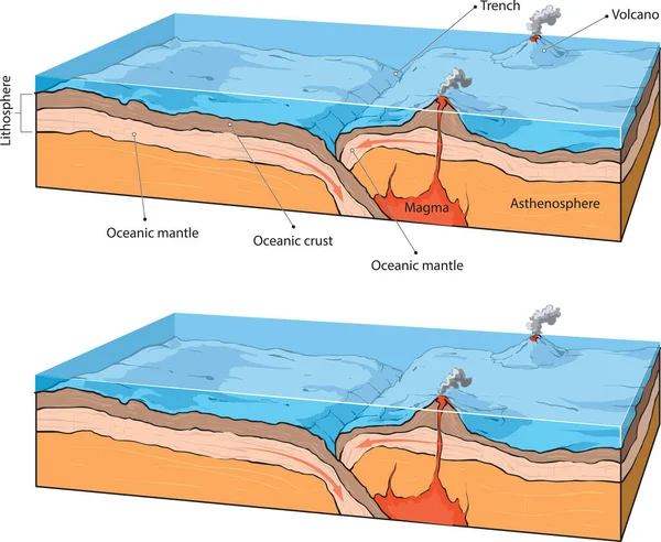
3d Illustration Of A Scientific Ground Cross-section To Explain Subduction And Plate Tectonics With Labels
Image, 15.9MB, 14043 × 9933 jpg
Page 1 >> Next