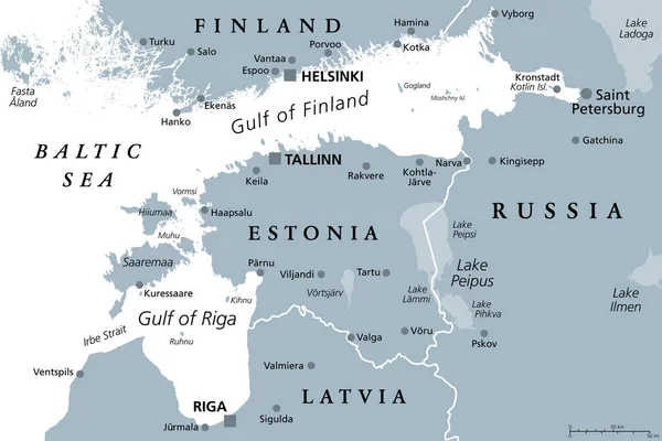
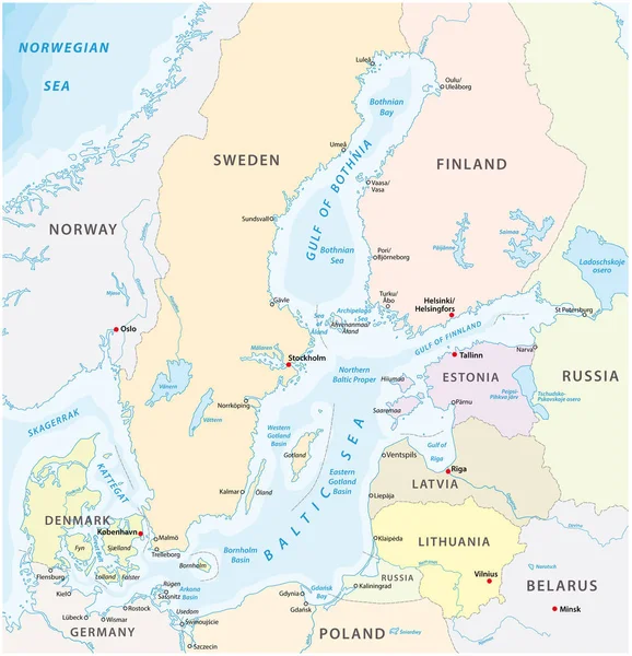
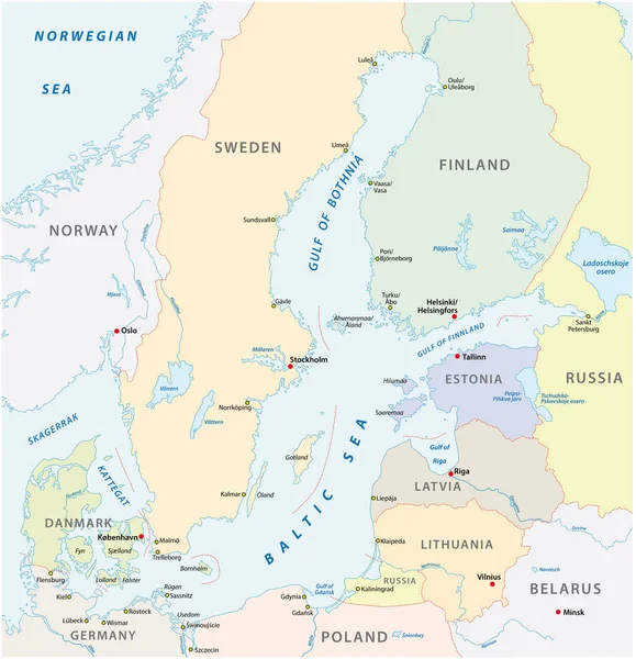
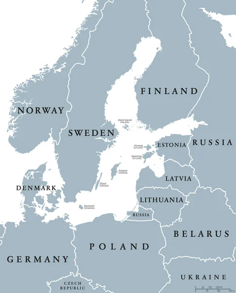
Stock vector Danish island Bornholm and Germanys largest island Ruegen, gray political map. Both islands are located in southern Baltic Sea, a marginal sea of the Atlantic Ocean. Illustration on white background.

Published: Oct.01, 2022 15:30:57
Author: Furian
Views: 11
Downloads: 0
File type: vector / eps
File size: 3 MB
Orginal size: 6000 x 6000 px
Available sizes:
Level: silver