Home
Images
Vectors
Videos
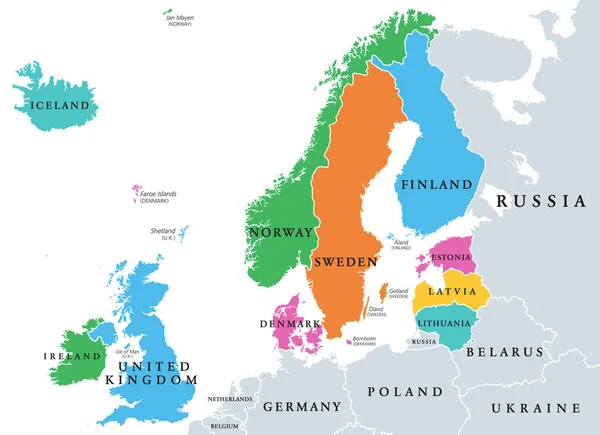
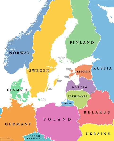
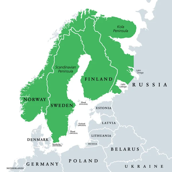
Stock vector Fennoscandia, Fennoscandian Peninsula, political map. Peninsula, comprising the Scandinavian and Kola Peninsulas, mainland of Finland, Norway and Sweden, Murmansk Oblast, and the Republic of Karelia.
Published:
Jun.21, 2022 17:27:29
Author:
Furian
Views:
368
Downloads:
0
File type:
vector
/
eps
File size:
1.56 MB
Orginal size:
6000
x
6000
px
Available sizes:
S
(500 x 500)
M
(1000 x 1000)
L
(2000 x 2000)
XL
(6000 x 6000)
VECT
(6000 x 6000)
EL0
(6000 x 6000)
Level:
silver
Download Vector
Vector topics:
Vector
Illustration
Travel
European
Border
Sweden
Scandinavia
Northern
Europe
Russia
Cruise
Country
Map
Cartography
Geography
Continent
Land
Nordic
Boundary
Political
Baltic
Arctic
Destination
Finland
Region
Murmansk
Karelia
Atlas
Norway
Scandinavian
Peninsula
Mainland
Mapping
Lapland
Kola
Fennia
Baltic Sea
Lake Onega
Kola Peninsula
Sapmi
Scandia
Political Map
Murmansk Oblast
Lake Ladoga
Fennoscandian
Fennoscandia
Fenno
Fenno Scandinavia
Fennoscandian Peninsula
Fennoscandia Map
Similar stock vectors
Northern Europe, Subregion And Geoscheme, Political Map. The Islands Offshore From Mainland Northern Europe And Countries Of The Main European Continent. Color Division For Statistical Purposes.
8268 × 6000
Norway Map - Vintage Vector Illustration
5500 × 6783
Baltic Sea Area, Colored Countries, Political Map, With National Borders And English Names. Countries Along The Coast Of The Baltic Sea, With Surrounding Countries In Europe. Isolated Illustration.
6000 × 7434
Norway Map - Vector Illustration
5500 × 6781
Highly Detailed Vector Map Of Norway With Administrative Regions,main Cities And Roads.
4055 × 5000
Highly Detailed Vector Map Of Finland With Administrative Regions,main Cities And Roads.
4151 × 5000
Finland Political Map
6374 × 9999