Home
Images
Vectors
Videos
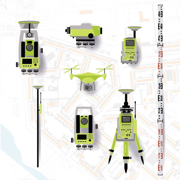
Stock vector Geodetic equipment vector illustration. Measuring instruments in flat design. Theodolite, tacheometer, total station, drone, level, map sketch isolated on world map background.
Published:
Apr.09, 2019 07:42:24
Author:
NatalyKa7
Views:
220
Downloads:
5
File type:
vector
/
eps
File size:
2.57 MB
Orginal size:
5000
x
5000
px
Available sizes:
S
(500 x 500)
M
(1000 x 1000)
L
(2000 x 2000)
XL
(5000 x 5000)
VECT
(5000 x 5000)
EL0
(5000 x 5000)
Level:
beginner
Download Vector
Vector topics:
Construction
Measurement
Pole
Globe
Elevation
Engineering
Cartography
Latitude
Longitude
Land
Geology
Topography
Terrain
Resources
Projection
Satellite
Inventory
Gravitation
Sputnik
Estimate
Mapping
Coordinate
Leveling
Theodolite
Tacheometer
Land Surveying
Leveling Instrument
Topographic Map
Photogrammetry
Laser Level
Cadaster
Geological Survey
Geological Exploration
Mining Engineering
Land Survey
Ecological Research
Land Resources
Field Controller
Geodetic Station
Similar stock vectors
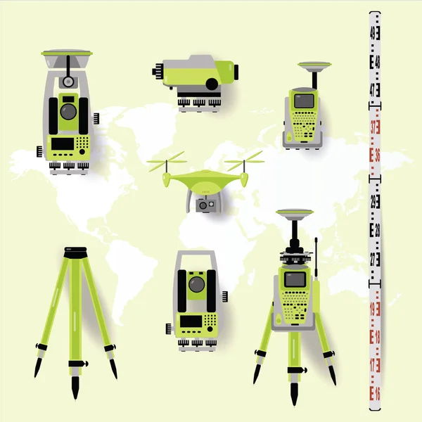
Geodetic Measuring Equipment, Engineering Technology For Land Survey On World Map Background. Flat Design
5000 × 5000
Set Of Banners. Air Delivery. Drone Flying Over The City. City Map On The Background. Aerial Drone Taking Photography And Video.
5001 × 5001
Flying Shipment Of A Package By UAV Drone With Autonomous Guide
7000 × 3937
Heavy Drones Landing On Ground For Delivering Cargo Containers
1920 × 1080
Drone
4000 × 7070
Autonomous Aircraft Use Abstract Concept Vector Illustrations.
7292 × 3126
Geodetic Measuring Equipment Icon Set, Engineering Technology For Land Survey On World Map Baclground
5000 × 5000
Drone Technology
4837 × 5315