Home
Images
Vectors
Videos
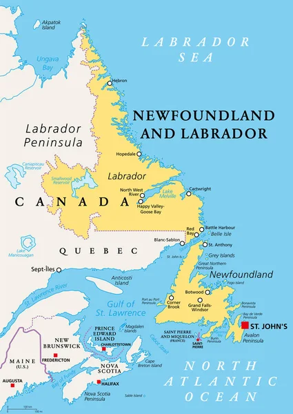
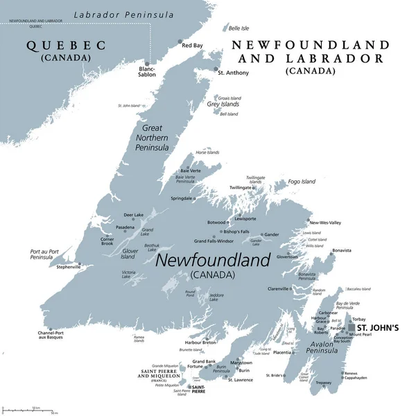
Stock vector Island of Newfoundland, gray political map. Part of Canadian province of Newfoundland and Labrador with capital St. Johns. Island off the coast of mainland North America southwest of Labrador Sea.
Published:
Apr.23, 2023 11:45:58
Author:
Furian
Views:
63
Downloads:
1
File type:
vector
/
eps
File size:
4.63 MB
Orginal size:
6000
x
6000
px
Available sizes:
S
(500 x 500)
M
(1000 x 1000)
L
(2000 x 2000)
XL
(6000 x 6000)
VECT
(6000 x 6000)
EL0
(6000 x 6000)
Level:
silver
Download Vector
Vector topics:
Large
Vector
Illustration
Travel
Gray
Capital
Sailing
Country
Map
Cartography
Geography
Paradise
Land
Overview
Labrador
Island
Canada
Atlantic
Destination
Region
Canadian
Atlas
Peninsula
Province
Americas
Mapping
Quebec
Avalon
Newfoundland
Miquelon
Saint Pierre
Infographic
North America
Atlantic Ocean
Saint Johns
Newfoundland And Labrador
St Johns
Political Map
Labrador Sea
St Pierre
Newfoundland Map
Great Northern Peninsula
Mount Pearl
Avalon Peninsula
Corner Brook
Glover Island
Bell Isle
Similar stock vectors
Newfoundland And Labrador, Political Map. Province Of Canada, In The Atlantic Region, With Capital St. Johns. Island Of Newfoundland And Continental Region Of Labrador Between Quebec And The Atlantic.
6000 × 8469
Newfoundland And Labrador Map
3100 × 4302
Nova Scotia, Maritime And Atlantic Province Of Canada, Gray Political Map. Cape Breton Island And Nova Scotia Peninsula, With Capital Halifax. Bordering On The Gulf Of Maine And On The Atlantic Ocean.
9000 × 6000
Map Of The Four Canada Atlantic Provinces
3100 × 4889
Newfoundland
5055 × 8328
Map Of Newfoundland And Labrador
4919 × 7021
Vector Road Map Of The Four Canada Atlantic Provinces
3100 × 4561
Illustration Of The Newfoundland
3033 × 5000