Home
Images
Vectors
Videos
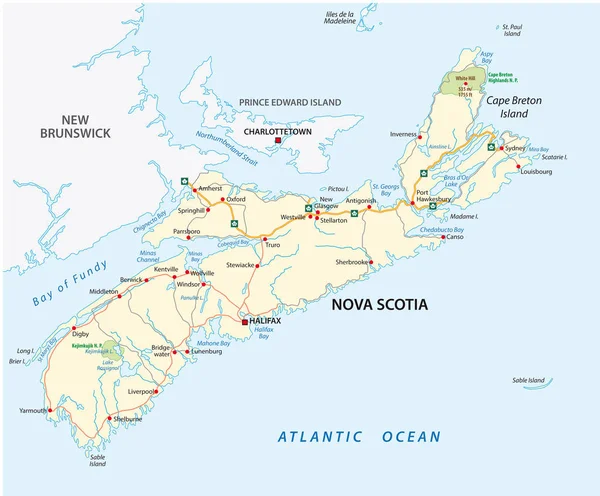
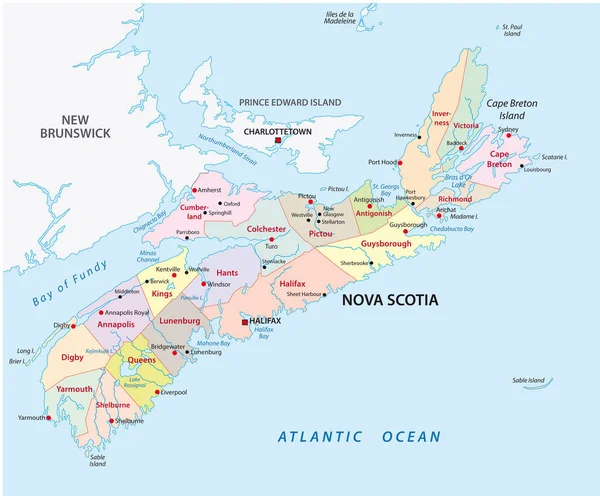
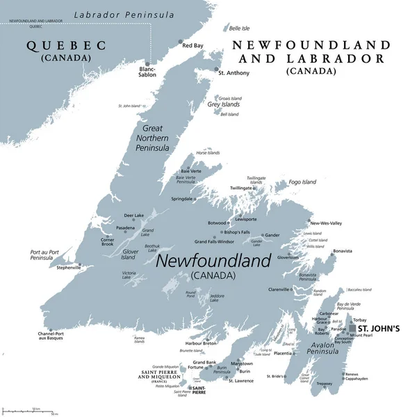
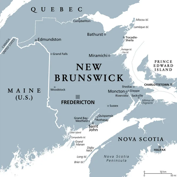
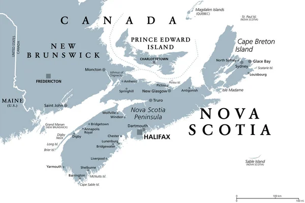
Stock vector Nova Scotia, Maritime and Atlantic province of Canada, gray political map. Cape Breton Island and Nova Scotia Peninsula, with capital Halifax. Bordering on the Gulf of Maine and on the Atlantic Ocean.
Published:
Mar.09, 2023 12:05:27
Author:
Furian
Views:
5
Downloads:
1
File type:
vector
/
eps
File size:
2.38 MB
Orginal size:
9000
x
6000
px
Available sizes:
S
(500 x 333)
M
(1000 x 667)
L
(2000 x 1333)
XL
(9000 x 6000)
VECT
(9000 x 6000)
EL0
(9000 x 6000)
Level:
silver
Download Vector
Vector topics:
Vector
Illustration
Isolated
Border
Gray
Capital
Country
Map
Cartography
Geography
Overview
State
Maritime
Boundary
Canada
Atlantic
Sydney
Maine
Canadian
Atlas
Peninsula
Province
Americas
Nova
Nation
Mapping
Maritimes
Scotia
Ns
Moncton
Truro
Halifax
Dartmouth
Charlottetown
Prince Edward Island
New Brunswick
North America
United States
Nova Scotia
Fredericton
Saint John
Atlantic Provinces
Maritime Provinces
Political Map
Cape Breton Island
Nova Scotia Map
Glace Bay
New Glasgow
CA NS
Nova Scotia Peninsula
Similar stock vectors
Nova Scotia Road Vector Map, Canada
3749 × 3100
Illustration Of The Newfoundland
3033 × 5000
Newfoundland And Labrador Map
3100 × 4302
Nova Scotia Administrative And Political Vector Map
3749 × 3100
Maritime
8239 × 6333
Island Of Newfoundland, Gray Political Map. Part Of Canadian Province Of Newfoundland And Labrador With Capital St. Johns. Island Off The Coast Of Mainland North America Southwest Of Labrador Sea.
6000 × 6000
New Brunswick, Maritime And Atlantic Province Of Canada, Gray Political Map. Bordering To Quebec, Nova Scotia, Gulf Of St Lawrence, Bay Of Fundy And The U.S. State Maine. With Capital Fredericton.
6000 × 6000
Vector Map Of The Canadian Province Of Nova Scotia
4000 × 3891