Home
Images
Vectors
Videos
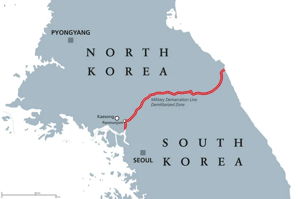
Stock vector Korean Peninsula, Demilitarized Zone Area, political map. North and South Korea with red Military Demarcation Line, capitals and borders. English labeling. Gray illustration, white background. Vector.
Published:
Jun.08, 2018 06:37:45
Author:
Furian
Views:
173
Downloads:
2
File type:
vector
/
eps
File size:
2.74 MB
Orginal size:
9666
x
6444
px
Available sizes:
S
(500 x 333)
M
(1000 x 667)
L
(2000 x 1333)
XL
(9666 x 6444)
VECT
(9666 x 6444)
EL0
(9666 x 6444)
Level:
silver
Download Vector
Vector topics:
Vector
Illustration
Labeling
Line
Border
Gray
Capital
North
South
Military
Country
Map
Cartography
Geography
Land
Asia
Conflict
State
Boundary
Republic
Korea
Seoul
Pyongyang
English
Atlas
Zone
Korean
Peninsula
Nation
Mapping
Armistice
Demarcation
White Background
East Asia
North Korea
South Korea
Yellow Sea
Political Map
Kaesong
Panmunjom
Demilitarized
Korea Map
English Labeling
Armistice Line
Similar stock vectors
Cape Verde Political Map
8000 × 8000
Samoan Islands Political Map
9999 × 5155
Rio Grande Do Sul State Map
5000 × 3500
Russia Political Map
10333 × 6100
Northern Ireland Political Map
9222 × 6883
Canary Islands Map Hand Drawing Doodle Outline Blue Isolated Travelling Concept
5779 × 3500
Comoros And Mayotte Political Map
9777 × 6518
Solomon Islands Political Map
9999 × 6236