Home
Images
Vectors
Videos
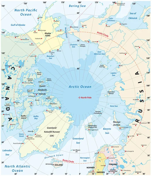
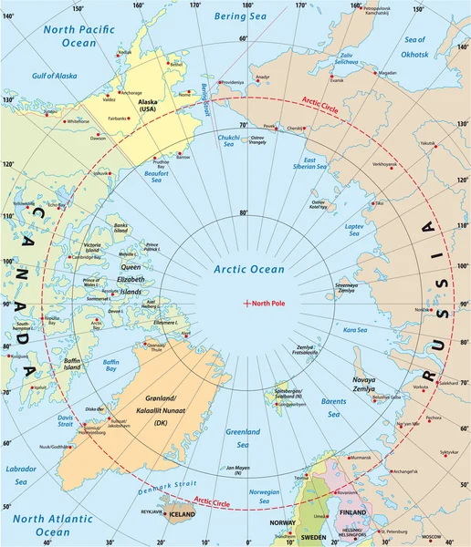
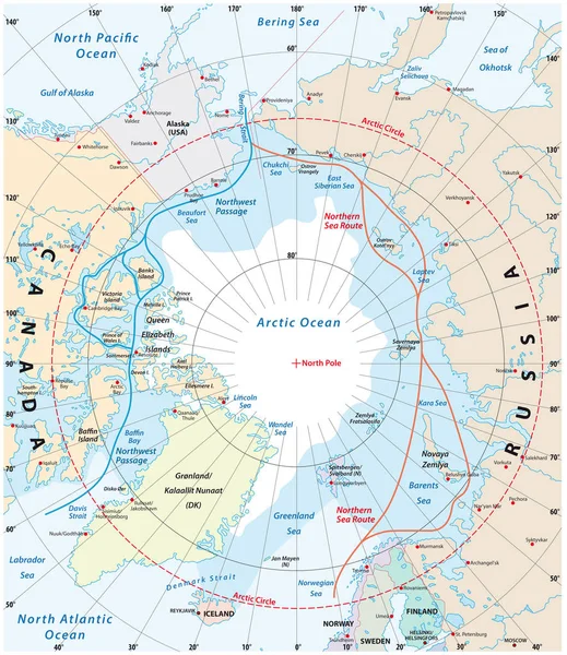
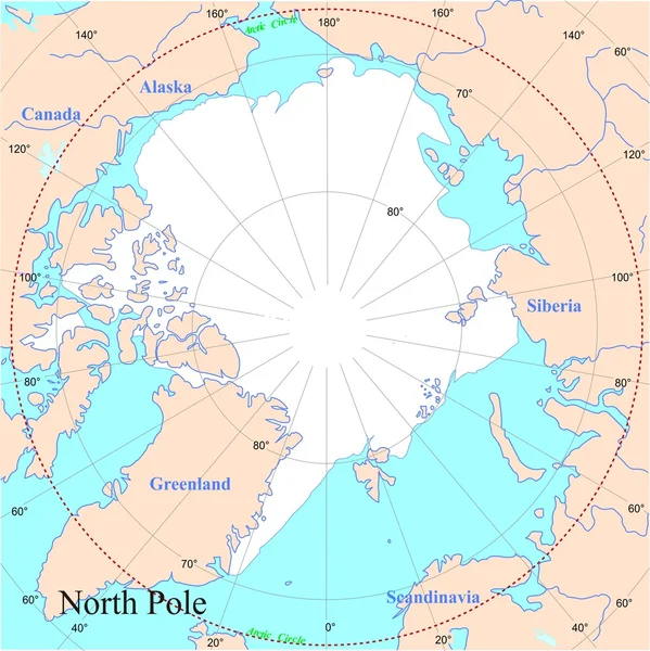
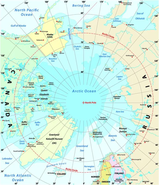
Stock vector Map of the Arctic with the least and largest extent of the ice cap 2018
Published:
Dec.08, 2021 14:16:53
Author:
PantherMediaSeller
Views:
10
Downloads:
0
File type:
vector
/
zip
File size:
0 MB
Orginal size:
3883
x
4000
px
Available sizes:
S
(485 x 500)
M
(971 x 1000)
L
(1942 x 2000)
XL
(3883 x 4000)
VECT
(3883 x 4000)
EL0
(3883 x 4000)
Level:
platinum
Download Vector
Vector topics:
With
Ice
Cap
Map
Arctic
Of
Largest
The
And
2018
Extent
Least
Ice Cap
Similar stock vectors
Map Of The Arctic With The Least And Largest Extent Of The Ice Cap 2018
3100 × 3585
Arctic Vector Map
3022 × 3509
Map Of The Arctic Region, The Northwest Passage And The Northern Sea Route
3100 × 3584
Geographic Position Of The North Pole Of The Earth, Political Map. Magnetic, Geomagnetic And Geographic North Pole. Map Of The Arctic Ocean And The Arctic Circle With Latitudes And Longitudes. Vector.
4000 × 4000
Antarctic Map
3544 × 3544
Map Of The Antarctic With The New Sea Protection Area In The Ross Sea
3592 × 3580
North Pole
5001 × 5005
Magnetic North Pole Drift, Political Map. The North Magnetic Pole Of Earth Moves Over Time, According To Magnetic Changes In The Core, Across Canadian Arctic, Over Arctic Ocean Towards Siberia. Vector
3652 × 4000