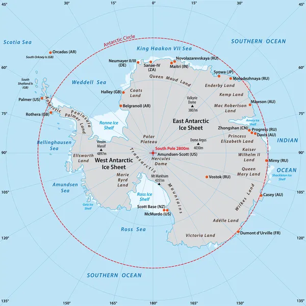
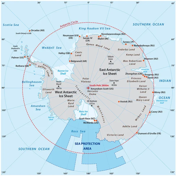
Stock vector Map of the Antarctic with the new sea protection area in the Ross Sea
Published: Nov.01, 2016 14:08:06
Author: Lesniewski
Views: 499
Downloads: 7
File type: vector / eps
File size: 1.3 MB
Orginal size: 3592 x 3580 px
Available sizes:
Level: bronze