Home
Images
Vectors
Videos
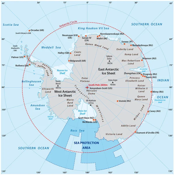
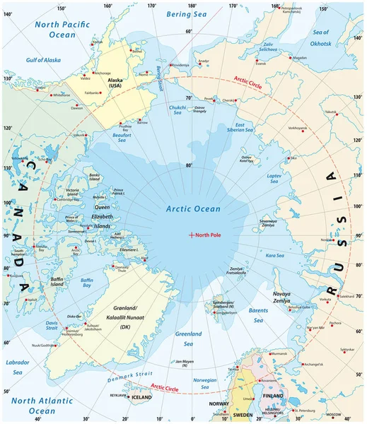
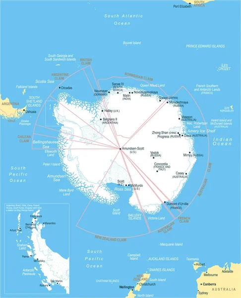
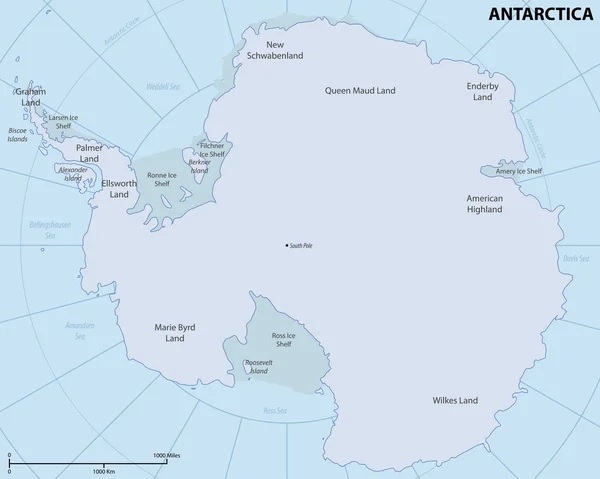
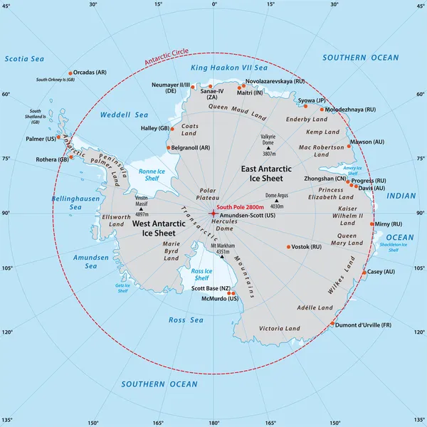
Stock vector Antarctic map
Published:
Aug.22, 2014 09:16:03
Author:
Lesniewski
Views:
726
Downloads:
18
File type:
vector
/
eps
File size:
1.27 MB
Orginal size:
3544
x
3544
px
Available sizes:
S
(500 x 500)
M
(1000 x 1000)
L
(2000 x 2000)
XL
(3544 x 3544)
VECT
(3544 x 3544)
EL0
(3544 x 3544)
Level:
bronze
Download Vector
Vector topics:
Vector
Circle
Illustration
New
Pole
Shelf
Earth
Planet
World
Usa
Ice
France
Ocean
Grid
Globe
South
Russia
Navigation
Map
Cartography
Geography
Latitude
Longitude
Africa
Germany
Station
Countries
Political
Projection
Antarctic
Polar
India
United
Kingdom
Southern
Orthographic
Antarctica
Argentina
Hemisphere
Antartica
Graticule
Zea Land
Similar stock vectors
Map Of The Antarctic With The New Sea Protection Area In The Ross Sea
3592 × 3580
Map Of The Arctic Region, The Northwest Passage And The Northern Sea Route
3100 × 3584
Antarctic Region Map - Vintage Vector Illustration
5500 × 6757
Arctic Region Map
6606 × 8192
Map Of The Arctic With The Least And Largest Extent Of The Ice Cap 2018
3100 × 3585
Antarctic Region Map - Vector Illustration
5140 × 6335
Map Of Antarctica
6010 × 4800
Arctic Ocean Sea Routes, Gray Political Map. Arctic Shipping Routes. Northwest Passage And Northern Sea Route. Maritime Paths, Used By Vessels To Navigate Through The Arctic. Illustration. Vector.
6000 × 6000