Home
Images
Vectors
Videos
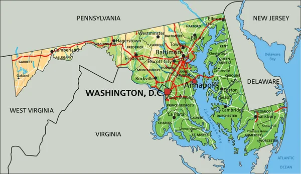
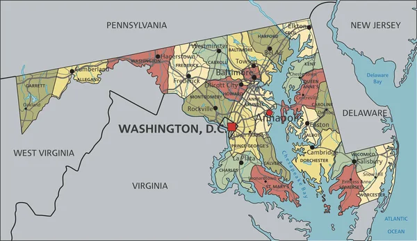
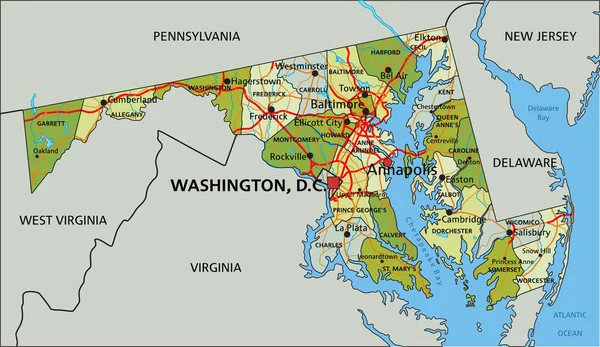
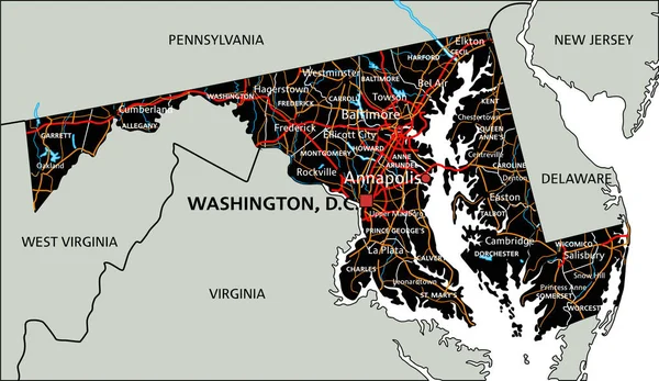
Stock vector Maryland, U.S. state, political map with borders and county names. State in the Mid-Atlantic region of United States, subdivided into 23 counties and the independent City of Baltimore. Old Line State
Published:
Aug.12, 2024 05:56:30
Author:
Furian
Views:
0
Downloads:
0
File type:
vector
/
eps
File size:
3.54 MB
Orginal size:
9000
x
6000
px
Available sizes:
S
(500 x 333)
M
(1000 x 667)
L
(2000 x 1333)
XL
(9000 x 6000)
VECT
(9000 x 6000)
EL0
(9000 x 6000)
Level:
silver
Download Vector
Vector topics:
Vector
Illustration
Travel
Border
Structure
Usa
Miniature
Country
Map
Cartography
Geography
Land
Overview
State
America
Boundary
Administrative
Destination
States
Region
Division
Federal
Atlas
MD
Americas
Maryland
Subdivision
County
Mapping
Names
Howard
Montgomery
Baltimore
Frederick
Counties
Carroll
Mid Atlantic
Infographic
United States
Subdivided
Free State
Political Map
Harford
Prince George
Old Line State
Baltimore County
Little America
Independent City
Anne Arundel
Similar stock vectors
Virginia Counties And Cities, Political Map. Commonwealth Of Virginia, A State In The Southeastern And Mid-Atlantic Regions Of The United States, Subdivided Into 95 Counties And 38 Independent Cities.
9000 × 4790
High Detailed Maryland Physical Map With Labeling.
3288 × 1905
High Detailed Virginia Physical Map With Labeling.
5550 × 3318
Maryland - Highly Detailed Editable Political Map With Labeling.
3288 × 1905
Virginia - Highly Detailed Editable Political Map With Labeling.
5550 × 3318
Highly Detailed Editable Political Map With Separated Layers. Maryland
3288 × 1905
High Detailed Maryland Road Map With Labeling.
3289 × 1905
High Detailed Virginia Physical Map.
5550 × 3318