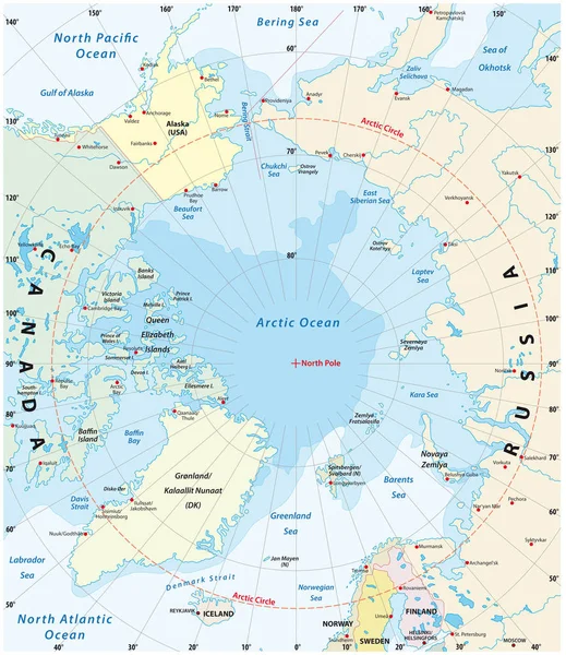
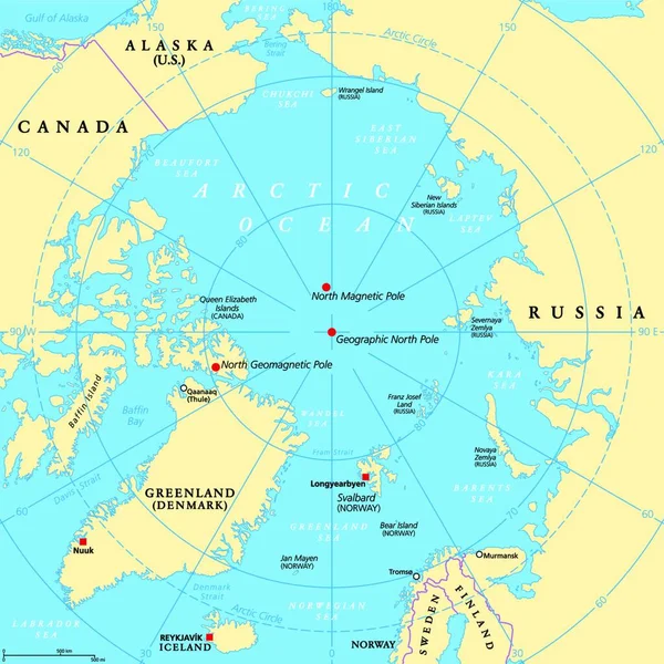
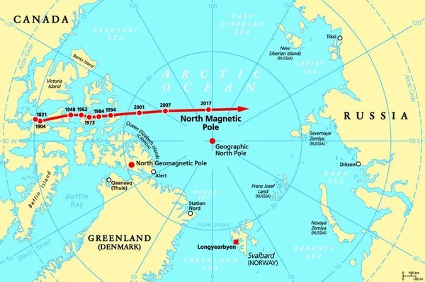
Stock vector Movement of North Magnetic Pole, political map. Magnetic North pole of Earth moves over time, according to magnetic changes in outer core, across Canadian Arctic, Arctic Ocean towards Siberia. Vector.
Published: Dec.14, 2021 07:08:35
Author: PantherMediaSeller
Views: 61
Downloads: 0
File type: vector / zip
File size: 0 MB
Orginal size: 4000 x 3652 px
Available sizes:
Level: platinum