Home
Images
Vectors
Videos
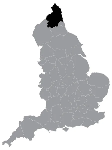
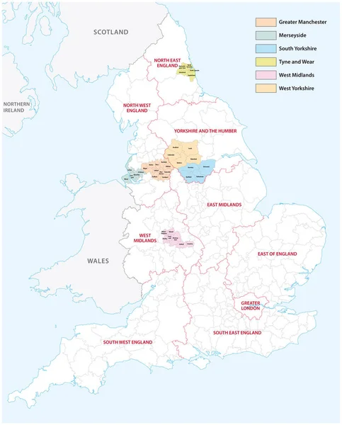
Stock vector Outline vector map of the six metropolitan counties of England, United Kingdom
Published:
Sep.17, 2021 08:26:52
Author:
Lesniewski
Views:
13
Downloads:
1
File type:
vector
/
eps
File size:
2.31 MB
Orginal size:
3575
x
4440
px
Available sizes:
S
(403 x 500)
M
(805 x 1000)
L
(1610 x 2000)
XL
(3575 x 4440)
VECT
(3575 x 4440)
EL0
(3575 x 4440)
Level:
bronze
Download Vector
Vector topics:
Color
Vector
Graphic
Illustration
Travel
Detail
Border
City
Contour
Detailed
Europe
Outline
Country
District
Map
Cartography
Geography
Ireland
Uk
Ceremonial
Island
Government
Political
Administrative
United
Kingdom
Britain
London
Region
Division
English
British
England
Province
Merseyside
Metropolitan
Wales
Scotland
County
Manchester
Counties
Infographic
Great Britain
West Midlands
Tyne And Wear
West Yorkshire
Greater Manchester
South Yorkshire
Similar stock vectors
Outline Map Of The Nine Regions Of England
3100 × 4130
Map Of Administrative Divisions Of England.
3754 × 5003
England Map With Counties Grey Isolated
5000 × 6463
England Map Labelled Black
5000 × 6463
United Kingdom Physical Map
3812 × 5671
Black Location Map Of English Ceremonial County (Lieutenancy Area) Of Northumberland Within Grey Map Of England
3600 × 4800
Map Of England
4000 × 4838
North East England Red Highlighted In Map Of England UK
5100 × 6592