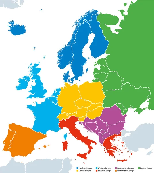
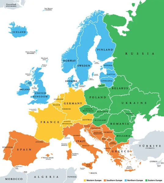
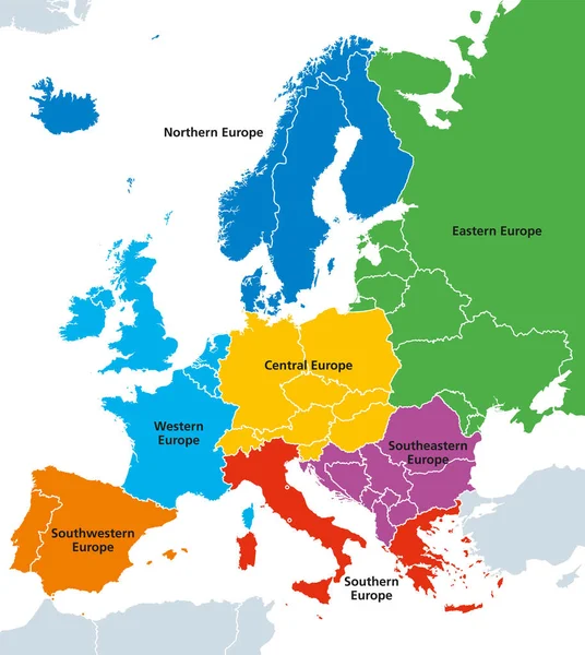
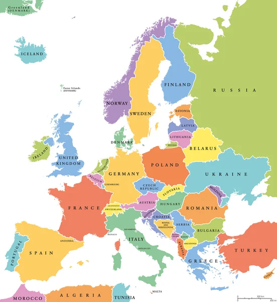
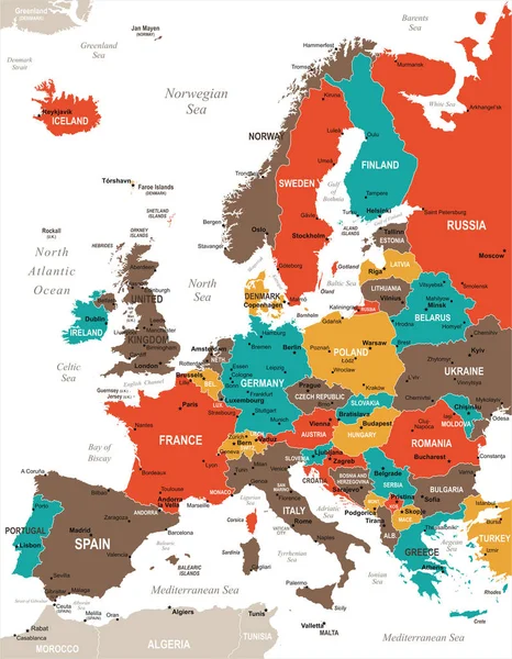
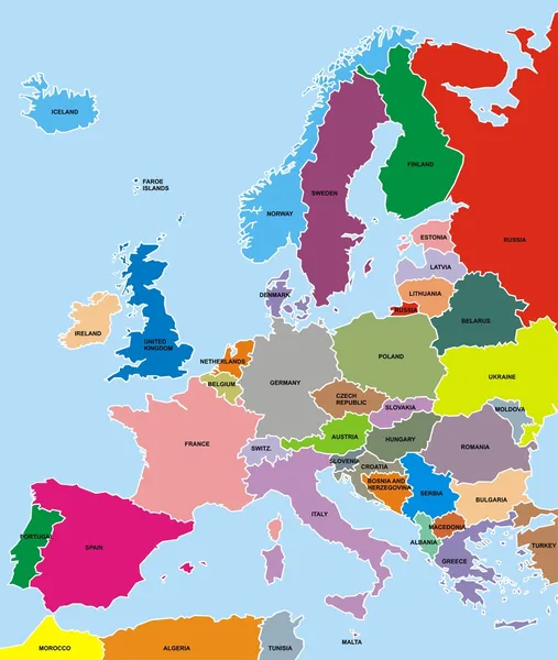
Stock vector Regions of Europe political map, single countries, English labeling

Published: Feb.22, 2018 07:59:20
Author: Furian
Views: 2364
Downloads: 0
File type: vector / eps
File size: 5.42 MB
Orginal size: 7535 x 8433 px
Available sizes:
Level: silver