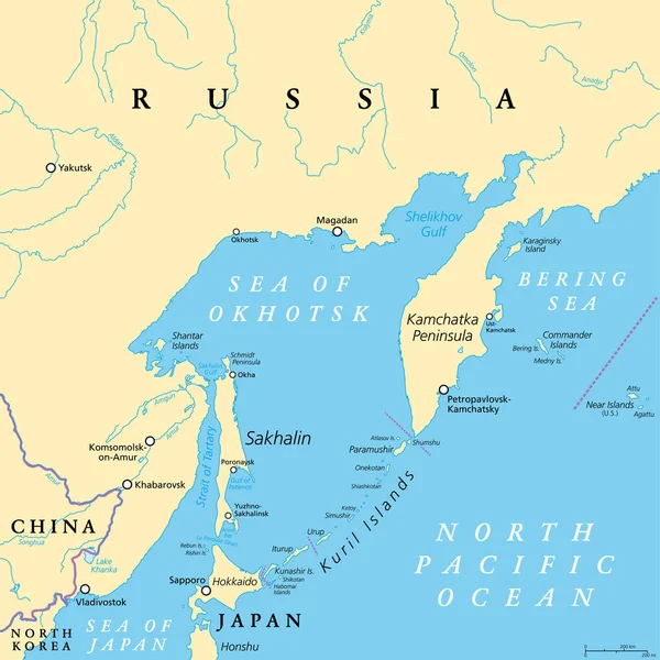
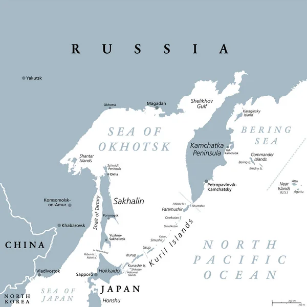
Stock vector Sea of Okhotsk, gray political map. Marginal sea of the North Pacific Ocean located between the Kamchatka Peninsula, the Kuril Islands, Hokkaido, Sakhalin, and a stretch of the eastern Siberian coast.
Published: Jun.15, 2023 16:26:35
Author: Furian
Views: 6
Downloads: 0
File type: vector / eps
File size: 3.28 MB
Orginal size: 6000 x 6000 px
Available sizes:
Level: silver