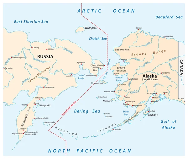
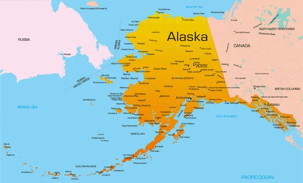
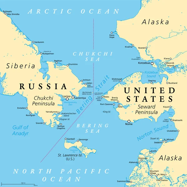
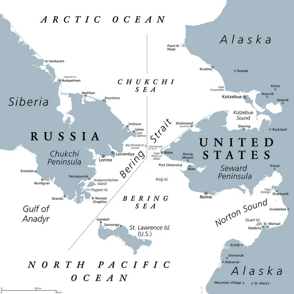
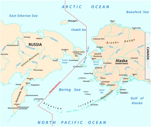
Stock vector vector map of the Bering Strait between Russia and Alaska
Published: Aug.03, 2020 08:04:29
Author: PantherMediaSeller
Views: 93
Downloads: 0
File type: vector / zip
File size: 0 MB
Orginal size: 6016 x 5056 px
Available sizes:
Level: platinum