Home
Images
Vectors
Videos
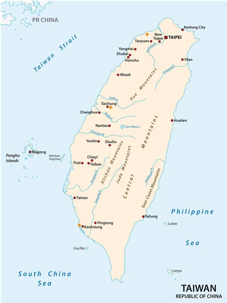
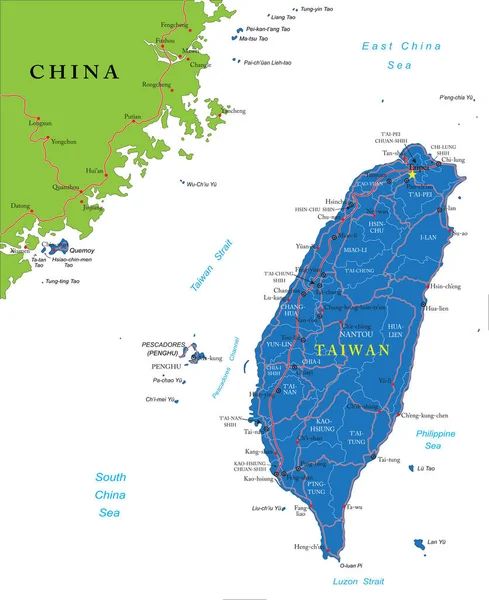
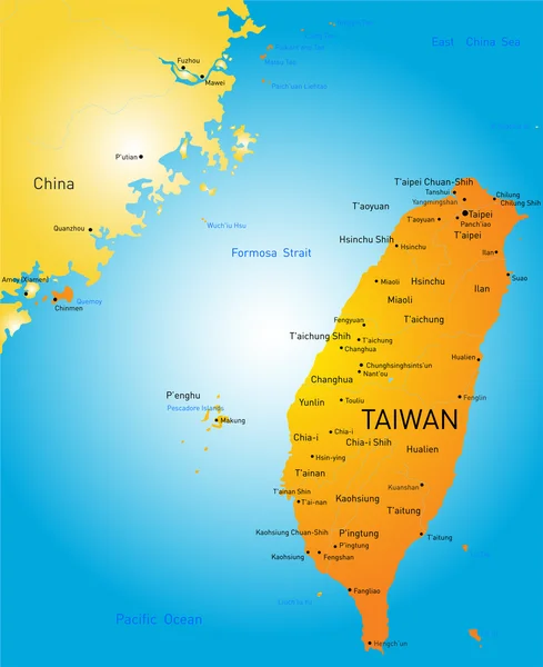
Stock vector Taiwan Strait, political map. Important waterway and disputed international waters, separating the island of Taiwan and continental Asia, which connects the East China Sea and the South China Sea.
Published:
Sep.23, 2023 21:56:29
Author:
Furian
Views:
106
Downloads:
6
File type:
vector
/
eps
File size:
4.95 MB
Orginal size:
6000
x
6000
px
Available sizes:
S
(500 x 500)
M
(1000 x 1000)
L
(2000 x 2000)
XL
(6000 x 6000)
VECT
(6000 x 6000)
EL0
(6000 x 6000)
Level:
silver
Download Vector
Vector topics:
Vector
Illustration
Transport
Shipping
Cargo
Route
Crisis
China
Navigation
Country
Map
Cartography
Geography
Asia
Conflict
Channel
International
Island
Passage
Transit
Republic
Strait
Waters
Dispute
Atlas
Taiwan
Taipei
Waterway
Mapping
Formosa
ROC
Archipelago
Prc
Fujian
Penghu
Infographic
South China Sea
Xiamen
Republic Of China
Political Map
Yonaguni
Philippine Sea
Kinmen
East China Sea
Choke Point
Taiwan Strait
Matsu Islands
Luzon Strait
Black Ditch
Fokien
Similar stock vectors
Vector Map Of The State Of America
3806 × 4000
Taiwan (Republic Of China) Vector Map
3100 × 4133
Map Of The Republic Of China, Taiwan
3100 × 4085
Taiwan Administrativ And Political Map
3100 × 4117
Blue-gray Detailed Map Of Taiwan Administrative Divisions And Location On The Globe.
5215 × 6418
Taiwan Highly Detailed Vector Map With Administrative Regions,main Cities And Roads.
4083 × 5000
Taiwan
6382 × 7831
Taiwan
4419 × 5422