Home
Images
Vectors
Videos
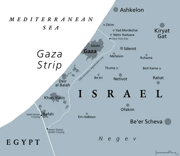
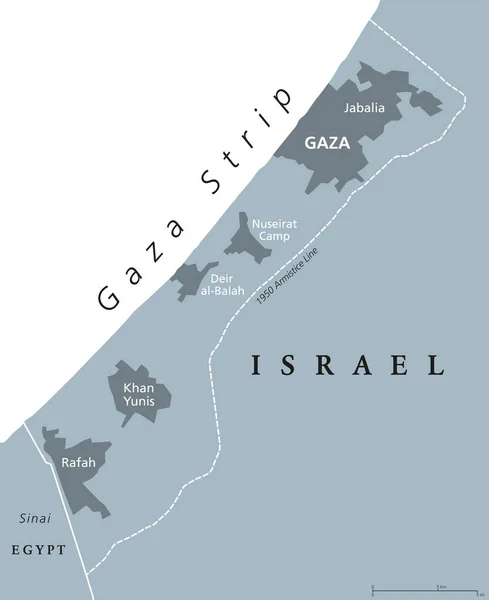
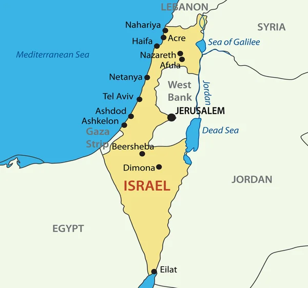
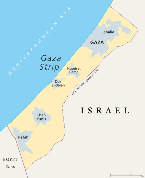
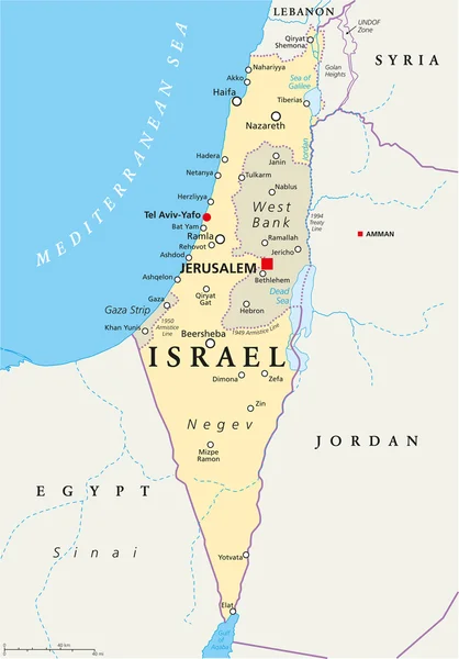
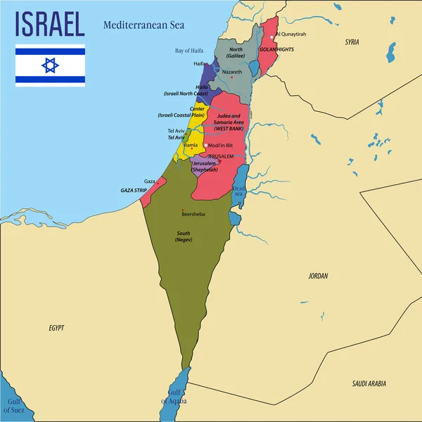
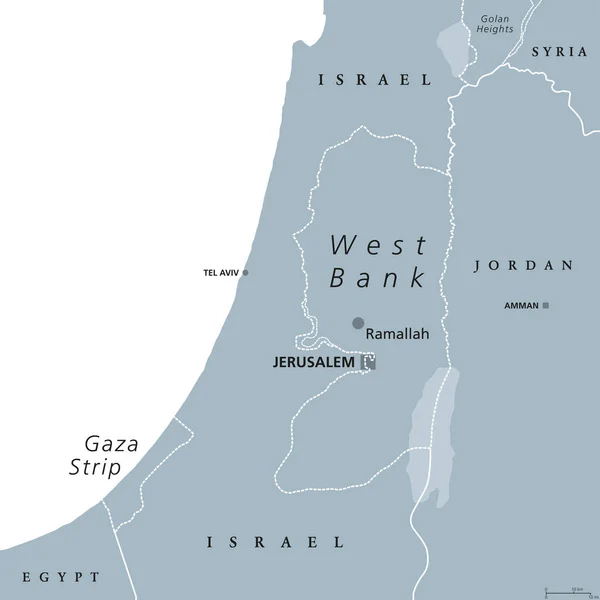
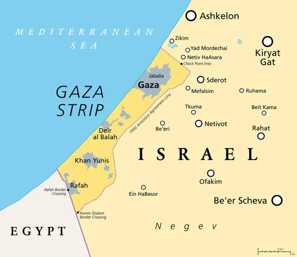
Stock vector The Gaza Strip and surroundings, political map. Gaza is a self-governing Palestinian territory and narrow piece of land located on the coast of the Mediterranean Sea, bordered by Israel and Egypt.
Published:
Oct.16, 2023 00:18:00
Author:
Furian
Views:
15
Downloads:
3
File type:
vector
/
eps
File size:
1.91 MB
Orginal size:
6906
x
6000
px
Available sizes:
S
(500 x 434)
M
(1000 x 869)
L
(2000 x 1738)
XL
(6906 x 6000)
VECT
(6906 x 6000)
EL0
(6906 x 6000)
Level:
silver
Download Vector
Vector topics:
Vector
Illustration
Piece
Sea
Line
Border
Agreement
Narrow
Coast
Country
Map
Cartography
Geography
Area
Egypt
Land
Mediterranean
State
Israel
Region
Territory
Atlas
Self
Palestine
Negev
Sinai
Mapping
Armistice
Governing
Palestinian
Gaza
Levant
Beersheba
Ashkelon
Middle East
Mediterranean Sea
Sinai Peninsula
Gaza Strip
Political Map
Sderot
Rafah
West Asia
Palestinian Territory
Kiryat Gat
Southern District
Jabalia
Khan Yunis
Self Governing
Beer Scheva
Deir Al Balah
Similar stock vectors
The Gaza Strip And Surroundings, Gray Political Map. Gaza, A Self-governing Palestinian Territory And Narrow Piece Of Land Located On The Coast Of The Mediterranean Sea, Bordered By Israel And Egypt.
6906 × 6000
Gaza Strip Political Map. Self Governing Palestinian Territory On Coast Of Mediterranean Sea. Borders To Israel And Egypt. Claimed By State Of Palestine. English Labeling. Gray Illustration. Vector.
7199 × 8833
State Of Israel - Vector Map
3626 × 3387
Gaza Strip Political Map
7198 × 8833
Israel Political Map
6000 × 8596
Vector Highly Detailed Political Map Of Israel With Regions And Their Capitals. All Elements Are Separated In Editable Layers Clearly Labeled.EPS 10
7000 × 7003
West Bank And Gaza Strip Political Map
8033 × 8033
State Of Palestine Political Map
6000 × 6000