Home
Images
Vectors
Videos
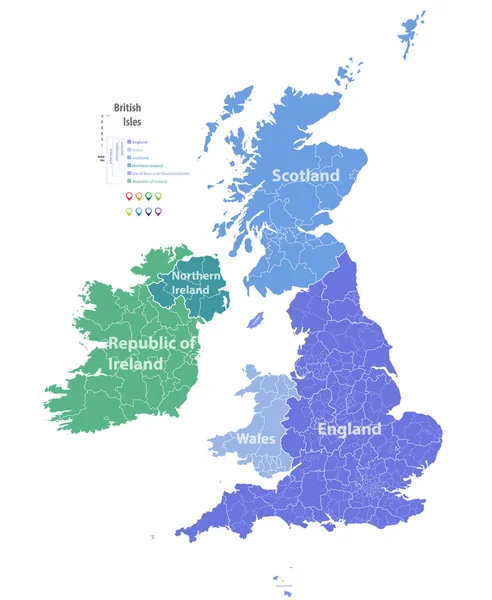
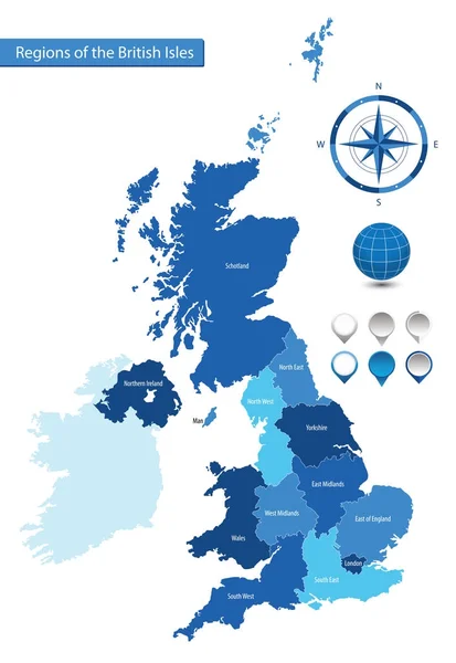
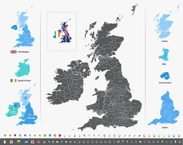
Stock vector vector map of British Isles with administrative divisions
Published:
Aug.22, 2016 05:35:48
Author:
Jktu_21
Views:
377
Downloads:
20
File type:
vector
/
eps
File size:
14.28 MB
Orginal size:
7292
x
5774
px
Available sizes:
S
(500 x 396)
M
(1000 x 792)
L
(2000 x 1584)
XL
(7292 x 5774)
VECT
(7292 x 5774)
EL0
(7292 x 5774)
Level:
silver
Download Vector
Vector topics:
Map
Britain
London
England
Yorkshire
Merseyside
Wales
Scotland
County
Staffordshire
Derbyshire
Kent
Hampshire
Cheshire
Lancashire
Essex
Glasgow
Devon
Surrey
Somerset
Belfast
Cardiff
Hertfordshire
Great Britain
United Kingdom
Nottinghamshire
City Of London
Northern Ireland
Leicestershire
England Flag
North Yorkshire
West Midlands
Greater London
Tyne And Wear
West Yorkshire
Ireland Flag
United Kingdom Flag
Northern Ireland Flag
Ireland Map
Greater Manchester
South Yorkshire
Great Britain Map
Scotland Map
Scotland Flag
England Map
Location Icons
Northern Ireland Map
United Kingdom Map
Wales Flag
British Isles Map
Similar stock vectors
Vector Map Of British Isles
5979 × 7292
Browser Window With Map Of Scotland, Searching Scotland In Internet.
6250 × 3950
Political Map Of Ireland Isolated On White Background
6000 × 5038
Vector Maps Of United Kingdom, Italy, Germany, France And Spain With Administrative Divisions. All Layers Detachable And Labeled.
7292 × 7292
Ireland Provinces Maps
6000 × 4636
Map Of Great Britain - Composition Of Wine And Grapes
3000 × 3296
Vector Map Of The Regions Of The British Isles
4887 × 7087
Ireland Map With Shapes Of Regions Blank Vector Map Of The Country With Regions Borders Of The
6203 × 4837