photo free
Home Images Vectors Videos

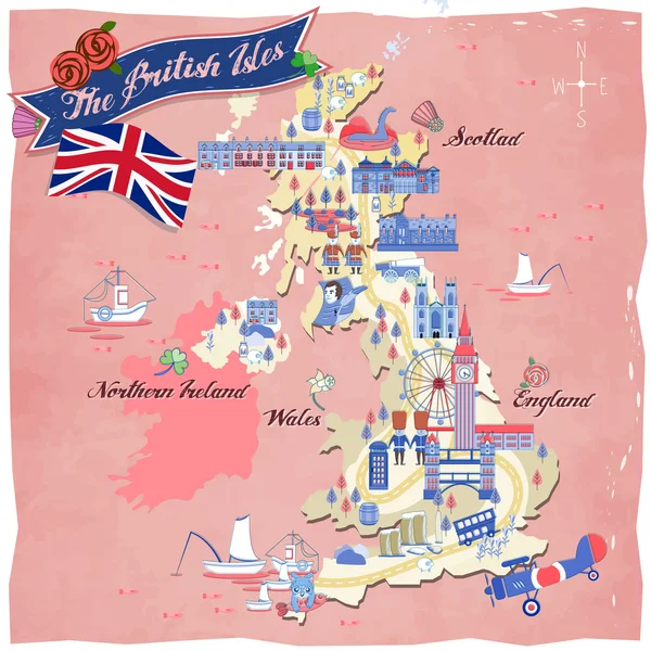
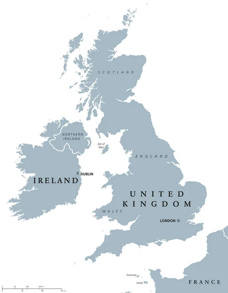
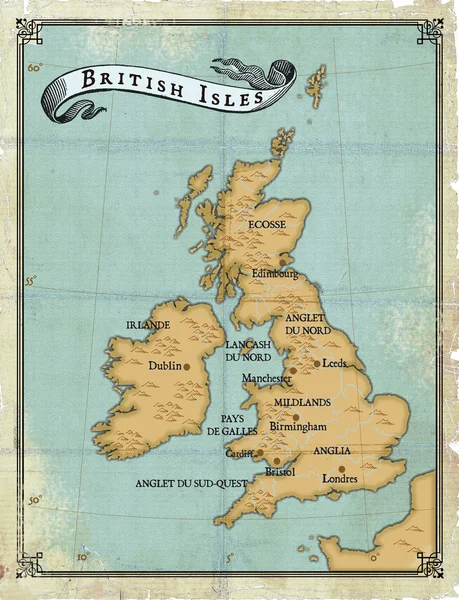
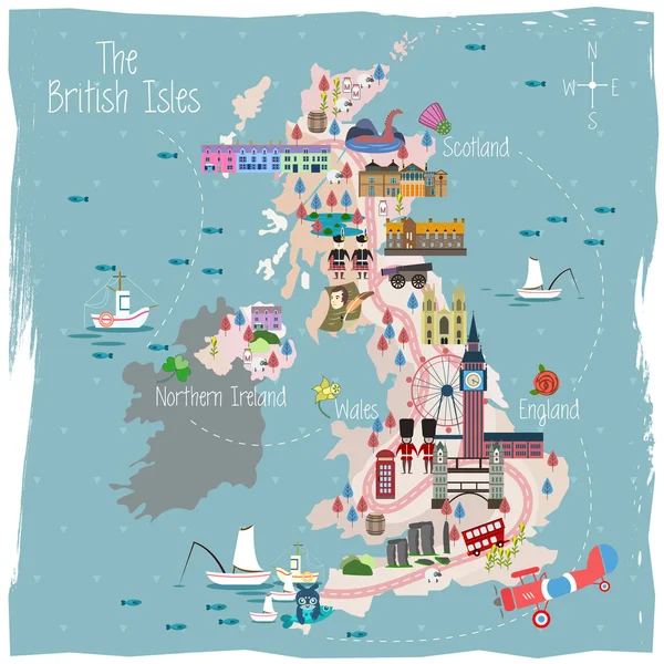
Stock image British Isles Map

stock vector United Kingdom travel map

United Kingdom Travel Map

Vector, 6.68MB, 4000 × 4000 eps
stock vector British Isles map gray radial dot pattern

British Isles Map Gray Radial Dot Pattern

Vector, 5.65MB, 6000 × 7400 eps
stock vector United Kingdom countries and Ireland political map

United Kingdom Countries And Ireland Political Map

Vector, 0.89MB, 7085 × 9111 eps
stock vector British Isles map vector

British Isles Map Vector

Vector, 0.7MB, 8858 × 5906 eps
stock vector Ireland and United Kingdom political map

Ireland And United Kingdom Political Map

Vector, 2.66MB, 6998 × 8999 eps
stock vector British Isles map vector

British Isles Map Vector

Vector, 0.84MB, 8858 × 5905 eps
stock vector British Isles Map

British Isles Map

Vector, 5.3MB, 6000 × 7715 eps
stock vector Black Outline Vector Map of The British Isles &  Cities

Black Outline Vector Map Of The British Isles & Cities

Vector, 2.82MB, 3239 × 3790 eps
stock vector United Kingdom map

United Kingdom Map

Vector, 3.98MB, 5000 × 5000 eps
stock vector Map of Ireland

Map Of Ireland

Vector, 9.33MB, 5320 × 7021 eps
stock image Age-old map British Isles

Age-old Map British Isles

Image, 7.65MB, 2388 × 3116 jpg
stock image British Isles from space on model of planet Earth with country borders. Extremely fine detail of planet surface and clouds. 3D illustration. Elements of this image furnished by NASA.

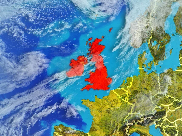
British Isles From Space On Model Of Planet Earth With Country Borders. Extremely Fine Detail Of Planet Surface And Clouds. 3D Illustration. Elements Of This Image Furnished By NASA.

Image, 14.47MB, 5000 × 3750 jpg
stock vector great britain map and flag icon

Great Britain Map And Flag Icon

Vector, 1.08MB, 5315 × 5315 eps
stock image Closeup of Ruffled Ireland Flag, Ireland Flag Blowing in Wind

Closeup Of Ruffled Ireland Flag, Ireland Flag Blowing In Wind

Image, 17.01MB, 6000 × 4000 jpg
stock vector Map of the United Kingdom

Map Of The United Kingdom

Vector, 0.03MB, 5301 × 5146 eps
stock vector Ireland Political Map

Ireland Political Map

Vector, 3.66MB, 6000 × 7468 eps
stock vector vector map of British Isles

Vector Map Of British Isles

Vector, 7.63MB, 5979 × 7292 eps
stock image 3D British Isles map

3D British Isles Map

Image, 1.53MB, 3000 × 4000 jpg
stock vector Europe with a part of the Middle East, gray political map. Western part of the continent Eurasia, located in the Northern Hemisphere. Countries with international borders and English labeling. Vector

Europe With A Part Of The Middle East, Gray Political Map. Western Part Of The Continent Eurasia, Located In The Northern Hemisphere. Countries With International Borders And English Labeling. Vector

Vector, 4.99MB, 6370 × 6000 eps
stock vector Vector map of the regions of the British Isles

Vector Map Of The Regions Of The British Isles

Vector, 1.58MB, 4887 × 7087 eps
stock vector Map and Flags of British Isles

Map And Flags Of British Isles

Vector, 10.51MB, 5040 × 6040 eps
stock image UK British Isles flag map on white background 3d illustration with clipping path to remove shadow

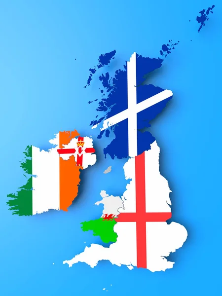
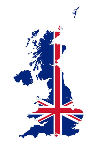
UK British Isles Flag Map On White Background 3d Illustration With Clipping Path To Remove Shadow

Image, 5.16MB, 7500 × 7500 jpg
stock image UK Map

UK Map

Image, 3.69MB, 5300 × 3975 jpg
stock image British Isles with national flags on simple blue political globe. 3D illustration.

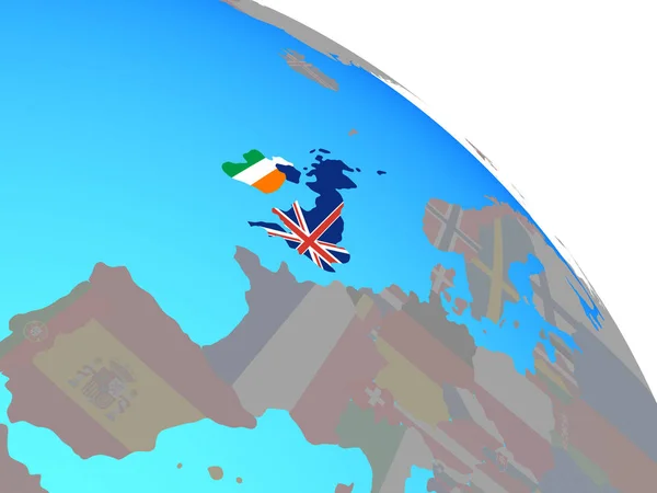
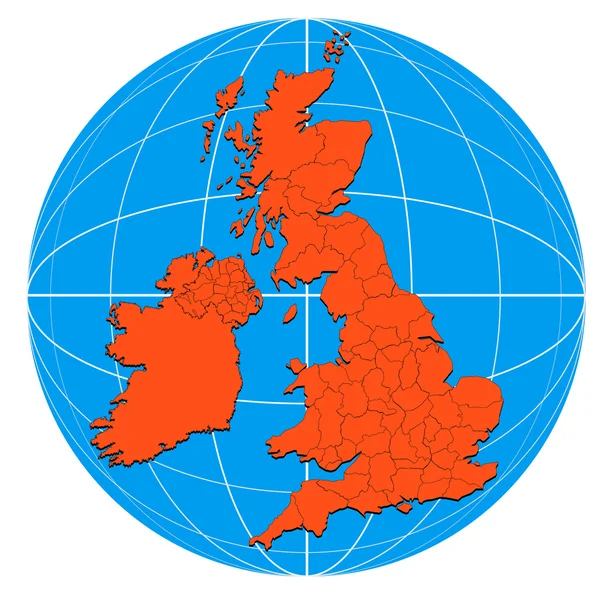
British Isles With National Flags On Simple Blue Political Globe. 3D Illustration.

Image, 1.59MB, 5000 × 3750 jpg
stock vector Europe with a part of the Middle East countries, political map. Western part of continent Eurasia, located in the Northern Hemisphere. Countries with international borders and English labeling. Vector

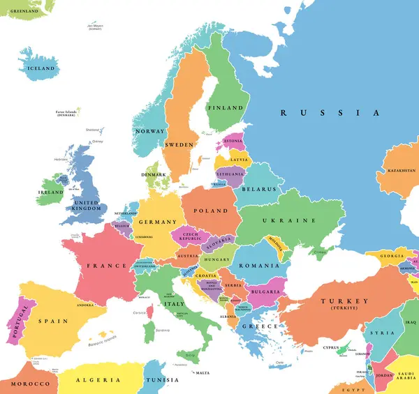
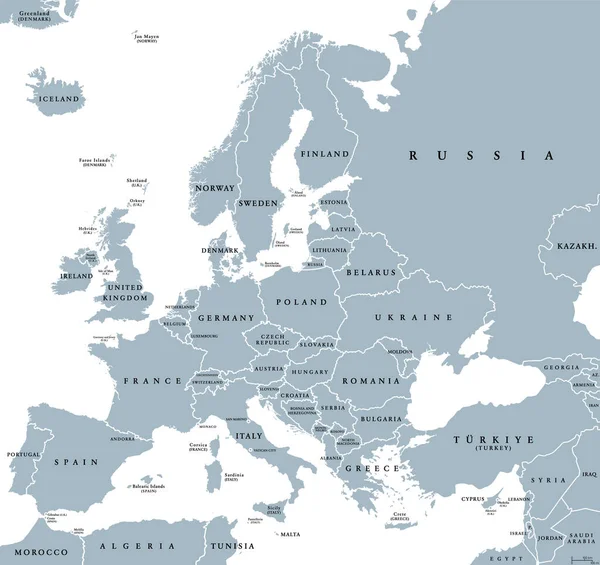
Europe With A Part Of The Middle East Countries, Political Map. Western Part Of Continent Eurasia, Located In The Northern Hemisphere. Countries With International Borders And English Labeling. Vector

Vector, 5.92MB, 6370 × 6000 eps
stock vector watercolor map of United Kingdom

Watercolor Map Of United Kingdom

Vector, 6.63MB, 3502 × 5763 eps
stock vector Polygonal british islands maps. Map of United kingdom and ireland in low poly style. Country map in geometric style for your infographics

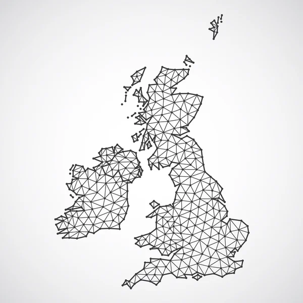
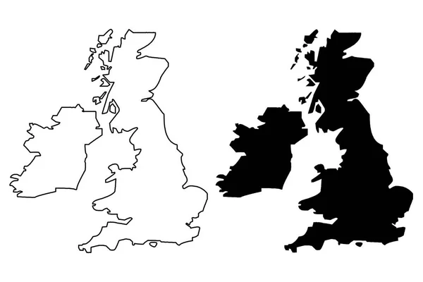
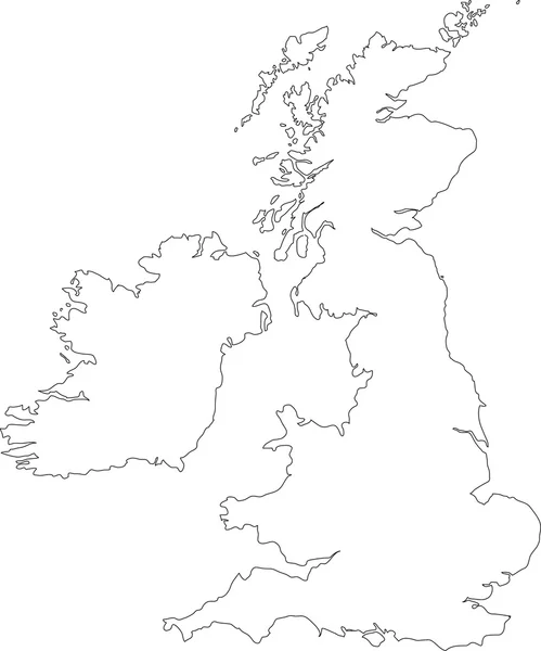
Polygonal British Islands Maps. Map Of United Kingdom And Ireland In Low Poly Style. Country Map In Geometric Style For Your Infographics

Vector, 0.81MB, 4000 × 4000 eps
stock vector Shetland Islands

Shetland Islands

Vector, 1.04MB, 2413 × 3779 eps
stock vector watercolor map of United Kingdom

Watercolor Map Of United Kingdom

Vector, 7MB, 3425 × 5732 eps
stock vector watercolor map of United Kingdom

Watercolor Map Of United Kingdom

Vector, 6.8MB, 3700 × 5870 eps
stock vector Europe map radial dot pattern gray color

Europe Map Radial Dot Pattern Gray Color

Vector, 4.29MB, 6000 × 7018 eps
stock vector vector map of British Isles administrative divisions colored by countries and regions. Districts and counties maps and flags of United Kingdom,Northern Ireland, Wales, Scotland and Republic of Ireland

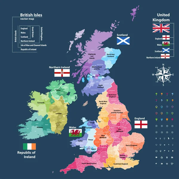
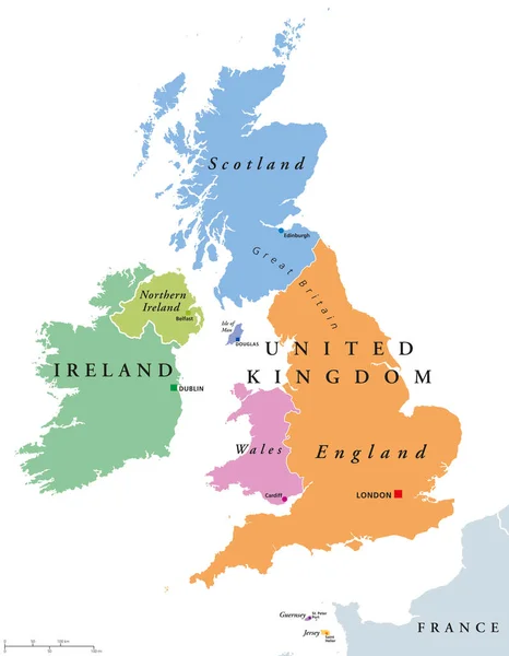
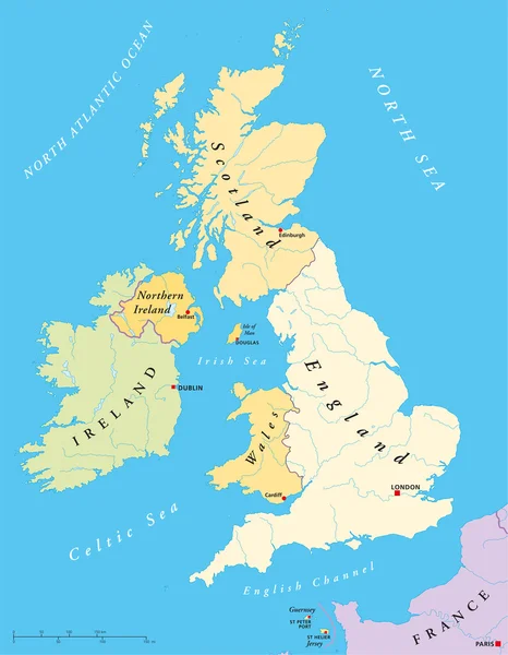
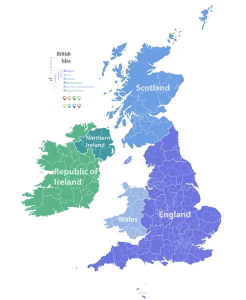
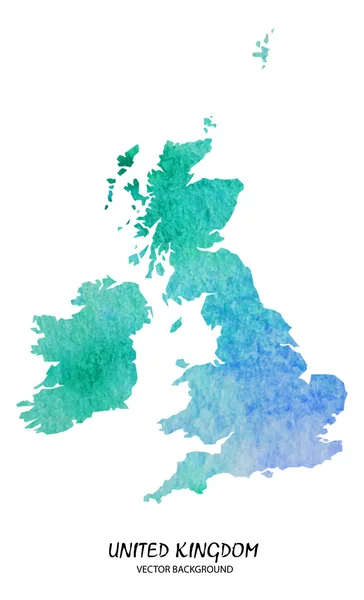
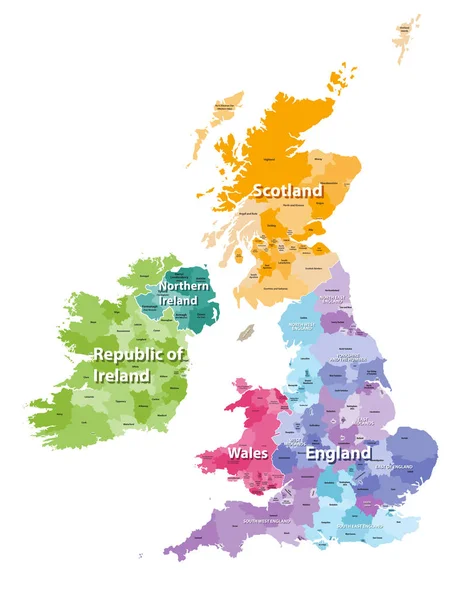
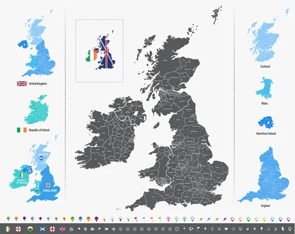
Vector Map Of British Isles Administrative Divisions Colored By Countries And Regions. Districts And Counties Maps And Flags Of United Kingdom,Northern Ireland, Wales, Scotland And Republic Of Ireland

Vector, 11.71MB, 7292 × 7292 eps
stock image United Kingdom 2

United Kingdom 2

Image, 1.53MB, 7000 × 5000 jpg
stock vector United Kingdom travel map

United Kingdom Travel Map

Vector, 2.41MB, 4000 × 4000 eps
stock vector Black Outline Vector Map of The British Isles Illustration

Black Outline Vector Map Of The British Isles Illustration

Vector, 2.47MB, 3140 × 3774 eps
stock vector British Isles map colored by countries and regions

British Isles Map Colored By Countries And Regions

Vector, 7.39MB, 5664 × 7292 eps
stock vector England counties vector map

England Counties Vector Map

Vector, 13.84MB, 7294 × 4690 eps
stock image Texas longhorn bull skull

Texas Longhorn Bull Skull

Image, 6.73MB, 4000 × 5605 jpg
stock vector Map of United Kingdom and Ireland in black and color

Map Of United Kingdom And Ireland In Black And Color

Vector, 0.78MB, 5774 × 3353 eps
stock vector Map of United Kingdom and Ireland in black and color

Map Of United Kingdom And Ireland In Black And Color

Vector, 0.78MB, 5774 × 3353 eps
stock vector Silhouette of Europe. Gray halftone dots, varying in size and spacing. Map of Europe. Dotted outline and surface under Robinson projection. Isolated ilustration on white background. Vector.

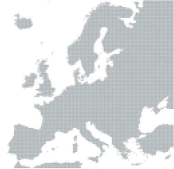
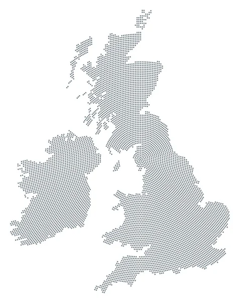
Silhouette Of Europe. Gray Halftone Dots, Varying In Size And Spacing. Map Of Europe. Dotted Outline And Surface Under Robinson Projection. Isolated Ilustration On White Background. Vector.

Vector, 5.85MB, 8033 × 7799 eps
stock vector Map of United Kingdom and Ireland

Map Of United Kingdom And Ireland

Vector, 0.64MB, 5804 × 5543 eps
stock image Globe British Isles Map

Globe British Isles Map

Image, 2.9MB, 3886 × 3862 jpg
stock vector The detailed map of the United Kingdom with regions or states and cities, capitals. Actual current relevant UK, Great Britain administrative devision.

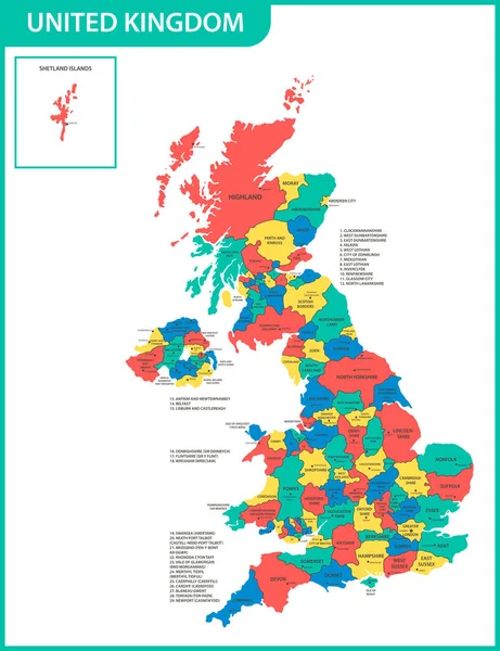
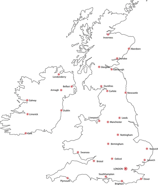
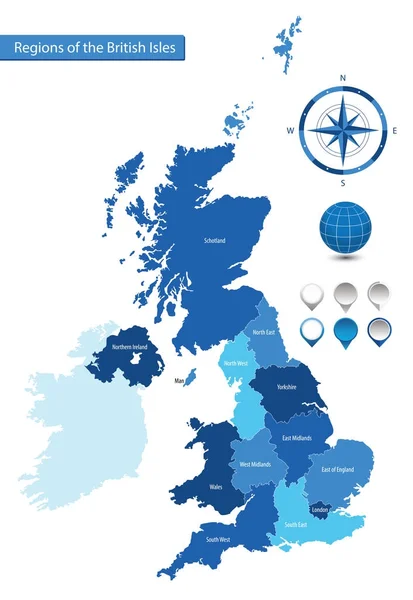
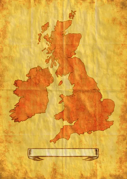
The Detailed Map Of The United Kingdom With Regions Or States And Cities, Capitals. Actual Current Relevant UK, Great Britain Administrative Devision.

Vector, 2.52MB, 5000 × 6500 eps
stock vector Shetland Islands

Shetland Islands

Vector, 0.87MB, 4145 × 6492 eps
stock vector vector map of British Isles with administrative divisions

Vector Map Of British Isles With Administrative Divisions

Vector, 14.28MB, 7292 × 5774 eps
stock image UK map in satellite photo, England terrain view from space. Physical topographic map of Great Britain and Ireland islands. Detailed photography of United Kingdom. Elements of image furnished by NASA.

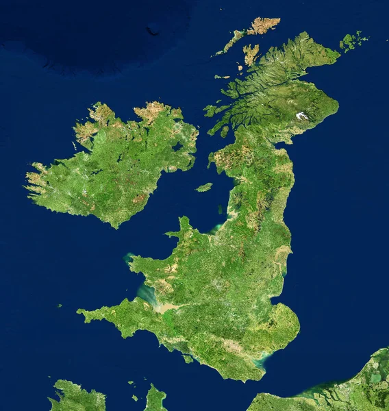
UK Map In Satellite Photo, England Terrain View From Space. Physical Topographic Map Of Great Britain And Ireland Islands. Detailed Photography Of United Kingdom. Elements Of Image Furnished By NASA.

Image, 14.27MB, 5000 × 5281 jpg
stock image Map of the Great Britain with Union Jack

Map Of The Great Britain With Union Jack

Image, 1.7MB, 1800 × 2400 jpg
stock image Scotland map on black

Scotland Map On Black

Image, 0.78MB, 2800 × 4300 jpg
stock vector Union Jack, UK flag in the outline of United Kingdom

Union Jack, UK Flag In The Outline Of United Kingdom

Vector, 2.1MB, 6489 × 9733 eps
Page 1 >> Next