Home
Images
Vectors
Videos
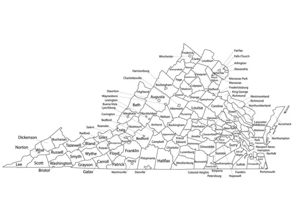
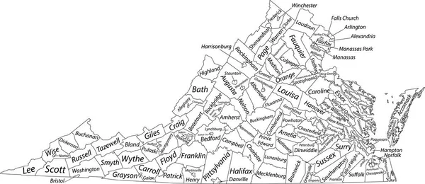
Stock vector White vector administrative map of the Federal State of Virginia, USA with black borders and name tags of its counties
Published:
Dec.28, 2021 10:03:10
Author:
momcilo.jovanov
Views:
0
Downloads:
0
File type:
vector
/
eps
File size:
2.44 MB
Orginal size:
7505
x
3258
px
Available sizes:
S
(500 x 217)
M
(1000 x 434)
L
(2000 x 868)
XL
(7505 x 3258)
VECT
(7505 x 3258)
EL0
(7505 x 3258)
Level:
bronze
Download Vector
Vector topics:
Vector
Illustration
Design
Sign
Travel
Mountain
Flag
Road
Position
Symbol
Icon
City
Usa
Journey
Outline
District
Direction
Map
Cartography
Land
Topography
Unity
Division
Voting
Insignia
Election
Coat Of Arms
Cut Out
Travel Destinations
National Flag
No People
Physical Geography
Line Art
Washington Dc
Eastern USA
Western USA
Contour Line
Relief Carving
Relief Map
Topographic Map
Flat Design
In Silhouette
Virginia Us State
Similar stock vectors
White Outline Counties Map With Counties Names Of US State Of Virginia
4800 × 3600
Simple Vector White Map With Black Borders And Numbers Of Arrondissements Of Paris, France
6705 × 3587
Topographic Map Of Trinidad And Tobago With Black Contour Lines
5000 × 4671
Maps Of England With And Without Counties And Major Cities
7556 × 3111
Simple (only Sharp Corners) Map Of Bermuda Vector Drawing. Merca
6901 × 2500
Hand Drawn Cartoon Illustration On White Background
2747 × 4000
Black Flat Blank Vector Administrative Map Of The Australian External Territory Of COCOS (KEELING) ISLANDS, AUSTRALIA
3715 × 6000
This Picture Is Showing The Place Of Positions In A Cricket Field For All The Fielders During The Cricket Match, Vintage Line Drawing Or Engraving Illustration.
6574 × 9282