Home
Images
Vectors
Videos
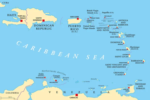
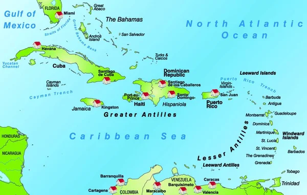
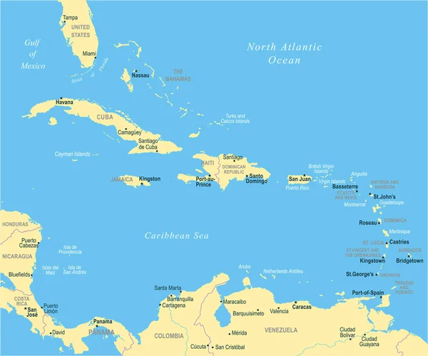
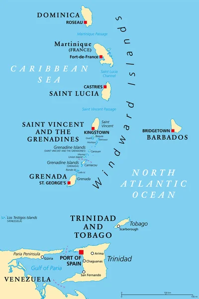
Stock vector Windward Islands political map. Islands of the Lesser Antilles, south of the Leeward Islands in the Caribbean Sea. From Dominica, Martinique, Saint Lucia, Saint Vincent and the Grenadines, to Grenada.
Published:
Apr.11, 2022 07:46:05
Author:
Furian
Views:
184
Downloads:
3
File type:
vector
/
eps
File size:
2.87 MB
Orginal size:
6000
x
9000
px
Available sizes:
S
(333 x 500)
M
(667 x 1000)
L
(1333 x 2000)
XL
(6000 x 9000)
VECT
(6000 x 9000)
EL0
(6000 x 9000)
Level:
silver
Download Vector
Vector topics:
Vector
Illustration
Travel
Sea
French
City
France
Capital
Cruise
Country
Map
Cartography
Geography
Land
Island
Destination
Islands
Caribbean
Atlas
Windward
Americas
Lesser
Mapping
Trinidad
Venezuela
Bridgetown
Dominica
Barbados
Grenada
Grenadines
Tobago
Martinique
Antilles
Kingstown
Castries
Roseau
Venezuelan
Caribbean Sea
South America
Atlantic Ocean
Lesser Antilles
Saint Vincent
Saint Lucia
St Georges
Political Map
Port Of Spain
Fort De France
Windward Islands
Gulf Of Paria
Los Testigos
Similar stock vectors
Lesser Antilles Political Map
8985 × 6000
The Card Is Modern And Pictorially Illustrates ... The Card Can Be Used Immediately And Is Optimized For Printing And Application In Digital Medien..der Color Mode Is Rgb.
6808 × 4328
Trinidad And Tobago Road Map
6536 × 6712
Windward Islands, Gray Political Map. Islands Of Lesser Antilles, South Of Leeward Islands In The Caribbean Sea. From Dominica, Martinique, Saint Lucia, Saint Vincent And The Grenadines, To Grenada.
6000 × 9000
Vector Illustration On Map On Atlas
6808 × 4328
Vector Illustration On Map On Atlas
6808 × 4328
The Caribbean Map - Vector Illustration
6598 × 5500