
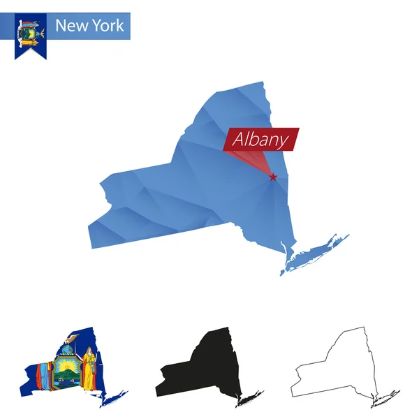
Stock image Albany Vector Map
Gray Vector Map Of The Federal State Of New York, USA With White Borders Of Its Counties
Vector, 0.83MB, 5605 × 4271 eps


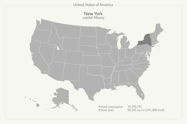
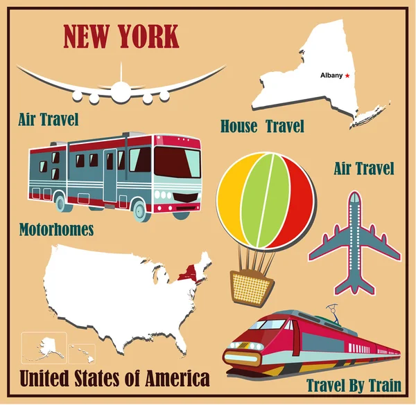
United States Of America Isolated Map And New York State Territory. Vector USA Political Map. Geographic Banner Template
Vector, 0.7MB, 6000 × 4000 eps

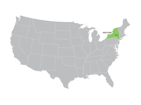

United States Of America Isolated Map And New York State Territory. Vector USA Political Map. Geographic Banner Template
Vector, 0.73MB, 6000 × 4000 eps


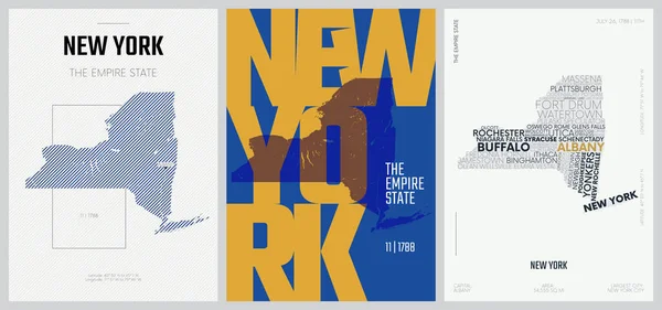
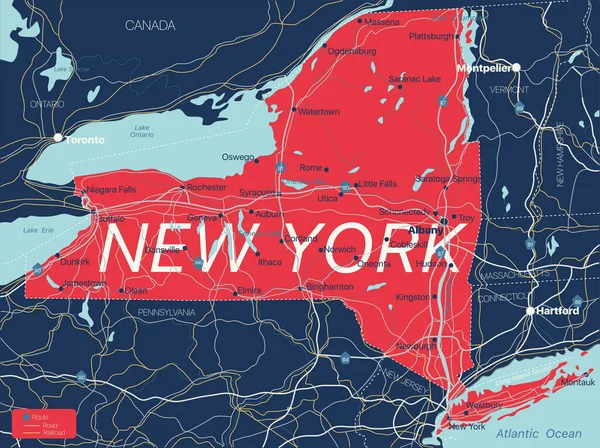
11 Of 50 Sets, US State Posters With Name And Information In 3 Design Styles, Detailed Vector Art Print New York Map
Vector, 3.22MB, 8896 × 4168 eps


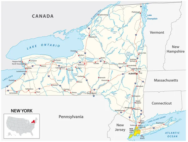
Blue Similar New York Map. New York Map Blank. New York Map Vector. New York Map Flat. New York Map Template. New York Map Object. New York Map Eps. New York Map Infographic. New York Map Clean.
Vector, 2.83MB, 5000 × 4501 eps
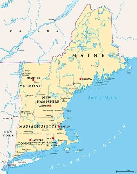
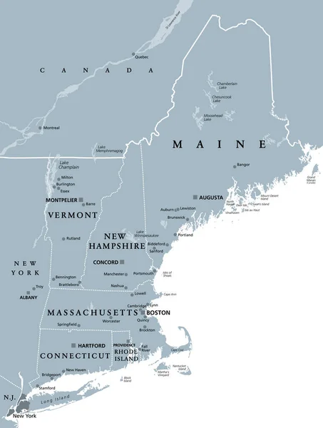
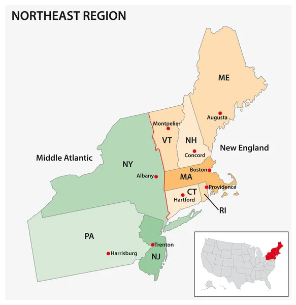
New England Region Of The United States Of America, Political Map. Maine, Vermont, New Hampshire, Massachusetts, Rhode Island And Connecticut With Their Capitals And Borders. Illustration. Vector.
Vector, 5.85MB, 6000 × 7627 eps

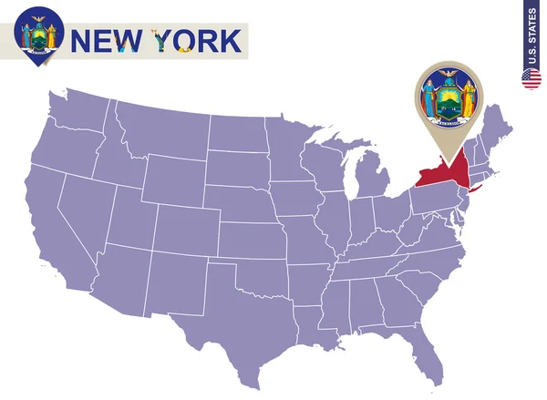
Official Current Vector Great Seal Of The Federal State Of New York, USA
Vector, 2.87MB, 4910 × 4910 eps
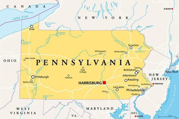
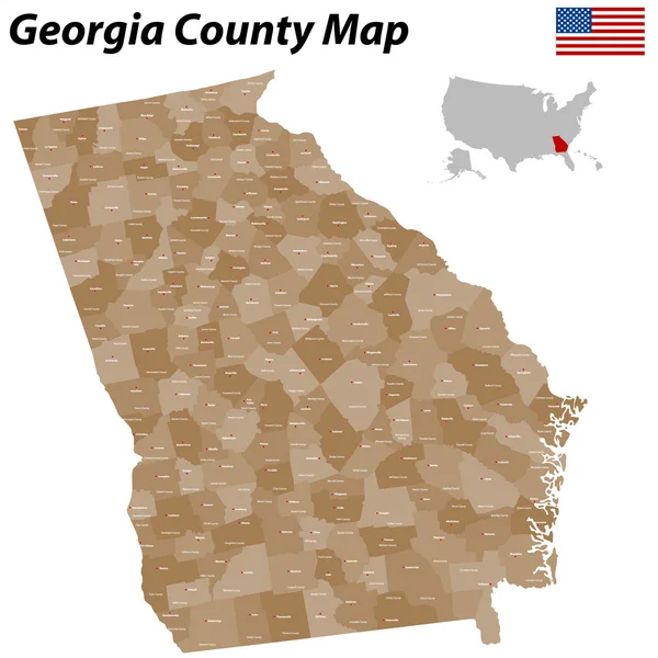
Pennsylvania, PA, Political Map. Officially The Commonwealth Of Pennsylvania. State In The Northeastern United States Of America. Capital Harrisburg. Keystone State. Quaker State. Illustration. Vector
Vector, 3.67MB, 9000 × 6000 eps
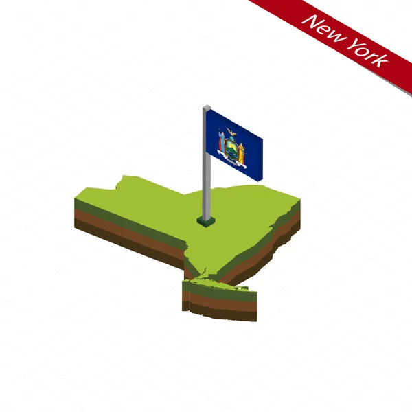


Vector New York State Map Silhouette. Isolated Vector Illustration. Black On White Background.
Vector, 2.33MB, 5588 × 4474 eps
New England Region Of The United States Of America, Gray Political Map. Maine, Vermont, New Hampshire, Massachusetts, Rhode Island And Connecticut With Capitals And Borders. Illustration. Vector.
Vector, 3.22MB, 6000 × 7940 eps


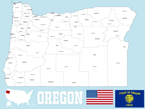
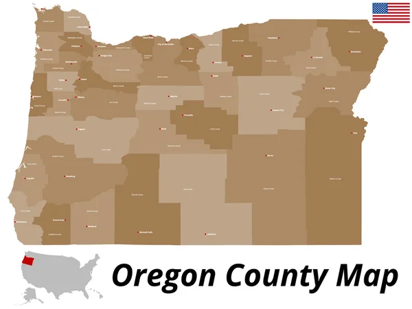
Oregon, OR, Political Map With The Capital Salem. State In The Pacific Northwest Region Of The Western United States Of America, With The Nickname The Beaver State. Illustration. Vector.
Vector, 3.84MB, 8516 × 6000 eps


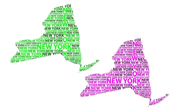
Sketch New York (United States Of America) Letter Text Map, New York Map - In The Shape Of The Continent, Map New York (state) - Green And Purple Vector Illustration
Vector, 1.25MB, 7379 × 4724 eps


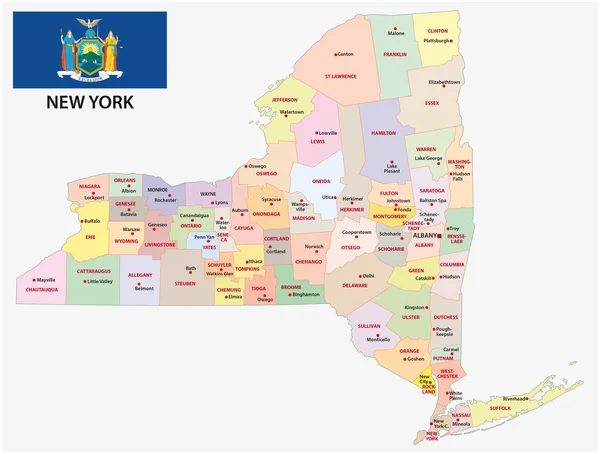
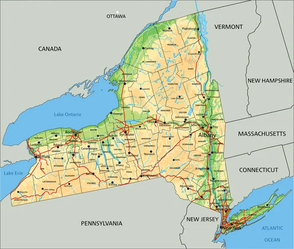
New York, U.S. State, Subdivided Into 62 Counties, Multi Colored Political Map With Capital Albany, Borders And County Names. State In The New England Region Of The United States. The Empire State.
Vector, 2.61MB, 7671 × 6000 eps

New York - Flat Collection Of US States Flags. Flags Of Twelve Flat Icons Of Various Shapes. Set Of Vector Illustrations
Vector, 25.36MB, 7520 × 5251 eps

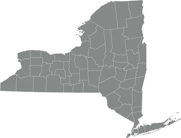
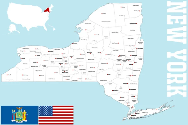
New York State Counties, Gray Political Map. New York, A State Of The Northeastern United States, One Of The Mid-Atlantic States, Subdivided Into 62 Counties. Map With Boundaries And County Names.
Vector, 2.59MB, 7671 × 6000 eps

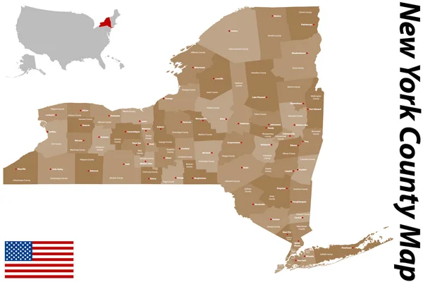
New York State Counties, Political Map. New York, A State Of The Northeastern United States, One Of The Mid-Atlantic States, Is Subdivided Into 62 Counties. Map With Boundaries And County Names.
Vector, 3.54MB, 7636 × 6000 eps
Page 1 >> Next